
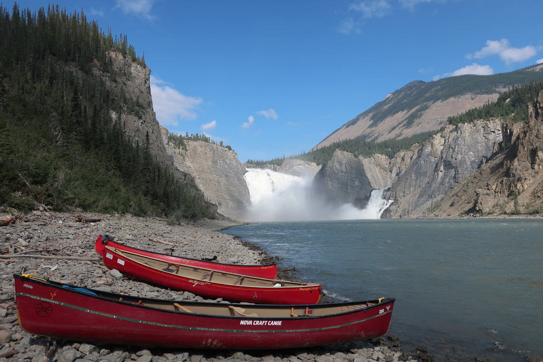
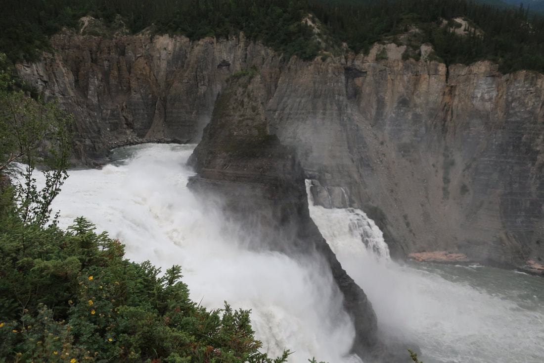
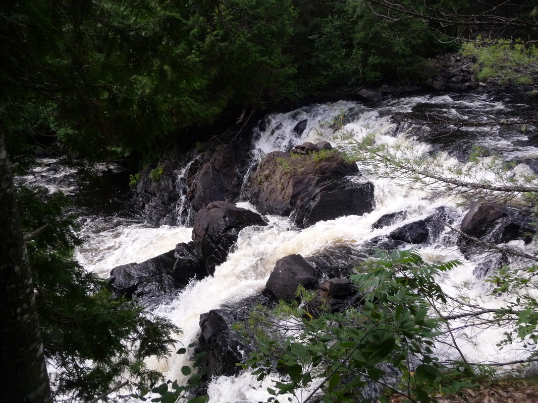
South Nahanni River at Virginia Falls
The South Nahanni river is normally the top of any canoeist's bucket list and for good reason. Designated a UNESCO World Heritage Site, the South Nahanni River boasts spectacular natural beauty in the form of waterfalls, canyons, hotprings, whitewater, and jagged peaks. For me, my obsession with the Nahanni started as a young girl reading Canadian Canoeist Bill Mason's books with ample photos of the northern river gem. We started planning a self-guided canoe trip down the South Nahanni river in the fall of 2019. Back then we had a group of 10 eager paddlers ready to go but COVID had other plans. Fast forward to 2022 when only 6 of the original group finally took off via float plane and landed in Rabbitkettle Lake, our chosen starting point for our adventure.
The South Nahanni river is part of Nahanni National Park and covers 565km from it's headwaters to it's confluence with the Liard River. We chose the classic 14 day route that covers 335km of the river from Rabbitkettle lake to Nahanni Butte. One of our group members Joel decided to head out a week early and tackle the upper section Moose Ponds before joining up with us.
Day 1 Saturday July 16th: Whitehorse to Rabbitkettle Lake
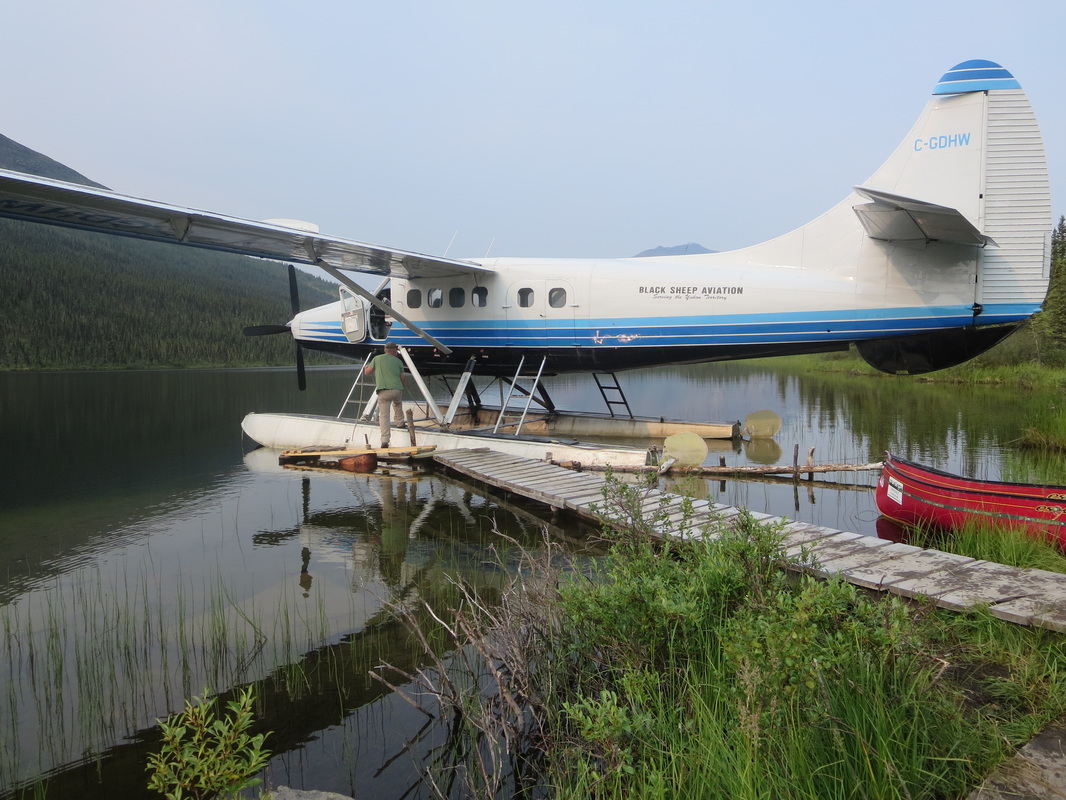
After 3 years of waiting, a troublesome air travel day including lost luggage, and some unsettled weather, we finally took off from Whitehorse with Alkan Air towards Rabbitkettle. Why leave from Whitehorse and not Fort Simpson? The rest of our group was from Whitehorse, and it was cheaper to fly in direct from the Yukon.
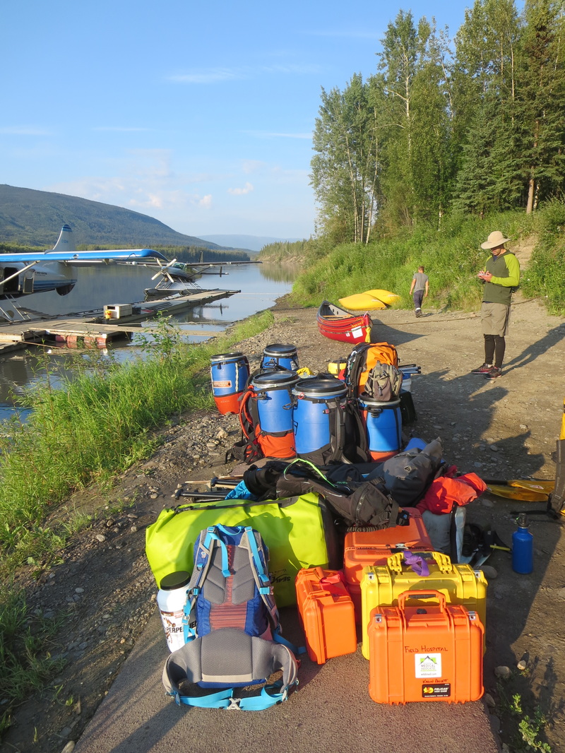
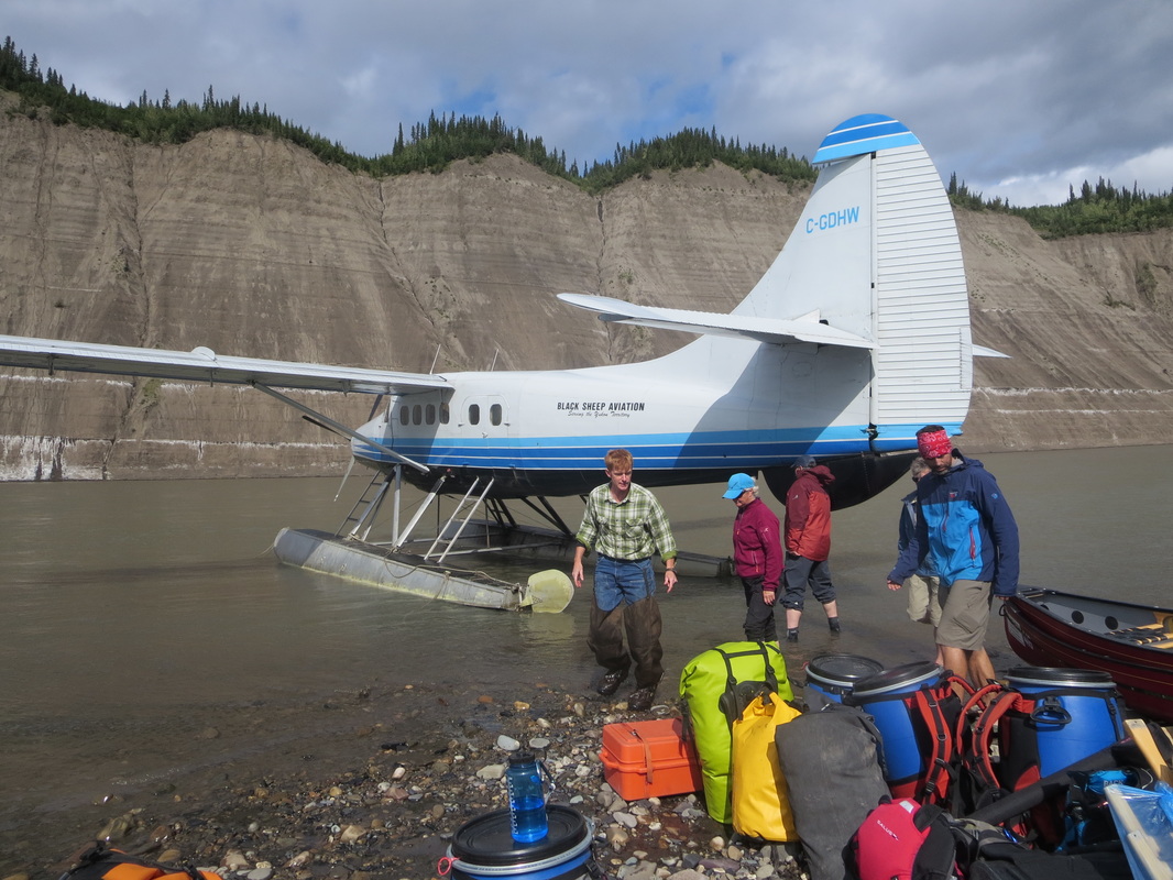
The Cessna Caravan needed 2 flights to transport all our gear in so one group left from Whitehorse and the other from Watson Lake. In addition to the two flights needing to land at Rabbitkettle, we also needed to liase with our 6th paddler who had started his trip a week earlier and had paddled down from the headwaters Moose Ponds section to meet up with us. The logistics were somewhat complicated including flying in a tandem boat and flying out a solo boat!
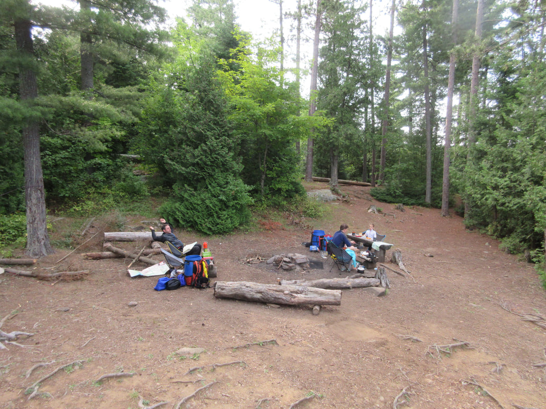
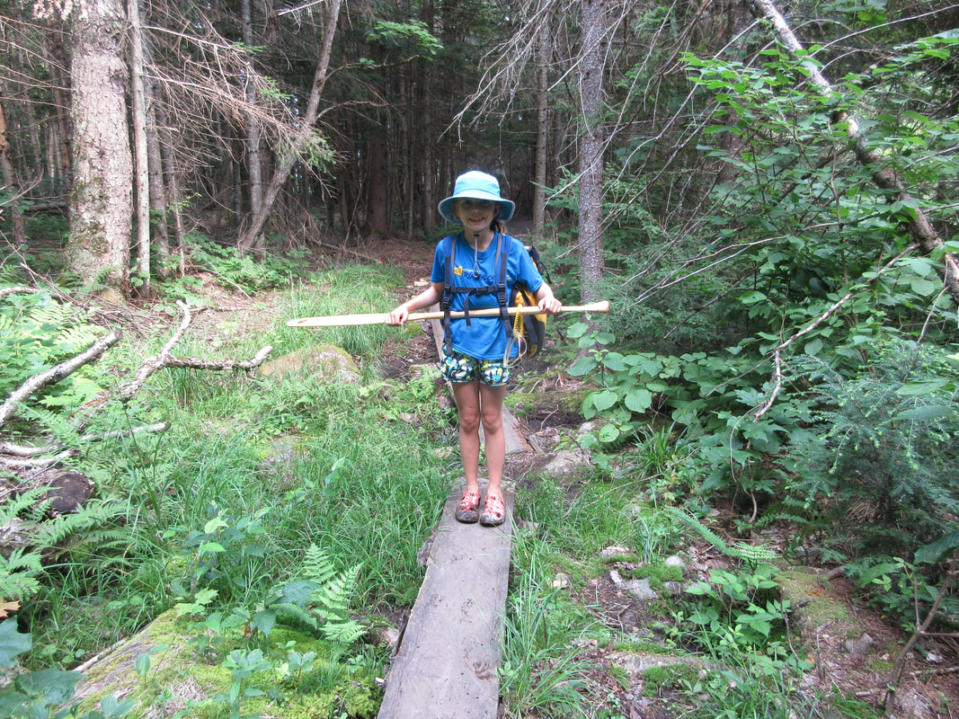
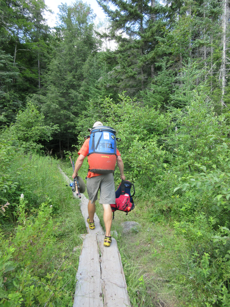
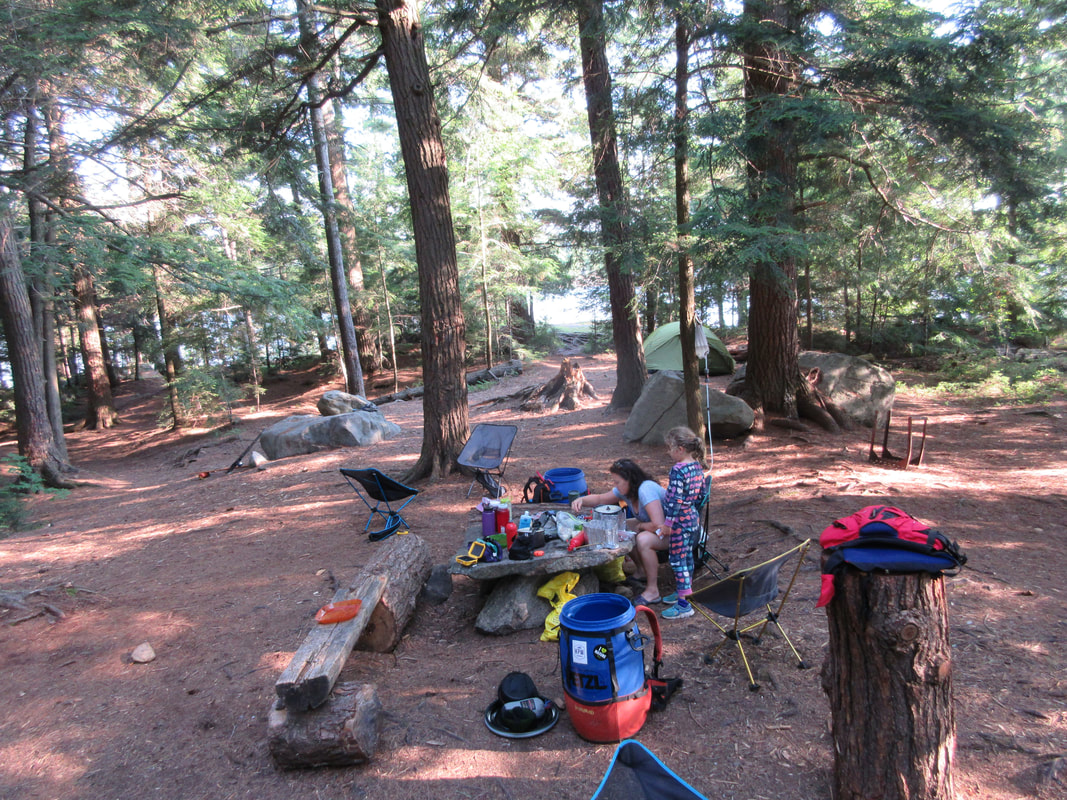
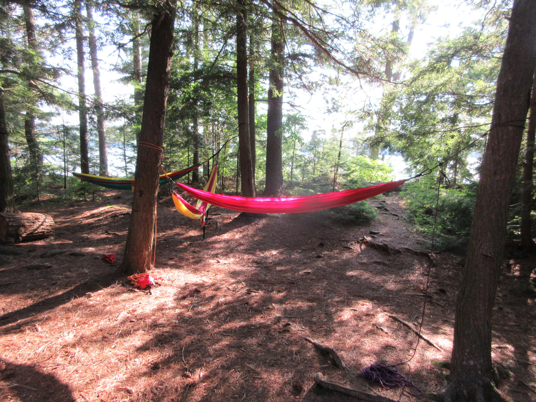
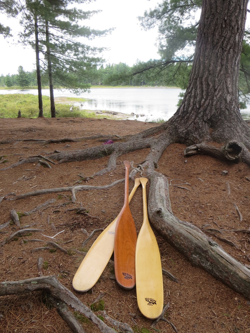
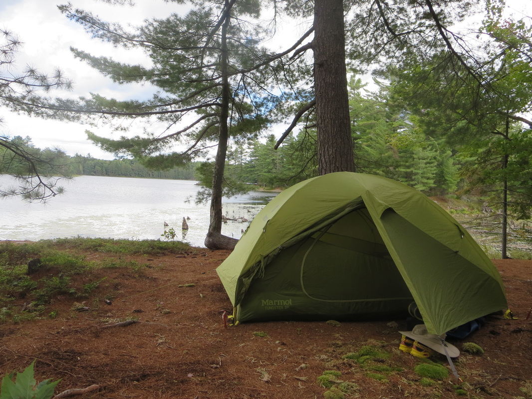
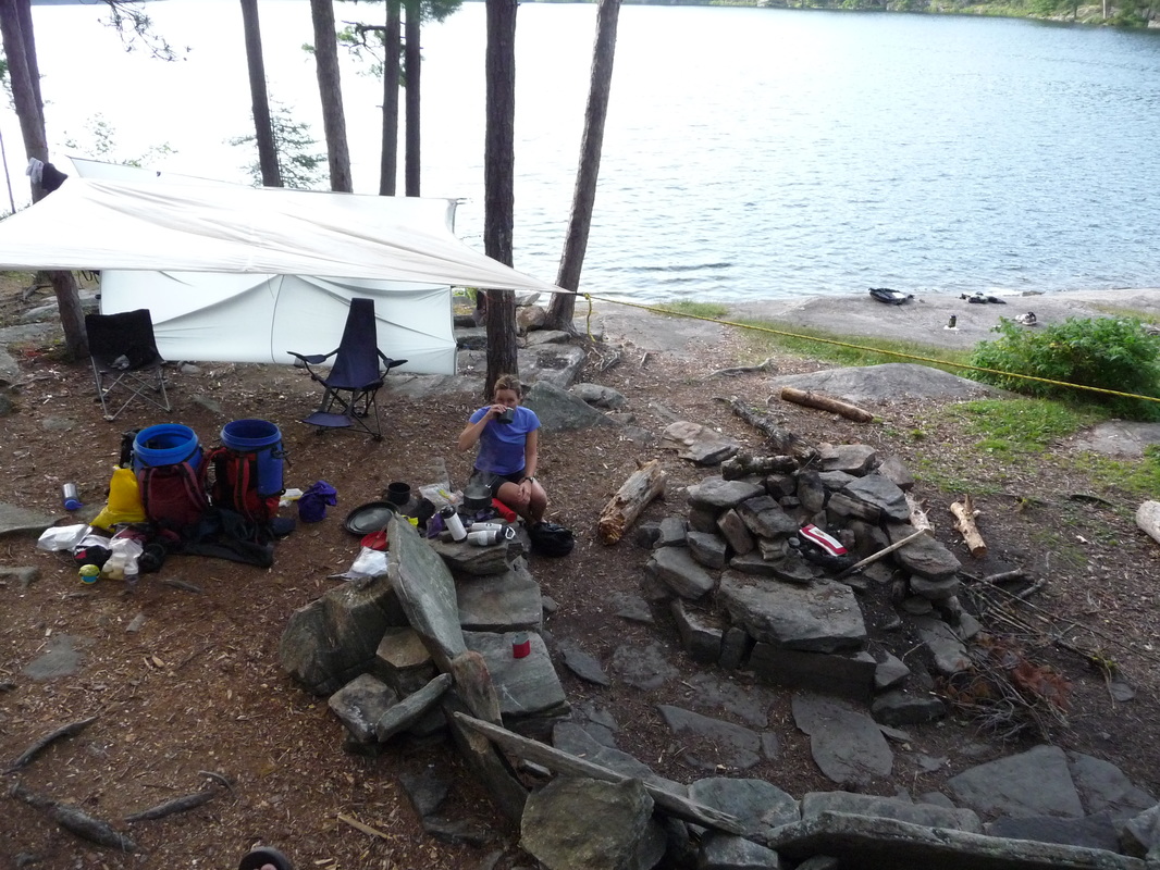
When we arrived at Rabbitkettle there were a few groups coming and going and various planes landing and taking off. We immediately noticed the need to put on our bug jackets and pull out the DEET from our packs. The lake is sheltered from the wind and can be on the buggy side. We set up camp on the obvious platforms and waited for plane #2 to arrive. The campsite also has an outhouse and metal food storage lockers. I learned how to put on a spray deck on a canoe and saw some new birds to me: a Red-necked Grebe being one!
Day 2 Sunday July 17th: Rabbitkettle Lake
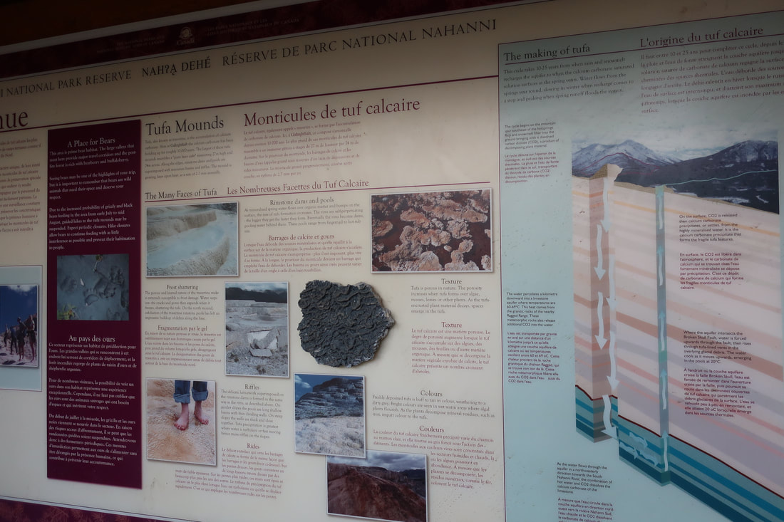
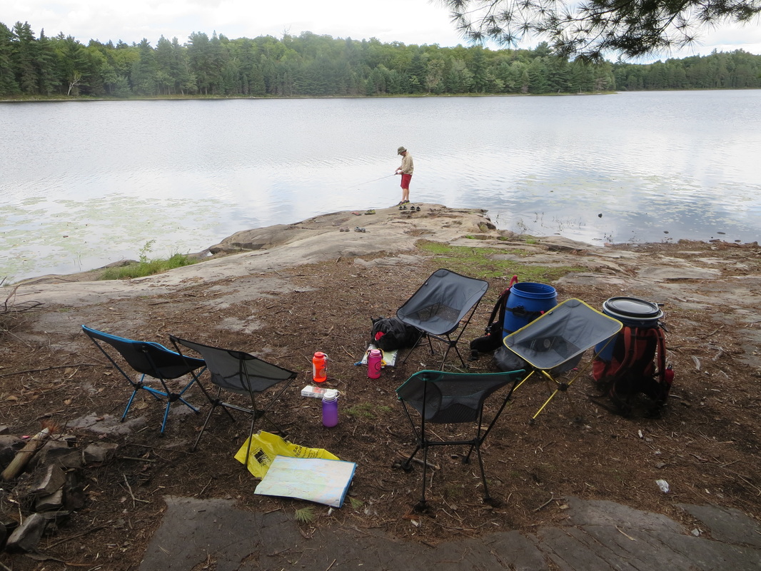
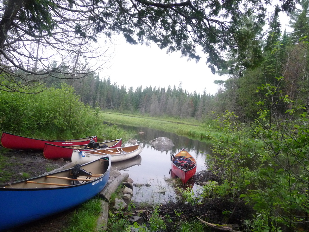
Today was set aside for two reasons: 1) To have a buffer day in case a float plane couldn't take off or land the day before and 2) to hike the Tufa mounds with a Parks Canada Staff. The Tufa mounds are in a Zone 1 area of the park and cannot be visited unless a staff member is with you. At the staff cabin, there was no staff present either the Saturday or Sunday of our trip. The guided hikes are normally conducted daily at 8:30AM and 1:30PM but because there was no staff present there was no access for us. We waited and waited for a plane to arrive but it never did. Instead we went and checked out the 'back door' creek out of Rabbitkettle Lake (accessed from the north or upstream end of the lake) that would enable us to avoid a 900m portage trail the next day to get to the river proper. We paddled over to the creek and walked the length of the creek to check for any hazards like wood that could be an issue while paddling down it's current. It looked fine! We got our first glimpse at the river and immediately noticed it's width, silty nature, and current speed. We returned to the lake and spent time fishing, swimming, and had a floating lunch on the lake to escape the bugs. Mia had an encounter with a Black Bear who was grazing on the various berries in the area.
The South Nahanni river is part of Nahanni National Park and covers 565km from it's headwaters to it's confluence with the Liard River. We chose the classic 14 day route that covers 335km of the river from Rabbitkettle lake to Nahanni Butte. One of our group members Joel decided to head out a week early and tackle the upper section Moose Ponds before joining up with us.
Day 1 Saturday July 16th: Whitehorse to Rabbitkettle Lake
After 3 years of waiting, a troublesome air travel day including lost luggage, and some unsettled weather, we finally took off from Whitehorse with Alkan Air towards Rabbitkettle. Why leave from Whitehorse and not Fort Simpson? The rest of our group was from Whitehorse, and it was cheaper to fly in direct from the Yukon.
The Cessna Caravan needed 2 flights to transport all our gear in so one group left from Whitehorse and the other from Watson Lake. In addition to the two flights needing to land at Rabbitkettle, we also needed to liase with our 6th paddler who had started his trip a week earlier and had paddled down from the headwaters Moose Ponds section to meet up with us. The logistics were somewhat complicated including flying in a tandem boat and flying out a solo boat!
When we arrived at Rabbitkettle there were a few groups coming and going and various planes landing and taking off. We immediately noticed the need to put on our bug jackets and pull out the DEET from our packs. The lake is sheltered from the wind and can be on the buggy side. We set up camp on the obvious platforms and waited for plane #2 to arrive. The campsite also has an outhouse and metal food storage lockers. I learned how to put on a spray deck on a canoe and saw some new birds to me: a Red-necked Grebe being one!
Day 2 Sunday July 17th: Rabbitkettle Lake
Today was set aside for two reasons: 1) To have a buffer day in case a float plane couldn't take off or land the day before and 2) to hike the Tufa mounds with a Parks Canada Staff. The Tufa mounds are in a Zone 1 area of the park and cannot be visited unless a staff member is with you. At the staff cabin, there was no staff present either the Saturday or Sunday of our trip. The guided hikes are normally conducted daily at 8:30AM and 1:30PM but because there was no staff present there was no access for us. We waited and waited for a plane to arrive but it never did. Instead we went and checked out the 'back door' creek out of Rabbitkettle Lake (accessed from the north or upstream end of the lake) that would enable us to avoid a 900m portage trail the next day to get to the river proper. We paddled over to the creek and walked the length of the creek to check for any hazards like wood that could be an issue while paddling down it's current. It looked fine! We got our first glimpse at the river and immediately noticed it's width, silty nature, and current speed. We returned to the lake and spent time fishing, swimming, and had a floating lunch on the lake to escape the bugs. Mia had an encounter with a Black Bear who was grazing on the various berries in the area.


Day 3 Monday July 18th: Rabbitkettle to Hell Roaring Creek (46km, 8 hours)
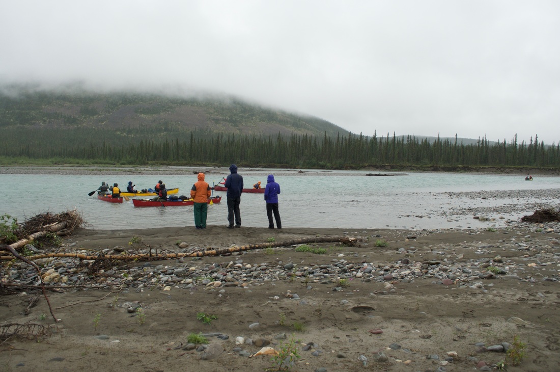
Day 3 I woke up disgruntled as I realized that my 8 year old inflatable sleeping pad had a slow leak and had to be blown up several times over the night. I did a dunk test in the clear waters of Rabbitkettle lake (my last chance to do so as the Nahanni is very silty) but could not find the pinhole or source of the leak. We packed up camp and heading to our 'back door' creek and as we were doing so the float planes started to arrive to drop off/pick up more groups. To complete the creek paddle, you have to drag your canoe a short 10m distance at one point. To get back into your boat, you must descend a steep bank and balance on the gunwhales of your canoe to get back in. This was a highly entertaining process and luckily no one screwed up. By the time we paddled the creek and got to the Nahanni proper, we canoed a short distance down the river to the Rabbitkettle kiosk where the portage trail ends.
When we arrived, we signed in at the register and met a guided group of canoeists who had just finished portaging and were starting/continuing their trip. They mentioned that a Parks Canada staff member had just flown in and would be leading a hike at 1:30PM. By that time, we just wanted to get going down the river and didn't want to allot anymore time to the Tufa mounds, even though we didn't get to see them.
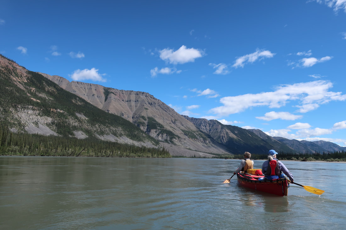
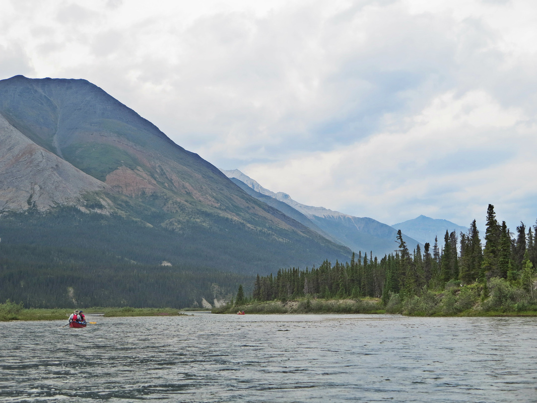
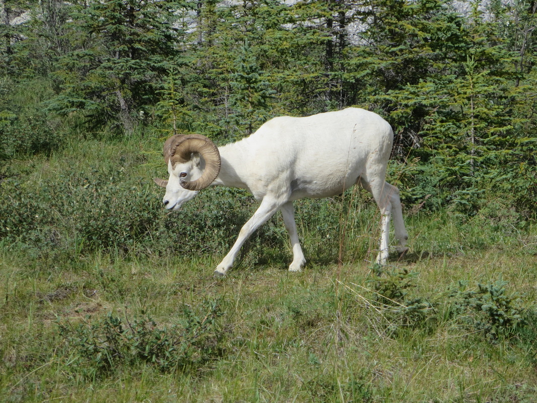
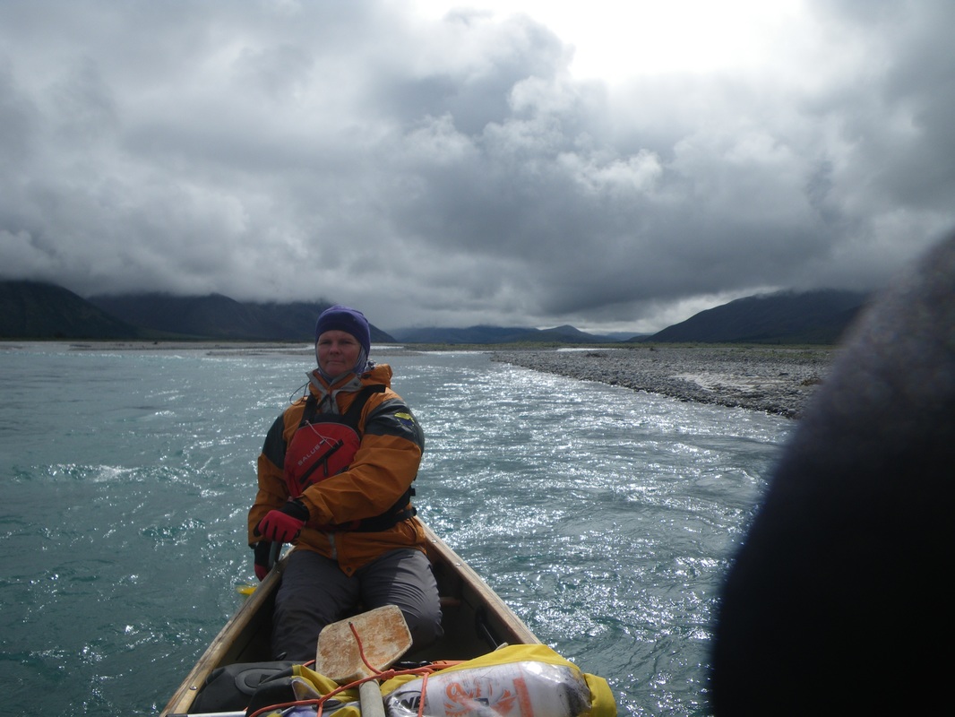
The river valley here has peaks on either side, and has mainly coniferous forest mixed in with rocky terrain. On one of our gazes, we saw a Dall Sheep and two lambs on a scree slope but weren't quick enough to catch a shot. The weather on the river today including sun, clouds, brief periods of light rain, high winds and no wind.
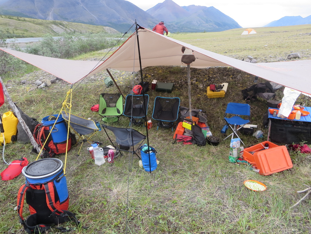
We found a large camping site on the upriver side of Hell Roaring creek. When we arrived the winds were high making it hard to set up our bug shelter. The winds made the bugs scarce but when the winds died, they were definitely noticeable. Around 9PM each evening the mosquitoes came out to feast which correlated with us migrated to our tents to read!
Day 3 I woke up disgruntled as I realized that my 8 year old inflatable sleeping pad had a slow leak and had to be blown up several times over the night. I did a dunk test in the clear waters of Rabbitkettle lake (my last chance to do so as the Nahanni is very silty) but could not find the pinhole or source of the leak. We packed up camp and heading to our 'back door' creek and as we were doing so the float planes started to arrive to drop off/pick up more groups. To complete the creek paddle, you have to drag your canoe a short 10m distance at one point. To get back into your boat, you must descend a steep bank and balance on the gunwhales of your canoe to get back in. This was a highly entertaining process and luckily no one screwed up. By the time we paddled the creek and got to the Nahanni proper, we canoed a short distance down the river to the Rabbitkettle kiosk where the portage trail ends.
When we arrived, we signed in at the register and met a guided group of canoeists who had just finished portaging and were starting/continuing their trip. They mentioned that a Parks Canada staff member had just flown in and would be leading a hike at 1:30PM. By that time, we just wanted to get going down the river and didn't want to allot anymore time to the Tufa mounds, even though we didn't get to see them.
The river valley here has peaks on either side, and has mainly coniferous forest mixed in with rocky terrain. On one of our gazes, we saw a Dall Sheep and two lambs on a scree slope but weren't quick enough to catch a shot. The weather on the river today including sun, clouds, brief periods of light rain, high winds and no wind.
We found a large camping site on the upriver side of Hell Roaring creek. When we arrived the winds were high making it hard to set up our bug shelter. The winds made the bugs scarce but when the winds died, they were definitely noticeable. Around 9PM each evening the mosquitoes came out to feast which correlated with us migrated to our tents to read!

Day 4 Tuesday July 19th : Hell Roaring Creek to Last Chance Island (46km, 6.5 hours, 1861ft)
On the water by 10AM, we paddled for an hour before finding a windy gravel bar to get out and have a bathroom break. The mosquitos make bathroom breaks unbearable in protected areas even despite using different tactics including DEET fumigating, bug jackets and even pee funnels. Back in the boats we set off again until our stomachs growled for lunch. We found another gravel bar to stop at and munch on preserved meets, cheese, crackers, and bagels.
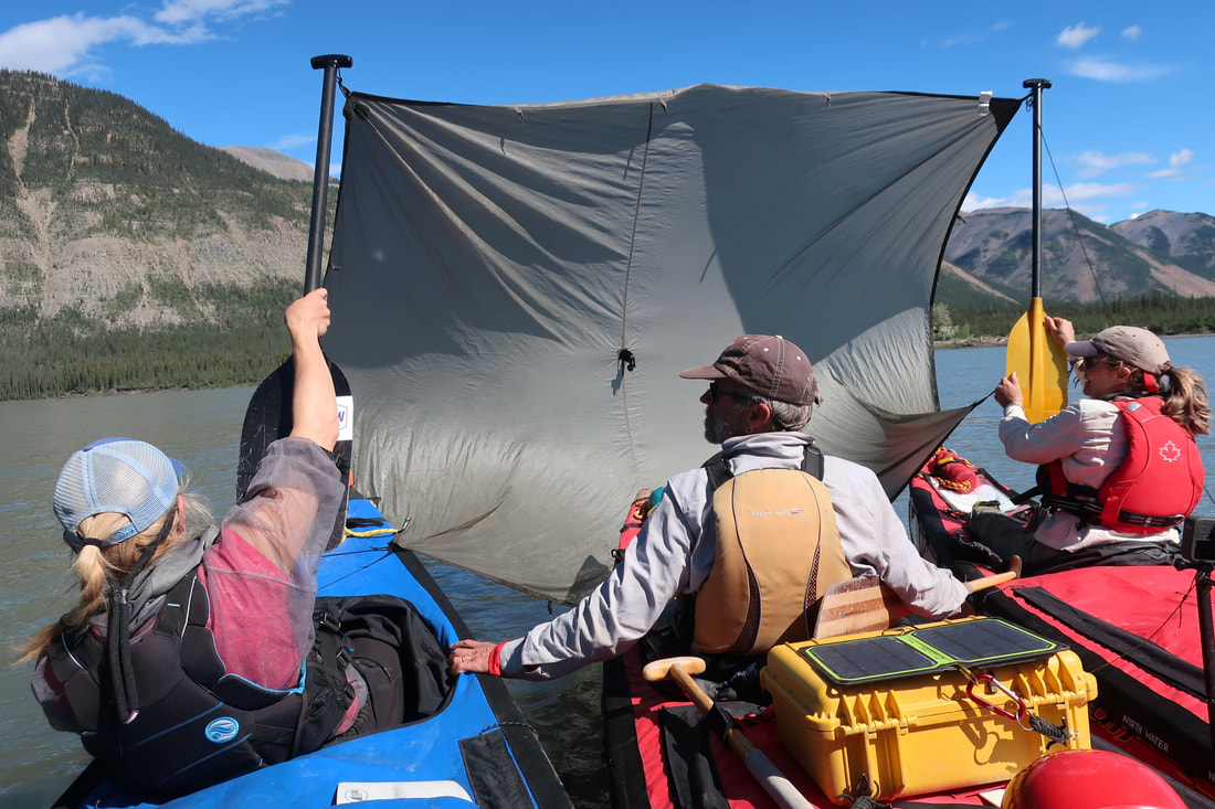
The river in this section is characterized by having small swifts and small wave trains. None of it is very risky, but the current is moving at a good clip. The river moves through 'big squiggly' and 'little squiggly' lines. One of the straight stretches we launched a sail and zoomed along quite successfully...until the river twisted again! Last chance island is the last gravel bar island before Virginia Falls. In the guide book on page 25, it is beside the word 'South'. We scouted spot that could work for camping and found a workable area that was exposed to wind - no bugs! We decided against setting up a tarp or bug shelter due to the sunny conditions and wind.
After a hearty chili and cornbread meal, we relaxed after dinner - some fished, some chatted, some doodled, some read. As the wind died off, the dust and silt covered most of our gear with a fine layer of grey that would remain a constant for the rest of the trip. We also missed a clear creek nearby, meaning we would have to let our filter water settle out in a large blue sink before processing it.
On the water by 10AM, we paddled for an hour before finding a windy gravel bar to get out and have a bathroom break. The mosquitos make bathroom breaks unbearable in protected areas even despite using different tactics including DEET fumigating, bug jackets and even pee funnels. Back in the boats we set off again until our stomachs growled for lunch. We found another gravel bar to stop at and munch on preserved meets, cheese, crackers, and bagels.
The river in this section is characterized by having small swifts and small wave trains. None of it is very risky, but the current is moving at a good clip. The river moves through 'big squiggly' and 'little squiggly' lines. One of the straight stretches we launched a sail and zoomed along quite successfully...until the river twisted again! Last chance island is the last gravel bar island before Virginia Falls. In the guide book on page 25, it is beside the word 'South'. We scouted spot that could work for camping and found a workable area that was exposed to wind - no bugs! We decided against setting up a tarp or bug shelter due to the sunny conditions and wind.
After a hearty chili and cornbread meal, we relaxed after dinner - some fished, some chatted, some doodled, some read. As the wind died off, the dust and silt covered most of our gear with a fine layer of grey that would remain a constant for the rest of the trip. We also missed a clear creek nearby, meaning we would have to let our filter water settle out in a large blue sink before processing it.
Day 5 Wednesday July 20th: Last Chance Island to Virginia Falls (45km, 7.5 hours, elev 1882)
Today we left camp at 10:10AM and immediately faced a headwind that would stay with us most of the day. The breezes however alternated from hot to cold back to hot all day long which seemed odd. The river here is wide with big squigglies and with current but the headwind definitely posed an extra challenge. We found a nice clear creek to fill up our water bottle and bladders. Water filters definitely do not like the silty waters of the Nahanni.
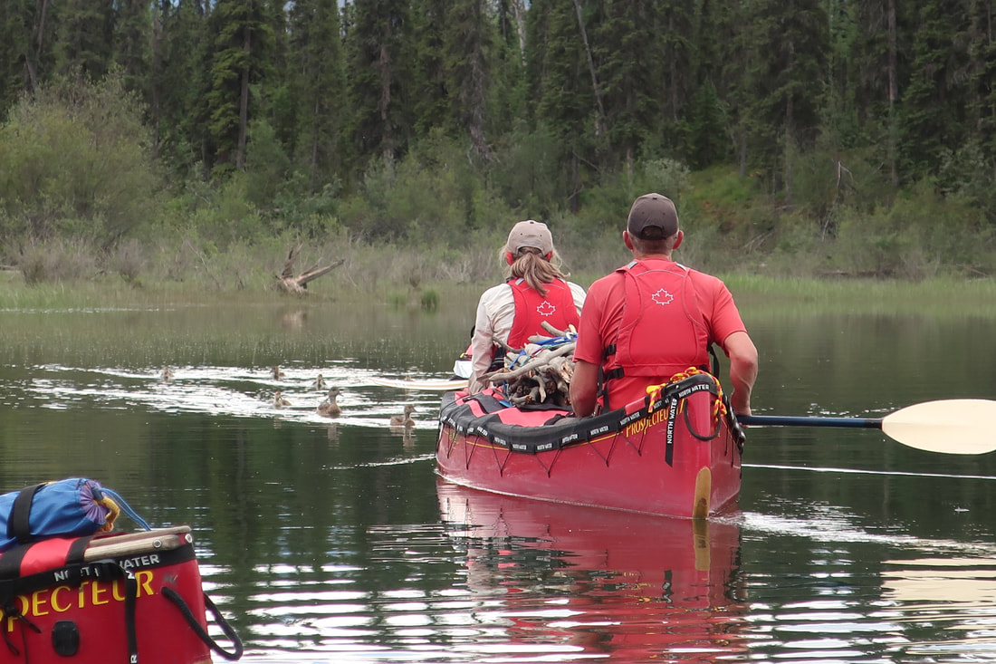
On the last turn before Virginia Falls, there is access to Oxbow lake on river left which is worth checking out. Find the creek entrance (about 2m wide) and follow it in about 1 minute paddle to the Oxbow Lake. Here, paddle to the end of the lake and around the corner. This lake is supposed to be excellent for wildlife viewing. Our group saw a bull moose and some interesting waterfowl (American Widgeon).
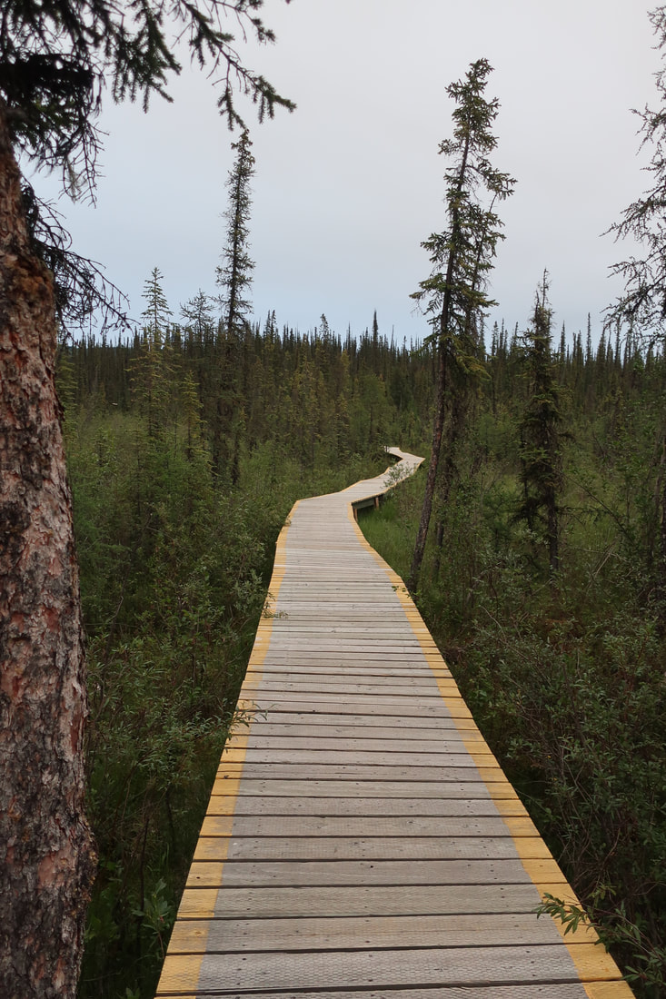
After our visit we returned to the river to the home stretch before the docks of Virginia Falls become visible. There are three sets of docks here and they all have ramps that head up to a maze of boardwalk trails that lead to campsites, gazebos, outhouses, the Warden's cabin, and the falls. The food cache lockers here are enormous, and there are many campsites with platforms, picnic tables, and firepits to use. The outhouses even have toilet paper and hand sanitizer. Luxury! We noticed right away we weren't the only users of this space. Some visitors fly in for the day, some just overnight, and some guided groups took up large areas. What was interesting for me in comparison to many other national parks I have visited is the kilometers of boardwalks have been installed on this site. The mosquitos seem to disappear as well - bonus! There isn't much firewood at the falls, so if you need some, collect some before you arrive!
After a chicken burrito supper, highlighted by a resident Snowshoe Hare and a resident pesky Gray Jay, we walked the 1km on boardwalks down to the falls. The magnificence of these falls cannot be overstated. The power of nature, the beauty, the dramatic scene - amazing. We took a million photos and videos and visited all the lookout spots to get the best angle. It was marvelous. I could stay for longer. Good thing as we planned a two night stay here!
We returned to our site to have a dessert of shortbread out of the Dutch oven and then fell asleep to the distant sound of the falls.
Today we left camp at 10:10AM and immediately faced a headwind that would stay with us most of the day. The breezes however alternated from hot to cold back to hot all day long which seemed odd. The river here is wide with big squigglies and with current but the headwind definitely posed an extra challenge. We found a nice clear creek to fill up our water bottle and bladders. Water filters definitely do not like the silty waters of the Nahanni.
On the last turn before Virginia Falls, there is access to Oxbow lake on river left which is worth checking out. Find the creek entrance (about 2m wide) and follow it in about 1 minute paddle to the Oxbow Lake. Here, paddle to the end of the lake and around the corner. This lake is supposed to be excellent for wildlife viewing. Our group saw a bull moose and some interesting waterfowl (American Widgeon).
After our visit we returned to the river to the home stretch before the docks of Virginia Falls become visible. There are three sets of docks here and they all have ramps that head up to a maze of boardwalk trails that lead to campsites, gazebos, outhouses, the Warden's cabin, and the falls. The food cache lockers here are enormous, and there are many campsites with platforms, picnic tables, and firepits to use. The outhouses even have toilet paper and hand sanitizer. Luxury! We noticed right away we weren't the only users of this space. Some visitors fly in for the day, some just overnight, and some guided groups took up large areas. What was interesting for me in comparison to many other national parks I have visited is the kilometers of boardwalks have been installed on this site. The mosquitos seem to disappear as well - bonus! There isn't much firewood at the falls, so if you need some, collect some before you arrive!
After a chicken burrito supper, highlighted by a resident Snowshoe Hare and a resident pesky Gray Jay, we walked the 1km on boardwalks down to the falls. The magnificence of these falls cannot be overstated. The power of nature, the beauty, the dramatic scene - amazing. We took a million photos and videos and visited all the lookout spots to get the best angle. It was marvelous. I could stay for longer. Good thing as we planned a two night stay here!
We returned to our site to have a dessert of shortbread out of the Dutch oven and then fell asleep to the distant sound of the falls.

Day 6 July 21st: Sunblood Mountain Hike and Portage Carry #1 (16km hike, 4km portage)
Today ended up being our only layover of the trip (even though others were planned - more on this later). We woke up to a hearty eggs benedict and peameal bacon breakfast by Joel which would help fuel us for later in the day.
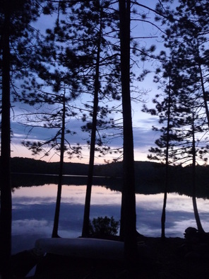
We paddled across the river in our empty canoes to the trailhead for the Sunblood Mountain hike around 11AM. I have included the times a lot in these posts but time doesn't really matter in the NWT in July as it never gets dark. There is no pressure to be back to camp, and I never turned on my headlamp once.
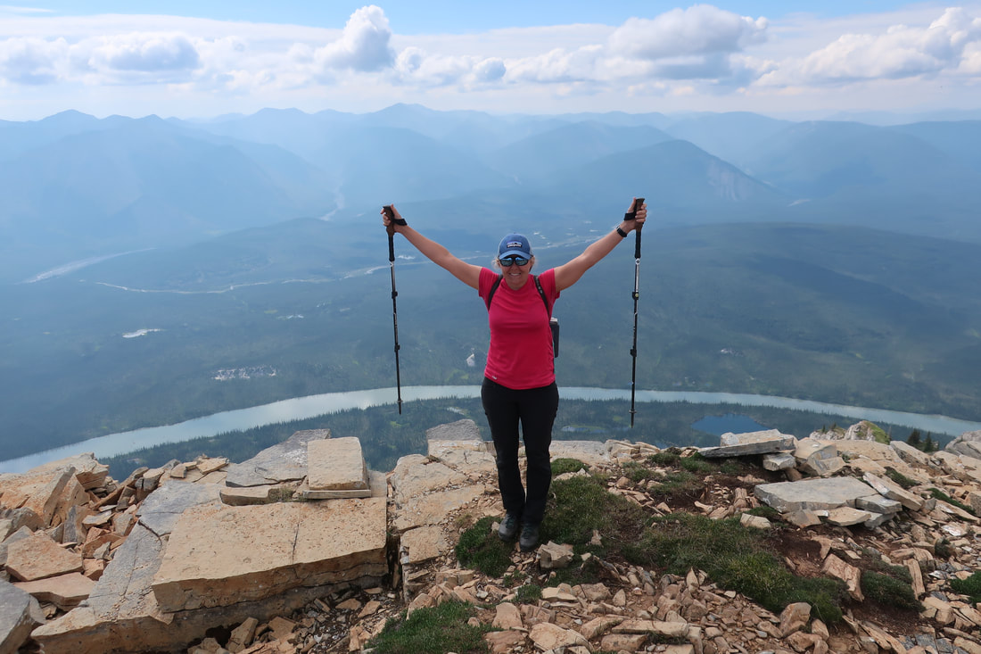
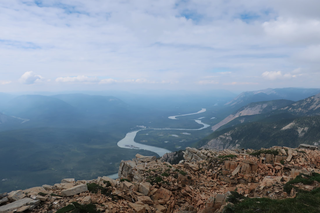
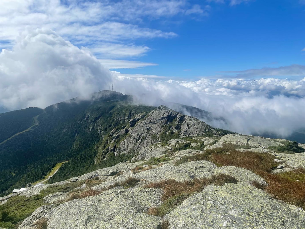
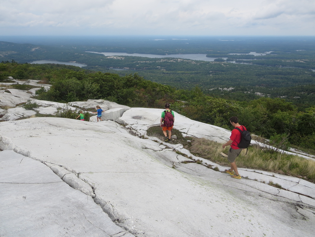
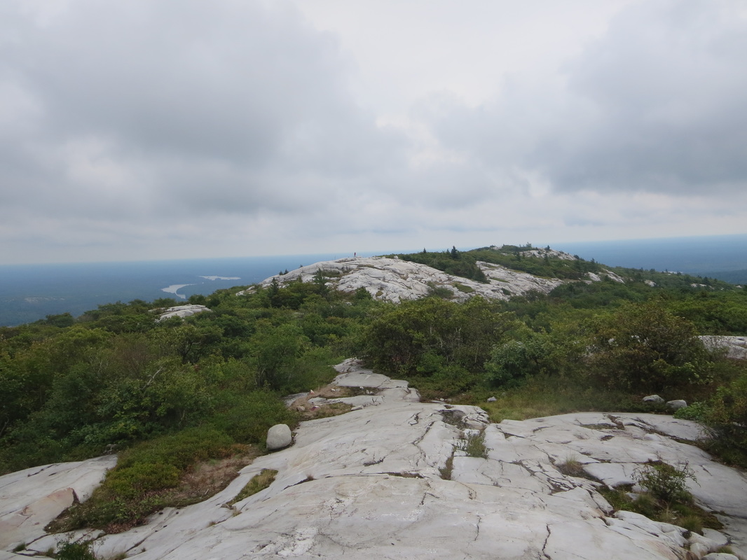
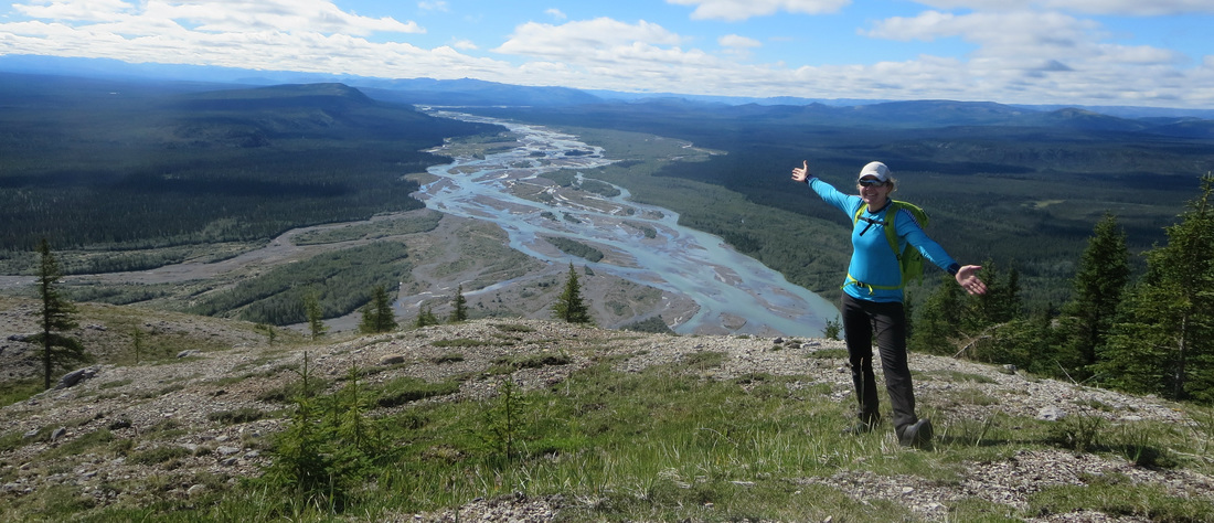
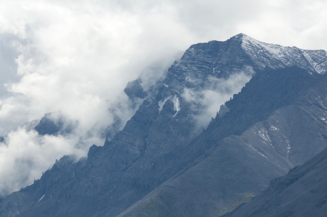
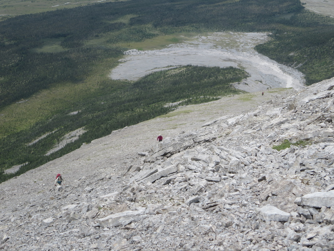
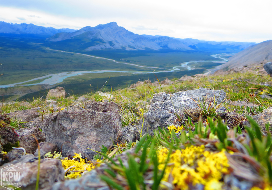
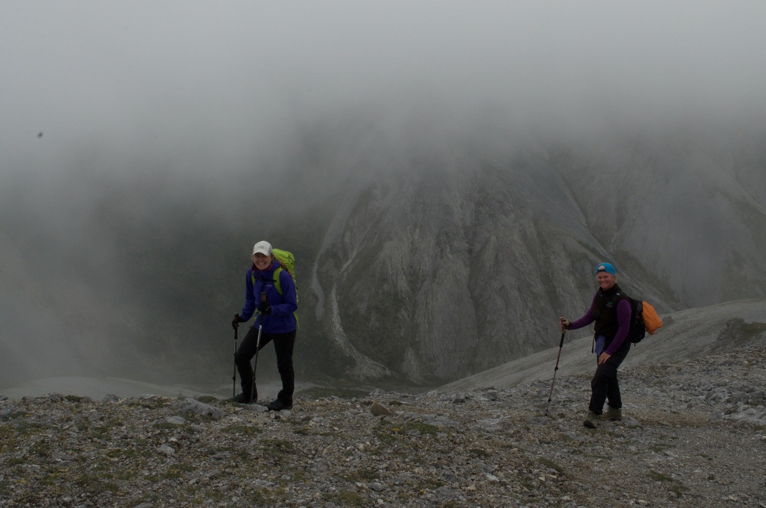
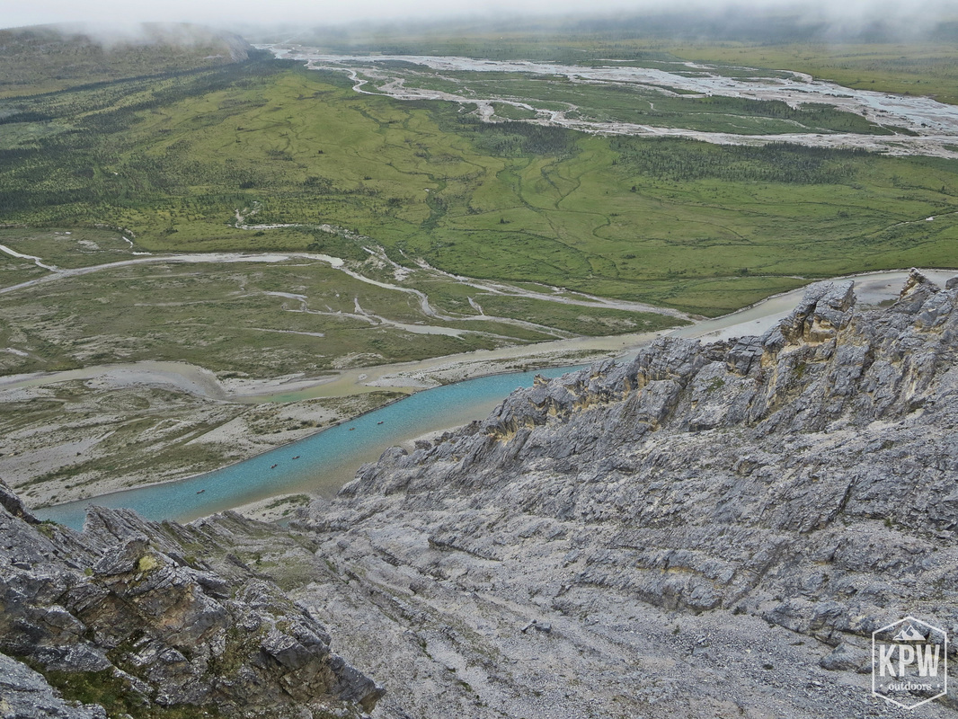
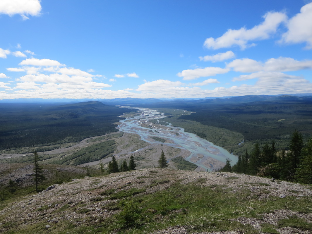
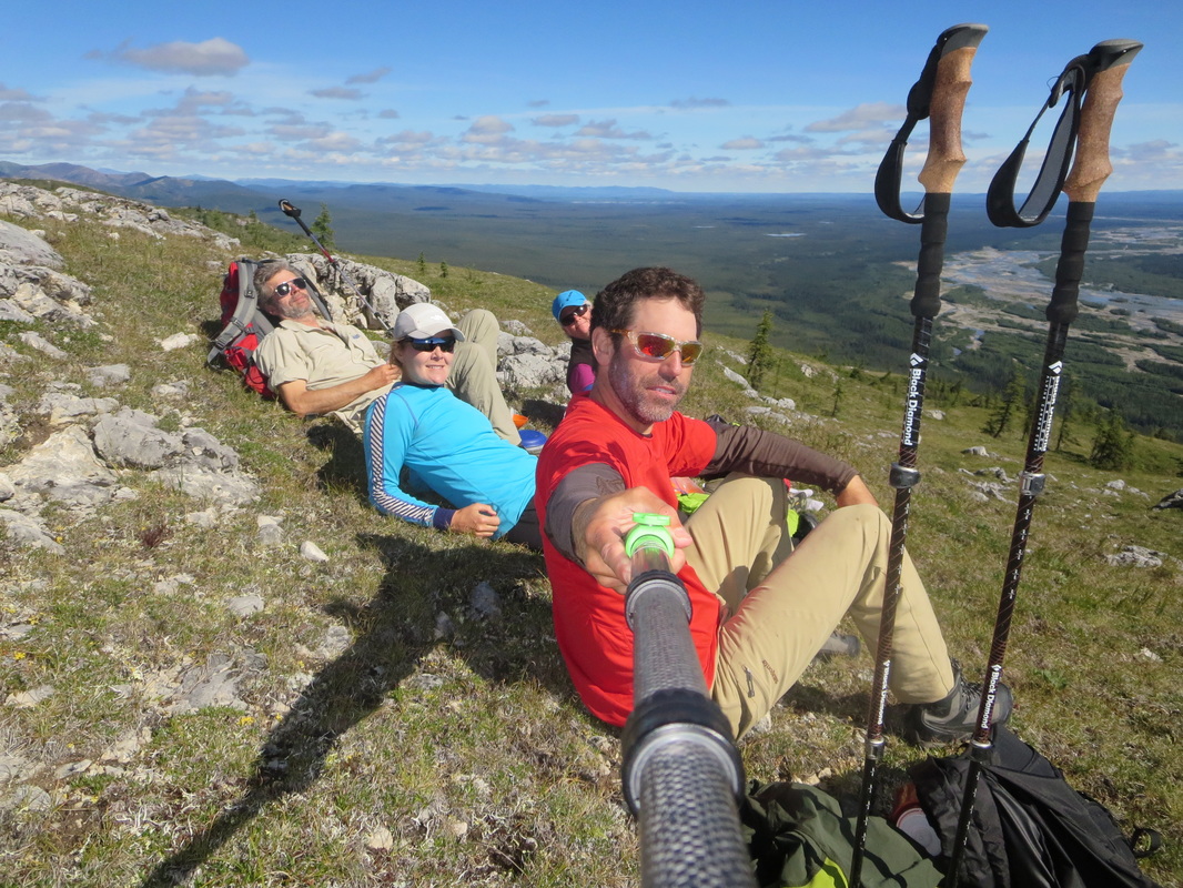
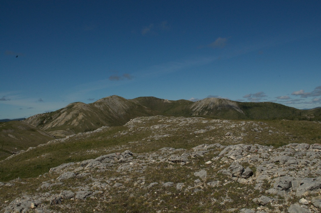
The Sunblood Mountain trail starts off in the forest scrub near the river and ascends quickly up to a scree slop that traverses across to the mountain's shoulder. On the traverse you get some stunning views of the river, a glimpse of the falls and then the canyon below. When you turn to ascend the shoulder, you are in a drainage between Sunblood and the adjacent slope. The trail ascends a consistent rate, making all our bodies happy that the day was overcast as our hearts pounded and lungs took in the alpine air. The ascent was about 3200 feet, similar to a short Adirondack peak. The summit is marked with a big rock cairn. It also has a ugly green communications tower on it and is home to an aggressive community of ground squirrels that will approach you without fear. The views of the Nahanni valley were the reward for the hike and I was happy to test out my lungs after suffering from a positive COVID test a few weeks before.
It took us 3 hours to get to the summit and 2 to return and the afternoon sun broke through and created burning hot conditions. We paddled back over to camp and Scott, Pauline and I briefly jumped into the river to cool off. After a delicious Moroccan stew for dinner we packed up some gear that we didn't need over night and took a load across the portage trail. From the campsite it took us 35minutes one way to do the carry that is mainly on boardwalks. The steep switchbacks at the end of the trail are regular dirt trail. At the bottom there is a metal storage locker you can leave your gear in safely. We got our first view of the bottom of the falls (stunning!) as well as Fourth Canyon where the whitewater begins.
Today ended up being our only layover of the trip (even though others were planned - more on this later). We woke up to a hearty eggs benedict and peameal bacon breakfast by Joel which would help fuel us for later in the day.
We paddled across the river in our empty canoes to the trailhead for the Sunblood Mountain hike around 11AM. I have included the times a lot in these posts but time doesn't really matter in the NWT in July as it never gets dark. There is no pressure to be back to camp, and I never turned on my headlamp once.
The Sunblood Mountain trail starts off in the forest scrub near the river and ascends quickly up to a scree slop that traverses across to the mountain's shoulder. On the traverse you get some stunning views of the river, a glimpse of the falls and then the canyon below. When you turn to ascend the shoulder, you are in a drainage between Sunblood and the adjacent slope. The trail ascends a consistent rate, making all our bodies happy that the day was overcast as our hearts pounded and lungs took in the alpine air. The ascent was about 3200 feet, similar to a short Adirondack peak. The summit is marked with a big rock cairn. It also has a ugly green communications tower on it and is home to an aggressive community of ground squirrels that will approach you without fear. The views of the Nahanni valley were the reward for the hike and I was happy to test out my lungs after suffering from a positive COVID test a few weeks before.
It took us 3 hours to get to the summit and 2 to return and the afternoon sun broke through and created burning hot conditions. We paddled back over to camp and Scott, Pauline and I briefly jumped into the river to cool off. After a delicious Moroccan stew for dinner we packed up some gear that we didn't need over night and took a load across the portage trail. From the campsite it took us 35minutes one way to do the carry that is mainly on boardwalks. The steep switchbacks at the end of the trail are regular dirt trail. At the bottom there is a metal storage locker you can leave your gear in safely. We got our first view of the bottom of the falls (stunning!) as well as Fourth Canyon where the whitewater begins.
Day 7 July 22nd: Virginia Falls to Clearwater Creek (11.3km plus 2 carries of portage 1483 ft elev)
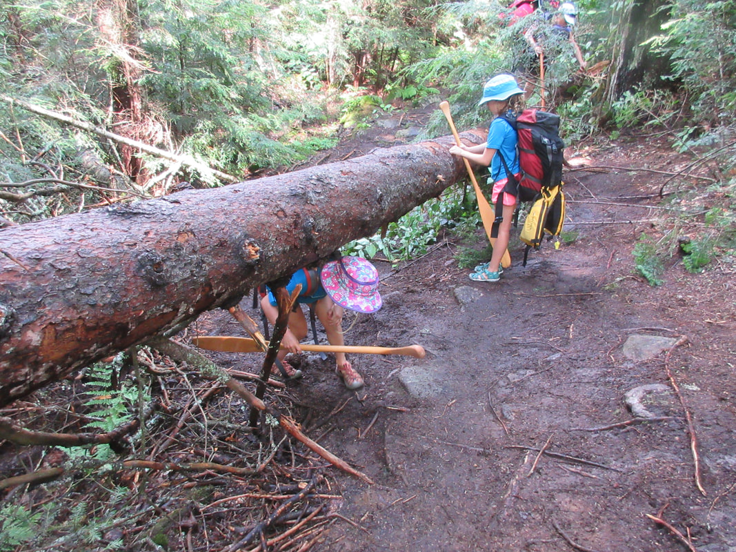
Today we had a quick oatmeal breakfast and got straight to work packing up. There are two options for the portage: 1) Walk on flat boardwalks from the campsite to connect to the portage trail for a total of about 2.2km one way or 2) Paddle carefully on river right 900m downstream to an opening on shore (closer to the top of the falls) to start portaging. Members of our group did both depending on comfort levels. We needed to portage 2 more carries to get all the gear down to the bottom of the falls for a total of 3 including the one from last night. We did take off our spray decks for portaging and had eaten all of our big bulky food (at least most of it before this point). On my last load down on the switchbacks I was a bit shaky with my legs after the 20km+ day yesterday and the two descents down the steep trail today.
Once the portaging was complete, it was time to get to work putting the spraydecks back on, loading the boats, donning our drysuits, and eating lunch. After those tasks were complete we wandered up closer to the falls and did a quick photo shoot. The falls are so impressive - you could never get sick of them. I was sad to see them go.
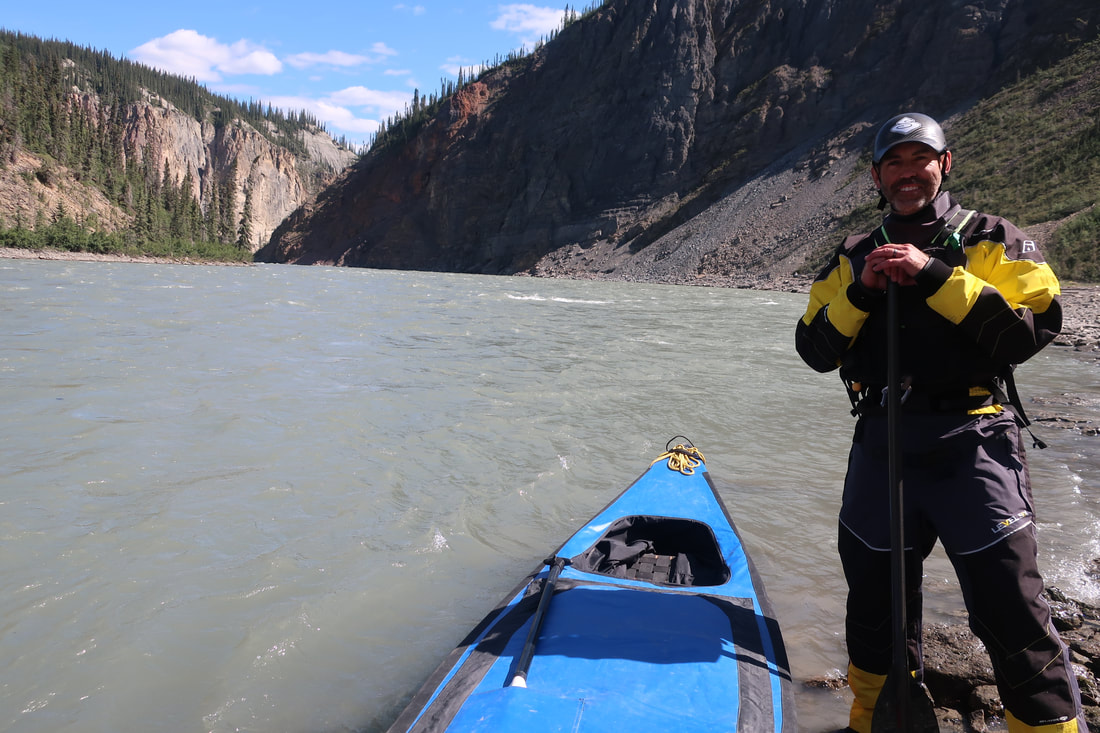
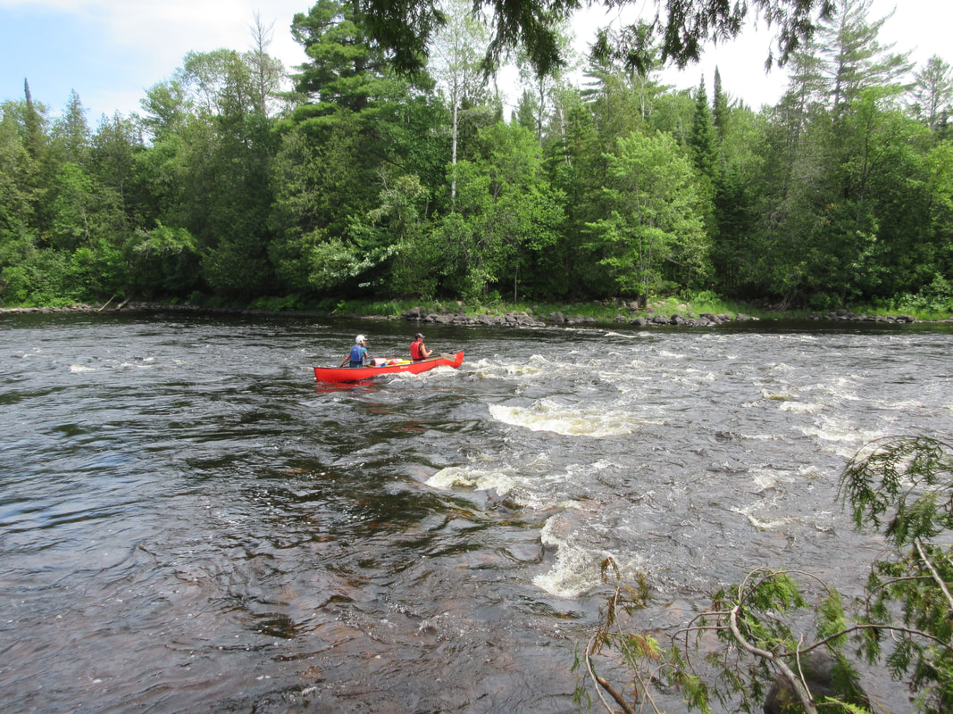
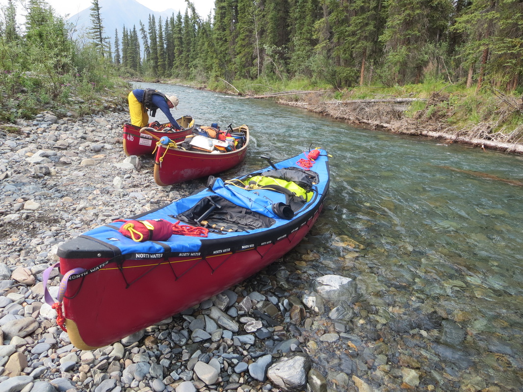
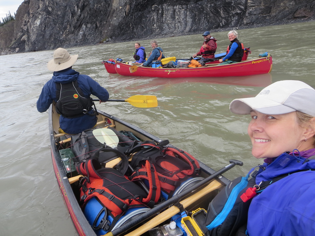
Fourth Canyon is the the first canyon and is where the real whitewater begins. The whitewater on the Nahanni is mainly caused by compression of current in canyons and converging currents with other tributaries. Fourth canyon has reputation of being big and wild and most guiding companies will catamaran canoes or raft clients down these big waves. Our group of 3 canoes just paddled it and with a spray deck on and some active paddling, we did have have any issues. That said we are all experienced (20+ yrs) whitewater paddlers and were doing a self-guided trip. There are definitely big waves in the 3 rapids and some turns so make sure you have your game face on. The False Canyon rapid was no issue as well, easily snuck on the right. Our max speed in the canyons according to the GPS was 18.3km/hr!
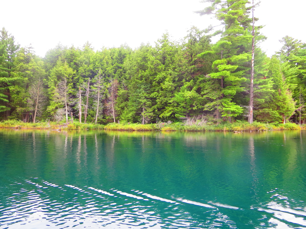
As someone from Ontario who only wears a drysuit in the spring and fall, it was my first time wearing one in the summer heat. When we arrived at our Clearwater Creek campsite I thought my drysuit was leaking due to the dampness inside. Turns out it was just sweat! We quickly set up a clothesline to dry out our wet gear and changed into our bathings suits to swim in the clear blue lagoon at the creek. Although swimming in the Nahanni will take your breath away literally, it is sometimes worth the refreshing dunk as was the case today.
The afternoon sun without mosquitos made lounging in bathing suits easy. We enjoyed some classic Mac & Cheese for dinner and socialized all evening in our camp chairs on our temporary beach home!
Today we had a quick oatmeal breakfast and got straight to work packing up. There are two options for the portage: 1) Walk on flat boardwalks from the campsite to connect to the portage trail for a total of about 2.2km one way or 2) Paddle carefully on river right 900m downstream to an opening on shore (closer to the top of the falls) to start portaging. Members of our group did both depending on comfort levels. We needed to portage 2 more carries to get all the gear down to the bottom of the falls for a total of 3 including the one from last night. We did take off our spray decks for portaging and had eaten all of our big bulky food (at least most of it before this point). On my last load down on the switchbacks I was a bit shaky with my legs after the 20km+ day yesterday and the two descents down the steep trail today.
Once the portaging was complete, it was time to get to work putting the spraydecks back on, loading the boats, donning our drysuits, and eating lunch. After those tasks were complete we wandered up closer to the falls and did a quick photo shoot. The falls are so impressive - you could never get sick of them. I was sad to see them go.
Fourth Canyon is the the first canyon and is where the real whitewater begins. The whitewater on the Nahanni is mainly caused by compression of current in canyons and converging currents with other tributaries. Fourth canyon has reputation of being big and wild and most guiding companies will catamaran canoes or raft clients down these big waves. Our group of 3 canoes just paddled it and with a spray deck on and some active paddling, we did have have any issues. That said we are all experienced (20+ yrs) whitewater paddlers and were doing a self-guided trip. There are definitely big waves in the 3 rapids and some turns so make sure you have your game face on. The False Canyon rapid was no issue as well, easily snuck on the right. Our max speed in the canyons according to the GPS was 18.3km/hr!
As someone from Ontario who only wears a drysuit in the spring and fall, it was my first time wearing one in the summer heat. When we arrived at our Clearwater Creek campsite I thought my drysuit was leaking due to the dampness inside. Turns out it was just sweat! We quickly set up a clothesline to dry out our wet gear and changed into our bathings suits to swim in the clear blue lagoon at the creek. Although swimming in the Nahanni will take your breath away literally, it is sometimes worth the refreshing dunk as was the case today.
The afternoon sun without mosquitos made lounging in bathing suits easy. We enjoyed some classic Mac & Cheese for dinner and socialized all evening in our camp chairs on our temporary beach home!


Day 8 July 23rd: Clearwater Creek to Moose Camp (35km, 5 hours,9km before The Gate 1298ft)
We woke up today with overcast skies and cooler temps which were grateful for being another drysuit wearing day. There were a few small rapids and converging whirlpools and tricky currents in our path today that required attention and proper gear. A swim in any canyon or on the river could be long and wearing a drysuit would definitely help your chances of survival.
The first major rapid we hit was Figure 8 rapid which has been apparently dramatically lessened since the flood in 2006. I agree as there wasn't much to it. We scouted it on the gravel bar and hopped right back into them and ran it without issues. Then we hit Wriggley creek where we all spun in a whirlpool at one point but nothing major. Then we hit Tricky currents which are two currents that converge around an island and look non threatening until you look down and see a whirlpool 2 feet below where your paddle should be hitting the water. Again, our group had no issues but I can see how the boils and converging currents could indeed be tricky for some and we did hear some guided groups had swimmers here. The fastest speed of the day was 19.3km/hr but generally the current is moving around 10km/hr.
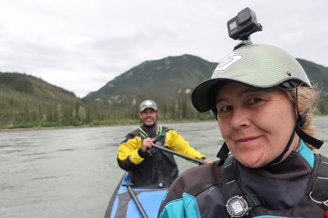
We entered the 40km long Third Canyon today. I learned some tips for using my GoPro today from another group member: audio commands! I was amusing in some of the rapids and canyons today hearing "Go Pro stop recording" or "GoPro take a photo"!
At the Virginia Falls campsite we found out from the parks staff that The Gate campsite was currently closed to a bear encounter that had happened earlier that month. Apparently a large guided group encountered a bear that came into camp looking for food and was not scared. The group deployed bear spray onto the bear and it successfully deterred it. Parks Canada had closed the campsite and we were supposed to be the first group eligible to camp there...and were scheduled for 2 nights! Instead we opted to camp just before and just after The Gate instead just to be on the safe side. Other guided groups after us did the same. Why risk it?
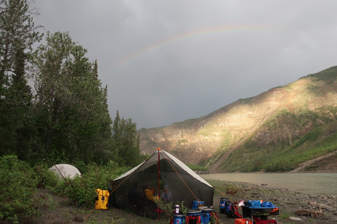
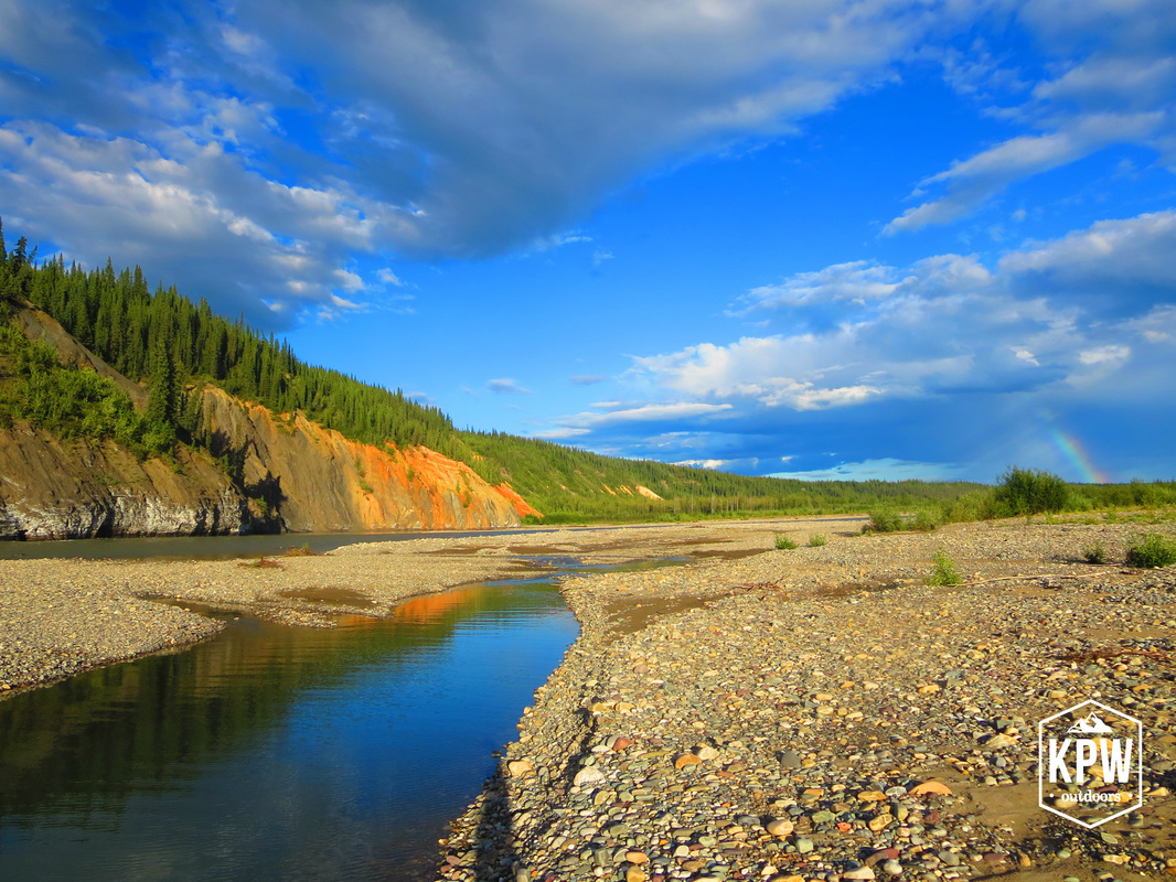
We set up camp on a gravel bar that had a large moose antler shed on it. Not too long later we heard an engine that was not a plane. It was a Parks Canada motorboat heading upstream! We ate a delicious cottage pie and played Quicktionary in our bug tent after dinner. An ominous cloud rolled in and rained on us very quickly and then almost immediately after the sun came out and surprised us with a double rainbow display!
We woke up today with overcast skies and cooler temps which were grateful for being another drysuit wearing day. There were a few small rapids and converging whirlpools and tricky currents in our path today that required attention and proper gear. A swim in any canyon or on the river could be long and wearing a drysuit would definitely help your chances of survival.
The first major rapid we hit was Figure 8 rapid which has been apparently dramatically lessened since the flood in 2006. I agree as there wasn't much to it. We scouted it on the gravel bar and hopped right back into them and ran it without issues. Then we hit Wriggley creek where we all spun in a whirlpool at one point but nothing major. Then we hit Tricky currents which are two currents that converge around an island and look non threatening until you look down and see a whirlpool 2 feet below where your paddle should be hitting the water. Again, our group had no issues but I can see how the boils and converging currents could indeed be tricky for some and we did hear some guided groups had swimmers here. The fastest speed of the day was 19.3km/hr but generally the current is moving around 10km/hr.
We entered the 40km long Third Canyon today. I learned some tips for using my GoPro today from another group member: audio commands! I was amusing in some of the rapids and canyons today hearing "Go Pro stop recording" or "GoPro take a photo"!
At the Virginia Falls campsite we found out from the parks staff that The Gate campsite was currently closed to a bear encounter that had happened earlier that month. Apparently a large guided group encountered a bear that came into camp looking for food and was not scared. The group deployed bear spray onto the bear and it successfully deterred it. Parks Canada had closed the campsite and we were supposed to be the first group eligible to camp there...and were scheduled for 2 nights! Instead we opted to camp just before and just after The Gate instead just to be on the safe side. Other guided groups after us did the same. Why risk it?
We set up camp on a gravel bar that had a large moose antler shed on it. Not too long later we heard an engine that was not a plane. It was a Parks Canada motorboat heading upstream! We ate a delicious cottage pie and played Quicktionary in our bug tent after dinner. An ominous cloud rolled in and rained on us very quickly and then almost immediately after the sun came out and surprised us with a double rainbow display!
Day 9 July 24th: Moose Camp to Asteroid Camp (26.2km including the hike, 600ft ascent on hike)
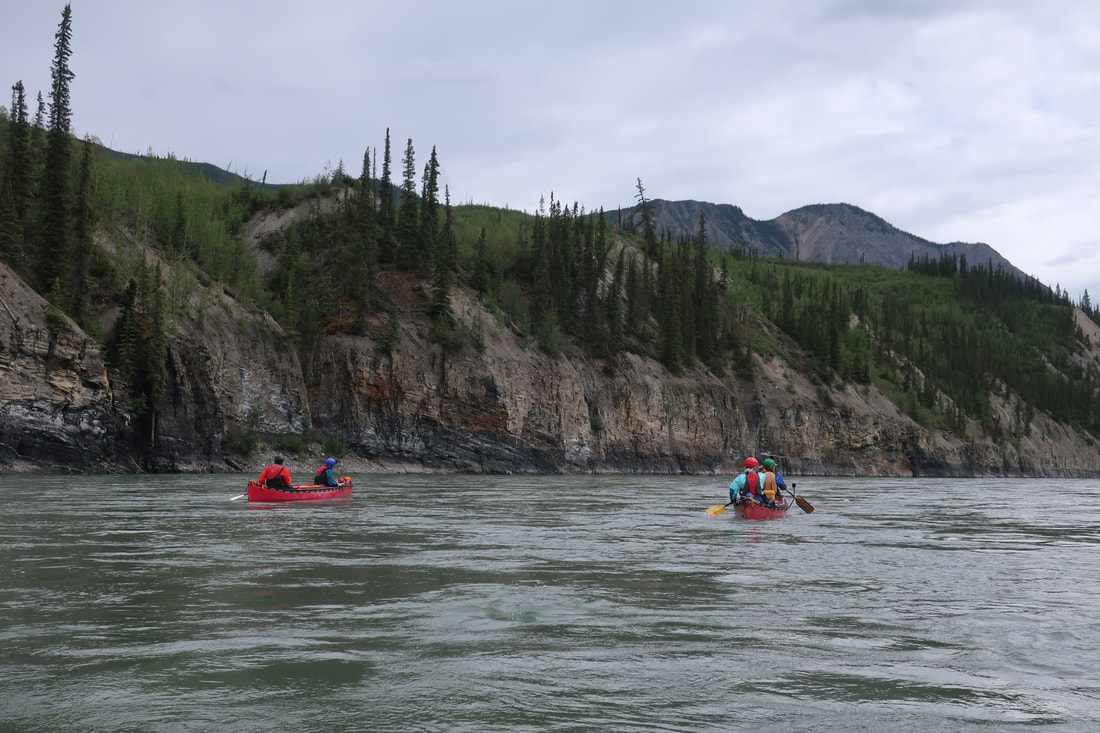
Packed up and headed downstream a short distance through Third Canyon. We were blessed with beautiful vistas and lovely paddling through swifts - no drysuit today!
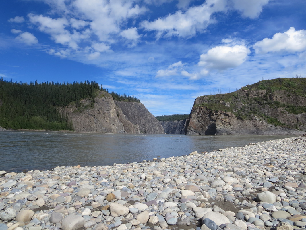
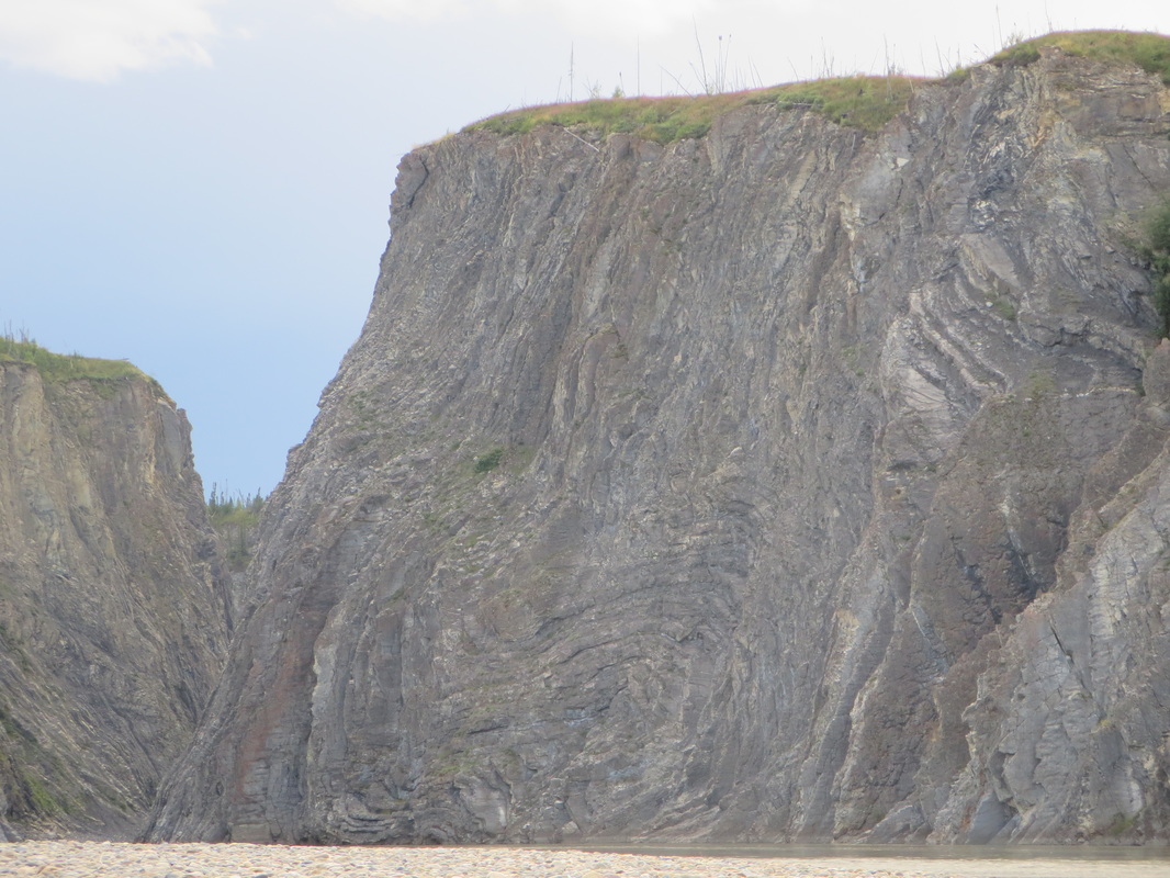
Stopped at The Gate campground keeping an eye out for bears and hiked to the top of the bluff to look at the Pulpit rock. The hike required crossing a creek, ascending 600 feet of steep boulders and rooty trail. The reward is worth the effort though. The views are amazing! The lookout points at the top are on detached blocks so be careful when you are up there. My rock climber eyes spotted this chossy rock and chose not to linger on it! When we descended, a Parks Canada motorboat was travelling back downstream (same one as yesterday). Then a helicopter flew through The Gate and buzzed the Pulpit rock. Then a float plane flew over....all within 10 minutes. This river is busy!
Not too long after the gate we found a gravel bar we could camp on. The afternoon sun was beating down on us so our first priority was to set up a tarp for shade. This was another day swimming was mandatory and took no time at all to dry off. We ate a delicious Pad Thai dinner and cheesecake for dessert and shared stories from our travels to Southeast Asia.
Just after dinner the wind died and some smoky forest fire air moved in. We named this camp Asteroid Camp because of peculiar black rock we found that was so different from anything else we had seen that it had to be from outer space!
Packed up and headed downstream a short distance through Third Canyon. We were blessed with beautiful vistas and lovely paddling through swifts - no drysuit today!
Stopped at The Gate campground keeping an eye out for bears and hiked to the top of the bluff to look at the Pulpit rock. The hike required crossing a creek, ascending 600 feet of steep boulders and rooty trail. The reward is worth the effort though. The views are amazing! The lookout points at the top are on detached blocks so be careful when you are up there. My rock climber eyes spotted this chossy rock and chose not to linger on it! When we descended, a Parks Canada motorboat was travelling back downstream (same one as yesterday). Then a helicopter flew through The Gate and buzzed the Pulpit rock. Then a float plane flew over....all within 10 minutes. This river is busy!
Not too long after the gate we found a gravel bar we could camp on. The afternoon sun was beating down on us so our first priority was to set up a tarp for shade. This was another day swimming was mandatory and took no time at all to dry off. We ate a delicious Pad Thai dinner and cheesecake for dessert and shared stories from our travels to Southeast Asia.
Just after dinner the wind died and some smoky forest fire air moved in. We named this camp Asteroid Camp because of peculiar black rock we found that was so different from anything else we had seen that it had to be from outer space!


Day 10 July 25th: Asteroid Camp to Painted Rocks (22.1km including 6km hike 1248 ft elev)
The morning of Day 10 was not best for me. After 9 nights of sleeping on a deflating mattress (and having to re-inflate in multiple times per night) my back got very cranky and started to revolt. Gravel bars are not the most forgiving place to sleep on with a disfunctional mattress. After popping some ibuprofen and doing some stretches, my hubby offered me his functional mattress for the night and we could switch. That is love!
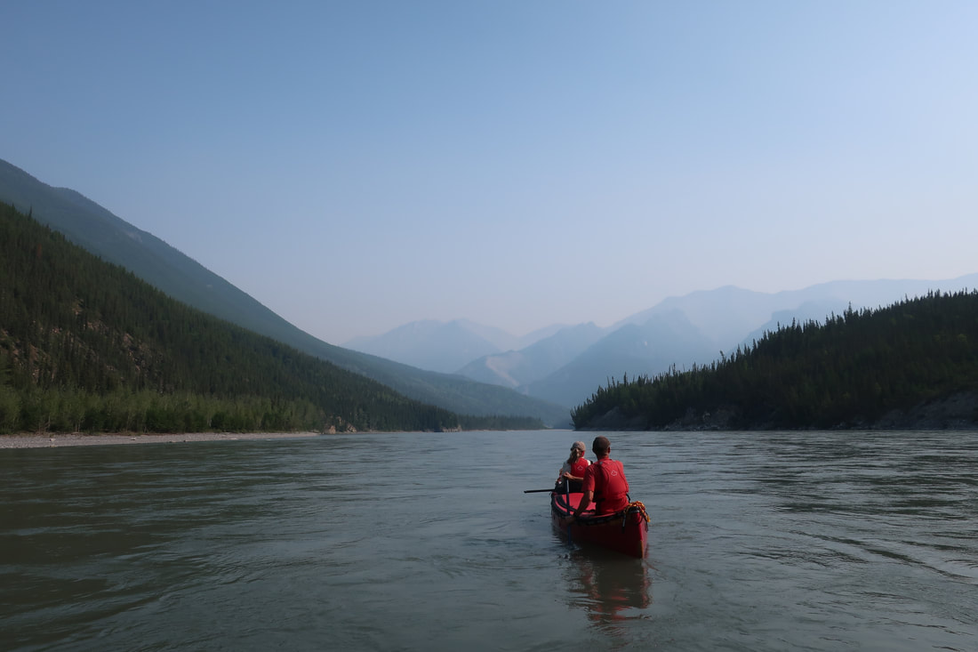
This morning was also very moody due to the smoky skies. There was little to no wind and the smoke settled in for most of the day. We left Third Canyon and rounded a big bend to see some very picturesque scenes with the smoke lingering in the valley. You could start to really smell it and taste it the further we went downstream.
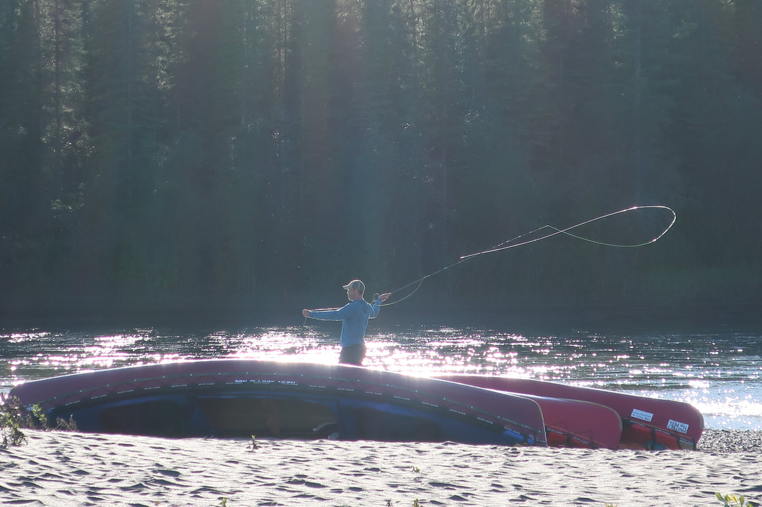
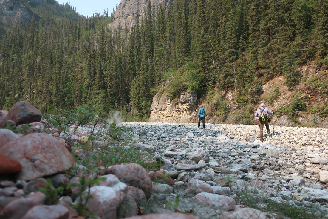
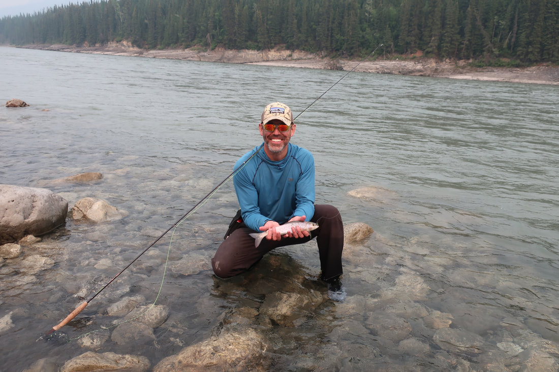
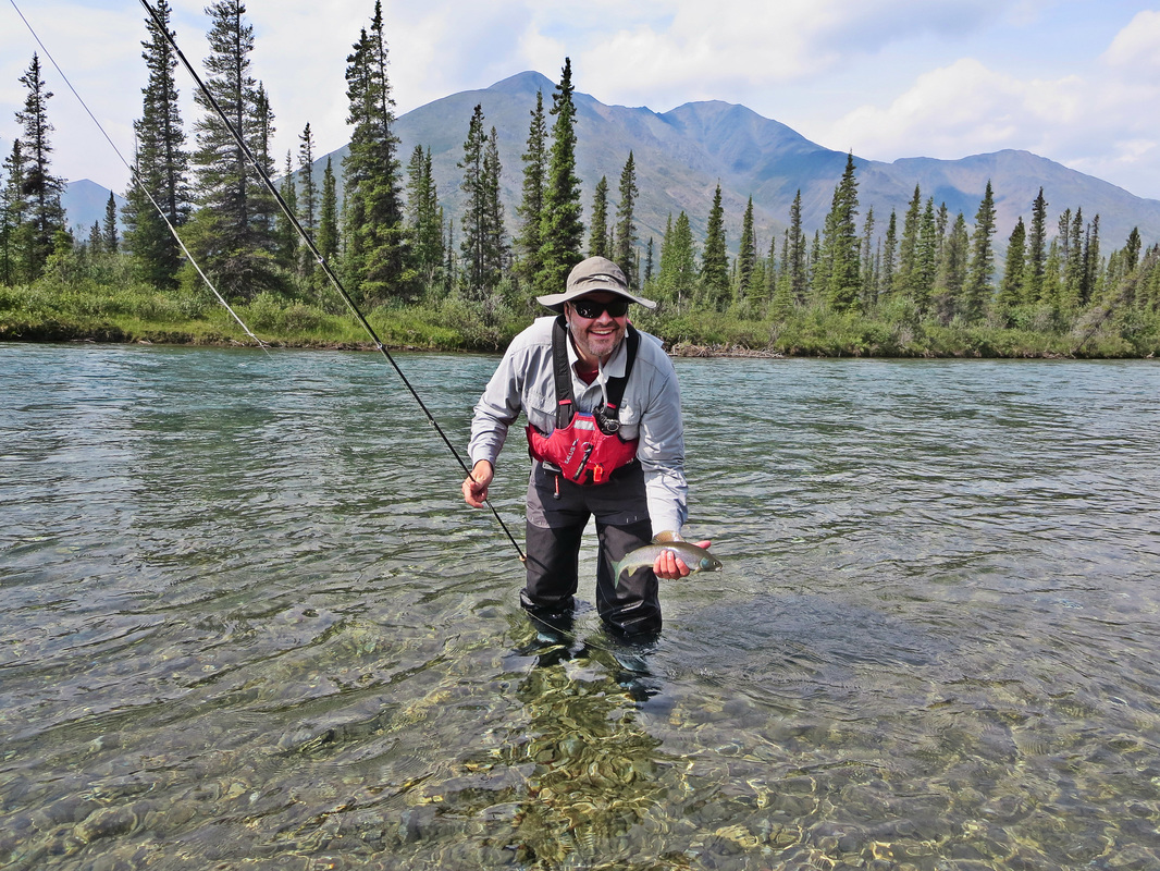
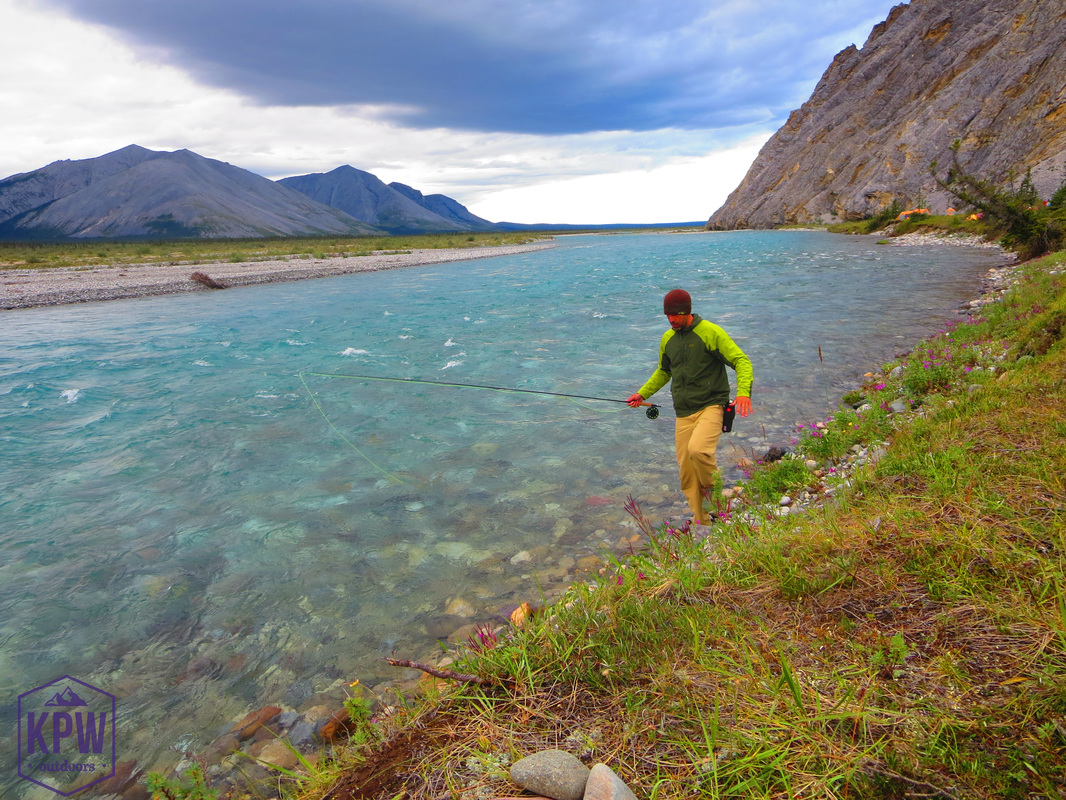
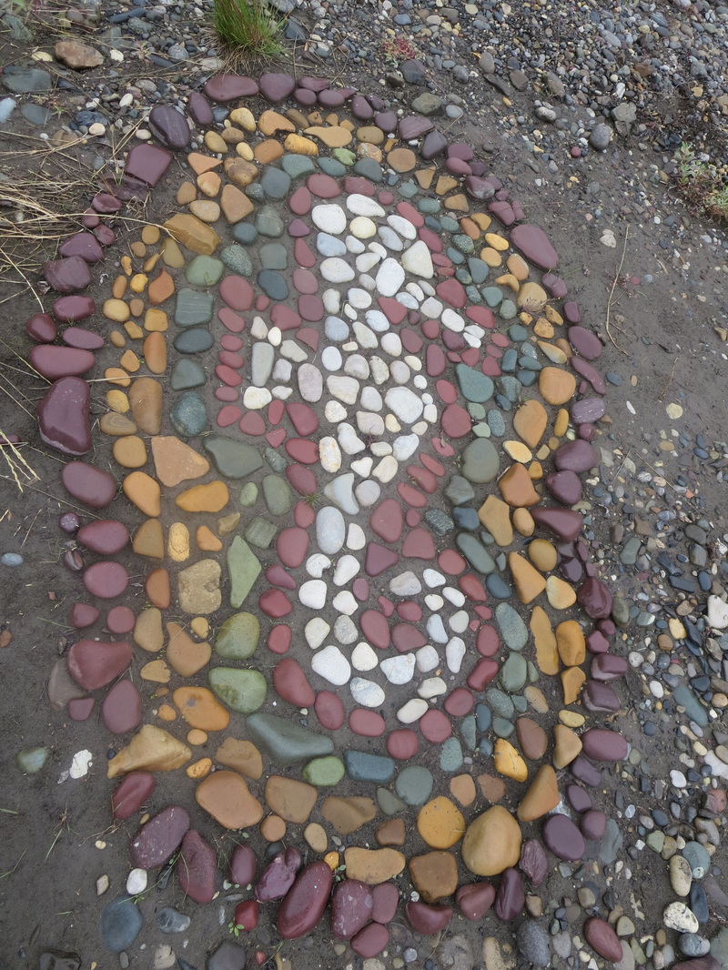
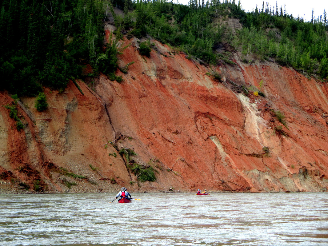
At the beginning of Second Canyon, we pulled over on river right at Painted Canyon to do a short hike to see the rocks. The rocks here have some sort of red pollen or something on them that turn them red. Be careful - if you walk on these rocks with bare feet, sit on them or wipe your finger on them your skin will turn yellow! The hike was easy up a creek bed and crossed a creek multiple times - keep your wet shoes on! We walked up to the end and turned around and had lunch back at the canoes. An obvious campspot was not being used so we decided to take it and have a half day rest. Glenn pulled out his fly fishing rod and caught 6 Grayling here at the mouth of the creek and the river. Other members swam, read, napped and made pie.
The lack of air movement created some smoky and buggy conditions until after dinner when a subtle breeze started to pick up and move some of the stagnant air out. After dinner a guide from an NRA canoeing group came to visit us (to compare itineraries) and we had a lovely chat.
The morning of Day 10 was not best for me. After 9 nights of sleeping on a deflating mattress (and having to re-inflate in multiple times per night) my back got very cranky and started to revolt. Gravel bars are not the most forgiving place to sleep on with a disfunctional mattress. After popping some ibuprofen and doing some stretches, my hubby offered me his functional mattress for the night and we could switch. That is love!
This morning was also very moody due to the smoky skies. There was little to no wind and the smoke settled in for most of the day. We left Third Canyon and rounded a big bend to see some very picturesque scenes with the smoke lingering in the valley. You could start to really smell it and taste it the further we went downstream.
At the beginning of Second Canyon, we pulled over on river right at Painted Canyon to do a short hike to see the rocks. The rocks here have some sort of red pollen or something on them that turn them red. Be careful - if you walk on these rocks with bare feet, sit on them or wipe your finger on them your skin will turn yellow! The hike was easy up a creek bed and crossed a creek multiple times - keep your wet shoes on! We walked up to the end and turned around and had lunch back at the canoes. An obvious campspot was not being used so we decided to take it and have a half day rest. Glenn pulled out his fly fishing rod and caught 6 Grayling here at the mouth of the creek and the river. Other members swam, read, napped and made pie.
The lack of air movement created some smoky and buggy conditions until after dinner when a subtle breeze started to pick up and move some of the stagnant air out. After dinner a guide from an NRA canoeing group came to visit us (to compare itineraries) and we had a lovely chat.
Day 11 July 26th: Painted Rocks to Dry Canyon (28.5km, 5 hours)
Today we were on the water by 10AM after a comfortable sleep for me on a fully inflated mattress. We had beautiful blue skies and no smoke to exit Second Canyon. The landscape changed here as we entered Deadmen Valley. The valley widened and you could see the Headless Range. For more interesting stories about this valley read the book "Legends of the Nahanni Valley" by Hammerson Peters.
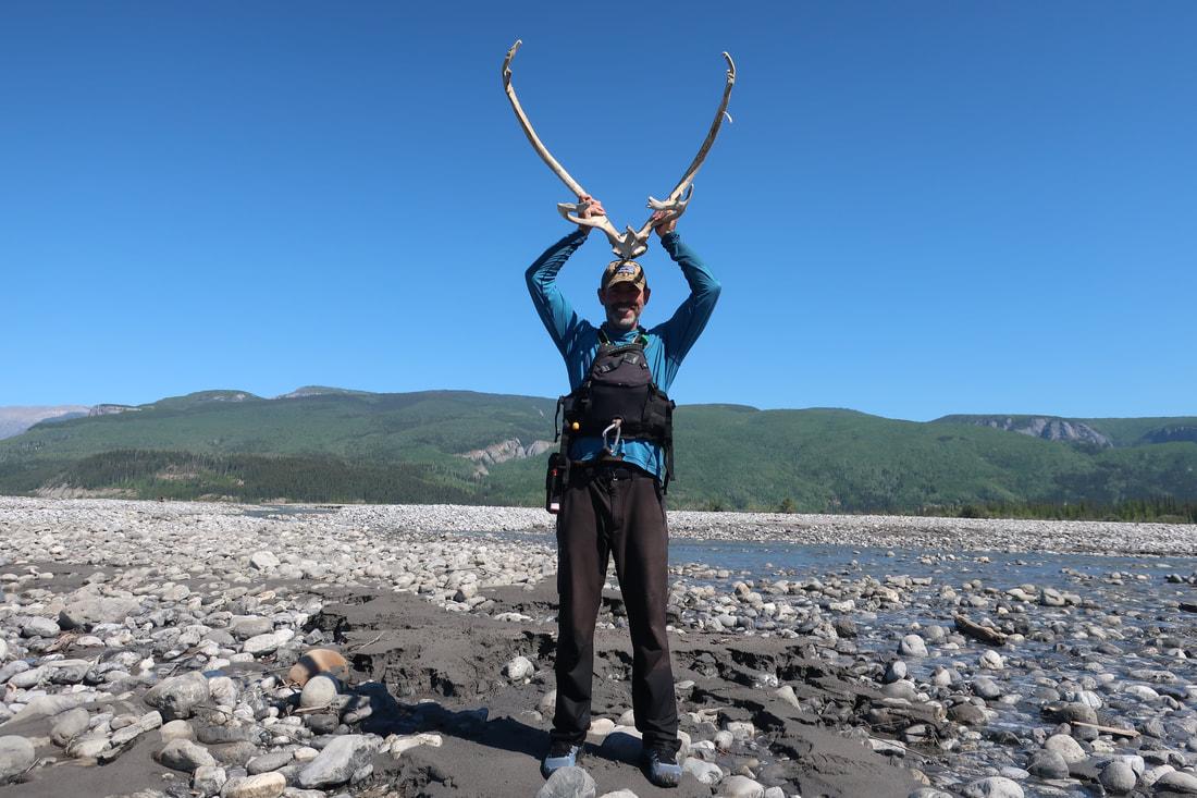
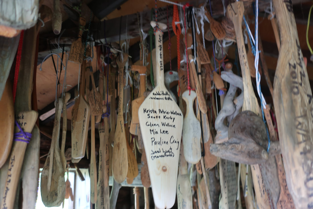
We stopped at the outflow of Prairie Creek for lunch and only 200m downstream I spotted a large Caribou antler set with partial skull that we stopped and checked out. Then another 200m downstream on river right is a Forestry Cabin we wanted to check out. We pulled over and had to use rock climbing skills to climb up the bank but in hindsight it would have been easier to paddle down to the Warden's cabin a few hundred meters more downstream and then walk on the trail back to the Forestry Cabin. Inside, are hundreds on mini paddles with the names of paddlers who have paddled the river hanging from the roof. Very Cool! A thermometer outside of the cabin read 30C in the shade!! Very buggy here!
Another 5 mins downstream was Dry Canyon, our campsite destination for the night. The direct sun was oppressive by mid-afternoon so we set up a tarp for some shade. We quickly put up the tents and changed into our bathers for a dip. I stayed in for over 10 mins. A record! The winds picked up in the afternoon and blew over our shelter and left us baking in the sun once again. This day it was imperative to swim and drink as much as possible as heat exhaustion was a real threat.
Today we hit the tents early as the wind finally died and the bugs came out in hoards. After being so sun exposed today it was nice to lay down and rest. I fell asleep instantly.
Today we were on the water by 10AM after a comfortable sleep for me on a fully inflated mattress. We had beautiful blue skies and no smoke to exit Second Canyon. The landscape changed here as we entered Deadmen Valley. The valley widened and you could see the Headless Range. For more interesting stories about this valley read the book "Legends of the Nahanni Valley" by Hammerson Peters.
We stopped at the outflow of Prairie Creek for lunch and only 200m downstream I spotted a large Caribou antler set with partial skull that we stopped and checked out. Then another 200m downstream on river right is a Forestry Cabin we wanted to check out. We pulled over and had to use rock climbing skills to climb up the bank but in hindsight it would have been easier to paddle down to the Warden's cabin a few hundred meters more downstream and then walk on the trail back to the Forestry Cabin. Inside, are hundreds on mini paddles with the names of paddlers who have paddled the river hanging from the roof. Very Cool! A thermometer outside of the cabin read 30C in the shade!! Very buggy here!
Another 5 mins downstream was Dry Canyon, our campsite destination for the night. The direct sun was oppressive by mid-afternoon so we set up a tarp for some shade. We quickly put up the tents and changed into our bathers for a dip. I stayed in for over 10 mins. A record! The winds picked up in the afternoon and blew over our shelter and left us baking in the sun once again. This day it was imperative to swim and drink as much as possible as heat exhaustion was a real threat.
Today we hit the tents early as the wind finally died and the bugs came out in hoards. After being so sun exposed today it was nice to lay down and rest. I fell asleep instantly.


Day 12 July 27th: Dry Canyon to Lafferty (24km, 7 hours)
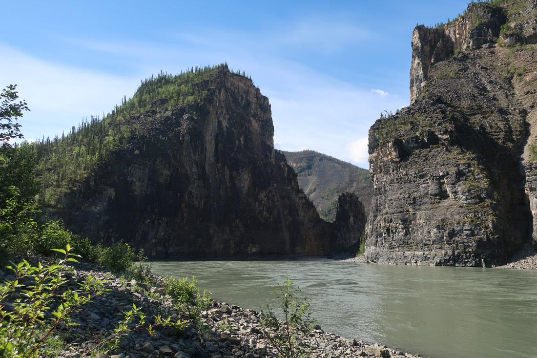
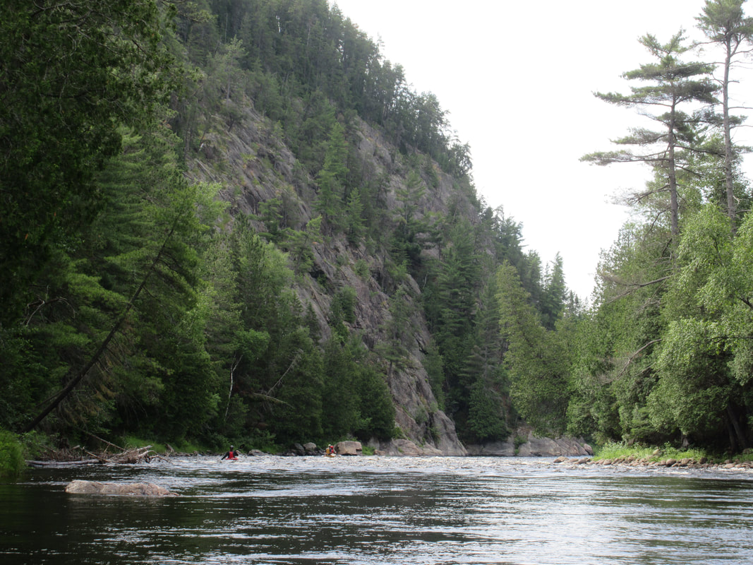
Today we started our day with a hike up Dry Canyon. We couldn't even entertain the thought of hiking in the heat yesterday so we went for a hike up the dry creek bed and checked out all the caves and boulders in the Canyon. We didn't go up too far, but did feel like we got a good 1.5 hours of walking in. We returned to the boats and changed out of hiking gear to drysuits as the dramatic entrance into First Canyon was almost visible. We scouted the George's Riffle rapid from the island and eliminated the sneak as an option. George's Riffle is certainly no riffle at all! Sweat built under our wetsuits as we moved along the shorelines. Left of centre looked like the best option so up we went to run it. Glenn and I were the first boat down and when we hit the converging currents Glenn (who was in the stern) opted for Plan B and veered right early which after some hard paddling through some wild waves proved to be successful missing the boils, recirculating eddy. Everyone else stayed left of centre which was also successful. No swims!
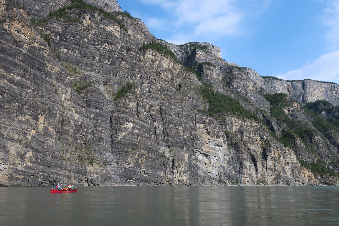
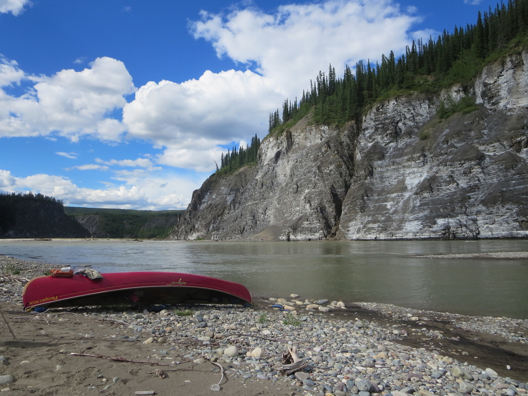
Just downstream at the first gravel bar we stopped for lunch and took off the sweat suits we were wearing for the rest of the day. The cool air felt so refreshing! First Canyon is now my favourite canyon of the trip- tall canyon walls that don't let up for hours. It's hard to pay attention to your paddling when all you are doing is 'oooing' and 'awwing' at the scenery. Mindblowing!
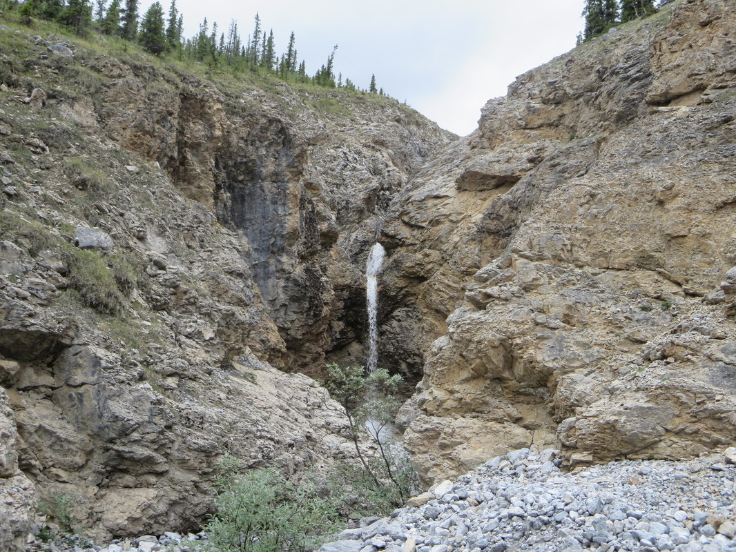
We stopped at the Whitespray natural spring (looks like a 10m wide small waterfall/rapid) on river left to fill up bottles and bladders. Some of the best water I have ever tasted. Soon after you reach Lafferty campground. We pulled in beside a guided group and set up on the gravel bar. Glenn graciously lent me his mattress again and it was my turn to make dinner again: a sweet potato peanut stew which turned out well. The smoky skies returned this evening and we were in bed by 8PM.
Today we started our day with a hike up Dry Canyon. We couldn't even entertain the thought of hiking in the heat yesterday so we went for a hike up the dry creek bed and checked out all the caves and boulders in the Canyon. We didn't go up too far, but did feel like we got a good 1.5 hours of walking in. We returned to the boats and changed out of hiking gear to drysuits as the dramatic entrance into First Canyon was almost visible. We scouted the George's Riffle rapid from the island and eliminated the sneak as an option. George's Riffle is certainly no riffle at all! Sweat built under our wetsuits as we moved along the shorelines. Left of centre looked like the best option so up we went to run it. Glenn and I were the first boat down and when we hit the converging currents Glenn (who was in the stern) opted for Plan B and veered right early which after some hard paddling through some wild waves proved to be successful missing the boils, recirculating eddy. Everyone else stayed left of centre which was also successful. No swims!
Just downstream at the first gravel bar we stopped for lunch and took off the sweat suits we were wearing for the rest of the day. The cool air felt so refreshing! First Canyon is now my favourite canyon of the trip- tall canyon walls that don't let up for hours. It's hard to pay attention to your paddling when all you are doing is 'oooing' and 'awwing' at the scenery. Mindblowing!
We stopped at the Whitespray natural spring (looks like a 10m wide small waterfall/rapid) on river left to fill up bottles and bladders. Some of the best water I have ever tasted. Soon after you reach Lafferty campground. We pulled in beside a guided group and set up on the gravel bar. Glenn graciously lent me his mattress again and it was my turn to make dinner again: a sweet potato peanut stew which turned out well. The smoky skies returned this evening and we were in bed by 8PM.


Day 13 July 28th: Lafferty to the North Elbow (26km including hike to Lafferty Pools)
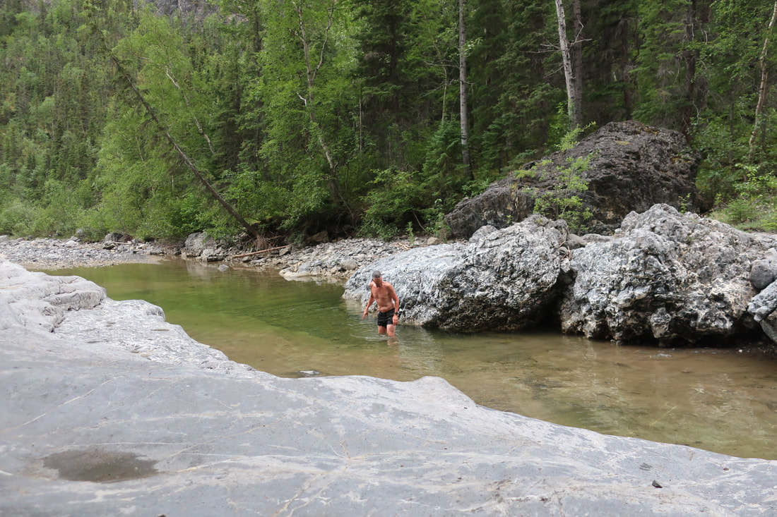
Today was supposed to be a layover day at Laffery but with 2 guided groups plus our self-guided group all supposed to leave the next morning and head to the hot spring we knew that having 30+ people in the hot spring wouldn't be fun or even possible (its not that big!). We woke up to some rain and cloudy skies and decided to walk up Lafferty Creek (along the left there is a trail) to the pools where the canyon becomes very narrow. On this cold cloudy day I chose not to swim but some of our members did and carried on up through the slot canyon at the top!
We returned to camp to pack up and a raft group started taking over our campspot after they had just arrived at camp...at noon! Boy do they pack heavy! We ate lunch and ran the left sneak past Lafferty Riffle to the end of First Canyon where the Kraus Hotsprings are located on river right only about 2km downstream from Lafferty. The Kraus' are a couple that used to inhabit that land on and off for decades. Only one outbuilding remains - an old cabin that is again filled with small paddles and the names of paddlers who have travelled it's waters. Unbenounced to us, Joel had made a small wood paddle and had us sign it and hung it in the cabin. We confirmed our place in Nahanni history.
The cabin is only about a 50m walk on trail from the hotspring. We jumped in the hotspring which was warm, but not super hot and tried not to mind the slime and scum and smell of rotten eggs a.k.a. hydrogen sulfide. The warm water on our bodies was a welcome change. Joel used his sat phone in the hotspring to call our floatplane company to confirm a pick up time in two days time. We washed the scum and slime off us in the clear creak water below before changing and jumping into the canoe for a floating lunch/snack. Returning to paddling after this was a bit of chore as we all had jelly muscles from the hotspring!
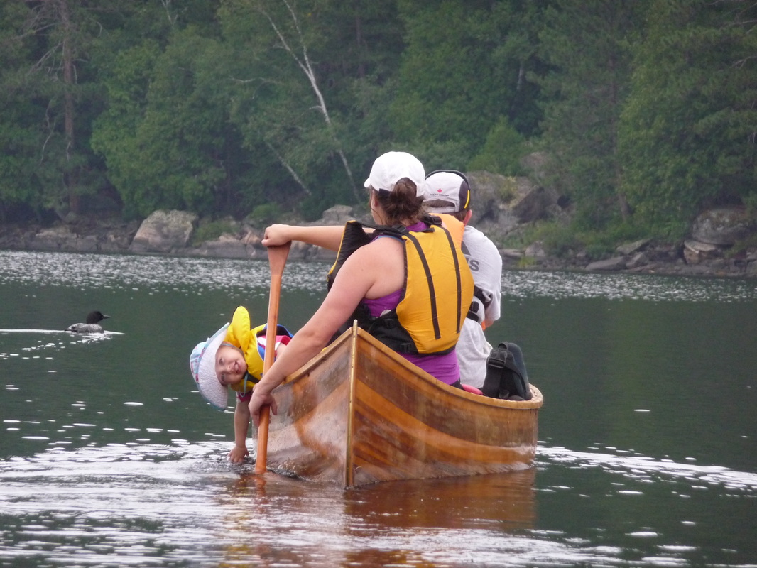
We paddling for a couple of hours and out of the blue saw two heads swimming in the river in front of us. A cow moose and calf were swimming across the river! We were far enough away to witness the whole crossing and then saw the two successful exit on the far side. Momma looked a bit confused trying to identify what species the 3 red canoes were!
We found a wide open gravel bar to call home for the night near the North Elbow. We had some time to rest before dinner today as we waited for some bison goulash to heat up and cornbread. After dinner in the bug shelter we played a competitive game of Taco Cat Goat Cheese Pizza! A fun kids game that adults can play as well...and may even draw blood!! Heading to bed these even was interrupted but a couple of Common Nighthawks calling as they came out to feast on insects. The Nighthawk's call is more barking then melodic so it took some time before they moved on for us to fall asleep!
Today was supposed to be a layover day at Laffery but with 2 guided groups plus our self-guided group all supposed to leave the next morning and head to the hot spring we knew that having 30+ people in the hot spring wouldn't be fun or even possible (its not that big!). We woke up to some rain and cloudy skies and decided to walk up Lafferty Creek (along the left there is a trail) to the pools where the canyon becomes very narrow. On this cold cloudy day I chose not to swim but some of our members did and carried on up through the slot canyon at the top!
We returned to camp to pack up and a raft group started taking over our campspot after they had just arrived at camp...at noon! Boy do they pack heavy! We ate lunch and ran the left sneak past Lafferty Riffle to the end of First Canyon where the Kraus Hotsprings are located on river right only about 2km downstream from Lafferty. The Kraus' are a couple that used to inhabit that land on and off for decades. Only one outbuilding remains - an old cabin that is again filled with small paddles and the names of paddlers who have travelled it's waters. Unbenounced to us, Joel had made a small wood paddle and had us sign it and hung it in the cabin. We confirmed our place in Nahanni history.
The cabin is only about a 50m walk on trail from the hotspring. We jumped in the hotspring which was warm, but not super hot and tried not to mind the slime and scum and smell of rotten eggs a.k.a. hydrogen sulfide. The warm water on our bodies was a welcome change. Joel used his sat phone in the hotspring to call our floatplane company to confirm a pick up time in two days time. We washed the scum and slime off us in the clear creak water below before changing and jumping into the canoe for a floating lunch/snack. Returning to paddling after this was a bit of chore as we all had jelly muscles from the hotspring!
We paddling for a couple of hours and out of the blue saw two heads swimming in the river in front of us. A cow moose and calf were swimming across the river! We were far enough away to witness the whole crossing and then saw the two successful exit on the far side. Momma looked a bit confused trying to identify what species the 3 red canoes were!
We found a wide open gravel bar to call home for the night near the North Elbow. We had some time to rest before dinner today as we waited for some bison goulash to heat up and cornbread. After dinner in the bug shelter we played a competitive game of Taco Cat Goat Cheese Pizza! A fun kids game that adults can play as well...and may even draw blood!! Heading to bed these even was interrupted but a couple of Common Nighthawks calling as they came out to feast on insects. The Nighthawk's call is more barking then melodic so it took some time before they moved on for us to fall asleep!

Day 14 July 29th: North Elbow to Nahanni Butte (61km 7 hours)
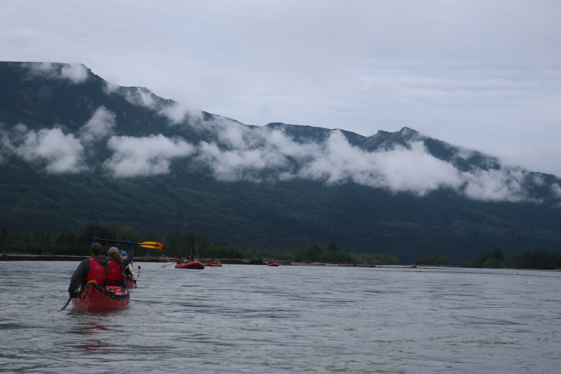
Today we woke up to low cloud weather and damp conditions from rain overnight. We pulled out the Goretex for the first time on the trip. With a slow pancake breakfast to start the day, we saw the guided group of rafts head downstream before us. We got on the water a little later than normal at 10:30AM and saw a the second guided canoe group coming downstream at us so we bolted onto the river. Two of our group members are YRQ (Yukon River Quest) alumnists and it was as if we were in a race with a group ahead and behind. Our group found a maintainable pace that was fast enough to pass the raft group and not let the canoe group catch up. The river turns right at Trickster Peak and then mellows out and becomes very braided and shallow in places.
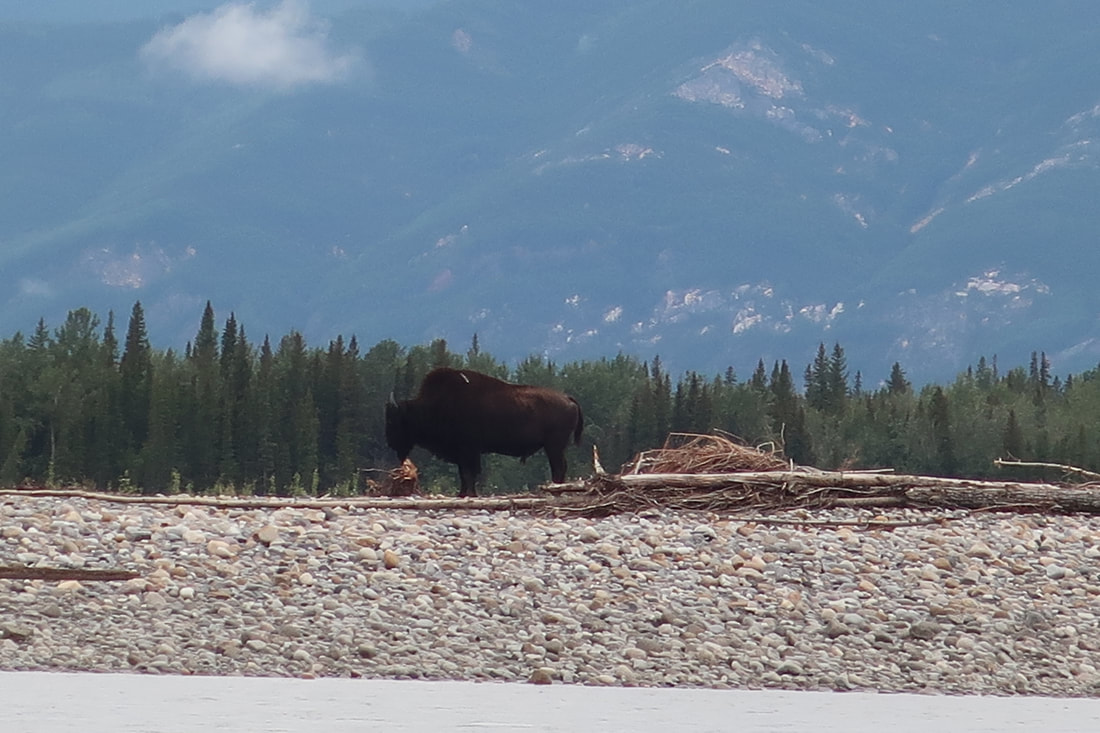
Just after we had passed the raft group, a group member spotted a large brown piece of wood on shore. After a short glance through the binoculars it was not a piece of wood, but a bison! This young male was a great at posing and did not move the entire time we passed it. Very cool! Soon after we passed the park boundary sign and kept going down The Splits. Before we knew it we had passed the last gravel bar because the river banks become very muddy in the last 20km before Nahanni Butte. We decided to carry on to the Butte and camp in the campground on river right.
Arriving at the campground tired after a 61km, 7 hour paddle we pulled our gear up the muddy bank onto a flat grassy area. There were a few outbuildings and tables there but and some bison patties on the ground. The mosquitos there were the worst of the trip by far...going to the bathroom, eating unzipping a bug jacket, or showing any exposed skin was hazardous. There must have been a million on the campsite. We set up our tent without the fly inside one of the outbuildings and set up our bug shelter to eat in. Everything that evening was about managing sanity from the 1000 mosquito cloud following each individual!
Day 15: Nahanni Butte to Whitehorse
On Day 15 we strolled into the thriving metropolis of Nahanni Butte We had heard there was a general store and the potential for a cold drink or ice cream. We walked about 10-15 mins from the campground past the airport and an outfitter to the very small community and found the store. It was closed on weekends! No luck! We returned to the campground just as our float plane was landing. Unfortunately the water was too low to be picked up at the campground (mud flat) so we canoed directly across the river to a sandy area that was deeper and more appropriate for loading. Being on the second flight, we shuttled our gear over to the landing spot and waited a couple hours before the plane returned. Goodbye Nahanni, you were amazing! Bucketlist trip complete!
Check out the 6 minute video below of the trip!
Today we woke up to low cloud weather and damp conditions from rain overnight. We pulled out the Goretex for the first time on the trip. With a slow pancake breakfast to start the day, we saw the guided group of rafts head downstream before us. We got on the water a little later than normal at 10:30AM and saw a the second guided canoe group coming downstream at us so we bolted onto the river. Two of our group members are YRQ (Yukon River Quest) alumnists and it was as if we were in a race with a group ahead and behind. Our group found a maintainable pace that was fast enough to pass the raft group and not let the canoe group catch up. The river turns right at Trickster Peak and then mellows out and becomes very braided and shallow in places.
Just after we had passed the raft group, a group member spotted a large brown piece of wood on shore. After a short glance through the binoculars it was not a piece of wood, but a bison! This young male was a great at posing and did not move the entire time we passed it. Very cool! Soon after we passed the park boundary sign and kept going down The Splits. Before we knew it we had passed the last gravel bar because the river banks become very muddy in the last 20km before Nahanni Butte. We decided to carry on to the Butte and camp in the campground on river right.
Arriving at the campground tired after a 61km, 7 hour paddle we pulled our gear up the muddy bank onto a flat grassy area. There were a few outbuildings and tables there but and some bison patties on the ground. The mosquitos there were the worst of the trip by far...going to the bathroom, eating unzipping a bug jacket, or showing any exposed skin was hazardous. There must have been a million on the campsite. We set up our tent without the fly inside one of the outbuildings and set up our bug shelter to eat in. Everything that evening was about managing sanity from the 1000 mosquito cloud following each individual!
Day 15: Nahanni Butte to Whitehorse
On Day 15 we strolled into the thriving metropolis of Nahanni Butte We had heard there was a general store and the potential for a cold drink or ice cream. We walked about 10-15 mins from the campground past the airport and an outfitter to the very small community and found the store. It was closed on weekends! No luck! We returned to the campground just as our float plane was landing. Unfortunately the water was too low to be picked up at the campground (mud flat) so we canoed directly across the river to a sandy area that was deeper and more appropriate for loading. Being on the second flight, we shuttled our gear over to the landing spot and waited a couple hours before the plane returned. Goodbye Nahanni, you were amazing! Bucketlist trip complete!
Check out the 6 minute video below of the trip!


 RSS Feed


