
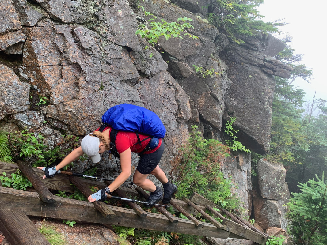
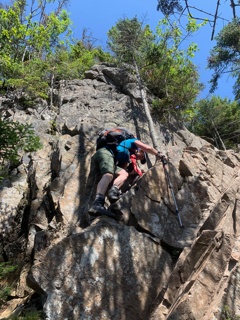
Ladder section on the Hi-Cannon Trail
The forecast for August 8th, 2019 wasn't optimal. After a full night of hard rain and thundershowers we opted against the possible ridge walks and slide hikes on our list. With rain in the forecast for the day, we chose a short hike up Cannon Mountain in the Franconia area of the White Mountains in New Hampshire.
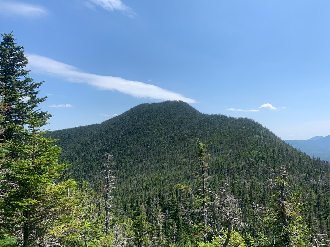
Cannon Mountain stands at 4080' and is known for it's ski hill and tramway. The summit has a viewing tower that I wasn't aware of when I started this hike and apparently has awesome views of the Franoconia area on a clear day.
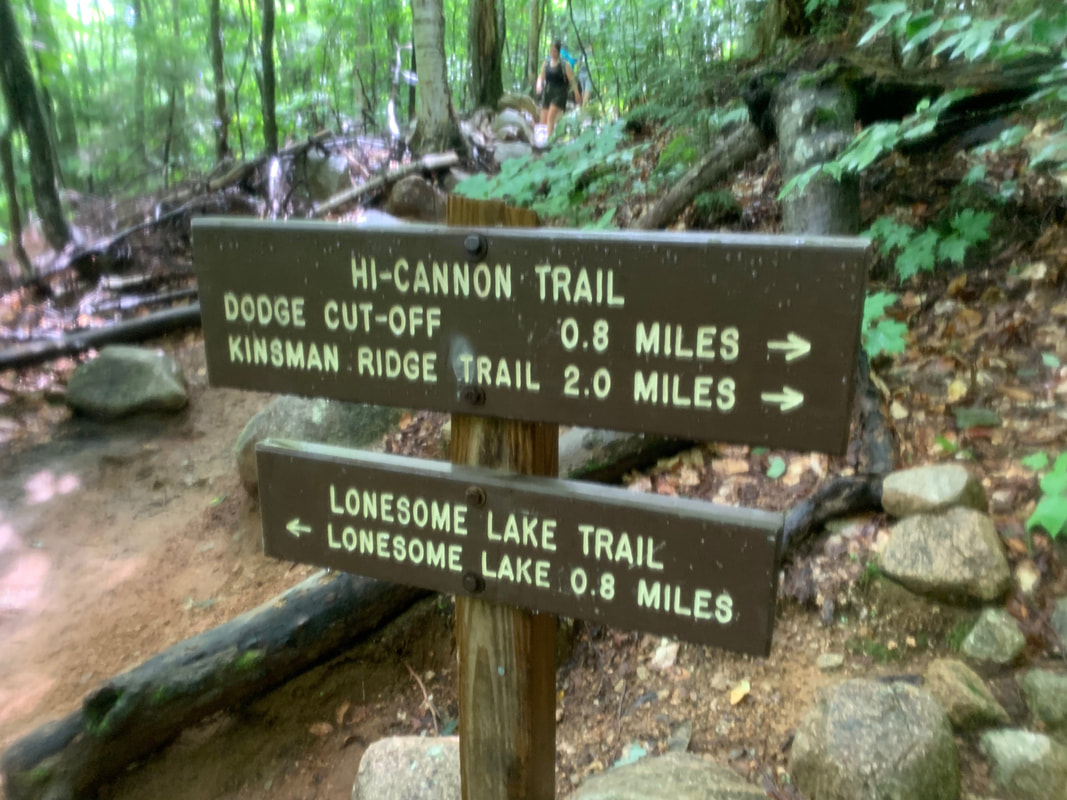
We started late at 10:15 AM after changing our plan and attempting to wait out rain storms. We parked at the Lafayette Campground hiker parking (1900') and walked up through the campground following the signs to the Lonesome Lake Trailhead. Quickly after the hiking trail begins, it splits and we took the right hand option: Hi Cannon Trail. The 2.8 mile trail up begins with a severely eroded section that is covered in a small granules akin to kitty litter. The trail takes no time to become steep and remind you that if you wore too many layers you will want to take them off ASAP.
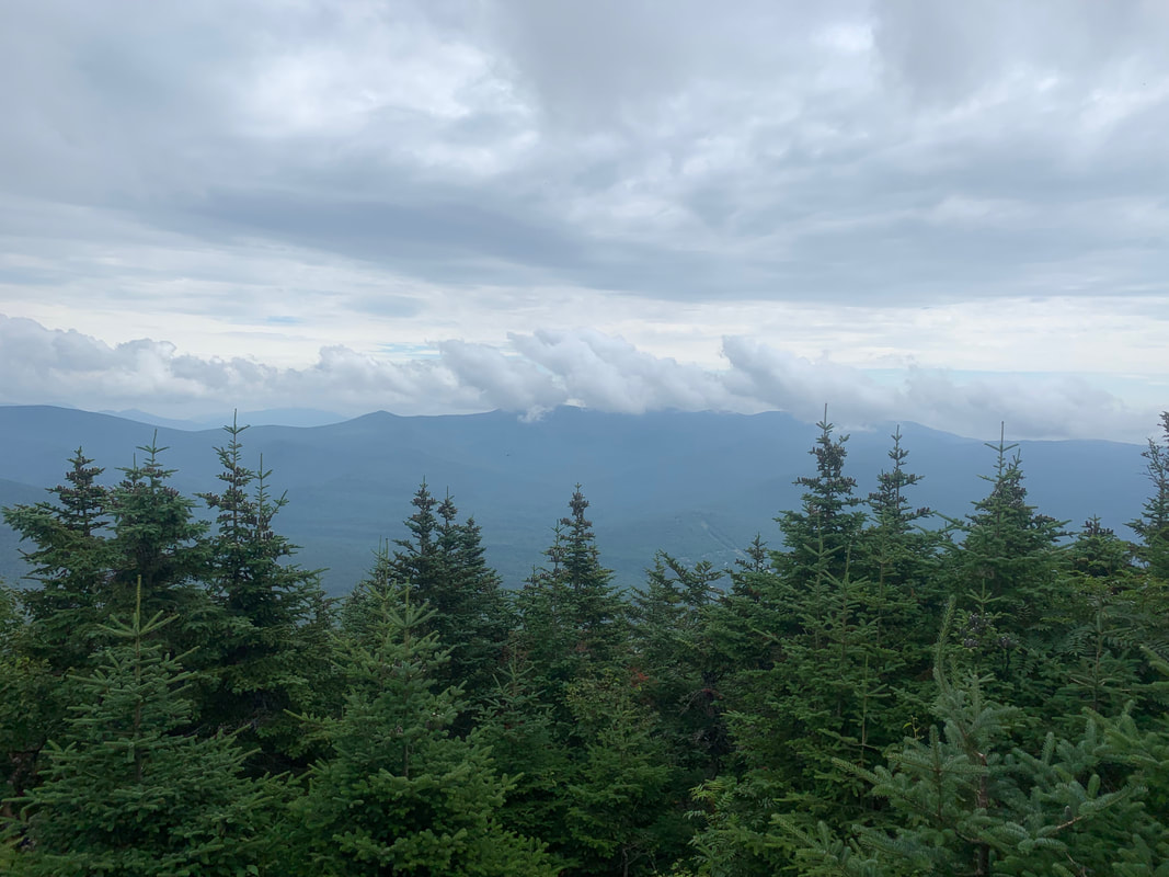
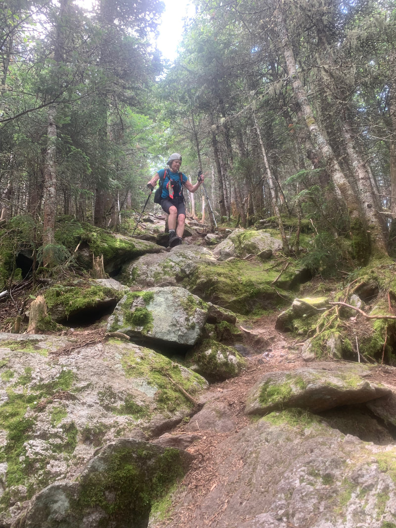
The middle third of the trail is the most challenging. Boulders become larger and larger and require more hand and foot actions. The skies opened up on us here and before we knew it every foot hole became a deep puddle and water streamed down the steep slope. The final third of the trail opens up to more slab friction hiking which I will note is tricky when a river of water is flowing on top of them. At about 3500' the slabs apparently offer views of the Franconia ridge that we unfortunately weren't able to see on this day. A mixture of sweat and rain entered my mouth and soon every square inch of my body was soaking wet.
By the time we reached the ridge, every flat spot had become enormous puddle and water started to squish out of my boots as it had flowed hard down my legs soaking my socks for the past hour. We dodged puddles despite having soaking wet feet and found two more junctions to head up to the tower at the summit.
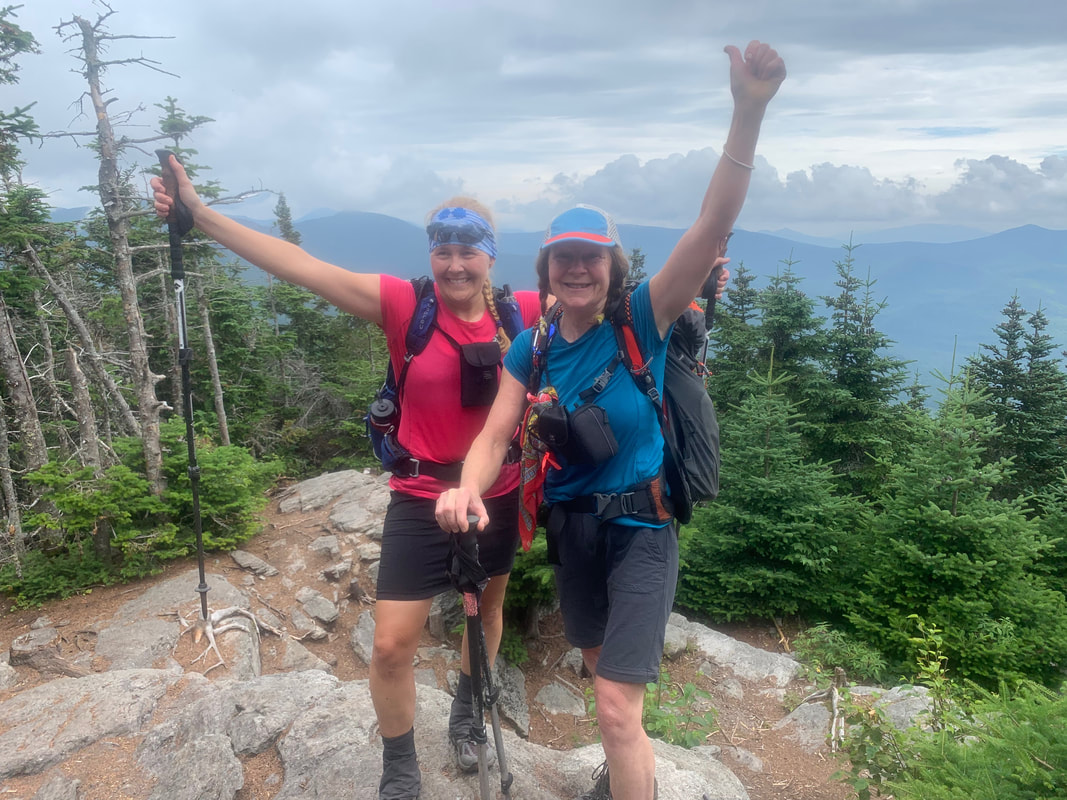
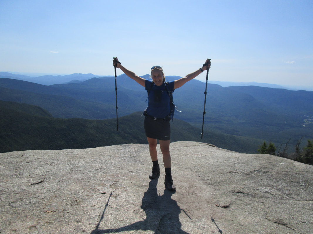
Upon arrival the summit tower is completely enormous and impossible to miss. We hadn't taken a single photo of the hike before this point because of the rain so we raced under the roof after the first set of stairs and pulled out the camera for some summit shots. There was no point going up to the top with this weather so we packed up and ran down the trail. Our bodies were chilled from being wet and not moving for a few minutes at the summit. About 20 minutes into our descent the rain slackened and the sun started to break through.
The return trip down the Hi Cannon trail is nothing to shake a stick at. It's steep, slippery when wet, and requires focus and attention. We barely spoke and concentrated on our footing. I was hoping we would have some views on the way down but we didn't. A old well-used ladder takes you up and down a steep section and there was one slab section that could be consequential if you lost your footing as it seems like you might just go off the edge!
We finished the hike at 1:45 PM and definitely thought that even though it was the shortest hike we had done this trip, it was the toughest in terms of trail conditions. It reminded us of a 'normal' Adirondack hike. I may have to do this hike again in nicer weather...I am sure the views are worth it!
Stats:
Elevation gain: 2309 feet
Distance: 8.5km
Time: 3 hours, 30 mins
Up to 67/115!
Cannon Mountain stands at 4080' and is known for it's ski hill and tramway. The summit has a viewing tower that I wasn't aware of when I started this hike and apparently has awesome views of the Franoconia area on a clear day.
We started late at 10:15 AM after changing our plan and attempting to wait out rain storms. We parked at the Lafayette Campground hiker parking (1900') and walked up through the campground following the signs to the Lonesome Lake Trailhead. Quickly after the hiking trail begins, it splits and we took the right hand option: Hi Cannon Trail. The 2.8 mile trail up begins with a severely eroded section that is covered in a small granules akin to kitty litter. The trail takes no time to become steep and remind you that if you wore too many layers you will want to take them off ASAP.
The middle third of the trail is the most challenging. Boulders become larger and larger and require more hand and foot actions. The skies opened up on us here and before we knew it every foot hole became a deep puddle and water streamed down the steep slope. The final third of the trail opens up to more slab friction hiking which I will note is tricky when a river of water is flowing on top of them. At about 3500' the slabs apparently offer views of the Franconia ridge that we unfortunately weren't able to see on this day. A mixture of sweat and rain entered my mouth and soon every square inch of my body was soaking wet.
By the time we reached the ridge, every flat spot had become enormous puddle and water started to squish out of my boots as it had flowed hard down my legs soaking my socks for the past hour. We dodged puddles despite having soaking wet feet and found two more junctions to head up to the tower at the summit.
Upon arrival the summit tower is completely enormous and impossible to miss. We hadn't taken a single photo of the hike before this point because of the rain so we raced under the roof after the first set of stairs and pulled out the camera for some summit shots. There was no point going up to the top with this weather so we packed up and ran down the trail. Our bodies were chilled from being wet and not moving for a few minutes at the summit. About 20 minutes into our descent the rain slackened and the sun started to break through.
The return trip down the Hi Cannon trail is nothing to shake a stick at. It's steep, slippery when wet, and requires focus and attention. We barely spoke and concentrated on our footing. I was hoping we would have some views on the way down but we didn't. A old well-used ladder takes you up and down a steep section and there was one slab section that could be consequential if you lost your footing as it seems like you might just go off the edge!
We finished the hike at 1:45 PM and definitely thought that even though it was the shortest hike we had done this trip, it was the toughest in terms of trail conditions. It reminded us of a 'normal' Adirondack hike. I may have to do this hike again in nicer weather...I am sure the views are worth it!
Stats:
Elevation gain: 2309 feet
Distance: 8.5km
Time: 3 hours, 30 mins
Up to 67/115!


 RSS Feed


