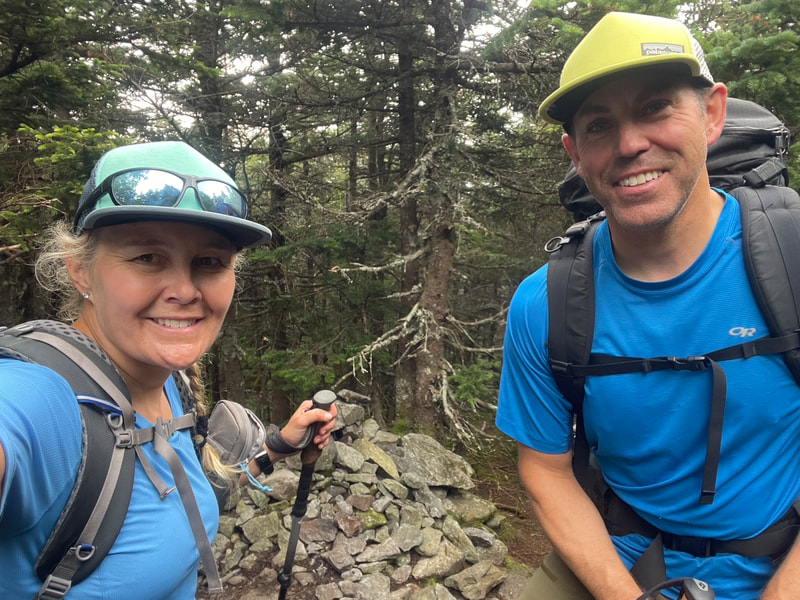
Welcome to KPW Outdoors
  • Home
  • About
  • Blog
  • Gear Reviews
  • Trip Reports
  • Media
  • Contact

BIG SLIDE

20/3/2022

0 Comments

 
Picture
March 15th, 2022

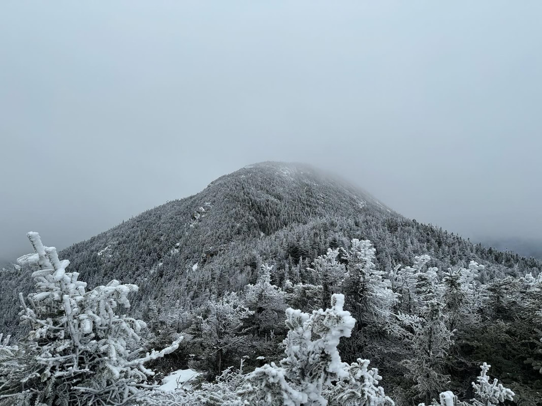
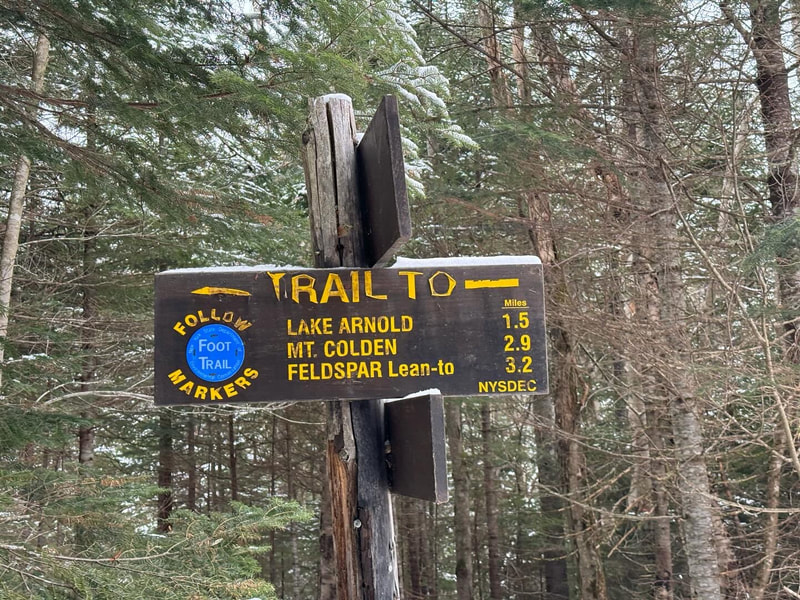
After our first day back in two years yesterday our legs were feeling the toll of the ascent the day before. We decided on a shorter, one peak hike that I needed for my winter list: Big Slide. We drove from Keene where we were staying over to Keene Valley to start from the parking lot and hike up over the 3 brothers to the summit.

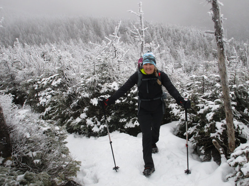
Today our group of 4 was able to start at the same time and hike together after being separated yesterday with our Covid testing appointments. The last time I hiked Big Slide was back in October of 2011 when my husband Glenn and I waded through hip deep snow and crawled to the summit after starting in the parking lot on wet leaves. Surely this official winter ascent would be easier. We would find out!
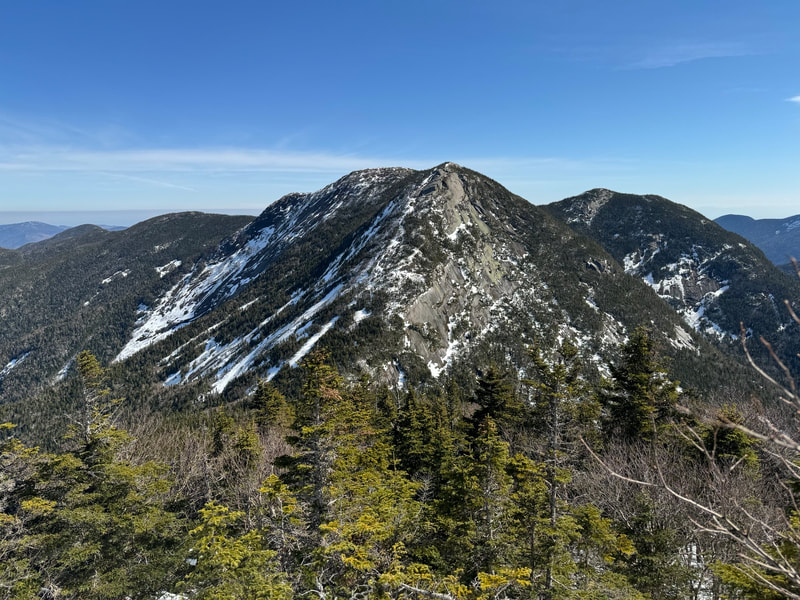
Even though today was about bagging another winter peak, it was more about our friend Ivan. At 76, he wasn't sure he still had it in him to do a mountain. He had a knee replaced in 2019, and hadn't been back to the 'dacks since. He started with us up the Brothers, and we thought if he had to turn around then at least he would have been about to have a nice hike with views. The weather today was above freezing and we were down to our baselayers in no time. We hit the first brother and realized our pace was slow, but with the daylight available in March, the warm temperatures and the fact that Ivan was trying to push himself we allowed him to continue to set the pace. After the third brother it was apparent that this pace was going to really slow us down, Ivan gave Deb and I a blessing to run ahead to tag the summit and return to the junction that marked the descent down to the JBL area. 

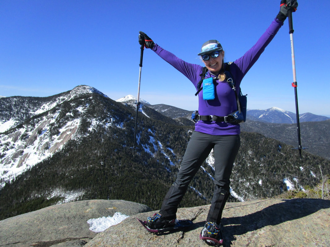
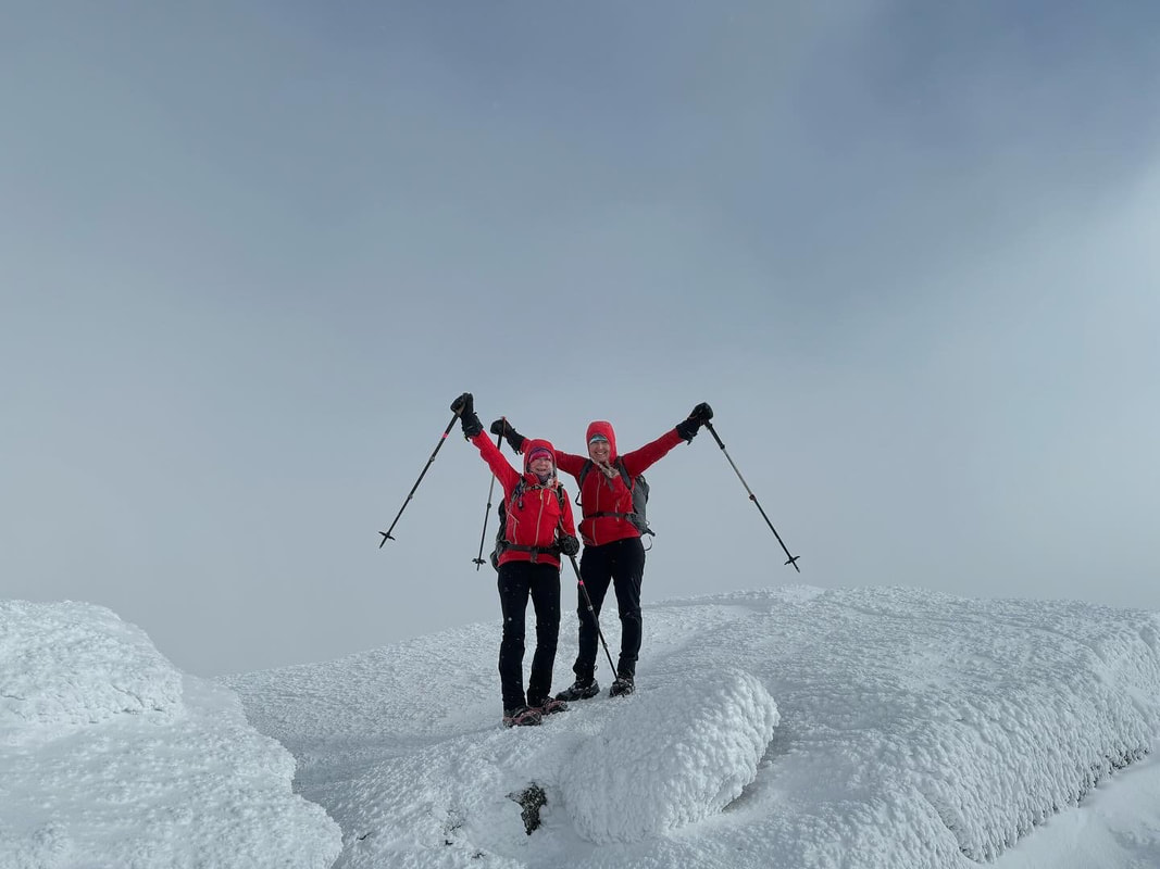
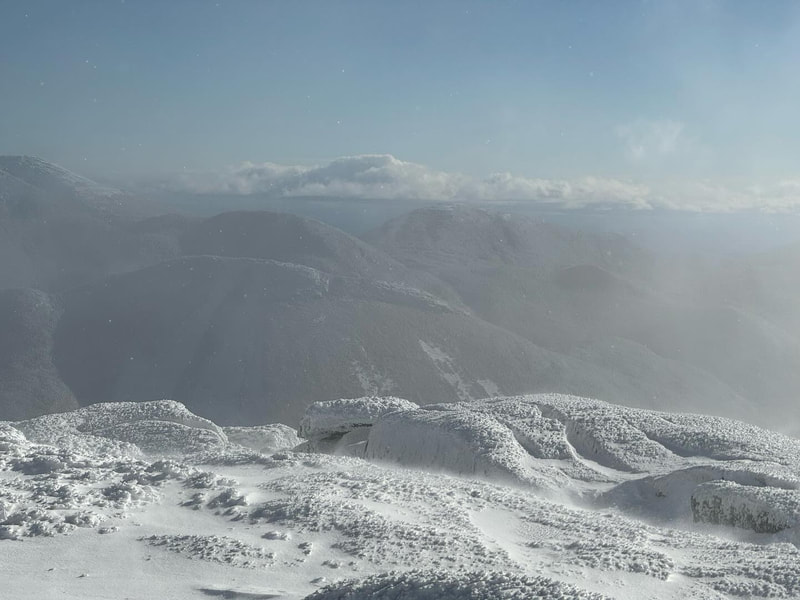
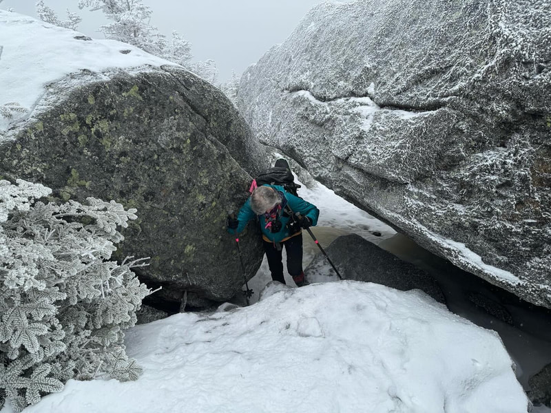
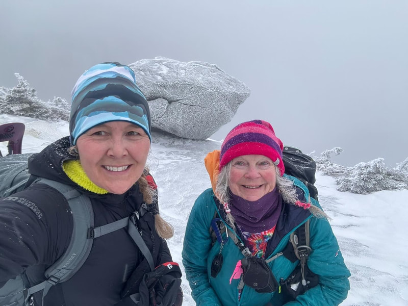
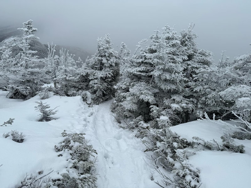
Deb and I took off and ran up the summit which had just freshly been slid down by three women we had just passed. We dug the crampons of our snowshoes in and felt our heart rates increase as we stepped over the area that normally has a ladder (it was buried!). We got to the summit eager to see the furry summit steward (pine marten), but didn't want to linger too long as we wanted to head back down to see how Ivan was doing. We were getting worried he had pushed himself a bit too much and might need assistance getting back down. We downed some water and took a few photos and took off without even sitting down.

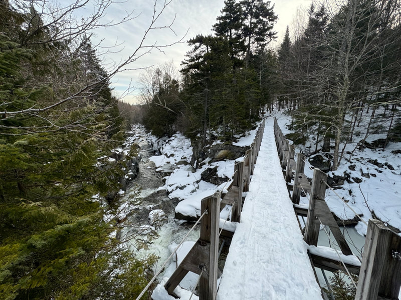
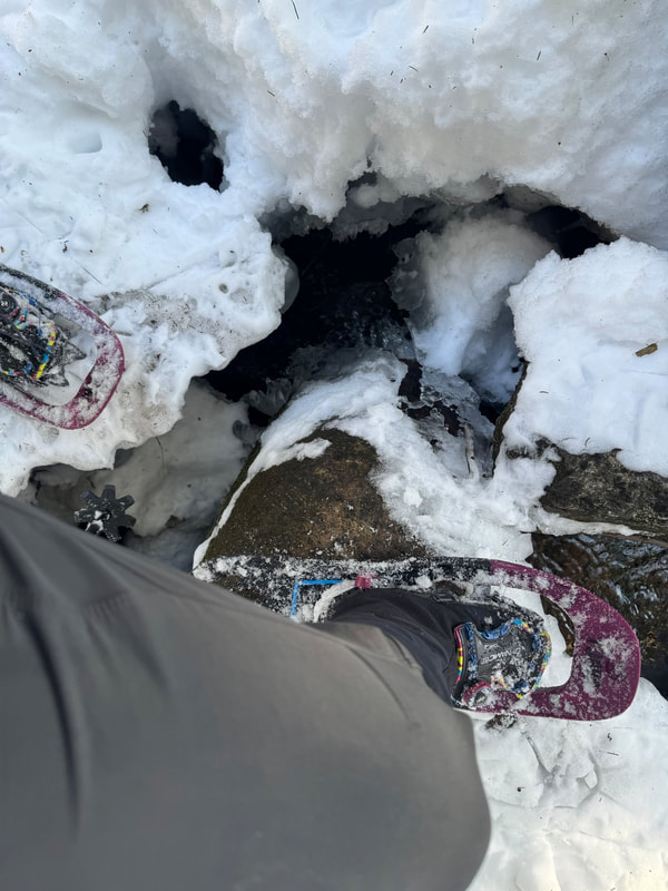
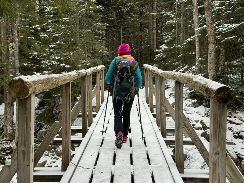
Unfortunately after we slid on our bums down from the summit we arrived at the junction to see that no one had gone down to JBL yet. So we headed back to the 3rd brother and within a couple minutes saw Ivan and Paul huffing their way up. They made it! We took a long lunch break at the junction and Ivan was elated that for the next while it was downhill. The downhill was indeed less energy intensive for sure but did cross a creek multiple times that had some ice bridges that were failing or about to fail. By the time we got down to John's Brook, there was little sign of the 10" of snow that fell 3 days before. In fact there was barely any snow left. We kept our snowshoes on until the parking lot though as they were beneficial most of the way. Ivan hit the wall on the way out so on a break I played one of his favourite tunes Irish Rover which we sang out loud which seemed to lift his spirits and give him a boost to finish the home stretch.

I am so impressed with the mental fortitude of Ivan on this day. For someone I thought we'd leave an hour or two into the day, here he was at the end! He had been to Big Slide's summit before and didn't care if he made it, but to walk 15km with over 3000ft of ascent is admirable. I hope I am like that at 76....

Upon return to Canada the next day, we learned about an overdue hiker that apparently had been hiking the Trap Dike in the blizzard on Saturday. Having hiked in the area for the days he was missing but not found which was a bit unsettling. According to the Adirondack Explorer, his body was found buried under 4 feet of snow in what must have been an avalanche. A very sad outcome for this hiker and his family and friends. Stay safe!

Stats:
Distance: 17.2km
Time: 8:31hr
Elevation: 1056m
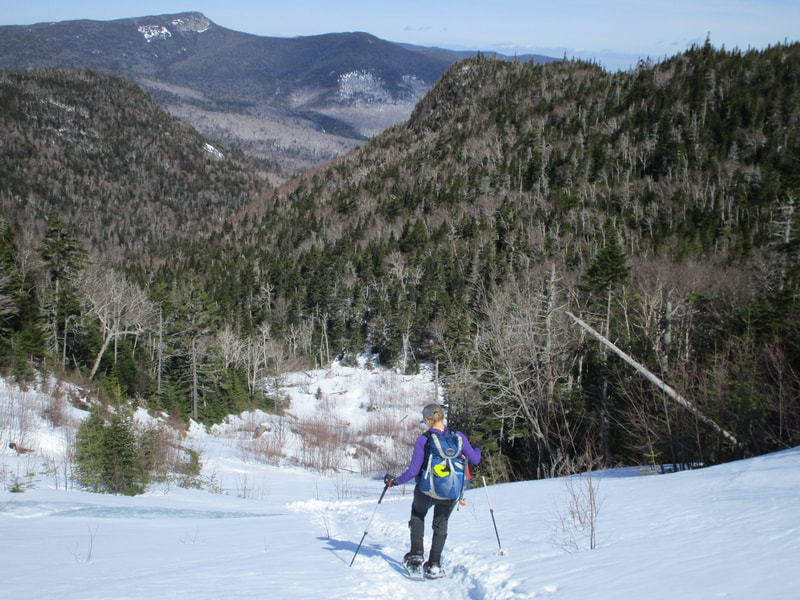
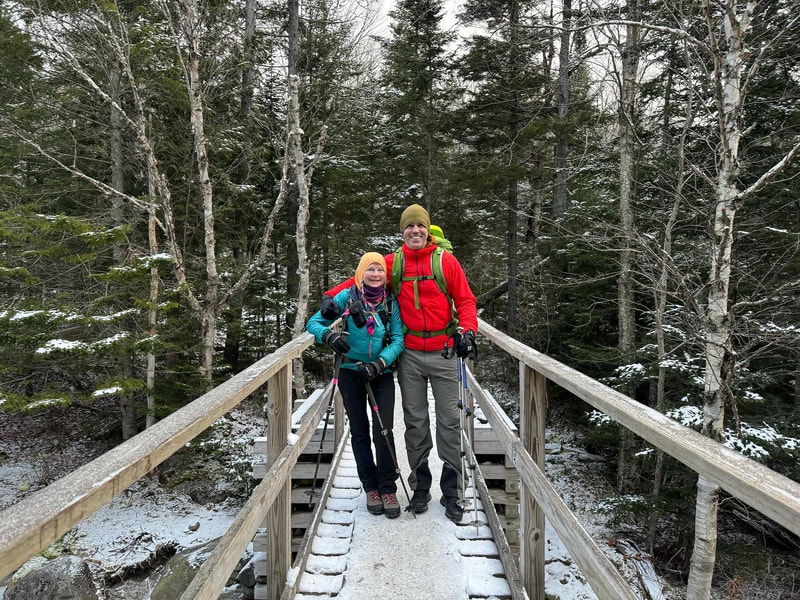
Paul and Krista on the descent
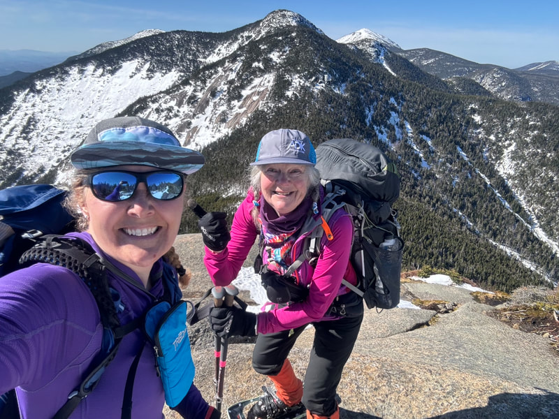
Krista on Big Slide summit
Deb and Ivan pondering a river crossing
Picture
0 Comments

PHELPS AND TABLETOP

20/3/2022

0 Comments

 
Picture
Deb and Krista on the summit of Phelps!
March 14th, 2022

Finally!! After a long two year hiatus, I finally crossed the border and headed straight to the Adirondacks! We crossed over on Sunday March 13th, a day later than planned but a large snowstorm was warning us that blizzard conditions were going to be imminent and driving would be 'impossible'. When we finally arrived in Lake Placid and then in Keene in felt like being back to our home away from home. I have spent loads of time in the Adirondacks over the past 15 years and it definitely felt good to be back.

One hoop us Canadians had to jump through in March of 2022 was to have a negative Covid test before re-entering Canada. So we found a free one you could get done at Walgreens in Lake Placid and had our appointments booked in advance for the earliest slots on Monday morning around 9:30AM. The drive-thru test was a breeze - they did Deb and I together. Our two other trip mates had to wait a whole extra hour so we went ahead and started our day off on South Meadow road.

I needed Phelps and Tabletop for my Winter 46er list. We thought those two would fit the bill nicely as a re-introduction to the Adirondacks after our 2 year hiatus. We had tried our best to keep our legs in mountain shape by strength training, walking up and down our local ski hill and doing numerous hikes and backpacking trips in Ontario. The hills just aren't as long, so nothing would fully prepare us for our return trip to the 'dacks.

We started the day late around 10 AM at the South Meadow Parking lot and skied into Marcy dam via the truck trail with our snowshoes on our packs. I love these combo days and my goal is to make all my Winter 46ers as interesting as possible. The skiing was really good- it had just dumped 10-12" of fresh snow two days before. We managed to ski past Marcy Dam and up a little bit more across a creek towards Phelps before we transitioned to snowshoes. Being on snowshoes felt a bit weird as I had spent most of the winter cross country skiing. Off we went to the Phelps turn off and started the inclined portion of the hike to the summit. I was in the lead and told Deb I was going to keep a steady pace on the ascent (not blazing fast but not lollygagging either). Turned out we passed two other parties and reached the summit first on that day! It was a bit of an ego boost for us having not hiked a mountain in 2 years! We still got it!

We took a break on the summit with some food and drink and had some photos taken by some other summiters. We didn't linger too long as we had to descend and then continue over to Tabletop. The descent went well despite being not sure how my knee would handle it after having a knee surgery during my 2 year hiatus. The slog up to the Tabletop turnoff is a part I had forgotten about. You do ascend quite a lot in this section.  I was reminiscing with Deb about a AT ski descent I did off Marcy down the ski trail parallel the hiking trail and it is quite steep. We saw a group of AT skiers heading up Marcy earlier which would have been a great day to do it with all the fresh snow. When we finally got to the Tabletop turnoff we  couldn't remember how far it was to the top. Deb thought it was 30-40 mins or so. I think it ended up being 45 so not too far off! I remembered the Tabletop summit from my first round as being unremarkable but I found this time it does have a really nice view from it despite the dead standing trees. 

Our descent went pretty fast but by now the toll of the ascents had worn out our legs and we marched out and down to our ski stash. We transitioned back on skis and found that now being late afternoon, the snow was freezing up again and things started to get icy. The ski trail out from Marcy Dam was incredibly fast....we were averaging 22km/hr not even poling! There was one part of the ski trail that I was concerned about and made a remark to Deb on the way in. A steep descent ends a one foot ledge drop off that would be consequential at speed. Knowing it was coming, I used the metal edges on my backcountry skis to dig into the snow as best I could and snowplowed my way towards the ledge with alarm bells ringing loudly in my brain. Could I stop before the ledge? With all the extra weight on my back (winter daypack and snowshoes) I came to a screaming halt 2meters before the ledge with my legs still in a wide plow formation. My upper body position was so far forward that it catapulted me into a faceplant into the snow! Luckily I did not go over the edge and besides having a mouthful of snow, I was no worse for the wear. Deb had one wipeout too in a different location, so it was definitely fast skiing!

We zoomed out the rest of the way on skis and finished our first day in the 'dacks and a natural high from the adventure we just had. Long overdue! 2 more winters in the bag!

Stats:
Time: 7h 37mins
Distance: 25.3km
Ascent: 1323m (this could be off as my watch wasn't working well)
Picture
0 Comments

LAKE SUPERIOR COASTAL BACKPACKING TRAIL

21/8/2021

0 Comments

 
Picture
Lake Superior Coastal Trail
The Lake Superior Coastal Trail extends on 65km of coastline on the eastern edge of Lake Superior inside Ontario's Lake Superior Provincial Park north of Sault Ste Marie. Campsites along the coast are used by kayakers, long distance backpackers, and some short distance backpackers that hike in from the many access points for one night. Due to the high demand by different user groups, it is recommended you book early. We booked our trip exactly 5 months out and still had issues with getting our campsites spaced the way we wanted.

The Coastal Trail is characterized by being rugged and I would agree with this description. From my vast backpacking experience (including the Pukaskwa National Park Coastal Trail just north of this one),  this trail is indeed challenging and I would NOT recommend it for beginners. The trail requires good tread on boots, scrambling skills involving hand and feet maneuvers, and confidence with some exposure while on coastal rock drop offs and hopping over rock gaps. I was fortunate to have dry conditions hiking the trail and our entire group agreed that we would not want to be on the trail in wet conditions as it would be very dangerous.

Here is my trip report that took place on Sunday August 15th to Thursday August 19th, 2021.

Day 1: Gargantua to Rhyolite Cove (6km, 900ft ascent, 3hrs, 15 mins)

We woke up at a motel in Sault Ste Marie and travelled the 1.5 hour drive to the Agawa Visitor Centre for when it opened at 9AM. After a quick orientation we got our car permits and found out our originally planned exit was not open and so we had to shorten our trip by a few kilometers. This ended up working to our advantage as we had a long drive back home the final day and we felt we didn't miss out on much.

It takes about 1hour to drive from our exit point at Sinclair Cove Boat Launch to the Gargantua road trailhead. The posted 40km/hr speed limit on the 14km stretch of gravel on Gargantua road is somewhat of a joke, as most of the time you can only drive half that speed while dodging potholes and washouts. It is also a one lane road, so be attentive for drivers coming in the opposite direction to you.

We started the day at 11AM at the trailhead and headed out to Gargantua beach. The coastal trail actually heads north 10km on a easy cart trail but then ends and you have to turn around and re-trace your steps. Most groups skip this out-and-back part of the trail and our group elected to omit it. We headed south and needed to cover 6km to Rhyolite Cove. It didn't take long before the trail turned into what we had read about in other trip reports: steep up and downs, technical terrain requiring exact foot placements and varied mediums such as rooty dirt paths to coastal rock to boulder hopping. There was 1 kilometer that took us one hour to complete! For reference, our group of 6 are all highly experienced backpackers and mountaineers, and have extensive hiking experience in the Adirondacks (most of us are ADK 46ers). 

We arrived at Rhyolite Cove in the hot afternoon sun and set up camp on the red shores. We took a welcome dip in the lake and settled in to the rhythms of backcountry camping. In 2021, the park has added bear boxes at some of the campsites along the coastal trail. Rhyolite Cove did have one and despite seeing several more along the way, this was the only site in 4 nights that had one. The rest of the time we hung our food.
Day 2: Rhyolite Cove to Baldhead River (13.5km, 1700ft ascent, 8 hours)

The task for the day was to cover 13.5km of terrain. Reading other backpacker's trip reports, we knew this northern section of the trail was the toughest so we headed out on the trail at 8AM. We met a couple of groups still packing to head out in the first hour or so of the day. Terrain today including numerous coves with large boulders, small pebbles and rounded rocks that looked like dinosaur eggs mixed with some forested trail and rugged coastal rock.

The forecast for our trip was daily highs in the mid-20's (celcius) with a humidex factor around 30C in the afternoon. It became apparent each day that forested areas were shaded and cool but offered no air movement so the sweating was profuse. Out on the coast in the direct sunlight, the coastal environment offered a breeze. What we didn't anticipate before starting was how hot the rocks would get baking in the sun and would radiate heat back on to you like an oven leaving you literally dripping in sweat. Swimming in the lake at the end of each day was one of our top priorities.

​The Coastal trail is a marked path. It has two ways of marking: Rock cairns that show the way on the rocky coastline and blue plastic backpacker trail markers on trees where permissable. Given that active hiking requires intensive concentration on foot placements on this trail, were were glad we had 6 pairs of eyes on the lookout for the next cairn or marker. The trail is very well marked if you are attentive - we only made one mistake the entire trip.

The Baldhead River campspot was great - the area is busy with traffic from the Orphan Lake day hiking trail area. I did have cell service both here, Rhyolite and Coldwater but not in the southern sections that were ironically closer to the highway. 

Today's stats show how gruelling this section of trail was averaging less than 2km/hr.
dDay 3: Baldhead River to Coldwater River South (7.5km, 800 ft ascent, 3 hours)

Today was an usually short backpacking day (thank you competitive booking) so we decided to take a leisurely pace to start of the day. Two of our group members decided to go fishing up the Baldhead River for an hour and we didn't get on the trail until after 9AM. 

The terrain of the trail relaxes south of here but don't let your guard down as the trail won't let you be inattentive for long. Things still stay interesting and require you to earn your mileage. Today's hike started by walking up to a double bridge crossing of the Baldhead River and then back down to the coast. At the end of the bridge there is a sign indicating a trail left leading to the Orphan Lake loop and then another to the right to send you back on the Coastal trail. Back on the gravel beach we continued along until we saw an obvious trail opening and blue marker. Don't be fooled here...this is part of the Orphan Lake Loop and NOT the Coastal trail. Two of our group members made a mistake here as they had left early due to issue with blisters from the day before. When the rest of the group arrived we made the right navigational decision as we noticed a few things: there is a large trail sign that has it's back to you indicating the Coastal trail stays along the coast as well as a blue hiking sign with a hiker on it without a backpack (indicating a day hiking trail not a backpacking trail) and on the map which we pulled out the trail obviously was not the one we wanted. Don't be duped here!

The Coastal trail continues to the end of the gravel beach (as the trail normally does) and heads up a steep incline over a bump to what I am guessing is the highest point of the trail. As we had extra time, we took some leisurely breaks and were treated to a visit from a Bald Eagle. Descending down off the bump we passed the Coldwater North campsite and scampered off some boulders to a beautiful sandy beach which we assumed was the Coldwater campsites as the river was flowing through the middle of it. This area was busy with day users and we figured out quickly that the campsites on this beach (not marked on the map) were for short overnight trips only steps away from your parked car.

Up over another rocky point we found the Coldwater South sites on a tropical looking sandy beach. We arrived early and took advantage of the sandy cove bottom and lake water to cool off in. Our group that had gotten off track met up with us here.
Day 4: Coldwater South to Barrett Island (15.2km, 1700 ft ascent, 7.5 hours)

Knowing Day 4 would be the longest on the trip, we left our favourite campspot just before 8AM. We started off the day tackling some coastal boulders and rocky coastline that occupied us for the first hour or so. Passing by a family camping at the picturesque Robertson Cove we found ourselves soon entering the easiest section of the trail at Katherine Cove. Here the trail is again beside the highway and has day use parking areas for it's sandy beaches. We found a young family already swimming in the mid-morning. The forested trail here is fairly easy going and soon after we were in another section of sandy beach and we could see the popular bathtub island. We made some good time through this section of sandy beaches and dunes. We took the path up to the highway to cross the bridge at the Sand River which was under construction and down to one lane which provided some sketchy running over the bridge to beat traffic. 

Down to the shoreline again, we entered some coastline and flat forested trail before popping out onto the Barrett North campspots. By now it was early afternoon, around 1PM when the heat started to get oppressive. We met a couple here new to backpacking who wanted lightweight backpacking tips as we passed by. The Baldhead beach was beautiful but the heat intensity was strong and we were dying to get out of the direct sun and back in the forest. Looking at the map and knowing were past Barrett South, the map shows a maximum of 500m to Barrett Island campsites, our destination. This is where things get tricky - the trail undulates in and off the coast and up and down so many times that it was a few kilometers in distance travelled. We walked on the hot coastal rock and finally found our home for the night on a rocky beach. The Barrett Island campsites were not big enough for our group's two 2P and 2 1P tents and one of our group members had to pitch a tent on the rocky shore. We generally weren't impressed with the camping in this section. 
Day 5: Barrett Island to Sinclair Cove Boat Launch (3km, 300 ft ascent, 1 hour)

Today's hike started at 8AM again not knowing if the distance travelled would be 1km or more. It was more but only took an hour. Today was the only day the air was still and there was no wave action on the lake. The haze in the sky seemed to be caused by nearby forest fires but the turquoise clear lake water was stunning. We enjoyed our final hour of hiking through mossy outcroppings and a final group celebration at Sinclair Cove. 

Back at the car, the shuttle took 2 hours to complete. In the meantime, the two of us left at the cove checked out the pictographs and chatted with visitors.

The Coastal trail will be remembered as Ontario's hardest backpacking route but also the most scenic. I was happy to report my fitness met the challenge and my gravitation to lightweight backpacking gear paid off. My pack weight at the beginning was 26lbs!

Trail stats:
Gargantua to Sinclair Cove: 44 km
Ascent: 5474 ft ascent
Hiking time: 24.5 hours
Moving average 2.9km/hr
Overall average including lunch and breaks: 1.8 km/hr
lakesuperiorcoastaltrail.gpx

0 Comments

WESTERN UPLANDS BACKPACKING TRAIL

16/8/2020

3 Comments

 
Picture
The Western Uplands Backpacking Trail
When the COVID-19 pandemic hit in Spring 2020, it drastically changed my summer travel plans so several Plan B’s started to develop. After travelling all across Canada in recent years to backpack some classic and off-the-beaten track trails, I decided I should check out the backpacking trail closest to where I live in my own province: The Western Uplands Backpacking Trail in Algonquin Provincial Park, Ontario. 

The Western Uplands trail consists of 3 loops that correspond to a short (~32km), medium (~54km) and long distances (~80km). The longest route (or 3rd loop) is over 80km long and is the one we chose to do this trip. When booking the campsites online, the system will only allow to book campsites within a certain distance away. If you are an experienced backpacker like myself, you may opt to call the park reservation agent and have them book campsites even further apart. We chose to do the loop in a clockwise rotation but you can choose to do it in either direction. From my experience it doesn’t matter which direction you travel. When we called to book many of the sites were taken so our choices were slim. If you must book Maggie Lake West like we did, it added an extra 4km to our total distance, which was 85km total!

Day 1 Wed August 12th : Trailhead to Maggie Lake West (14km, 1800ft ascent, 5 hours)


After a 3 hour drive to the Western Uplands trailhead, we were itching to get moving. We darted out of the car and across the bridge at 11AM, and chose the left trail at the first junction, sending us in a clockwise direction around the loop. The trail between the trailhead and Maggie is generally wide, well-travelled, and has some nice rolling hills. We found this part of the trail was the busiest that we encountered the entire trip and we started the trip on a Wednesday! One of the most surprising things was the disproportionately high number of all-female backpacking duos and groups.  I was so amazed, and also insanely happy to see this number of women out in the backcountry. Awesome!

We arrive at Maggie Lake and began our lengthy 2km detour to the west side of the lake to find our first campsite. The 2km (+2km back) detour may have been worth it as the campsite was awesome and the water was this awesome green colour that didn't come across well in any of the photos. The consistent breeze made the 31 degree humidex weather feel more tolerable and a dip in the lake felt amazing. We were able to dry out all our damp gear, eat a hearty meal and head to the tent at sunset.
Day 2 Thursday August 13th: Maggie Lake West to Islet Lake (30km, 3000ft ascent, 9 hrs)

Wake up time was 6AM as we knew this would be a long day distance-wise. Adding up the kilometres on the backpacking routes map we figured it would be a monster 27km day. I had only done a maximum of 23 km backpacking in the past so I was nervous and wanted to leave enough time to get to Islet Lake. Our average moving time including breaks the day before was 3.2km/hr so we figured it would take 9 hours to get there. 10 years ago I was backpacking with a 90L pack that weighed over 40lbs. In 2015 and 2017 I did backpacking trips with a 75L pack with pack weights in the 30lb range. On this trip (albeit shorter) I did this trip with a 55L pack with 27lbs. Lighter packs enable you to go further and get less tired in a day...well at least that was the theory that I was going to test out!

We were on the trail at 7:20AM and had to re-trace our steps back to the 2km to the main trail. We passed by many campsites with hikers still nestled in their tents. We handrailed Maggie Lake for some time before breaking away and heading north. This section of trail is fairly easy and before you know it you're at the turnoff to the first loop. We continued passed this turn off and for the next 7.6km or so the trail moves up and down over some hills (some are steep) and down through soupy mud puddles. Although our trip had 4 days straight of sun, it was apparent that the trail had recently been exposed to rain as the mud puddles were quite saturated meaning one misstep and you could end up with a soaker! The most prominent feature in this section is 'Bean's Boulder', a massive erratic that is parked right beside the trail that we conveniently used as an excuse for a rest stop. Soon after we came across two women about to pass us who had just gotten lost near Clara Lake by taking the portage trail instead of the hiking trail and wound up bushwhacking there way back to the trail. They had a long day ahead of them and had just added 3km to to their day. Yikes!

We arrived at Clara Lake in time for lunch and ate at the campsite right on the trail. This site is convenient with benches and easy access to water in case you need to filter some more water for your bottles. We noticed that on this site was also somewhat of a garbage dump laid with a heavy propane gas cylinder and random wrappers. I don't mind packing out garbage like wrappers but I draw the line at heavy objects. I wish people would just abide by the leave no trace principles and pack out what they packed in.

Leaving Clara Lake we passed over a beautiful ridge before descending down to the junction with the third loop. At the 17km mark for the day, Pincher Lake would have been a great place to set up camp and call it a day. It looks like a nice lake! We continued on and passed two male hikers who gave us a heads up of a tough climb ahead of us. This climb was to the lookout beside Stammer Lake. The climb was probably the longest and steepest climb of the trip, but wasn't anywhere as near as a steep and long as a Adirondack Peak. At the top of the ridge, you reach what feels like the height of land and can see into the distance initially and then it slowy drops down as you move through it. What we welcomed at this 'summit' was a breeze that had been absent all day in the sweltering heat. Once the descent was complete the march along Weed Lake and into Islet eases off and becomes fairly flat - something we were grateful for at the end of the 30km day.  Yes the GPS indicated we had done 30km, not 27km as per the map. We stayed on the southern most campsite on Islet which was good except for some slightly angled tent platforms. It was around that time when I notice that the bottom tip of my hiking pole was missing and the carbon shaft had cracked. I must have got it stuck in some mud puddle somewhere. My Black Diamond Carbon Cork Poles owe me nothing - they are over 10 years old and have been with me through thousands of miles on all my day hikes and backpacking trips. I was able to finish this hike and order a new lower shaft from Black Diamond for $9.95 USD. A 9 hour effort today was deserving of a cold drink, but one that would have to wait for another day. Instead we hydrated with Nuun tablets in our water bottles. Swimming was great on this lake and the loons put on a show!
Day 3 Friday August 14th: Islet Lake to Redwing Lake (28km, 3000 ft ascent), 10hours

Anticipating another long day, we woke up before our alarm at 5:45AM and sprung into action. I had been dabbling with some new recipes for this trip and was eager to try them out. I enjoy dehydrating my own food and try recipes that hold me hunger-wise and don't lead me to stomach growls 2 hours into my hiking day. I am going to do a separate blog on this topic but so far the food experiment has been worthwhile. So after our breakfast and pack up, we hit the trail at 7:30AM. The trail along Islet and around Ishkaday lake is flat and easy, allowing us to easily kick our pace up to 4km/hr. We passed several nice campsites on Islet Lake which were all full. The northernmost campsite is right one the trail where we met a male hiker just about to start his day. The northernmost junction to Rain Lake seems to become a more popular starting point for some hikers. We met several parties who had started from there and were doing the second or third loop from that trailhead. The 10km walk in and out on a old railroad does not appeal to me, but it may be convenient for some hikers.

The next section of trail over to Brown Lake continued to be easy walking with a few fluctuations in elevation thrown in. Beautiful hardwood ridges continued to dominant the forest in this part. We arrived a Brown Lake and saw that the campsites were still occupied! We had already been on the trail for a couple hours! We made some small chit chat and then begun our way over to the next section that leads you to the junction with the old 3rd loop trail that is now closed. The older maps still have this northern trail on it but the newer ones (we have a 2020-2021 map) do not. So we hopped on the portage trail and headed south to join the 2nd loop. This portage trail was littered with moose sign and had probably the most sign we had seen all trip with several fresh tracks in the mud and moose scat everywhere. The creek that runs along this trail is very marshy like and is perfect moose habitat. Unfortunately we didn't see any moose but they were hiding somewhere nearby for sure!

Before we knew it we were at Ladyslipper Lake and we by passed it and climbed a short hill to pass Gervais Lake. We decided to stop for lunch at a vacant campsite on Gervais. The site was large and would great for a group of 9. One thing to note- Although group sizes can be up to 9, there was often enough room for 1, maybe 2 tent sites at most sites that I saw. As a canoe guide I am always in search of the better sites for groups and this one could work albeit the swimming didn't look good here. We ate our lunch (a great recipe!) and doctored some blisters that were forming on my husband's feet. After we passed West Otterpaw Lake, we crossed a pair of women who had spotted a Garter snake eating a large toad. The five of us stared intently at this work of nature for a while before concluding that the snake would never be able to fit the large toad in it's body despite trying it's darndest. After lunch it got really hot and humid. The sweat dripped off our chins and every pore of our body was exploding with salty liquid. The stretch from West Otterpaw to Rainbow Lake became more technical and including several elevation changes and creek crossings. Some sections were even Adirondack-like: rocky and rooting with focused foot placements. 

Arriving at Rainbow we were desperate for more water but the campsites were all on side trails. A common feature on the Western Uplands is a sign on the trail saying 'Side Trail' to a campsite that can be 100m +.  Not wanting to add extra distance to our hike, we decided to forego the water fill up and head to Susan Lake instead. I don't remember the 3.7km to Susan being hard, but with the heat and dwindling water resources it wasn't easy. Luckily we passed two young women singing on the trail practicing for some performances which lifted all our spirits. Arriving at Susan, we stopped at the first campsite and filtered some water. Only 2km away from our destination for the day we were had no choice but to stop. We were all out of water even though I had started with 2L in the morning. The campsite on Susan was disgusting - loads of garbage in the firepit along with a bug repellent canister and various bits of paracord hanging from trees. I was not impressed. After a fluid fill up we headed up to the lookout above Susan Lake. This lookout has a log bench at it and has one of the best views of the trip. We really enjoyed this although it took some climbing to get to and even more climbing after our photo shoot at it. With 2km to go, we picked up the pace and marched over to Redwing Lake, our home for the night. We checked out both campsites and decided to take the more northern one with it's two nice flat tent spots. The second site seemed to have have had a tree blown over onto it's second tent spot! 

Upon arrival at camp we were dehydrated, hot, sweaty and blistered (Glenn). A 10 hour effort today for 28km. We set up camp, swam, ate and went straight to bed. We started talking about how this trip would probably been better done in 4 nights and 5 days instead of 3 nights. When my husband had booked it he had used a 1997 map with distances totalling 72 km for the loop. He also didn't have much choice of campsite as the with COVID there wasn't as much else to do so the spots were hard to come by. Speaking of inaccuracies, the 2020 map said we should have walked 24.5km on Day 3 but the GPS said 28km. That is a big difference! 
Day 4 Saturday August 15th: Redwing Lake to Trailhead (14km, 1200 ft ascent, 3.5 hours)

Another early rising day we woke up to a chilly morning. Deb was already out of her tent and lowering the food hang. I hollered out "Is there snow out there?" and we all chuckled and wore a an extra layer getting out of the tent. The cool air was something we wanted to take advantage of so we were on the trail by 7:45AM.

Glenn's blisters had really grown in yesterday's heat and the blister bandages we brought did not stick to his feet.  Today I pulled out the roll of athletic tape and re-visited my taping skills from my athletic therapy days and taped up his heels. He was able to hike out the rest of the trip no problem which I was grateful for as he was contemplating wearing his crocs out! 

The section from Redwing Lake to the junction of the first loop seemed to go by quickly. Campsites were all full passing Lupus Lake, Thunder lake and Romona Lake. The difference in the trail in the first loop junction was incredible. The trail widened significantly and the rest of the way out was an easy march. We even saw a trail runner who was running the first loop! We were out just after 11AM, a fast and easy end to the trip. We high-fived each other, took a quick selfie and headed to the Mad Musher restaurant in Whitney.  Check out my video of the trip below!


Recommendations/Notes:
- Call to reserve sites with larger distance gaps as online booking limits distances
- If experienced and deciding to do the 3rd loop, booking 4 nights would be best
- Do not leave garbage behind on the sites, in firepits, or on the trail. Pack out everything you packing in.
- Booking in August or September would be better for avoiding bugs
- The trail is mainly in the woods, not many views
- Moose sign becomes more and more apparent in the 2nd and 3rd loops
- Trail is more overgrown in 3rd loop but still easy to follow
- Campsites can accommodate 1 tent for sure, some 2, and rarely 3.
- Larger lakes are more 'swimmable' as some smaller lakes are weedy and shallow
- If there has been recent rains, the muddy spots on the trail will be more soupy so gaitors would be recommended. 
-Even if all campsites are full the trail does not feel crowded and lakes don't seem busy
-Trail markers are Blue on the 1st loop, Yellow on the 2nd, and Red on the 3rd
-There is cell service at Maggie Lake (I use Bell Mobility)
-Buy your Backpacking Trail Map from Friends of Algonquin Park 
-Gear List for the Western Uplands
-Blog for food and recipes - coming soon!

Totals:
Distance: 85km
Ascent: 8855 ft
.gpx file
3 Comments

SAWTEETH

16/8/2020

0 Comments

 
Picture
View of the Great Range from Sawteeth Mountain
Waking up to a cold -18C weather at the ACC Keene Farm Hut, we knew instantly what we our objective for the day would be. Newly accumulated 2 inches of snow meant that a ski approach to a Winter 46er was now a possibility. Needing Sawteeth Mountain, we loaded up the car and drove over to the parking lot only to find one other lonely car in the parking lot. 

We walked with our skis over to the gate and signed in. Trucks were out plowing driveways and streets and so we had to dodge a couple on our walk in. We donned our skis at the gate and commenced the 5km ski up to Ausable Lake. Only one snowshoe track was fresh in the snow and it was easily avoided. Past snowmobile tracks had compressed the snow making for an easy approach to the lake. 

Arriving at the lake we stashed our skis beside the hut and transitioned into snowshoes. We were hoping for a broken trail across the bridge. After taking in the views of Ausable lake and the blue skies that served as the backdrop we scampered past the turn off for Rainbow Falls. On the trail, we noticed it had been broken out but the last snowshoe track was from over a week ago and the trail was lumpy in places. Not ideal, but better than nothing.
We huffed an puffed our way up 3 km of uphill trail crawling under many fir trees and kneeling under fallen hardwoods. I had brought my mountaineering axe with me attached to my backpack and it seemed to get caught  on hundreds of branches. I broke trail to the Sawteet-Pyramid Junction only to find that the sign was mostly buried.

Heading up Sawteeth from the junction, there was a thin layer of ice on the trees coated with a snow icing. Lucking out the steepest sections were completely snow covered and snowshoes could be used to pass through them. The wind had filled in any semblance of a track on these exposed areas so we had to pay attention to the keep on the trail. 

At the top, we found a couple of possible summit areas but couldn’t find the actual marker. Most likely buried or blown off, we checked our GPS and knew we were at the highest point we could be. The bluebird day made for fabulous views of the Great Range and the sun had started to warm up the morning’s air. It took us 4 hours to get to the summit.

After a short photo session, we headed back down to the junction for a sheltered lunch/snack break. In no time we were back at the bridge below which had turned into a warm amphitheatre of solar radiation. We couldn’t resist the temptation of having another rest here and snack break before we returned to the skis.

The ski out took 30 mins. We flew down the Lake Road and were reminded of why winter hiking is so awesome with the ability to cut time on skis. We signed out and hiked out to the parking lot, in the warm almost spring like air.

Totals:
20.03km
Time: 7 hours
Ascent: 3100 feet
0 Comments

SOLO WINTER HIKE OF GOTHICS, ARMSTRONG, & UWJ

16/8/2020

0 Comments

 
After completing my first round of the 46 Adirondack High Peaks in 2012, I then turned my attention to helping my husband and some friends finish their first round, repeating over half of the 46ers again. My husband finally finished on Allen Mountain in March of 2018.  With that now complete, I've turned my attention to focus on completing the 46ers in the winter and become a Winter 46er (W46). Before starting today's hike I already have 15 winter official summits in the bag, and about a dozen unofficial (hiked in winter conditions but not really in the Dec 21-March 21st timeframe).

We planned to head down to Keene Valley on Mountainfest weekend in mid- January. Due to a mix of bizarre circumstances with other adventure partners (injuries, winter storms, other logistics) I found myself planning a solo winter hike. This was to be my first solo hike in the Adirondacks but I felt I had the experience, fitness and proper gear to tackle it. My objective for the day was to hike to Gothics (4736') via the Beaver Meadow Falls trail over Armstrong (4400') and Upper Wolfjaw (4185') and then return via the Wedge Brook trail. 

I signed in at the register at 7:30AM and started the march down the Lake Road. The road had been compressed with many snowmobile passes and that combined with the -17C temperatures, I was able to bareboot on the compact snow all the way to the junction with the Beaver Meadows Trail. The trail is immediately after the 2 mile sign on the Lake Road.

I have never ascended this trail before so it was a new approach for me. Upon arrival it was obvious that the trail had been used this winter but had been filled in with a couple inches of fresh powder that I would break to the col. I switched to snowshoes at this point and wore the snowshoes for the remainder of the day. It wasn't long on this fairly flat trail that you meet the beautiful Beaver Meadow Falls. Completely frozen, I would have preferred to ascend the blue line with crampons and ice axes (I am a climber) but this time I had to ascend the ladder to the left and snowshoe the vertical up the hiking trail. After a the quick heart pounding vertical, the trail grade eases and you fall into a nice hiking rhythm with views of the surrounding peaks in all directions.
After at least a mile of gentle slope, the grade starts to steepen slightly (heel lifters up!) and climbs up over a ridge. On the far side of this ridge you get to see distant peaks like Sawteeth, Colvin, Nippletop and Dix. The trail here contained much more powder and I had a few tricky steps traversing a steep slope. Up here, there were many more open areas where the trail was difficult to follow as wind had filled in the path with snow. That said, there was an abundance of noticeable activity in all directions from snowshoe hares. At one point I found this extremely large boulder, which seemed to be the community centre of sorts for bunny activity with tracks galore.
At 10:30AM I reached the the col between Gothics and Armstrong and the range trail. Gothics was in view and I knew that it was only another 0.5 mile to the top. Without stopping I started up towards Gothics noticing that the snow on the ridge was much deeper 6-12".  Heading up to a treeless, exposed summit like Gothics I would normally stop to throw on a shell layer, goggles, and neck warmer. Today was a rare windless day (the calm before the storm) so I darted right up without stopping. I reached Gothics summit at 10:56AM and had completed the 3700 foot ascent from the Gate.
Without taking a break I returned down to the col and the junction. Just below the Gothics summit are these windswept small cornice type snow heaps. The windward side was awesome compact neve type snow that was easy to walk on whereas the leeward side had loads of loose snow on sketchy slopes. A hiker before I had arrived had taken the leeward side that I had unconsciously followed up to the summit struggling at times. On the return I took the smarter, faster option which was much more stable and less scary. Back at the junction I fueled up on hot chocolate, pepperettes and baked goods and continued up to Armstrong.

The trail up to Armstrong was fairly straight forward except for one waist-high rock outcropping that was hard to ascend with about a foot of fresh powder on it. The hiker before me was travelling in the opposite direction and had slid down the rock. I had to resort to using vegetation to help me up and over. I was at Armstrong's rocky summit less than a minute later. Had a quick swig of water (that was partially frozen even in my insulated cozy). It was 11:48AM! I had time to spare so I put my feet up! 
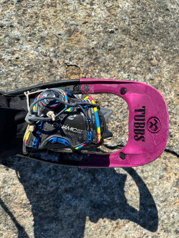
Heading down off Armstrong, the grade steepens and the focus narrows. There were a few sections where foot placements were specific and hanging onto trees ensured you didn't tumble down too quickly. Here is the point where I have in the past descended a ladder which I think was buried under snow (photo above, right). At one point I looked down and one of my Tubbs Flex VRT snowshoes were bent like a banana between a tree and the icy slope. I definitely see why they are called 'Flex' snowshoes - they were perfect all day long for me. After hitting the col between Armstrong and UWJ,  I raised my heel lifters and headed up hopefully for the final time today. 

About half way up, I finally met my first group of people today. Three guys dressed in mountaineering boots  and no snowshoes post holing along the ridge trail - every step dropping 12 inches or more. I find this super frustrating as  it not only wrecks the trail, but it is also a rule that you must bring skis or snowshoes with you at all times in the winter to avoid this. My only solace was that a winter storm was arriving that evening and dumping sufficient snow to fill in the post-holes. I arrived at UWJ summit at 12:35 and noticed that my summit shots were now different - clouded in and snow falling. The storm had started. I decided to put my water bottle in my jacket for the descent to help reverse the process of my water freezing.
Leaving UWJ's summit I headed down to the Wolfjaw Col and pass a few parties on the way up to UWJ. There was so much powder on the descent that even without a small toboggan I could glissade down on my aggressive mountain snowshoes. I found the junction at the col, fueled up one more time and headed down the Wedge Brook Trail. I have descended this trail once before. It starts by ascending along some exposed rock and then steeply descends about 1900ft before the gradient eases. All alone again, the best way I could think of to march through this section was to sing. Unfortunately the song in my head all day today was Rick Springfield's "Jessie's Girl" whose lyrics I repeated over and over to pass the time. Meeting the river trail, the trail climbs along the banks of the East Branch Ausable River and then finally descends to a bridge and connects back to the Lake Road near the 1 mile mark. A quick flat march out and the day was complete. I finished the day at 3:00PM. Upon reflection I thoroughly enjoyed hiking solo and will definitely hike solo again in the future!

Stats:
Distance: 18 km / 11.2 miles
Time: 7.5 hours
Ascent: 4500ft
Temperature: -17C/1 F
.gpx file

What I wore:
Baselayer: Helly Hansen Lifa top and bottom
Pants: Outdoor Research Cirque Pants plus OR Crocodile Gaiters
Jacket: Outdoor Research Uberlayer
Hat: Buff
Mitts: Black Diamond Mercury Mitts

What I ate:
Homemade banana bread mini loaf
2 x Breakfast Cookies (I put craisins instead of raisins, other nuts & seeds, choc chips)
Pepperettes
Chocolate
Water and Hot Chocolate
​​​​​
0 Comments

SEWARD RANGE-DONALDSON, EMMONS AND SEWARD

4/1/2020

0 Comments

 
Picture
Seward Range- Looking at Donaldson and Emmons from just below Seward Summit
I have a love/hate relationship with getting out of bed. I am not an early riser, and loathe the sound of alarm clocks waking me up every morning. Alpine starts are a bit different however, as the reason you are getting up is motivated by an activity you want to do, and hiking mountains will always justify an early start and spring me into action willingly and eagerly. Our objective for the day, the Seward Range in the High Peaks Region of the Adirondacks, almost always requires an early start. The range includes 4 High Peaks but on this day we were shooting for 3 that are along the same ridge: Mt Donaldson (4140ft), Mt Emmons (4040 ft) and Seward Mountain (4361ft). In term of Adirondack Peaks, the Seward Range is not home to the highest of the high peaks but always present a challenge due to the distance you have to travel, the ascent gained and the unmarked herd paths that connect the peaks. I have done this range twice before but never in the winter and was eager to see it in a new season. We stayed at Shaheen's motel in Tupper Lake the night before the hike and set the alarm for 5:30AM.

We were lucky to be able to drive into the summer trailhead parking lot on this day and the Subaru was able to drive through the snow on Corey's Road no problem. Parking at the winter lot adds an extra 10km to your hike day, one that we wanted to avoid. We arrived at the trailhead parking lot at and signed in at the register before dawn at 6:45AM. With the recent snowfall we were hoping to xc ski into the Caulkins Brook turn off but there still was too many open drainages and downed tree fall. A friend of mine had been in to do this range 2 days prior but there was little to no snow in the range. How conditions can change in a day! We left the trailhead with microspikes on our feet and snowshoes on our back and hammered down the trail. We noticed a plethora of deer tracks and scrapes in the snow and then out of the blue two deer ran by us. We got to the junction just as light started to peak over the ridge and we took a quick break to turn off our headlamps and take a sip of water. The next leg of the journey is hammering down the wider double track horsetrail to the Caulkins Brook cairn and turnoff. About a minute before the turn, another solo hiker caught up to us and mentioned that he had found one of Glenn's 'past-it's-prime' microspikes. Glenn looked down at his feet and realized he had lost one some time ago! The hiker had hung it up on a tree over a 10 minute walk back and we decided to leave it there and continue on. The solo hiker whizzed by us and headed up the herd path on his snowshoes. As the ascent begun, we switched to snowshoes for more traction. It was a good call, because the snow depths increased quickly as we ascended. From my memory, I knew that the Caulkins ascent was gradual but steady and was around 2000 feet gain. For the past couple years I had been using a Garmin Fenix 5S for gauging progress on ascents with it's altimeter but as soon as I started my ascent the altimeter stopped working. I later fixed this with a software update but at the time I somewhat enjoyed not knowing how much further I had to go. It was great to follow a broken path up Caulkins - there was no trace of my friend's group's tracks from 2 days ago. Only one quick snack and drink break on the way up and were were starting to see the views.   
Signing in pre-dawn
Donaldson summit
View towards Seward
View of the Santanoni Range from Donaldson
At the top of the ridge, we found ourself up on top of Mt Donaldon at 10:30AM. We caught up to the solo hiker who we found out was Keene local Joe Bogardus and had hiked the Seward Range 17 times! He was on mission to bag all 4 peaks in the range in one day and was headed towards Emmons next. We decided to do the Mt Emmons and then Seward last even though the last time I was on the ridge I did it in the opposite direction. The last two times I had been on this ridge it had been clouded in and raining and we didn't have any views. Today was a beauty day and we were able to see several of the High Peaks and views of the Seward Ridge itself.

Joe took off and we followed soon after working through some ice bulge obstacles over to Emmons. One of these obstacles was tricky, and Glenn took out his ice axe to get over it. We passed Joe on his return trip and summited Mt Emmon's at 11:25AM. Here we had a quick lunch break. Glenn had been struggling with his layering system all day so he threw on his down jacket where as I, who was testing out the new Outdoor Research Refuge Air Jacket, was able to let the VerticalX synthetic insulation technology do the thermoregulating for me and didn't have to alter my layering system once during the whole day!
Big steps!
Mt Emmons summit
View towards Emmons
​After our break, we headed back up to Mt Donaldson and then followed Joe's track over to Seward, including some steeper areas in which the snow depth increased dramatically feeling like every snowshoe step sunk further backwards instead of moving upwards. It didn't help that under most of this deep snow was a thick coating of ice, so several steps sunk backwards and then slid backwards even more. Seward is a few hundred feet higher than Donaldson and Emmons, and the snow depths were that much deeper making forward progress more energy intensive. We weren't expecting to see Joe again as he would descend off the far side of Seward to continue on to his fourth peak of the day Mt Seymour. About 5 minutes from the Seward summit, Joe popped out from the trees to say he had changed his mind and conditions were too slow today for him to try to hit all 4 peaks. He was backtracking on the ridge - something we were going to do too. We hit the Seward summit at 1:20PM and then turned around and followed our broken trail back to the junction at Donaldson at 2PM.

Here we walked down the Caulkins Brook trail crawling over and under several obstacles including down trees, open streams, and re-routes around some blowdown. The trail looked definitely better packed down than when we ascended and later we would find out a third group that had a late start was up on the ridge. When we finally reached the cairn, we took our snowshoes off and I returned to my microspikes to walk in the snow on the way out. Glenn was re-united with his missing microspike which was hanging on a tree and as we marched along to the junction daylight was fading. At the junction we donned our headlamps (at the same place we had taken them off earlier in the day) and walked out to the parking lot with one thought in mind: food and drink. We arrived at the parking lot at 5:15PM and signed out at the register, noticing that the there was a third group on the ridge. We then walked over to our car, noticing that the parking lot had been plowed!! Elated we knew the drive out in the dark wouldn't be hairy and we would be back at the hotel in no time. Then we saw it....the Thule ski box on on the top of my car was open with my keys in it! I guess in the darkness in the morning I had taken out our hiking poles and forgotten to close it and didn't notice at all that I hadn't locked it up!! The hiking community is such a trustworthy bunch and nothing was stolen or taken. What a mistake! And that wasn't the last one....Glenn had unknowingly left his red gloves on the roof of the car in the dark on the way out and on the way out we sped out of the parking lot and left them lying on the road! After returning from our trip, I posted a few photos on the Adirondack 4000 footers Facebook page about the trail conditions where a member of the third party had found the gloves and are mailing them to us! The hiking community is so amazing!

Another amazing hike in the High Peaks region of the Adirondacks. Up to 22/46 peaks for my Winter ADK 46er round!


Stats:
Date: January 2, 2020
Hike Distance: 24.96km
Time: 10. 5 hours
Ascent: 5500ft
Moving average: 3.2km/hr
Overall average: 2.3kmr/hr
.gpx file
After the New Year's ice storm
Winter conditions
Glenn's microspike!
Seward Mountain Summit
0 Comments

CANNON MOUNTAIN VIA THE HI-CANNON TRAIL

12/8/2019

0 Comments

 
Picture
Ladder section on the Hi-Cannon Trail
The forecast for August 8th, 2019 wasn't optimal. After a full night of hard rain and thundershowers we opted against the possible ridge walks and slide hikes on our list. With rain in the forecast for the day, we chose a short hike up Cannon Mountain in the Franconia area of the White Mountains in New Hampshire.

Cannon Mountain stands at 4080' and is  known for it's ski hill and tramway. The summit has a viewing tower that I wasn't aware of when I started this hike and apparently has awesome views of the Franoconia area on a clear day.

We started late at 10:15 AM after changing our plan and attempting to wait out rain storms. We parked at the Lafayette Campground hiker parking (1900') and walked up through the campground following the signs to the Lonesome Lake Trailhead. Quickly after the hiking trail begins, it splits and we took the right hand option: Hi Cannon Trail. The 2.8 mile trail up begins with a severely eroded section that is covered in a small granules akin to kitty litter. The trail takes no time to become steep and remind you that if you wore too many layers you will want to take them off ASAP. 

The middle third of the trail is the most challenging. Boulders become larger and larger and require more hand and foot actions. The skies opened up on us here and before we knew it every foot hole became a deep puddle and water streamed down the steep slope. The final third of the trail opens up to more slab friction hiking which I will note is tricky when a river of water is flowing on top of them. At about 3500' the slabs apparently offer views of the Franconia ridge that we unfortunately weren't able to see on this day.  A mixture of sweat and rain entered my mouth and soon every square inch of my body was soaking wet.

By the time we reached the ridge, every flat spot had become enormous puddle and water started to squish out of my boots as it had flowed hard down my legs soaking my socks for the past hour. We dodged puddles despite having soaking wet feet and found two more junctions to head up to the tower at the summit. 

Upon arrival the summit tower is completely enormous and impossible to miss. We hadn't taken a single photo of the hike before this point because of the rain so we raced under the roof after the first set of stairs and pulled out the camera for some summit shots. There was no point going up to the top with this weather so we packed up and ran down the trail. Our bodies were chilled from being wet and not moving for a few minutes at the summit. About 20 minutes into our descent the rain slackened and the sun started to break through. 

The return trip down the Hi Cannon trail is nothing to shake a stick at. It's steep, slippery when wet, and requires focus and attention. We barely spoke and concentrated on our footing. I was hoping we would have some views on the way down but we didn't. A old well-used ladder takes you up and down a steep section and there was one slab section that could be consequential if you lost your footing as it seems like you might just go off the edge!

We finished the hike at 1:45 PM and definitely thought that even though it was the shortest hike we had done this trip, it was the toughest in terms of trail conditions. It reminded us of a 'normal' Adirondack hike. I may have to do this hike again in nicer weather...I am sure the views are worth it! 

Stats:
Elevation gain: 2309 feet
Distance: 8.5km
Time: 3 hours, 30 mins

Up to 67/115!
Turn right!
Emergency shelter spot?
Hi Cannon Trail
Summit tower
0 Comments

MOUNT TECUMSEH FROM THE MOUNT TECUMSEH TRAIL

12/8/2019

0 Comments

 
Picture
Mt Tecumseh summit marker 2019
Mount Tecumseh is a ski hill peak in the Sandwich Range in the southern White Mountains. The formerly 4003' peak has been re-measured in 2019 to read 3997'. As a peakbagger looking at completing the NE 111 (115er) list, I bagged this peak on August 7th, 2019. There are rumours that this peak might be taken off the NH 48 list but I hope it stays on the NE 111 (115) list. Fingers crossed my hiking efforts count!

Today's plan was altered due to a strong forecast that was to include rain and severe thunderstorms.  We decided instead to head up Mount Tecumseh from the longer Mount Tecumseh trail from Tripoli Road. Today we started at 9:30 AM, expecting a shorter hike than yesterday. The 6.2 mile round trip hike would be a perfect day out.

The trail from the parking lots jumps over two small brooks and then heads straight up. The grade is consistent and unrelenting. As it was hours before thunderstorms, the humidity levels were peaking and then wind was non-existent. Sweat dripped off our chins and flowed out of all our pours and we put one step in front of the other on this trail. That combined with numerous cobwebs made for a sticky mess on my skin. The trail was a soft soil slope with rocky boulders throughout. The trail is dense with forest cover and offers little to no views to gauge your progress.

After a 1700' slog up we were at 3700' an hit our first peak. The trail then drops into a col and hits a final ascent to the summit proper. We hit the summit 1 hour and 45 minutes after leaving the parking lot and were very grateful to feel the breeze at the summit ledge. A family of 5 were also at the summit (had come up from the ski hill side) that were lovely to talk to. We were surprised that the daughter had forgotten her shoes and had hiked up barefoot! 

The summit has a brand new summit marker and some beautiful views of the Tripyramids and Osceolas. Some longer distance views were obscured by clouds on this day as the storm clouds were building in the sky. After a drink, snack and obligatory summit photo shoot, we turned around and made our way back to the car.

Stats:
Distance: 9.5km/6 miles
Elevation: 2592 feet
Time: 3.5 hours
View from the summit of Mount Tecumseh
Mount Tecumseh Trail
Summit photo success!
Summit sign
0 Comments

MOUNT OSCEOLA AND EAST OSCEOLA FROM TRIPOLI ROAD

12/8/2019

0 Comments

 
Picture
View of East Osceola from Mount Osceola
Mount Osceola (4320') and East Osceola (4156') are two peaks that lie in the southern part of the White Mountains near the Sandwich Range.  These two peaks are on the NE 111 (115er) list  which I am working on and so we planned to hike these two peaks in one day on August 6th, 2019.

Our group decided to stay at Russell Pond Campground located on Tripoli Road just off the I93. This campground offers flush toilets, showers, waterfront and quiet private camping. The short commute to many hikes from this campground is also an attractive reason to stay at this campground. Tripoli road also offers road side camping for cheaper but with limited facilities. 

Four months prior to this hike I had knee surgery and was eager to test out my new and improved knee. That said, being uncertain of how the knee would react (especially on the descents) made me a bit nervous on this hike.

Starting at 8:15 AM from the parking lot on Tripoli Road, ($5 day parking fee), at a elevation of around 2200' . We set off up the gradual but rocky ascent up to Mount Osceola. The trail is well shaded and has a manageable grade the entire distance. My husband Glenn was part of our group and begun the hike at a slow pace due to an ankle injury. After 1600' of climbing and dodging rock boulders, he threw in the towel and turned around. That left two of us to head the rest of the way to the summit which we reached at 10:15 AM. The summit ledge from this peak is outstanding with beautiful views on sunny days like we had. We quickly identified our next objective from this summit and went on our way. 

The trail over to East Osceola is fairly straight forward except for one section called the Chimney. I hadn't read any trip reports or trail descriptions for this hike so I was surprised to hear the nervousness in many hiker's voices as they approached this section and asked us about how treacherous it was. The section is steep rocky section that can be up or downclimbed in about 4 moves.  Being a climber this section wasn't even an issue for me but for others I can see it might be scary. We chose the left route when coming from Mount Osceola.

The summit of East Osceola is treed and there is a rock cairn to indicate the summit. A trail coming from Greely ponds comes up from North side. We took a snack break here with a mother and daughter group before our 40 minute return trip back to Mount Osceola. On the return trip we chatted with a young woman who is a nurse from Long Lake area in the Adirondacks and we had a good chat about Adirondack hiking.

Crowds were starting to build on the summit of Mount Osceola upon our return with many people enjoying the views in various states of dress. Many were fully clothed but some were airing out their footwear and one had even taken off her pants! We took a quick drink break and headed down the trail to meet up with Glenn who was waiting in the car. My knee had no problem with this descent and I was pleased that I could be fully confident hiking mountains once again. We met a few more characters on the way down an saw some unprepared groups hiking with little to no gear or water on a hot summer's day. We returned to parking lot at 1:15 PM making it a 5 hour day.

Stats:
Distance: 12.93km/8.0 miles
Elevation gain: 2862 ft
Time: 5 hours
Slab rock near the summit of Mount Osceola
Summit of East Osceola
View of Mount Osceola
Summit of Mount Osceola
0 Comments
<<Previous

    Author

    Canadian gal hooked on pursuing outdoor adventures, testing outdoor gear, and a passion for outdoor education.

    Archives

    March 2022
    August 2021
    August 2020
    January 2020
    August 2019
    July 2019
    October 2018
    August 2018
    July 2018
    April 2018
    August 2017
    November 2016
    September 2016
    August 2016
    January 2016
    December 2015
    August 2015
    May 2015
    April 2015
    March 2015

    Categories

    All
    Backpacking Trips
    Climbing Trips
    Hiking Trips
    Paddling Trips
    Skiing Trips
    Trekking Trips

    RSS Feed

Instructor/Ambassador for:
Picture
Picture
Picture
​<script type="text/javascript" src="http://classic.avantlink.com/affiliate_app_confirm.php?mode=js&authResponse=d43d81bd3781e1d2abd21e2d070927932a5cd5c0"></script>

​