Day 1 (July 16): Mayo to Wind River
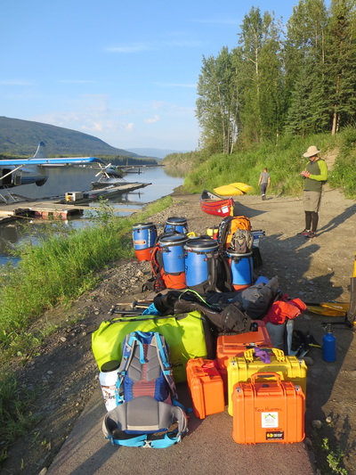
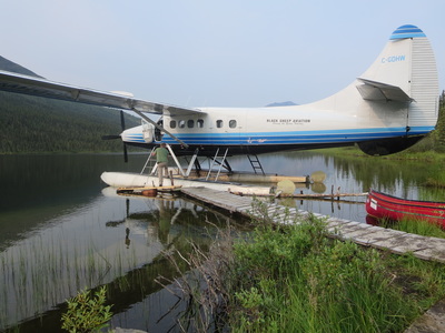
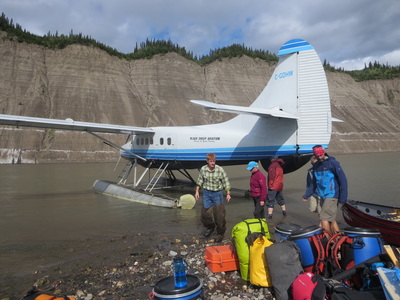
We arrived and unloaded our gear at the floatplane base at 7:15AM. Everything going into the plane had to be weighed: canoes (which if strapped on the outside of the plane count as double), gear, and people. The load capacity for our Turbo Otter was 2300lbs. We had 6 people and 3 canoes so this plane was the perfect size. Our plane took off on time at 8 AM, and we flew over mountains and Beaver Creek enroute to our final destination of McClusky Lake. The weather was hot and sunny, with some haze. Total flying time was 45mins. Unloading the plane at the dock, we dumped our gear on shore and immediately noticed a hunting outfitter cabin. Everyone except me portaged our gear 300m to the McClusky Creek, while I re-assembled our 17ft canoe that had been nested with a 16ft canoe for the plane ride in.
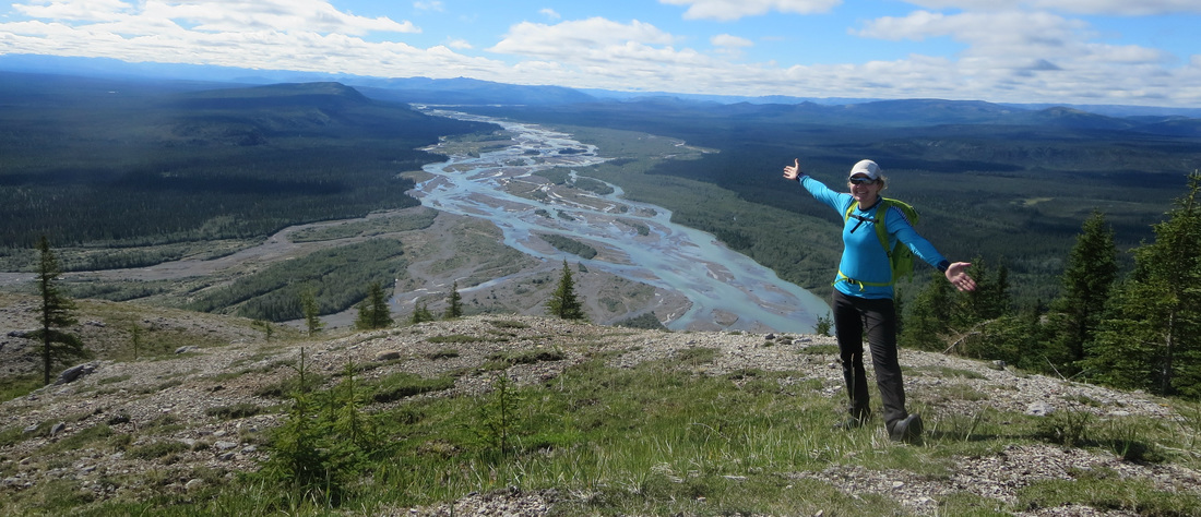
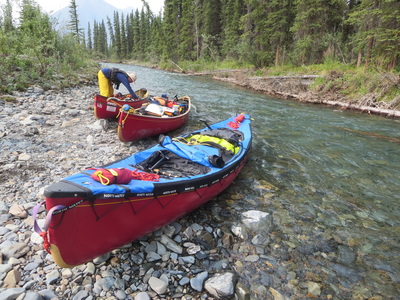
We loaded the canoes and at McClusky Creek and noticed that the water levels were low. This section of river is narrow, twisty and has many sweepers (downed trees). We scouted and lined much of it. We ducked under leaning trees and slid our boats around numerous obstacles. Do not rush this section of river-you can get into trouble quickly. Luckily we made it out unscathed. Joining with the Wind River proper, we found a campsite on river left (GPS Latitude:64.58762 Longitude:-134.48970) and set up camp for the first night. The first thing you notice about the Wind is the crystal clear turquoise water, gravel bars, and beautiful mountain scenery.
Our first night went well: breaking in backcountry routines, jobs and figuring out how to use new gear! Unfortunately our sunny weather disappeared and a thunderstorm moved in. A sign of a change of weather for sure...
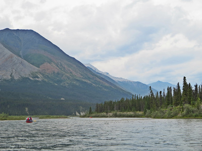
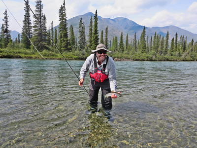
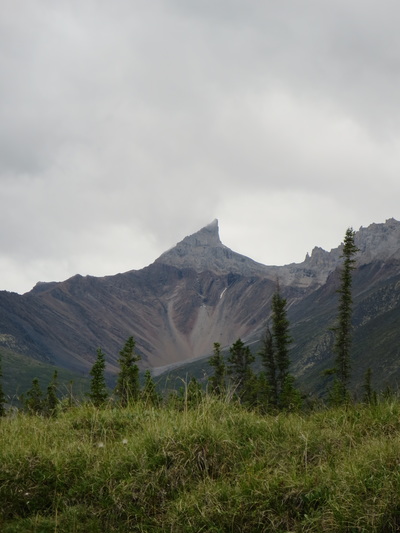
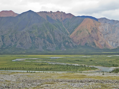
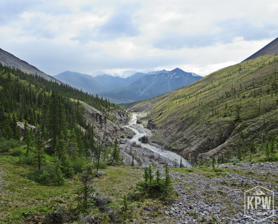
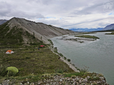
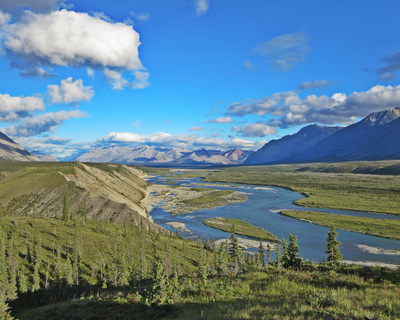
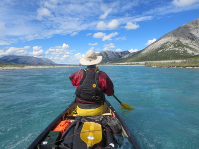
We left camp 1 at a leisurely time of 11AM. The river here is still fairly narrow, and is braided and twisty with many sweepers. After about an hour of travel the river relaxes and widens (picture below left). Enjoy the mountains in this section! Taking time to fish at our lunch break, the clouds rolled in and were ominous. We were on the lookout for 'Elf Cap' mountain (photo bottom right) and we camped on river left on a grassy bank below. GPS Latitude: 64.78242 Longitude:-134.64484.
What time is it? A question that was always in play as daylight in this part of the world is almost 24 hours in length. I never once used my headlamp on this trip and it never got dark. There was never any pressure to get something done before dark. I never knew if it was 7PM or 10PM. Bring a watch so you know!
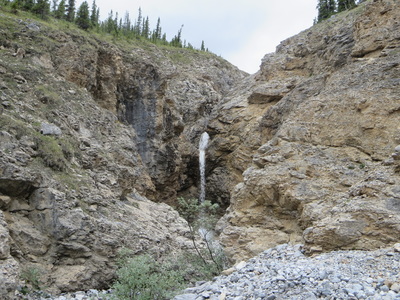
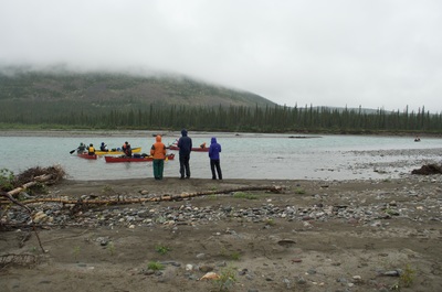
On the water around 10:45AM, we paddled a winding section of river for 45 mins before running into our first sign of humans. A group of 6 (plus a dog) greeted us at their campsite on river right (photo below left). The group was on a 24 day trip that included many days of hiking. We left them and immediately parked our canoes on river left and hiked up to a small waterfall that can be seen from the river. A short 15 minute hike up and we were there. This was a nice warm-up as the weather today was cold and windy. After a quick snack, we paddled for another half hour or so before finding a sheltered area for a lunch break. We continued on, passing a solo rafter out on a 2.5 month trip. He was no where to be seen, probably opting to not get out of his tent on such a miserable day.
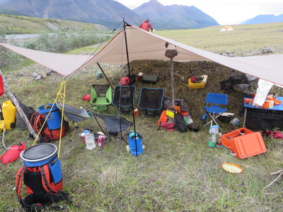
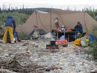
We arrived at the alluvial plain site, and found another large group camped at the first obvious campspot on river left. We continued on around the corner another 500m or so and pulled out at a second spot. The valley really opens up here and there are loads of camping spots in this area. We set up our tarp in a ravine, out of the wind. Our plan was to stay here two nights as hiking in this area is prime. GPS Latitude:64.88135 Longitude:-134.66612.
Joel treated us to a special dessert this evening-apple pie in the dutch oven. Yum! Our group used a firebox to cook on during this trip. Fireboxes reduce impact from campfires and leave fewer fire scars. We also had a curious caribou visitor on the plain this night, who wasn't sure if we were friend or foe. Rain came down hard this evening and overnight.
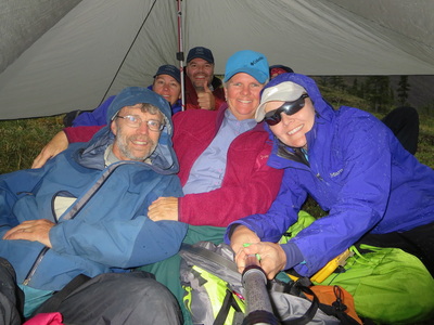
The creek and valley behind our campsite is unnamed on our map, but we called it Portal Creek. The hike starts on the grassy plain into an obvious valley. Once in the valley, there are options to climb ridges or to continue contouring around at lower elevations. Low lying cloud obscured mountain tops so we decided to walk on game trails lower in the valley. We saw wildlife sign of bear, sheep, and ground squirrel but didn't see much actual wildlife probably due to the weather. A hard rainshower came down on us at lunch so we huddled under a small tarp for shelter. A 10km hike in total, we returned to camp with firewood to burn in blue sky and sunny conditions. Just after dinner and drying out our gear, the rain started again and we were all in our tents at 9PM.
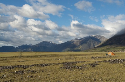
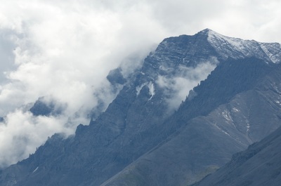
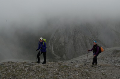
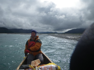
Woke up to cold, rain and wind. Temperature was 5 degrees celcius not including a considerable windchill. Rain was falling as snow on the mountaintops (middle photo below). We donned our drytops, drypants, and neoprene gloves and headed out in a gusty 40km/hr headwind down the river. We called this day 'Mordor Day' as it was like we were entering in a dark storm, like something out of a movie set.
We had to get out of the boat and jump around to regain lost circulation in the extremities. After playing "Hello, my name is Joe" and dancing around for 20 minutes we were ready to head back into the boats. The only thing that kept us going was a sliver of blue sky in the distance, exactly where we were going! We passed by a group camping on river right, and found a rocky ravine we dubbed the 'Solar Collector' to have lunch out of the wind. The sun came out briefly and we were able to feel the warm rays thaw our fingers and toes. As we hopped back into the boats, the wind came on full blast again and the sun hid behind the clouds. We paddled for 10 more minutes until we found a suitable campsite we called Terrace Bay on river right (the campsite had 3 distinct terrace levels). It was protected from the wind and rain and we set up camp quickly and got warm and dry. Sun came out later in the day and we hiked up the bluff to check out some hiking options for the next day. We spotted some Dall sheep on the hill, and we devoured the blueberries growing all around us. A short day on the river, only 25km. GPS Latitude:65.02667 Longitude:-134.86052.
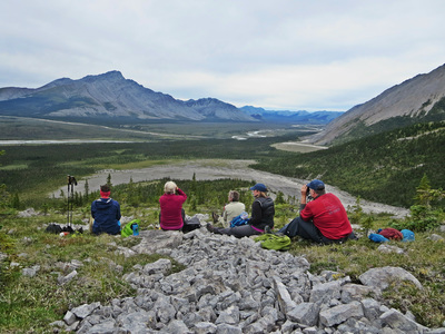
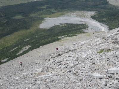
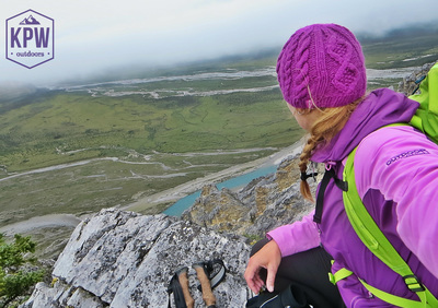
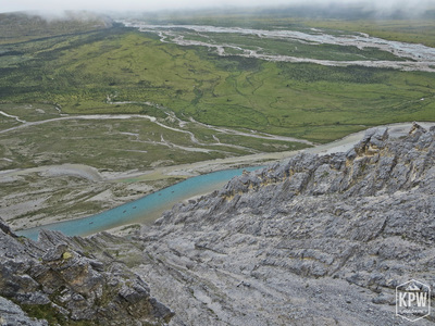
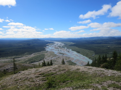
A cold night overnight with temperatures below freezing. A full moon and frost greeted us in the morning. Leaving camp at 11AM, we hiked the bluff behind the tents through a bog to a alluvial gravel fan at the base of the mountains. Our body temperatures rose in the first hour of hiking and we all had to peel off multiple layers of clothing. Passing a large (bear?) den, we gained elevation on the ridge through grassy terrain. The grass and trees thinned and we found ourselves hiking on steep, loose scree. We heard some squeaking around us, and found a small pika alarmed at our presence. We headed up to the summit and drank in the gorgeous views of the river in both directions. Even though we had seen sheep nearby the evening before, there were no sign of them today. We carefully made our way down the loose scree from the summit to a grassy knoll for lunch. The scree rock is very abrasive and wouldn't have been ideal for sitting on. We continued our descent picking up some firewood. Hike gained 1720ft of elevation from camp and summitted just over 4000ft. It took us a comfortable 5 hours. Note: Terrace Peak is not an official name, but our name for the peak behind our campsite.
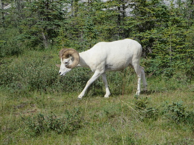
Woke up to raindrops on the tent fly once again and cold temps. As we packed up, I noticed a grizzly bear crossing the river about a kilometer upstream from our site. Joel had brought a spotting scope, so we monitored it's behaviour as it grazed on the far banks of the river as we packed up. Temps warmed up as the sun came out. We got on the water and immediately noticed that the river characteristics changed. Whitewater involved class 2 paddling and became more exciting. We stopped to check out another cute waterfall on river right, and then continued on a bit further to stop for lunch on a gravel bar. Paddled less than an hour further and gathered many photos and videos in the sunshine and turquoise water. Great scenery! Mount Royal is stunning. We arrived at the Mountain's End campsite on river right and caught up with another group also camped there. A glorious day enjoyed by all and a reprive from the cold and rain we have had so far. Another campsite resident also greeted us. A lone 'wild' Dall sheep we called Roger roamed around the campsites at will. Obviously not bothered by humans, he carefully but boldly wandered through our camp area grazing on the vegetation, allowing us to get great photos!
After dinner, 40+km/hr plus winds starting howling and our tarp looked more like a sail. We storm lashed our tent as the wind pushed the fabric and poles with purpose. A cold night ensued and I was glad I brought my down pants to wear as temperatures plummeted once again. GPS Latitude:65.11391 Longitude:-135.10718.
Today we woke up to a very cold and bitter day. The thermometer read +2 degrees celcius with a wind chill of -10C. We left for our hike at 11AM, and decided to gain the ridge behind camp despite the low lying cloud cover. Float planes flew low under the clouds all day and visibility was poor. We wanted to get to the spot that accomplished Yukon photographer Peter Mather took a famous photo of the the Wind River with the confluence of the Royal Creek with Royal Mountain in the background. Unfortunately, we knew there was no way we could re-create the photo, as Royal Mountain could not even be seen!
We climbed up 1500ft and watched a group of 5 canoes move down the river (photo bottom right). It was great to feel warm climbing the mountain and I dropped from 6 layers down to 3! At 3700ft, our group split: 3 returned down to camp to fish and do laundry, while the other three (including me) continued on hiking a cirque ridge. We climbed another 600ft and found ourselves in the clouds with only sheep paths to see where we were going. Descended 600ft back under the clouds where we could once again see the river from the back of the valley. At a distinct green notch (@4:30pm), Mia and I decided to descend and hike the 1hr back to camp to start dinner. Joel, continued on the ridge for another couple of hours, and coincidentally showed up at camp just as dinner was being served. The wind continued
to howl all day long we were all in our tents early at 8:15PM to warm up. Another night spent sleeping in in my down pants inside my sleeping bag and I was happy I brought them. It started to rain again when we got inside our tents and made us want to hibernate for the near future. Glad we brought some books to read! Temperature at bedtime was 4 degrees minus windchill.
Reluctant to get out of our warm cocoons, no one emerged from their tents until 9AM. Temperature was 4C minus windchill and the group conferenced to decide whether we should paddle on or stay put. We decided to paddle, and left at 12:30PM. Raining all morning, packing up was a chore. I wore a drytop with 4 layers underneath and toque along with my neoprene mitts with plastic bags overtop. The river changes at this point. Mountains end and the banks of the boreal forest take over. The current picks up and moves quickly (10km/hr). We covered 42 km to the confluence to the Little Wind River in about 5 hours which included 2 breaks and 1 lunch break. We saw a black bear on the banks today. It scurried out of sight soon after.
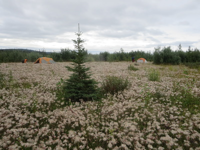
We set up camp on a gravel bar on river right, just past the confluence with the Little Wind. We called this site Aven Haven (photo bottom left) and set up just before it started to rain again. If I were a weather forecaster, the forecast would read: "Cold and windy today with the threat of rain". That would sum up the past week of this trip. GPS Latitude:65.39588
Longitude:-135.42140
Woke up once again to a cold 5 degrees celcius and rain. To lift our spirits, we had a pancake breakfast and noticed the other group we had been leap frogging coming down the river at us. They had taken a rest day yesterday and had miles to make up today. This group, called Youth of the Peel, had a interesting purpose to their trip which you can read more about here. It was already 10AM and they were on the water. Great to see a group of mainly native youth out enjoying this amazing area.
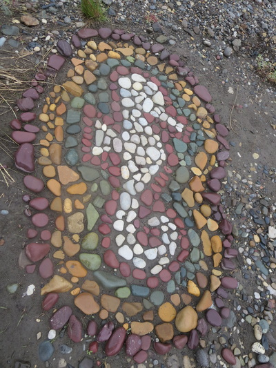
On the water around noon, I wore my raincoat and toque today with my drypants so I could keep on my 7 layers! We covered the 27km paddle with only one break. Saw a bald eagle on the river today. Low lying cloud, rain, no rain and wind hit us as we paddled. Luckily we made it to our next home at Mount Deception by lunchtime as the current remained to flow quickly. Crossed paths with the large group one last time as they left the site for lunch. We had our lunch soon after, and then set up camp. We noticed a few pieces of art left behind for us (photo below centre), using actual river rocks. High above Mount Deception, there were peregrine falcons calling, and also some mud swallow nests attached to the rock. Tomorrow, this mountain would be our hiking objective. GPS Latitude:65.59989 Longitude:-135.44432.
SUN!! We woke up feeling the warmth and heat of the sun's rays for the first time ever on this trip. The sky had pockets of blue which eventually opened up to majority blue! The weather changed and so did the feel of this trip. Able to shift from 'endure' mode to 'enjoy' mode made everyone happy.
We hiked up 1300ft right from camp to the top of Mount Deception. Ascending a series of ascending false summit bumps, the views are spectucular. We took a long leisurely bug-free lunch, and absorbed every bit of the sun's rays we could. We chose to come down the second and third ridges and had to bushwhack a bit back to camp. Returning the same way you came would avoid this. We returned to camp by 3PM, took time for a bath and dried out wet clothes and gear. After dinner, we ate shortbread out of the dutch oven, and played a competitive game of spoons. Group morale was on a major upswing!
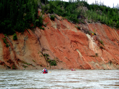
After leaving Mount Deception, the river changes from clear and turquoise to brown and silty. The sound of the silty hitting your canoe sounds like you've dived into a bowl of Rice Krispies. Loud 'snap, crackle, and pop' sounds along with grains hitting the bottom of the canoe make no secret that the composition of the river is different. The river widens, is full of downed trees, and deposits of coal can be found along the shores. There are sandy berms along the river banks and the boreal forest continues to cover most of the landscape. We covered the 43.3km in record time with an average travelling speed of 13.4km/hr and a record high maximum speed of 18km/hr. I think all the rain we have had brought the river levels up. Before the confluence with the Peel River, some striking red-orange cliffs appear and then you enter into a canyon. We decided to camp in the canyon, about 200m before the confluence. GPS Latitude:65.83620 Longitude:-135.29584.
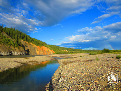
Today the weather was about 25 degrees and sunny. It was so hot in the canyon, it felt like we were in an oven. We felt compelled to swim, and dipped our bodies into the river in a deep eddy. It felt great to immerse ourselves in water. Not too long after our dinner that included a chocolate fondu dessert, some clouds appeared and some spotty showers sprung. In the distance a rainbow emerged (photo bottom right).
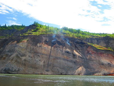
Leaving the Wind, the river descends rapidly in a canyon and looks intimidating as it joins the Peel River. Luckily, when the Wind meets the Peel, the confluence is very gentle and it's an easy merge to paddle. The Peel starts off in a canyon that is wide and slow moving, and then the valley widens and the river flows around a series of islands. Along the way, we saw a smoking bluff made up of burning coal (photo bottom left). Smelling like magic marker, we vacated the area quickly and moved on to where the river narrows again in the Peel Canyon. There are 2 rapids, one at the beginning (a class 2+ that is easily missed on the right side) and in the middle (a class 2 with cross current left to right). The water level was low so these rapids weren't as challenging as they could be at high water. We decided to camp between these two rapids on a gravel bar on river right in the canyon. The sun baked us in the canyon and we hid from the shade under tents, tarps, and canoes.
The lower part of the Wind and Peel are really good for rock hounding. We spent hours looking for cool, unique rocks in which there are plenty. In grey, purple, green, ivory, maroon, and combinations, there are always cool rocks to find. I finally had to cull my collection because I had too many! By 8PM, we were back in our tents because a rainstorm had found us. It continued all night. GPS Latitude:65.94937 Longitude:-134.8500.
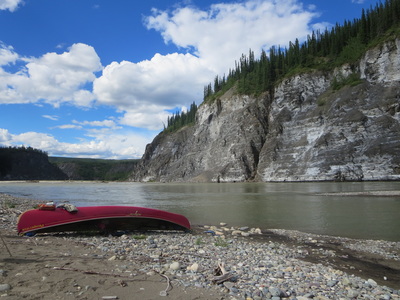
Woke up to pouring rain in the canyon. From 7AM-10:30AM we ate and packed up in the rain. Left the canyon site and front ferried across the second rapid in the canyon without issue. Enjoyed the rest of the canyon and the remainder of the day paddling around big river bends and large eroding cliffs. At several points, rockfall fell into the water from the cliffs so don't get too close!
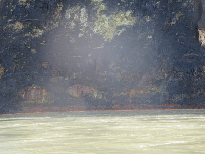
On one of our breaks, we saw a black bear on the opposite side of the river than us. We noticed a bald eagle on shore, and its eaglet in a nest in a tree nearby. We also saw 'eyes' on the river banks staring at us (photo bottom right). We found a camp after 45.5km of paddling, 5hrs. The campsite was about 10km before Taco Bar, and we called it Aspen Grove. GPS Latitude:65.94665 Longitude:-134.34203.
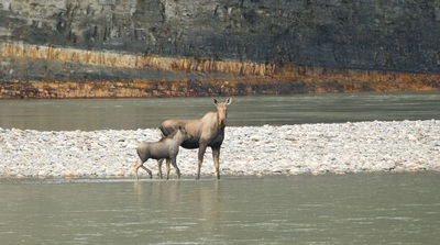
Once again, it was windy and rainy overnight. We woke up to find a moose cow and calf in trouble. They were on a gravel bar in the middle of the river trying to swim to the far side. They had spotted us, and had probably been pushed there by the wolves in the area (we saw tracks through our campsite). The pair tried to crossed the deep current, swimming with only their heads showing without luck. After 7 attempts and knowing the her calf was tiring, they returned to our side of the river upriver from us, thinking we were a threat. In between each attempt, the cow would look over at us, seeing if we had disappeared in the last 5 minutes (photos below).
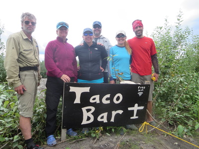
We floated the last 13.8km to Taco bar, our float plane pick-up spot. This spot (GPS Latitude:66.00300 Longitude:-134.21974), marked by a new big sign, is the pick-up spot for many of the Peel Region rivers just south of the Arctic Circle. We met a couple there with a pack canoe waiting for their pick up the next day. We ate lunch here, disassembled the 17ft canoe and got ourselves ready for pick-up. And guess what? It rained on us while we waited for pick-up! The flight back to Mayo was 2 hours in length.
I've learned not to underestimate the Wind River-constant current, many hazards, converging currents demand that you pay attention to it at all times. Whitewater experience is required. Being my first northern river trip, I am grateful to have had new experiences, new friends and new adventures. Even though we had challenging weather for almost the entire 15 days, the beauty of this place is absolutely stunning. I hope to return to this region again in the future and do more northern Canadian rivers. The Peel Watershed region's future is at risk at the moment. After visiting this stunning place I fully support the Protect the Peel conservation efforts. For more information check out their site and sign the pledge here.
What did I eat? Read about my menu planning here.
What gear did I bring? See my gear list here.
Did I make a video? Yes- check out my basic GoPro edit video below.
 RSS Feed

