
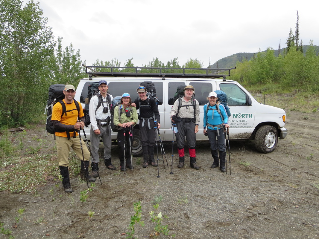
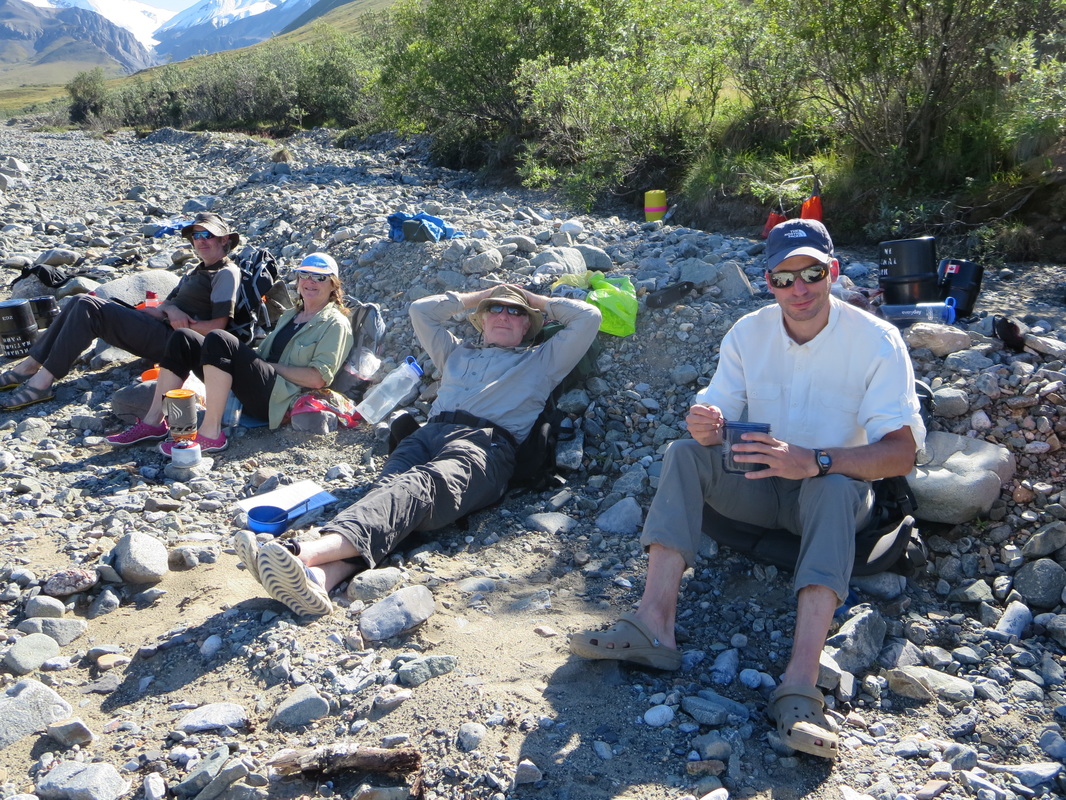
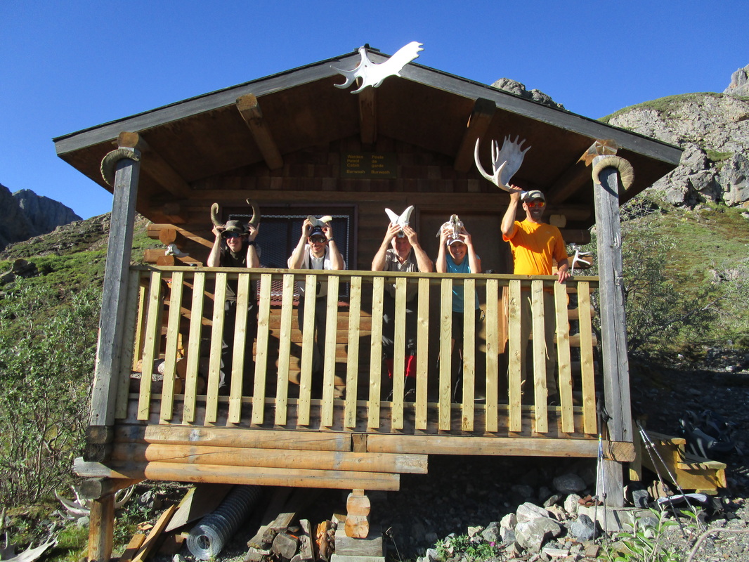
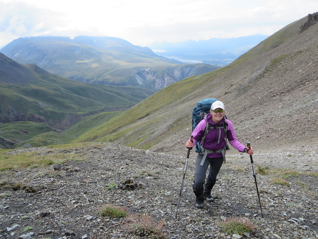
The Donjek Glacier backpacking route is rated as Kluane National Park's most difficult hike. It is listed as a 8-10 day backpacking route, ranging between 100-120km in distance. There are no trails and no designated camping sites, just a general route description and recommended areas to camp. Expert navigational skills are mandatory, and all food must be carried in approved bear proof barrels. The idea of doing this trip was generated by my friend Deb (in green above) who organized the trip from start to finish. The six of us: Deb, Glenn, Mike, Ivan, Marc and myself participated, and have all had years of backcountry experience and skills and were a competent group for this trip. We are all members of the Alpine Club of Canada's Ottawa section. This is our tale from August 2-10th, 2015:
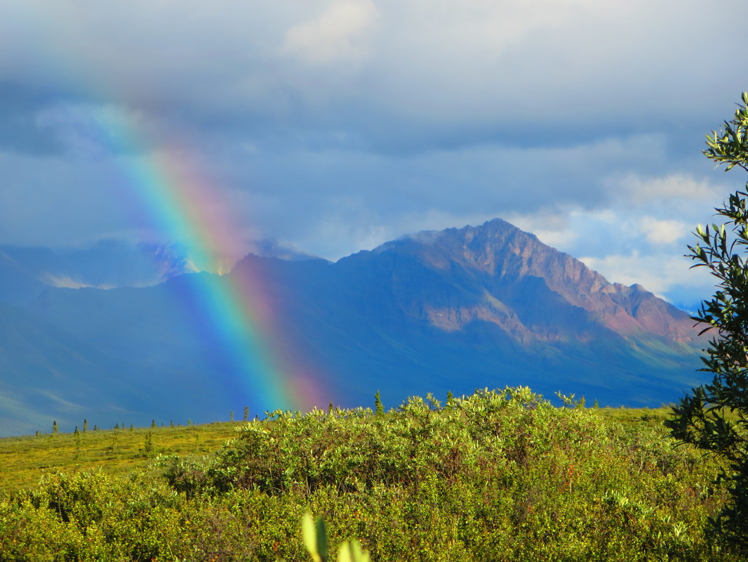
Day 1-Trailhead to Burwash Uplands Campspot (11km): Starting in Whitehorse at the highly recommended Red Door B and B, we were picked up by a local shuttle service provided by Up North Adventures who we hired to take our group of 6 to the trailhead and back 9 days later. Leaving Whitehorse, Yukon at 9:30 AM, we headed to Haines Junction where upon entering Kluane National Park, we had to register, obtain bear barrels, and permits. We paid a fee of $68.70 CDN each to enter the park. After a quick stop at the Haines Junction bakery (yum!), we set off to the trailhead. A couple hundred meters past the Duke River bridge outside of the small native hamlet of Burwash, we turned left down an old mining road. Rumour has it that you can drive 5.1km down this road but this road was in rough shape and so our driver seized an opportunity to turn around at 2.7km in. Here we started our journey. We hiked in on the road which turned into a ATV path over forested and mainly flat terrain for a total of 11km the first day. We noticed quickly the impacts mining has had on the area. There were marked stakes everywhere. I guess that's where the phrase 'Stake your claim' comes from! A perfect day for hauling heavy packs and a beautiful rainbow from the first recommended and well-used campspot at the foot of the Burwash Uplands. Campsite: Latitude:61.33951 Longitude:-139.29439
Day 1-Trailhead to Burwash Uplands Campspot (11km): Starting in Whitehorse at the highly recommended Red Door B and B, we were picked up by a local shuttle service provided by Up North Adventures who we hired to take our group of 6 to the trailhead and back 9 days later. Leaving Whitehorse, Yukon at 9:30 AM, we headed to Haines Junction where upon entering Kluane National Park, we had to register, obtain bear barrels, and permits. We paid a fee of $68.70 CDN each to enter the park. After a quick stop at the Haines Junction bakery (yum!), we set off to the trailhead. A couple hundred meters past the Duke River bridge outside of the small native hamlet of Burwash, we turned left down an old mining road. Rumour has it that you can drive 5.1km down this road but this road was in rough shape and so our driver seized an opportunity to turn around at 2.7km in. Here we started our journey. We hiked in on the road which turned into a ATV path over forested and mainly flat terrain for a total of 11km the first day. We noticed quickly the impacts mining has had on the area. There were marked stakes everywhere. I guess that's where the phrase 'Stake your claim' comes from! A perfect day for hauling heavy packs and a beautiful rainbow from the first recommended and well-used campspot at the foot of the Burwash Uplands. Campsite: Latitude:61.33951 Longitude:-139.29439
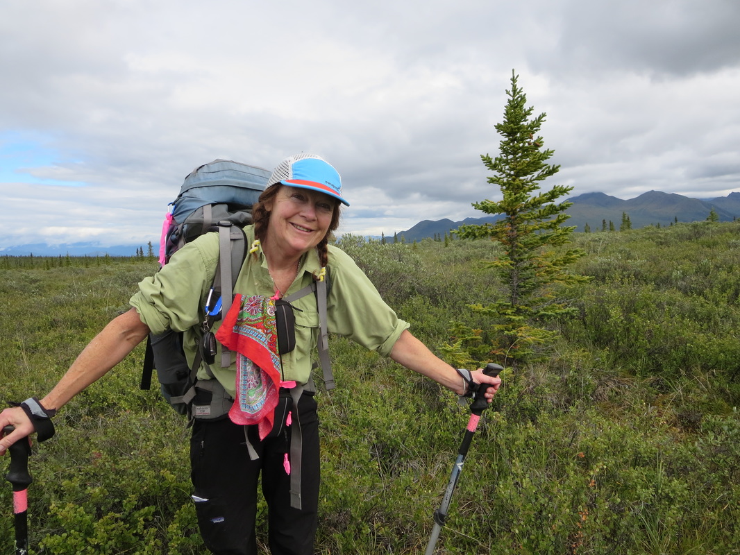
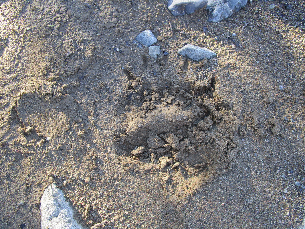
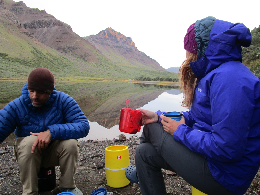
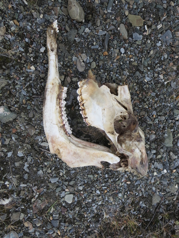
Day 2-Burwash Uplands to Burwash Creek near Park Boundary (17km): Up at 6 AM temperatures were around the freezing mark. I had had a cold night pre-dawn in my sleeping bag rated for 0 degrees celcuis/32F (in hindsight I should have brought my -7C bag). Luckily the sun was shining and it was only a matter of time before we were back on the trail. We started again on the ATV path across boggy hummock land for about 4km before making a big decision: continue on easy terrain but add 6km to the day OR bushwhack across the bog up and over a hill and end up in the same spot. The group opted for the easier terrain. A toss up of pros and cons whether or not we made the best decision as our packs were still quite heavy. We chose our course and off we went. Descending down to the Burwash Creek, we ate lunch and crossed the freezing cold creek to the mining road on the other side passing by an old cabin and trailer. We followed the mining road over a chasm then down to the river again. We followed the riverbed for many kilometers viewing many signs of bear activity, encouraging us more and more to keep hollering out our bear calls at regular intervals. My call was "Heeeeey Bear!", while other group members called: "Yo Bear!", "Oi Bear!", "Day-O", "Hey Hey" and "Fuzzy Bear!". Heading past a recommended campspot on the creek, we tried to continue on to the park boundary and Warden's cabin. We stopped a few km short and set up camp in a flat grassy spot on the creek's bank. Our kitchen was down on the river bank and and proved luxurious with couch-like backrests and easy access to water. At 7:45 PM, our group had eaten dinner and finished cleaning up including moving our bear barrels another 100m upstream. We were relaxing by the riverside conversing when, only 10m away around a corner, I saw a hump and a silver-brown furry bum headed in our direction. I recognized the creature and jumped up and quickly shouted "Bear-bear-bear!" and within second there were 6 of us erect with bear spray in hand shouting. The lone immature male bear, approached us from upwind and downstream, was as scared to see us and we were of it. It bolted downstream 100m and turned back to look at us. Ivan set off a bear banger and when it went off, the bear bolted onto the bank onto a ridge. It saw us again looking at us and took off. We measured a paw print and noted the print was about 6 inches wide. Shocked and stunned we got so close to a bear without warning, we decided to set-up nighttime watches to look out for its return and allow others to sleep with both eyes shut. Glenn and I took the 11PM-1AM shift which I labelled the "Land of the Midnight Sun Watch" as sunset and twilight lasted well after midnight. Just around 1 AM, we did see the eyes of a fox nearby but other than that, there was no sign of the bear ever again. That night was the coldest night of the trip with frost on the ground in the morning. Campsite: Latitude:61.32600 Longitude:-139.45670
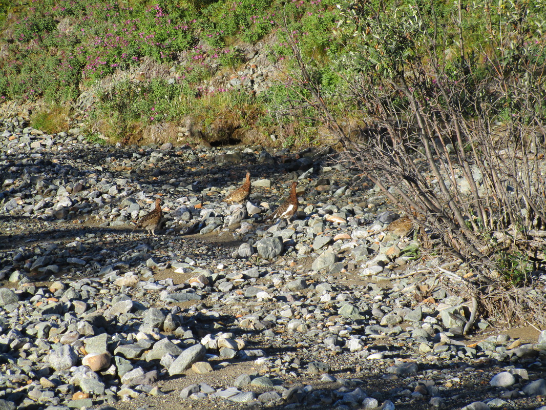
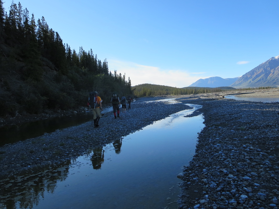
Day 3-Burwash Creek to Hoge Creek (12km): Waking up again after another cold night and 2 hours less sleep could have been a drag but at 6AM we were awokened by Deb to get up quickly and check out the caribou in our camp. Yes, two caribou had crossed the river and walked through our camp to graze on higher ground in the sun. We watched them roam for 10 mins and were undisturbed by our presence. A fantastic way to wake up! We packed up and headed out at 8:10 AM after enjoying a morning campfire to warm up after a cold night. Almost immediately we say a family of Ptarmigan on the creekbed. Another 3km further, we arrived at the Kluane National Park boundary and 1km further, we arrived at the warden's cabin. Campsite: Latitude:61.28918 Longitude:-139.56737
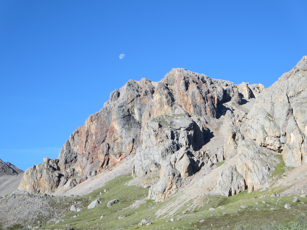
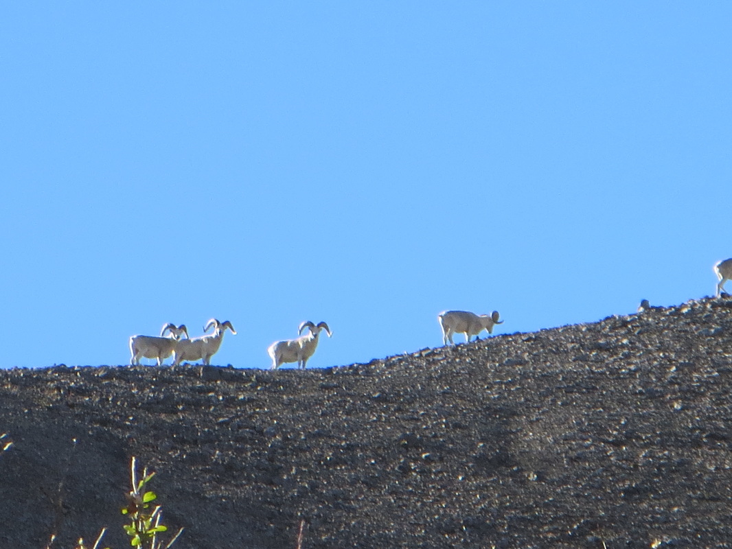
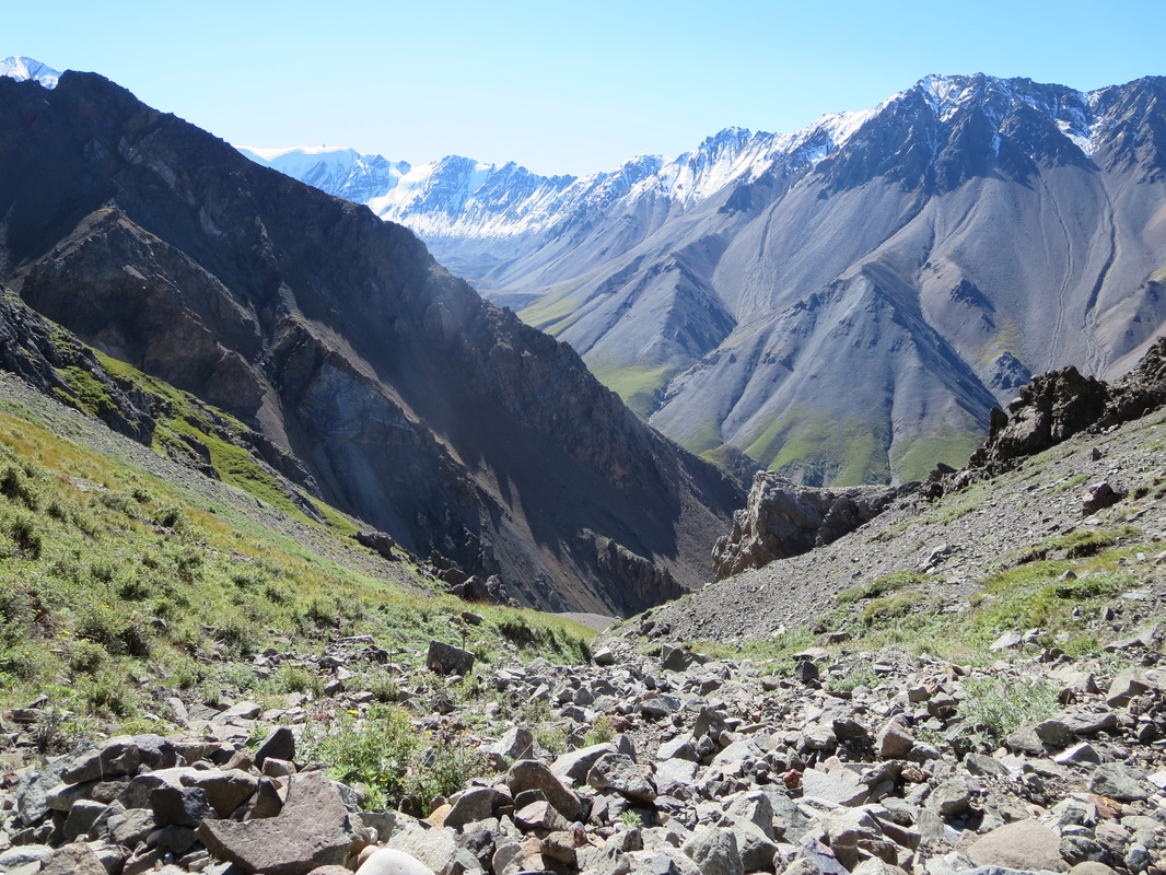
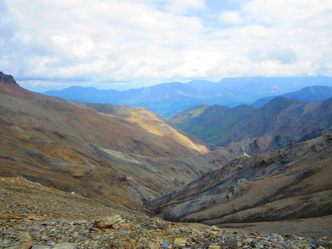
The remainder of this day was challenging. Ahead was a huge ascent up Hoge Pass, the highest point on the route at 7100feet elevation, followed by a steep rock descent down to Hoge Creek. The first leg of our ascent we saw a beautiful golden eagle flying over our heads. Into the alpine zone, we saw our first flock of Dall Sheep. Glenn was elated as it's always been a dream of his to see this species in the wild. Just as we were snapping photos of them, we saw another 2 flocks in the distance. What a day for wildlife viewing! The ascent up Hoge Pass was very gradual and not intimidating in the least. At the apex of the pass, we trended left onto the shoulder of a nearby peak and ate lunch, looking at the stunning views of snow capped peaks ahead. After lunch, we ascended and descended over a few ridges before finally descending down a green drainage to the Hoge valley. The views here are among the most stunning of the entire trip. Get your camera out! Getting down the first part of the descent was tricky over loose rocky boulder and steep angles. Losing your balance here would have been consequential for sure. It wasn't long before we found the valley bottom and started down Hoge Creek itself. The afternoon sun rays made the day even more difficult: UV rays began to beat down on our skin and river levels began to swell and crossings became more difficult. Deb and I had a difficult time with Hoge Creek as our shorter strides couldn't span the banks like the 4 guys. This slowed our group's progress down immensely as we estimated that we had to take our packs and boots off, don our water shoes, and reverse the process over a dozen times for crossing this creek again and again. Exhausted and sunburnt, we finished off the day just as we were about to exit the canyon but not yet near the Donjek River. We found a great plateau that we used to set up our tents, and made sure we had long sight lines to spot bear activity early and prevent a repeat of the night before. Did I mention we saw a pine marten? An excellent day for wildlife viewing: Caribou, Ptarmigan, Golden Eagle, Dall Sheep, Ground Squirrels, and Pine Marten all in one day! At 8PM we retreated to our tents, hoping to catch up on some sleep. The inside of our tents were a balmy 33 degrees celcius and took about 2 hours to finally cool down once the sun lowered behind the hills. Latitude:61.22678 Longitude:-139.50682
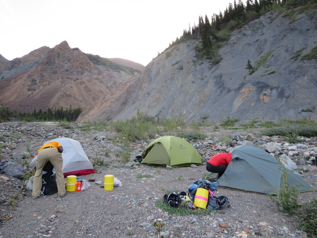
Hoge Creek campsite
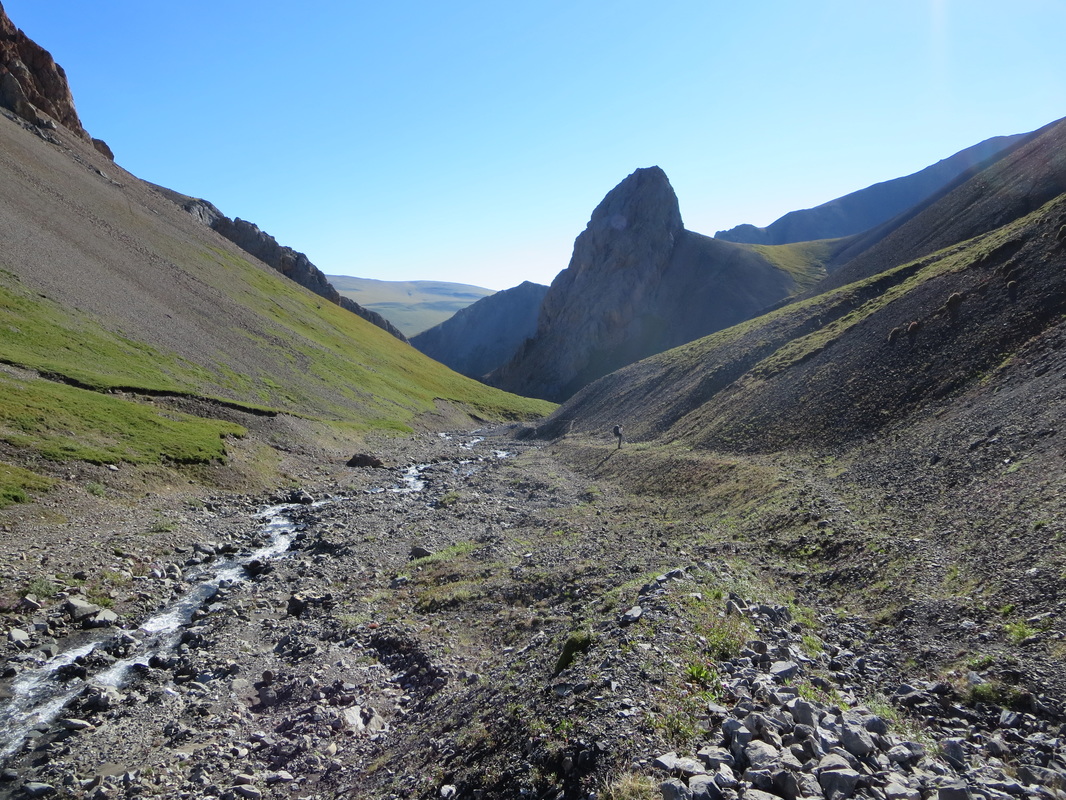
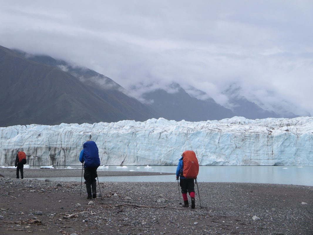
Day 4-Hoge Creek to Donjek Glacier (12km): Rising again at 6 AM, the dawn's temperature was warm and comfortable. At 8 AM, we left the campsite and hiked the remaining 3km down Hoge Creek towards the Donjek River. We crossed Hoge Creek 2 more times in that distance, this time much more easily due to the lower morning water levels. Turning left and heading upstream on the river bank of the Donjek River, we marched 5km on river stones towards the glacier itself. Finding wolf prints and moose sign along the river bank, it was easy to notice that the riverbed must swell to 4 times its size in the spring runoff. Spirits were high the closer and closer to the glacier we got. We stopped at lunch near a gorge but continued on the riverbed another 500m to see that we could not follow the riverbank any further because of a cliff. Forced to backtrack to the gorge, we ascended up a rocky creek to a mossy forest and bushwhacked for about 20mins until reaching an old horse trail as recommended by the route description. I say 'old' because although it was well defined, the horse trail was very overgrown, especially in the meadow areas and looked like it hadn't been used in years. We followed this horsetrail for the rest of the day making our way through the thick brush and sneaking peaks of the Donjek icefield on our right. We took advantage of viewpoints and attempted to snap shots of this massive glacier field although it was impossible to fit the entire size in one photo. At one break stop, I noticed that my GPS was missing from my hip pocket. Knowing that I had looked at it 20 mins earlier, I thought we should give it a shot and backtrack to see if we could find it. Within 10 mins of walking back, Glenn, Marc and I with bearspray in hand, found my GPS dangling from a bush branch at waist height having been snagged out of my pocket by the wrist strap. Lucky me! I made sure from this point on that the wrist strap was zipped up inside my pocket. Moving on, we crossed a number of dry creekbeds which made us worry a bit about where we were going to camp and replenish our water supply. The sun's rays were the most intense of the trip. We literally baked in the sun and couldn't put on enough sunscreen or find enough shade. We found a river bed to call home for the night and set up our tents above the horse trail on sloping ground. The views from this campsite riverbed were outstanding. We finally noticed at this point in the trip that our bear barrels were getting more easy to pack and had some extra room in them. All 4 guys had 2 barrels on the trip, one large and one solo size. Suddenly we heard sounds that were alike thunder at this site. We soon figured out that this sound was not thunder at all, but the sound of the calving glacier below us which would continue on and on. Cirrus clouds overhead at our 8PM bedtime, we were predicting a change in weather and it came overnight in the form of rain. Campsite: Latitude:61.15591 Longitude:-139.38815
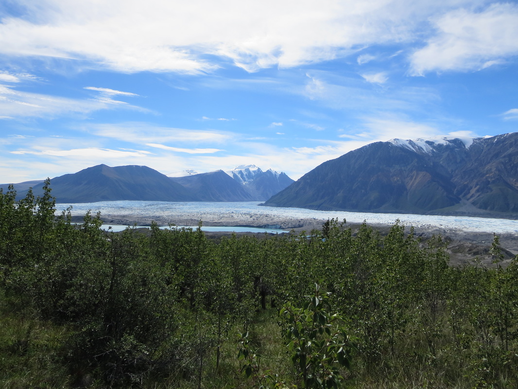
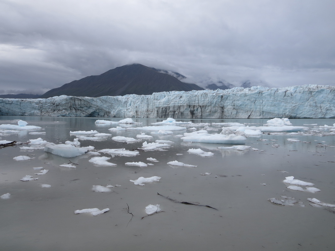
Day 5-Donjek Glacier to Big Horn Creek (15km): Our 6AM wake up was noisier than normal this morning as rain spat down on our tent. We set up a siltarp in the trees and ate breakfast under it instead of on the river bed as we had eaten dinner the night before. We left camp at 8:10AM and continued on the descending horsetrail. We lost the trail a few times crossing creeks and had to spend a few minutes looking for where the trail continued on the other side. Light rain drizzled down on us and everyone wore rainsuits and packcovers. The trail trended downward towards a meadow where we could see great viewpoints on the glacier. We left the horsetrail and went up to a hilltop and took some photos and timer shots. We continued to follow the bumps along the shoreline, and missed an easy entrance down to the shore from the cliffs. Instead we climbed to an even higher cliffpoint and Mike found a descent route down the wet rocky faces down to the shore along the glacier. Finally we arrived at the foot of the glacier! This glacier is one of the largest non-polar glaciers left in the world and is 56km long! Standing at it's toe, it must have been 80-100ft tall. We took loads of photos and ate lunch, enjoying the view. Sitting beside the glacier was like being in a refridgerator-cool and damp. Every 20 minutes or so, we heard calving and Deb was able to photograph a ripple from one of the ice chunks that fell off. We walked along the rocky shore and beach following the glacier's toe, examining the ice chunks and observing birds feeding in the waters at its base. This, to me, was the highlight of the trip. How often do you get to see something that incredible? The next 9km we walked away from the glacier in easy grassy meadows in the sub-alpine. Arriving at Big Horn Creek, we saw many signs of hares and managed to see a few darting around. We set up camp on a floodplain and ate under the siltarp once again. The water from the Big Horn was very silty, and our water filters were in need of cleaning every few litres of pumping. Even though the weather wasn't the best today, the night was still warm.
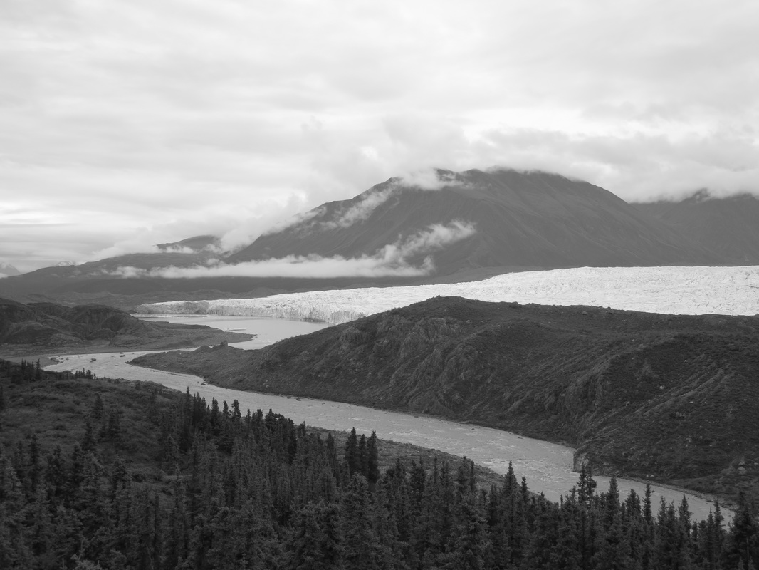
My black and white attempt of the Donjek Glacier and Donjek River.
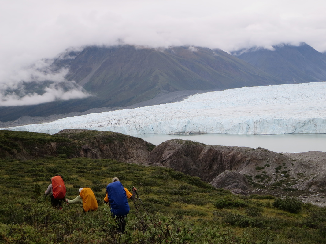

Marc, Glenn, and Ivan along the shores of the glacier.
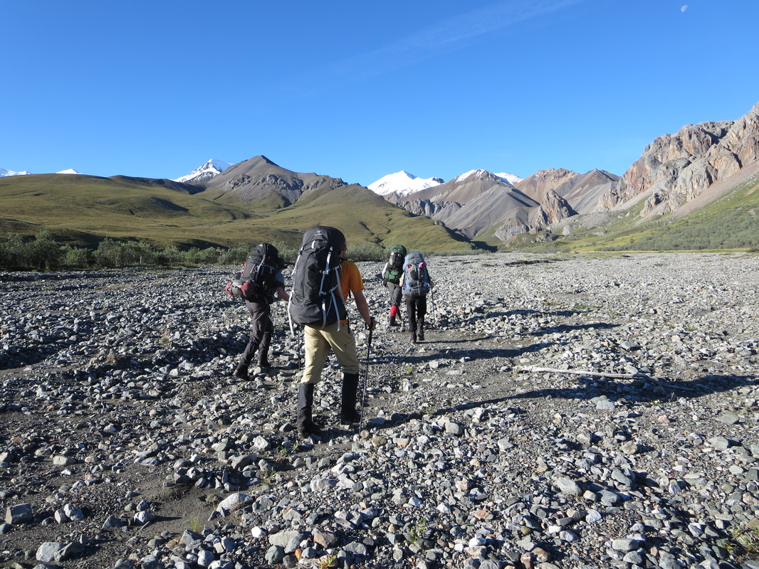
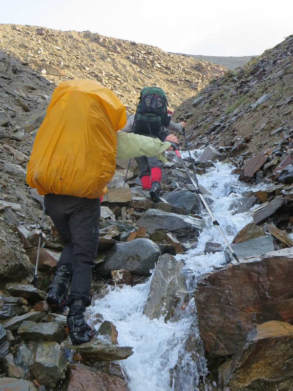
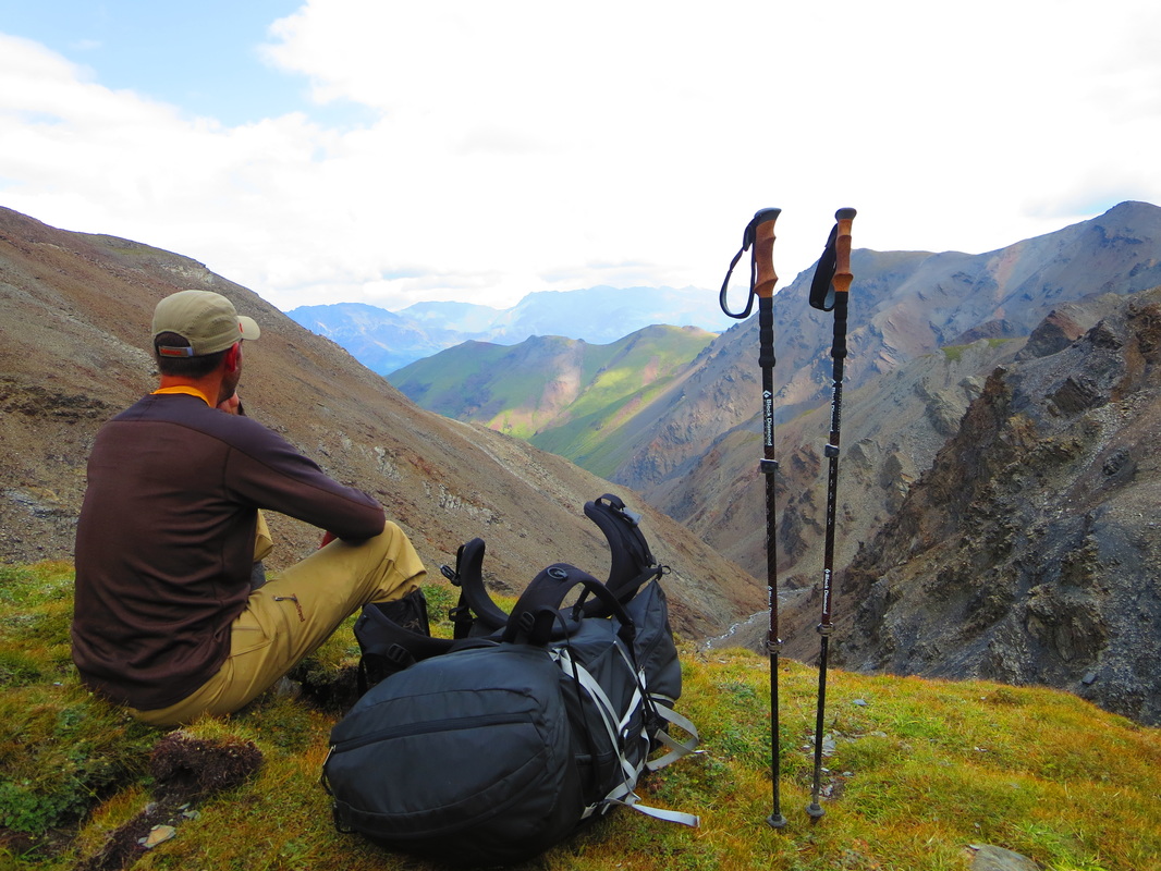
Day 6-Bighorn Creek to Atlas Creek (17km): Knowing that this day was going to be the hardest day physically of the trip, we all took advantage of any extra rations we thought we had and ate them either at last night's dinner or at this morning's breakfast. The overnight rain had made the air damp, and the warmth of food and hot drinks were welcome. We had donned our boots and rain gear right from the tent this morning. We packed up and headed up Expectation Pass, a 2000ft climb up through a creek and canyon finishing on a grassy boggy saddle. The climb took us 3 hours and once at the top of the pass, the final views of the Donjek glacier were seen before moving into the next valley. At 6000ft elevation, we contoured around the valley towards Atlas Pass. The valley displayed magnificent views of the alpine wilderness and hosted flocks of Dall sheep and a Golden Eagle. The eagle even performed an acrobatic display for us diving and gliding like it was on a rollercoaster. On the lighter side, Ivan's poor eyesight lead him to think that every white rock in this valley was a sheep and every brown rock was a bear. We didn't get to pull any tricks on him but it was entertaining to say the least to hear him confirm whether or not the boulders in the distance were animals or not. We managed to stay at the 6000ft contour thanks to Ivan's lead, and only had the final 900ft to climb to the top of Atlas Pass.The views from Atlas Pass were outstanding. The descent route actually started with a short ascent up and then down a soft muddy scree slope down to a saddle and a green patch of grass similar to a putting green. The soft soil underfoot made the descent fast and easy. One last steep scree slope and you are down on the valley floor once again on the shores of Atlas Creek. This creek was much different than the Hoge Creek with wide banks and easy narrow crossings allowing us to make time on the descent. We hiked all the way down to the Duke River finding a campspot described on the route on the right side and dived into our dinners on the banks of the Atlas. Campsite: Latitude:61.22996 Longitude:-139.20918
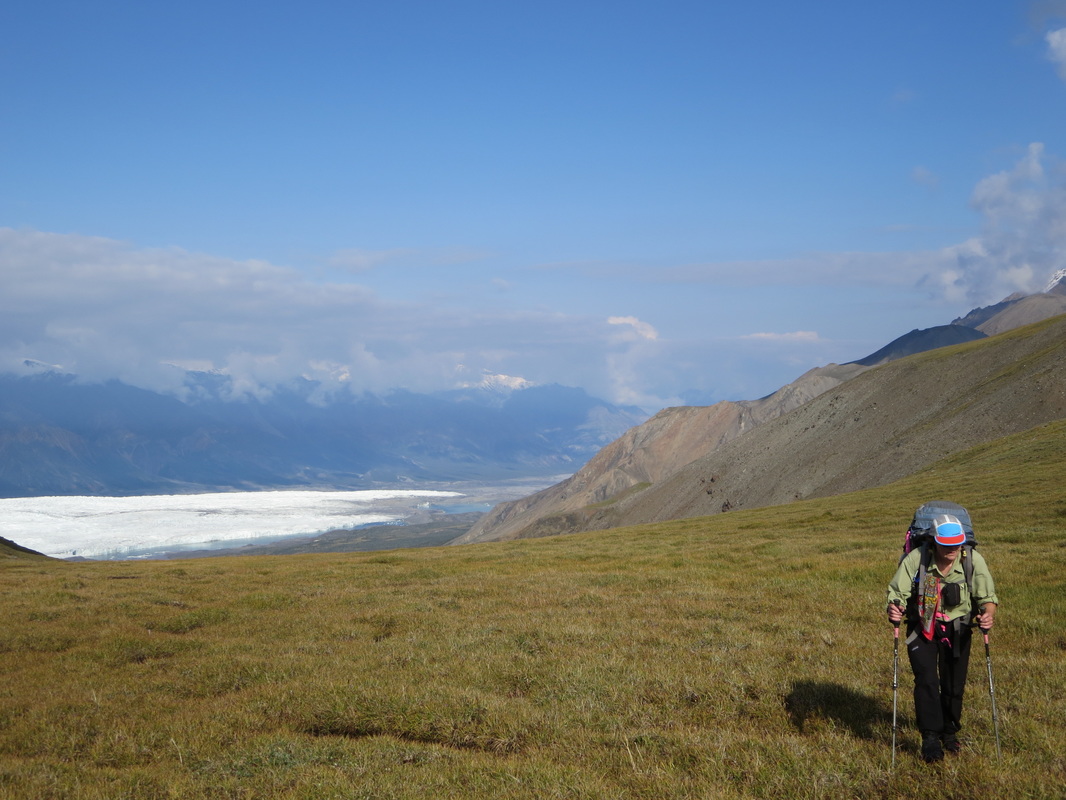
The view from Atlas Pass and the descent route.
Glenn on the putting green.
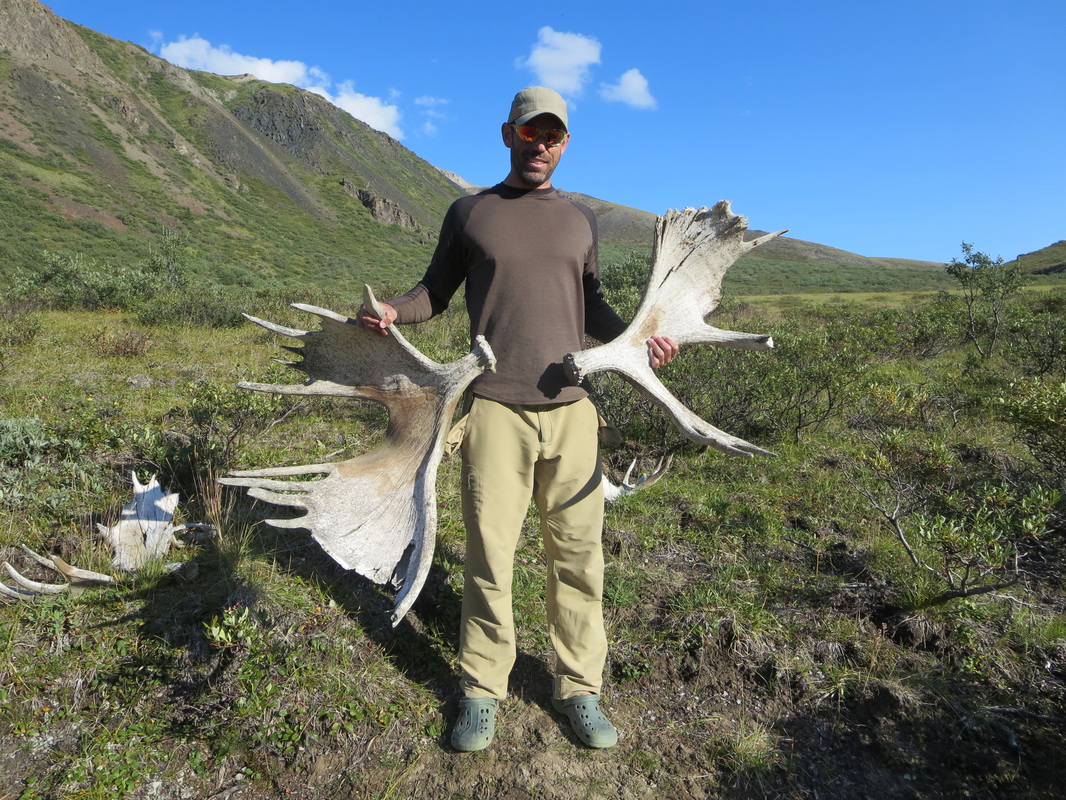
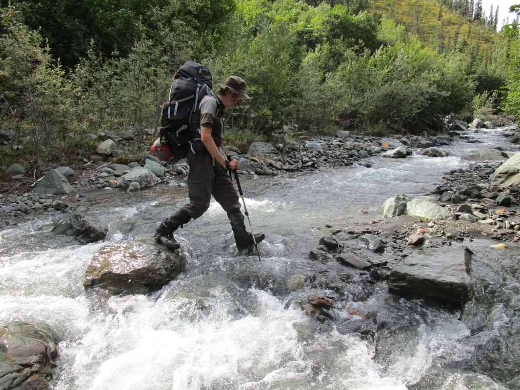
Day 8-Atlas Creek to Cache Lake (13km): On the trail again at 8 AM, we followed a game trail past our tentsite along the Duke River shore and then had to bushwhack up and around a large beaver dam system and finally down to the river shore after 2km. We followed the rocky Duke shore for another kilometer or so before finding a suitable crossing area. The Duke River crossing was to be our biggest crossing of the trip and the earlier we could get it done the better as rivers start to swell as the temperatures rise due to glacial runoff. We all donned our water shoes and rolled up our pants. Mike even removed his pants completely. Glenn and I went first, me holding on to the back of his pack. Up to the top of our thighs deep, freezing cold and tough current, we ferried over the deepest braid of the river. One step before hitting the shallow ground, we turned sideways and the current took my Croc water shoe and down the raging river. I accepted my loss, and hobbled onto the shore with only one shoe remaining. Glenn spotted the shoe downstream and decided to dump his pack and sprint 300m downstream and managed to retrieve it by jumping in the river once again (we were wet already). Yes! Ivan, Deb, Marc and Mike decided to hold a large 5 ft long piece of wood and ford the river as a group, crossing swiftly with minimal stumbles and falls. It took a few minutes after exiting to get the feeling back in our feet, dry off and let the sun help warm our bodies. It took me another hour or so before my pants felt dry again. Not following the instructions of the route and crossing about 4km away from the campsite proved to be challenging as we found ourselves doing multiple bushwhacks along the Duke river's left shore ascending countless feet and then returning to the river's shore. At the 8km mark from the campsite, we were to turn left on a difficult to find riverbed that led to a old road up to our campsite for the night at Cache lake. We missed the turnoff (our only navigational error of the trip), and noted that we were almost at the Grizzly Paw River confluence with the Duke before abruptly changing course. This 1km or so mistake was costly as we had to bushwhack, ascending 500+feet on a course backwards to where we were from. The only bonus of the bushwhack was that the hill was full of ripe blueberries-yum! After a slog of a bushwhack we found the road that led to the lake which was sunny and breezy. We set up camp on the shores of the lake overlooking snow capped peaks and dried out our wet tent and gear. Most of us went for a swim or bath in the lake. Glenn found 2 pairs of old shed moose antlers on the shores of the lake and there was ample moose habitat sign. Tonight's sleep was cold again as we were sleeping at an altitude of 5000 feet. This site, for me, was the most picturesque of the trip. The only thing that could have made it even better would have been to seen the Aurora Borealis but unfortunately that wasn't in the stars. I kept thinking how this route was the most stunning and scenic backpacking trip I have ever completed. The days did not disappoint. Ever. Campsite: Latitude:61.21035 Longitude:-139.06235


Day 8-Cache Lake to Copper Joe Creek (13km): Another 6 AM wake up but the sky was blue and the reflection in the lake outstanding. Knowing that our route today was all downhill and the end in near, extra rations were consumed and our packs were the lightest they've ever been. Mine was probably 10lbs lighter than when we started. Setting off from the lake, we followed the old road and saw many signs of moose activity. Shed antlers, moose scat, and a moose carcass were all witnessed. We finalled reached Copper Joe Creek, and began descending its rocky shores down our final valley. At lunchtime, we were still in a canyon along the riverbed. Mike spoke up suddenly say "There's an animal down there". Sure enough, we stood up to see the back of another larger male grizzly bear about 75m away. It approached our quiet group from downstream and upwind. Once we stood up it stood on its hind legs to check us out and then decided to bee line for the steep forested riverbank. It stopped about 100m away from us when Ivan fired off a bear banger and it took off into the forest, never to be seen again. I am glad we were travelling in a group of 6, all with a bearspray within hand's reach. I was surely skeptical of the bear bangers before the trip, but am a convert of them now seeing how effective they can be in two incidences. We quickly packed up and headed through a narrow section of the river and then finally exited the canyon. We found an old gravel road that we could walk out the final 5km. It was 2pm, so we had time to complete the route but our shuttle wasn't coming until the next day. We set up a camp at the junction between the creekbed and gravel road and spend our last night eating any extra food an singing around a campfire. A great way to end a fantastic trip.
Me enjoying the reflection at breakfast at Cache Lake

Day 9-Copper Joe Creek to Alaska Highway (5km): We tried to sleep in but breaking a habit is difficult. We spent our final morning leisurely eating breakfast and packing up. Oatmeal is a fast breakfast so before we knew it we were packed up and walking the final easy 5km out to the highway to wait for our shuttle. We did it! Yahoo! An amazing trip! The route turned out to be my longest backpacking trip to date. Trip totals: 118km, 11000ft of ascent!
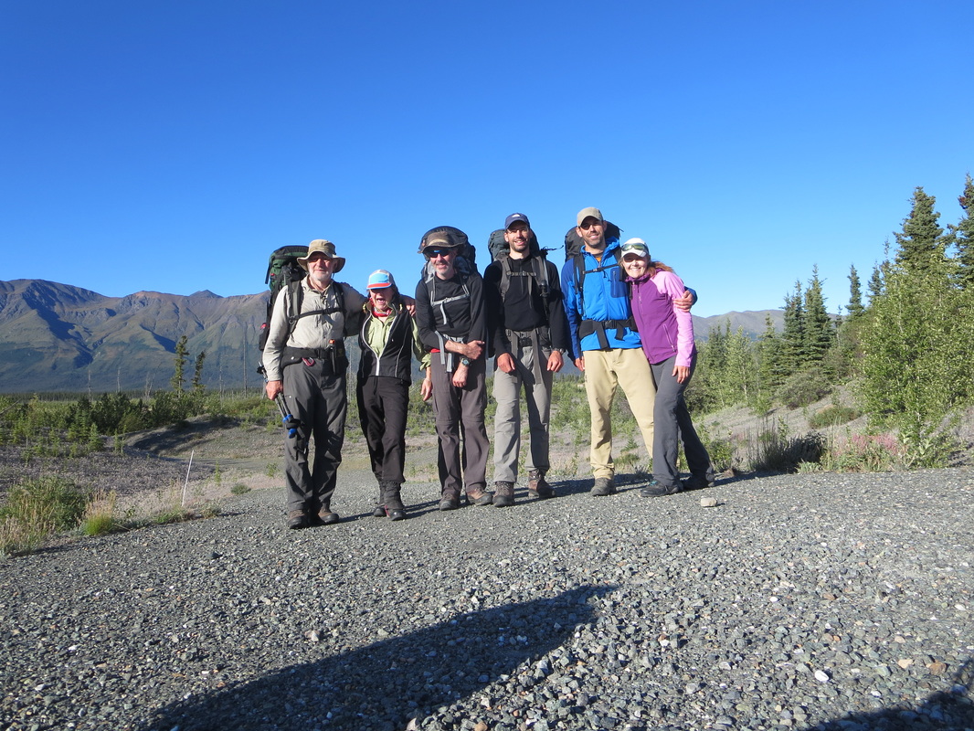
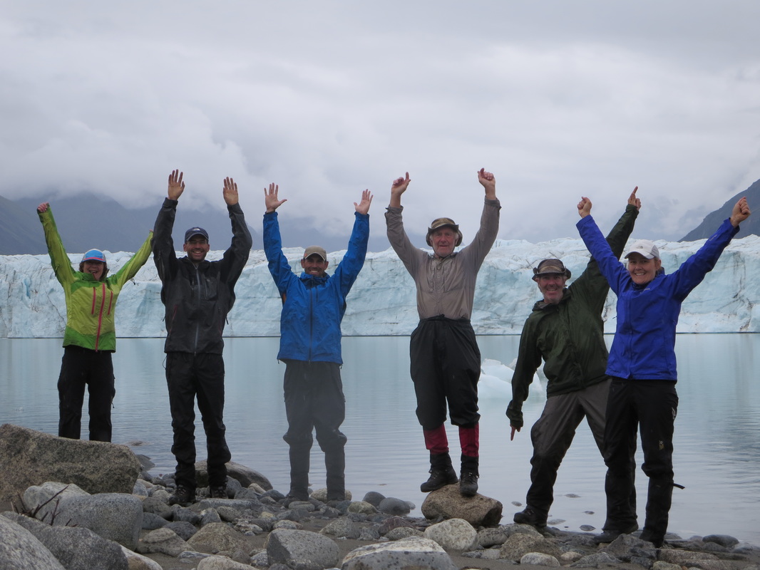
Ivan, Deb, Mike, Marc, Glenn and myself after 118km!
Thanks to Ivan and Mike for doing the navigational and routefinding work, to Deb for the logistics and coming up with the idea in the first place, and to Marc who let us stay in his house the night before the flight. Our group worked very well together and became closer through this journey. :) A few adjectives come to mind when looking back on this route: rugged, diverse, scenic, and truly wild. The wildest place I've ever been. We didn't see another human being for 9 days! The Yukon definitely did not disappoint, and I'm sure I'll be back one day.
What did I bring on this trip? Check out my packing list here. To access my .gpx file track for this route click here.
What did I bring on this trip? Check out my packing list here. To access my .gpx file track for this route click here.
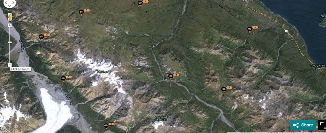
SPOT check-in campsite locations
 RSS Feed


