
The Western Uplands Backpacking Trail
When the COVID-19 pandemic hit in Spring 2020, it drastically changed my summer travel plans so several Plan B’s started to develop. After travelling all across Canada in recent years to backpack some classic and off-the-beaten track trails, I decided I should check out the backpacking trail closest to where I live in my own province: The Western Uplands Backpacking Trail in Algonquin Provincial Park, Ontario.
The Western Uplands trail consists of 3 loops that correspond to a short (~32km), medium (~54km) and long distances (~80km). The longest route (or 3rd loop) is over 80km long and is the one we chose to do this trip. When booking the campsites online, the system will only allow to book campsites within a certain distance away. If you are an experienced backpacker like myself, you may opt to call the park reservation agent and have them book campsites even further apart. We chose to do the loop in a clockwise rotation but you can choose to do it in either direction. From my experience it doesn’t matter which direction you travel. When we called to book many of the sites were taken so our choices were slim. If you must book Maggie Lake West like we did, it added an extra 4km to our total distance, which was 85km total!
Day 1 Wed August 12th : Trailhead to Maggie Lake West (14km, 1800ft ascent, 5 hours)
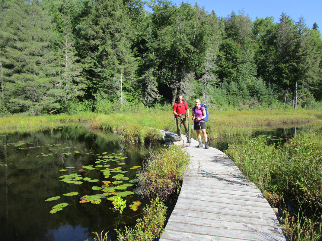
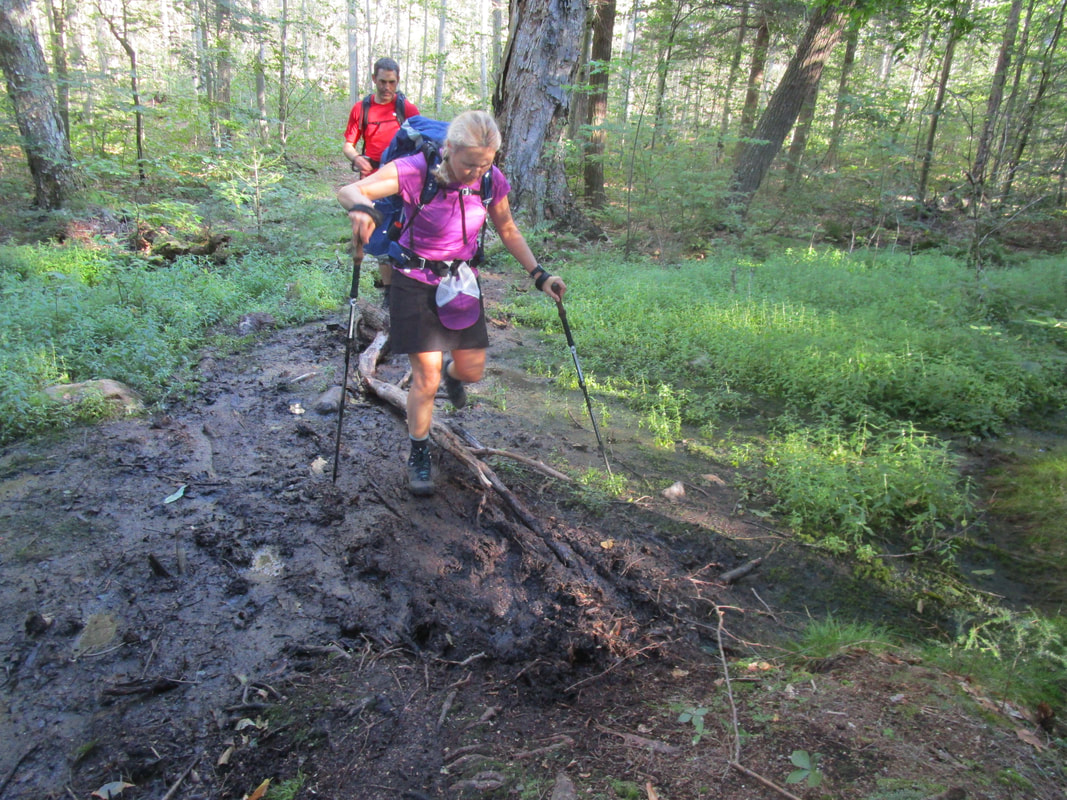
After a 3 hour drive to the Western Uplands trailhead, we were itching to get moving. We darted out of the car and across the bridge at 11AM, and chose the left trail at the first junction, sending us in a clockwise direction around the loop. The trail between the trailhead and Maggie is generally wide, well-travelled, and has some nice rolling hills. We found this part of the trail was the busiest that we encountered the entire trip and we started the trip on a Wednesday! One of the most surprising things was the disproportionately high number of all-female backpacking duos and groups. I was so amazed, and also insanely happy to see this number of women out in the backcountry. Awesome!
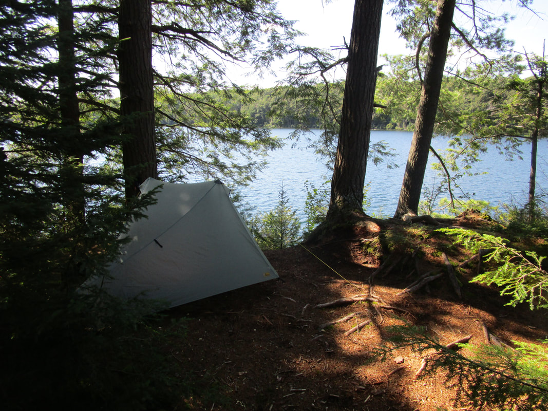
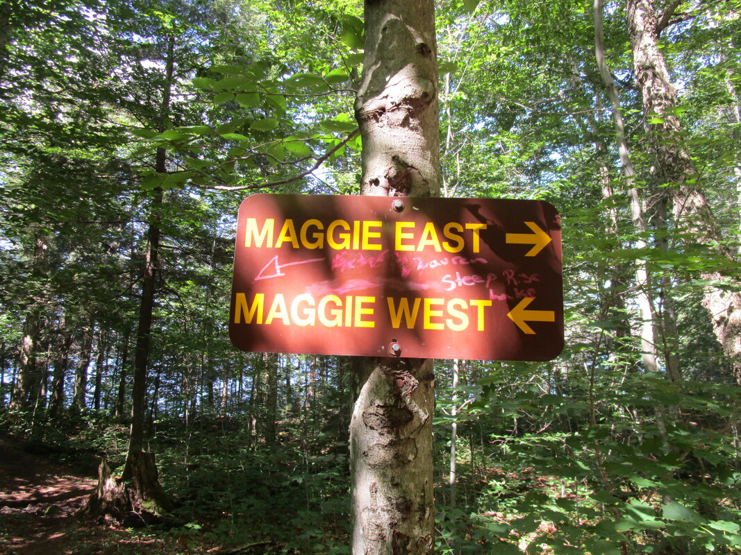
We arrive at Maggie Lake and began our lengthy 2km detour to the west side of the lake to find our first campsite. The 2km (+2km back) detour may have been worth it as the campsite was awesome and the water was this awesome green colour that didn't come across well in any of the photos. The consistent breeze made the 31 degree humidex weather feel more tolerable and a dip in the lake felt amazing. We were able to dry out all our damp gear, eat a hearty meal and head to the tent at sunset.
The Western Uplands trail consists of 3 loops that correspond to a short (~32km), medium (~54km) and long distances (~80km). The longest route (or 3rd loop) is over 80km long and is the one we chose to do this trip. When booking the campsites online, the system will only allow to book campsites within a certain distance away. If you are an experienced backpacker like myself, you may opt to call the park reservation agent and have them book campsites even further apart. We chose to do the loop in a clockwise rotation but you can choose to do it in either direction. From my experience it doesn’t matter which direction you travel. When we called to book many of the sites were taken so our choices were slim. If you must book Maggie Lake West like we did, it added an extra 4km to our total distance, which was 85km total!
Day 1 Wed August 12th : Trailhead to Maggie Lake West (14km, 1800ft ascent, 5 hours)
After a 3 hour drive to the Western Uplands trailhead, we were itching to get moving. We darted out of the car and across the bridge at 11AM, and chose the left trail at the first junction, sending us in a clockwise direction around the loop. The trail between the trailhead and Maggie is generally wide, well-travelled, and has some nice rolling hills. We found this part of the trail was the busiest that we encountered the entire trip and we started the trip on a Wednesday! One of the most surprising things was the disproportionately high number of all-female backpacking duos and groups. I was so amazed, and also insanely happy to see this number of women out in the backcountry. Awesome!
We arrive at Maggie Lake and began our lengthy 2km detour to the west side of the lake to find our first campsite. The 2km (+2km back) detour may have been worth it as the campsite was awesome and the water was this awesome green colour that didn't come across well in any of the photos. The consistent breeze made the 31 degree humidex weather feel more tolerable and a dip in the lake felt amazing. We were able to dry out all our damp gear, eat a hearty meal and head to the tent at sunset.

Day 2 Thursday August 13th: Maggie Lake West to Islet Lake (30km, 3000ft ascent, 9 hrs)
Wake up time was 6AM as we knew this would be a long day distance-wise. Adding up the kilometres on the backpacking routes map we figured it would be a monster 27km day. I had only done a maximum of 23 km backpacking in the past so I was nervous and wanted to leave enough time to get to Islet Lake. Our average moving time including breaks the day before was 3.2km/hr so we figured it would take 9 hours to get there. 10 years ago I was backpacking with a 90L pack that weighed over 40lbs. In 2015 and 2017 I did backpacking trips with a 75L pack with pack weights in the 30lb range. On this trip (albeit shorter) I did this trip with a 55L pack with 27lbs. Lighter packs enable you to go further and get less tired in a day...well at least that was the theory that I was going to test out!
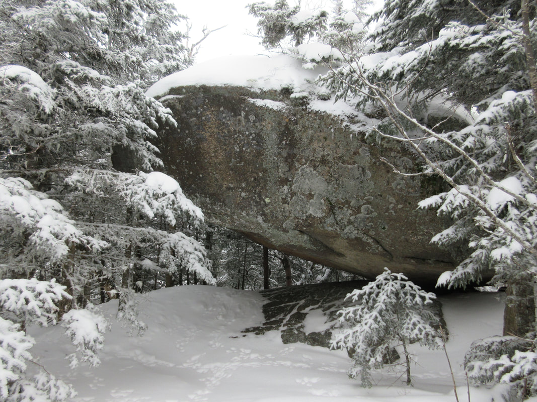
We were on the trail at 7:20AM and had to re-trace our steps back to the 2km to the main trail. We passed by many campsites with hikers still nestled in their tents. We handrailed Maggie Lake for some time before breaking away and heading north. This section of trail is fairly easy and before you know it you're at the turnoff to the first loop. We continued passed this turn off and for the next 7.6km or so the trail moves up and down over some hills (some are steep) and down through soupy mud puddles. Although our trip had 4 days straight of sun, it was apparent that the trail had recently been exposed to rain as the mud puddles were quite saturated meaning one misstep and you could end up with a soaker! The most prominent feature in this section is 'Bean's Boulder', a massive erratic that is parked right beside the trail that we conveniently used as an excuse for a rest stop. Soon after we came across two women about to pass us who had just gotten lost near Clara Lake by taking the portage trail instead of the hiking trail and wound up bushwhacking there way back to the trail. They had a long day ahead of them and had just added 3km to to their day. Yikes!
We arrived at Clara Lake in time for lunch and ate at the campsite right on the trail. This site is convenient with benches and easy access to water in case you need to filter some more water for your bottles. We noticed that on this site was also somewhat of a garbage dump laid with a heavy propane gas cylinder and random wrappers. I don't mind packing out garbage like wrappers but I draw the line at heavy objects. I wish people would just abide by the leave no trace principles and pack out what they packed in.
Leaving Clara Lake we passed over a beautiful ridge before descending down to the junction with the third loop. At the 17km mark for the day, Pincher Lake would have been a great place to set up camp and call it a day. It looks like a nice lake! We continued on and passed two male hikers who gave us a heads up of a tough climb ahead of us. This climb was to the lookout beside Stammer Lake. The climb was probably the longest and steepest climb of the trip, but wasn't anywhere as near as a steep and long as a Adirondack Peak. At the top of the ridge, you reach what feels like the height of land and can see into the distance initially and then it slowy drops down as you move through it. What we welcomed at this 'summit' was a breeze that had been absent all day in the sweltering heat. Once the descent was complete the march along Weed Lake and into Islet eases off and becomes fairly flat - something we were grateful for at the end of the 30km day. Yes the GPS indicated we had done 30km, not 27km as per the map. We stayed on the southern most campsite on Islet which was good except for some slightly angled tent platforms. It was around that time when I notice that the bottom tip of my hiking pole was missing and the carbon shaft had cracked. I must have got it stuck in some mud puddle somewhere. My Black Diamond Carbon Cork Poles owe me nothing - they are over 10 years old and have been with me through thousands of miles on all my day hikes and backpacking trips. I was able to finish this hike and order a new lower shaft from Black Diamond for $9.95 USD. A 9 hour effort today was deserving of a cold drink, but one that would have to wait for another day. Instead we hydrated with Nuun tablets in our water bottles. Swimming was great on this lake and the loons put on a show!
Wake up time was 6AM as we knew this would be a long day distance-wise. Adding up the kilometres on the backpacking routes map we figured it would be a monster 27km day. I had only done a maximum of 23 km backpacking in the past so I was nervous and wanted to leave enough time to get to Islet Lake. Our average moving time including breaks the day before was 3.2km/hr so we figured it would take 9 hours to get there. 10 years ago I was backpacking with a 90L pack that weighed over 40lbs. In 2015 and 2017 I did backpacking trips with a 75L pack with pack weights in the 30lb range. On this trip (albeit shorter) I did this trip with a 55L pack with 27lbs. Lighter packs enable you to go further and get less tired in a day...well at least that was the theory that I was going to test out!
We were on the trail at 7:20AM and had to re-trace our steps back to the 2km to the main trail. We passed by many campsites with hikers still nestled in their tents. We handrailed Maggie Lake for some time before breaking away and heading north. This section of trail is fairly easy and before you know it you're at the turnoff to the first loop. We continued passed this turn off and for the next 7.6km or so the trail moves up and down over some hills (some are steep) and down through soupy mud puddles. Although our trip had 4 days straight of sun, it was apparent that the trail had recently been exposed to rain as the mud puddles were quite saturated meaning one misstep and you could end up with a soaker! The most prominent feature in this section is 'Bean's Boulder', a massive erratic that is parked right beside the trail that we conveniently used as an excuse for a rest stop. Soon after we came across two women about to pass us who had just gotten lost near Clara Lake by taking the portage trail instead of the hiking trail and wound up bushwhacking there way back to the trail. They had a long day ahead of them and had just added 3km to to their day. Yikes!
We arrived at Clara Lake in time for lunch and ate at the campsite right on the trail. This site is convenient with benches and easy access to water in case you need to filter some more water for your bottles. We noticed that on this site was also somewhat of a garbage dump laid with a heavy propane gas cylinder and random wrappers. I don't mind packing out garbage like wrappers but I draw the line at heavy objects. I wish people would just abide by the leave no trace principles and pack out what they packed in.
Leaving Clara Lake we passed over a beautiful ridge before descending down to the junction with the third loop. At the 17km mark for the day, Pincher Lake would have been a great place to set up camp and call it a day. It looks like a nice lake! We continued on and passed two male hikers who gave us a heads up of a tough climb ahead of us. This climb was to the lookout beside Stammer Lake. The climb was probably the longest and steepest climb of the trip, but wasn't anywhere as near as a steep and long as a Adirondack Peak. At the top of the ridge, you reach what feels like the height of land and can see into the distance initially and then it slowy drops down as you move through it. What we welcomed at this 'summit' was a breeze that had been absent all day in the sweltering heat. Once the descent was complete the march along Weed Lake and into Islet eases off and becomes fairly flat - something we were grateful for at the end of the 30km day. Yes the GPS indicated we had done 30km, not 27km as per the map. We stayed on the southern most campsite on Islet which was good except for some slightly angled tent platforms. It was around that time when I notice that the bottom tip of my hiking pole was missing and the carbon shaft had cracked. I must have got it stuck in some mud puddle somewhere. My Black Diamond Carbon Cork Poles owe me nothing - they are over 10 years old and have been with me through thousands of miles on all my day hikes and backpacking trips. I was able to finish this hike and order a new lower shaft from Black Diamond for $9.95 USD. A 9 hour effort today was deserving of a cold drink, but one that would have to wait for another day. Instead we hydrated with Nuun tablets in our water bottles. Swimming was great on this lake and the loons put on a show!
Day 3 Friday August 14th: Islet Lake to Redwing Lake (28km, 3000 ft ascent), 10hours
Anticipating another long day, we woke up before our alarm at 5:45AM and sprung into action. I had been dabbling with some new recipes for this trip and was eager to try them out. I enjoy dehydrating my own food and try recipes that hold me hunger-wise and don't lead me to stomach growls 2 hours into my hiking day. I am going to do a separate blog on this topic but so far the food experiment has been worthwhile. So after our breakfast and pack up, we hit the trail at 7:30AM. The trail along Islet and around Ishkaday lake is flat and easy, allowing us to easily kick our pace up to 4km/hr. We passed several nice campsites on Islet Lake which were all full. The northernmost campsite is right one the trail where we met a male hiker just about to start his day. The northernmost junction to Rain Lake seems to become a more popular starting point for some hikers. We met several parties who had started from there and were doing the second or third loop from that trailhead. The 10km walk in and out on a old railroad does not appeal to me, but it may be convenient for some hikers.
The next section of trail over to Brown Lake continued to be easy walking with a few fluctuations in elevation thrown in. Beautiful hardwood ridges continued to dominant the forest in this part. We arrived a Brown Lake and saw that the campsites were still occupied! We had already been on the trail for a couple hours! We made some small chit chat and then begun our way over to the next section that leads you to the junction with the old 3rd loop trail that is now closed. The older maps still have this northern trail on it but the newer ones (we have a 2020-2021 map) do not. So we hopped on the portage trail and headed south to join the 2nd loop. This portage trail was littered with moose sign and had probably the most sign we had seen all trip with several fresh tracks in the mud and moose scat everywhere. The creek that runs along this trail is very marshy like and is perfect moose habitat. Unfortunately we didn't see any moose but they were hiding somewhere nearby for sure!
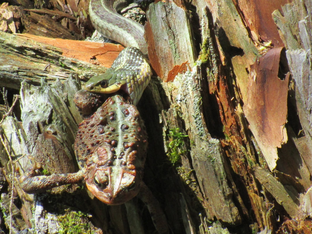
Before we knew it we were at Ladyslipper Lake and we by passed it and climbed a short hill to pass Gervais Lake. We decided to stop for lunch at a vacant campsite on Gervais. The site was large and would great for a group of 9. One thing to note- Although group sizes can be up to 9, there was often enough room for 1, maybe 2 tent sites at most sites that I saw. As a canoe guide I am always in search of the better sites for groups and this one could work albeit the swimming didn't look good here. We ate our lunch (a great recipe!) and doctored some blisters that were forming on my husband's feet. After we passed West Otterpaw Lake, we crossed a pair of women who had spotted a Garter snake eating a large toad. The five of us stared intently at this work of nature for a while before concluding that the snake would never be able to fit the large toad in it's body despite trying it's darndest. After lunch it got really hot and humid. The sweat dripped off our chins and every pore of our body was exploding with salty liquid. The stretch from West Otterpaw to Rainbow Lake became more technical and including several elevation changes and creek crossings. Some sections were even Adirondack-like: rocky and rooting with focused foot placements.
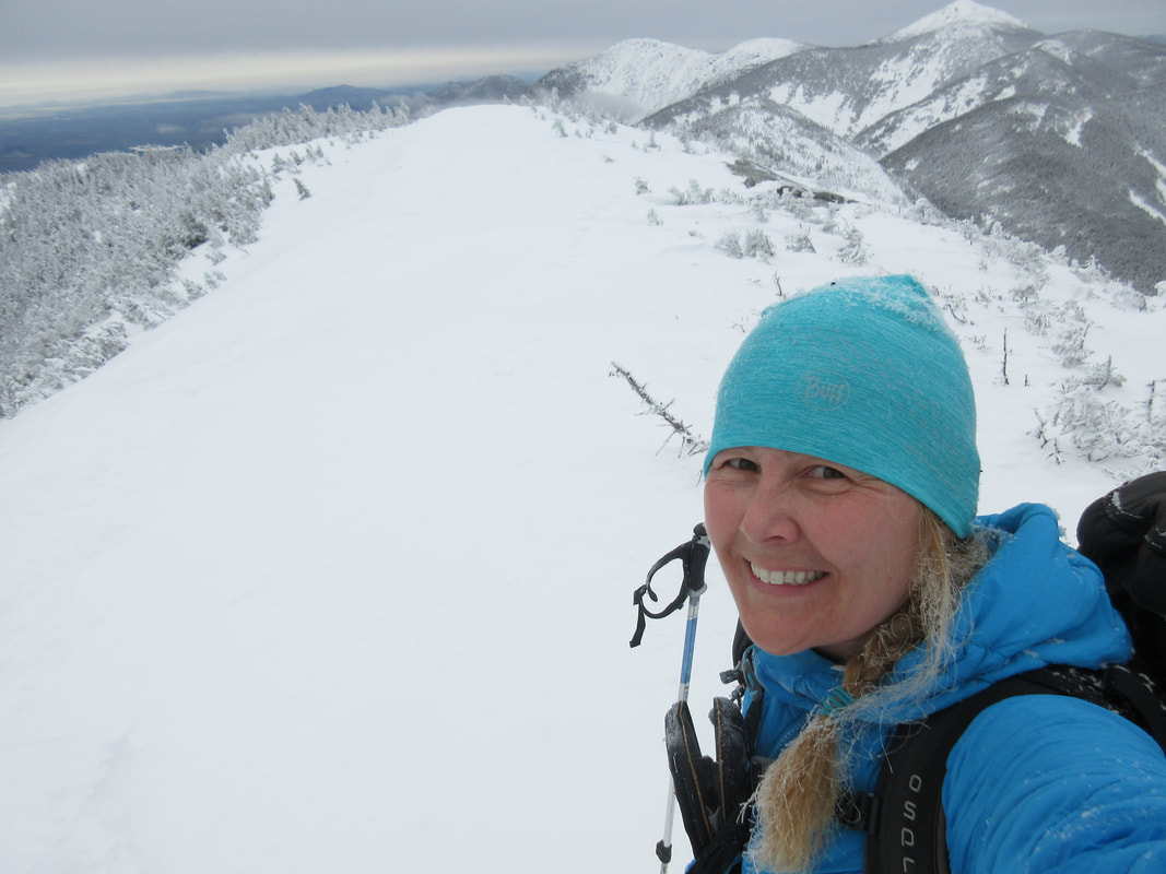
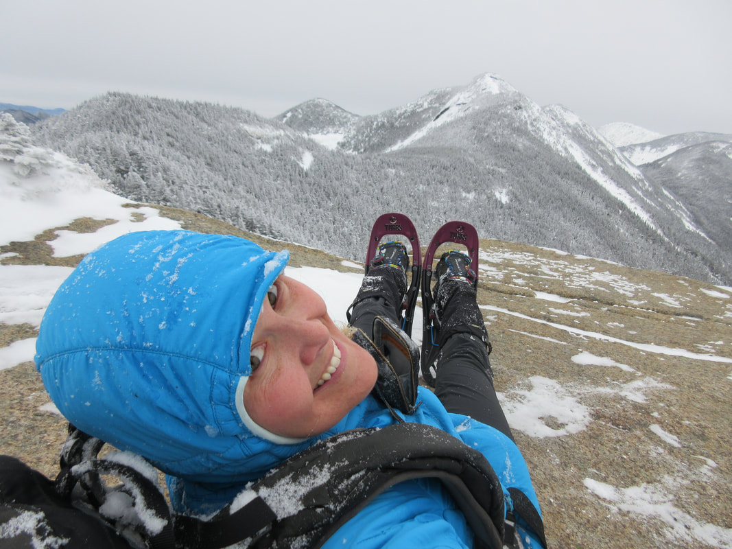
Arriving at Rainbow we were desperate for more water but the campsites were all on side trails. A common feature on the Western Uplands is a sign on the trail saying 'Side Trail' to a campsite that can be 100m +. Not wanting to add extra distance to our hike, we decided to forego the water fill up and head to Susan Lake instead. I don't remember the 3.7km to Susan being hard, but with the heat and dwindling water resources it wasn't easy. Luckily we passed two young women singing on the trail practicing for some performances which lifted all our spirits. Arriving at Susan, we stopped at the first campsite and filtered some water. Only 2km away from our destination for the day we were had no choice but to stop. We were all out of water even though I had started with 2L in the morning. The campsite on Susan was disgusting - loads of garbage in the firepit along with a bug repellent canister and various bits of paracord hanging from trees. I was not impressed. After a fluid fill up we headed up to the lookout above Susan Lake. This lookout has a log bench at it and has one of the best views of the trip. We really enjoyed this although it took some climbing to get to and even more climbing after our photo shoot at it. With 2km to go, we picked up the pace and marched over to Redwing Lake, our home for the night. We checked out both campsites and decided to take the more northern one with it's two nice flat tent spots. The second site seemed to have have had a tree blown over onto it's second tent spot!
Upon arrival at camp we were dehydrated, hot, sweaty and blistered (Glenn). A 10 hour effort today for 28km. We set up camp, swam, ate and went straight to bed. We started talking about how this trip would probably been better done in 4 nights and 5 days instead of 3 nights. When my husband had booked it he had used a 1997 map with distances totalling 72 km for the loop. He also didn't have much choice of campsite as the with COVID there wasn't as much else to do so the spots were hard to come by. Speaking of inaccuracies, the 2020 map said we should have walked 24.5km on Day 3 but the GPS said 28km. That is a big difference!
Anticipating another long day, we woke up before our alarm at 5:45AM and sprung into action. I had been dabbling with some new recipes for this trip and was eager to try them out. I enjoy dehydrating my own food and try recipes that hold me hunger-wise and don't lead me to stomach growls 2 hours into my hiking day. I am going to do a separate blog on this topic but so far the food experiment has been worthwhile. So after our breakfast and pack up, we hit the trail at 7:30AM. The trail along Islet and around Ishkaday lake is flat and easy, allowing us to easily kick our pace up to 4km/hr. We passed several nice campsites on Islet Lake which were all full. The northernmost campsite is right one the trail where we met a male hiker just about to start his day. The northernmost junction to Rain Lake seems to become a more popular starting point for some hikers. We met several parties who had started from there and were doing the second or third loop from that trailhead. The 10km walk in and out on a old railroad does not appeal to me, but it may be convenient for some hikers.
The next section of trail over to Brown Lake continued to be easy walking with a few fluctuations in elevation thrown in. Beautiful hardwood ridges continued to dominant the forest in this part. We arrived a Brown Lake and saw that the campsites were still occupied! We had already been on the trail for a couple hours! We made some small chit chat and then begun our way over to the next section that leads you to the junction with the old 3rd loop trail that is now closed. The older maps still have this northern trail on it but the newer ones (we have a 2020-2021 map) do not. So we hopped on the portage trail and headed south to join the 2nd loop. This portage trail was littered with moose sign and had probably the most sign we had seen all trip with several fresh tracks in the mud and moose scat everywhere. The creek that runs along this trail is very marshy like and is perfect moose habitat. Unfortunately we didn't see any moose but they were hiding somewhere nearby for sure!
Before we knew it we were at Ladyslipper Lake and we by passed it and climbed a short hill to pass Gervais Lake. We decided to stop for lunch at a vacant campsite on Gervais. The site was large and would great for a group of 9. One thing to note- Although group sizes can be up to 9, there was often enough room for 1, maybe 2 tent sites at most sites that I saw. As a canoe guide I am always in search of the better sites for groups and this one could work albeit the swimming didn't look good here. We ate our lunch (a great recipe!) and doctored some blisters that were forming on my husband's feet. After we passed West Otterpaw Lake, we crossed a pair of women who had spotted a Garter snake eating a large toad. The five of us stared intently at this work of nature for a while before concluding that the snake would never be able to fit the large toad in it's body despite trying it's darndest. After lunch it got really hot and humid. The sweat dripped off our chins and every pore of our body was exploding with salty liquid. The stretch from West Otterpaw to Rainbow Lake became more technical and including several elevation changes and creek crossings. Some sections were even Adirondack-like: rocky and rooting with focused foot placements.
Arriving at Rainbow we were desperate for more water but the campsites were all on side trails. A common feature on the Western Uplands is a sign on the trail saying 'Side Trail' to a campsite that can be 100m +. Not wanting to add extra distance to our hike, we decided to forego the water fill up and head to Susan Lake instead. I don't remember the 3.7km to Susan being hard, but with the heat and dwindling water resources it wasn't easy. Luckily we passed two young women singing on the trail practicing for some performances which lifted all our spirits. Arriving at Susan, we stopped at the first campsite and filtered some water. Only 2km away from our destination for the day we were had no choice but to stop. We were all out of water even though I had started with 2L in the morning. The campsite on Susan was disgusting - loads of garbage in the firepit along with a bug repellent canister and various bits of paracord hanging from trees. I was not impressed. After a fluid fill up we headed up to the lookout above Susan Lake. This lookout has a log bench at it and has one of the best views of the trip. We really enjoyed this although it took some climbing to get to and even more climbing after our photo shoot at it. With 2km to go, we picked up the pace and marched over to Redwing Lake, our home for the night. We checked out both campsites and decided to take the more northern one with it's two nice flat tent spots. The second site seemed to have have had a tree blown over onto it's second tent spot!
Upon arrival at camp we were dehydrated, hot, sweaty and blistered (Glenn). A 10 hour effort today for 28km. We set up camp, swam, ate and went straight to bed. We started talking about how this trip would probably been better done in 4 nights and 5 days instead of 3 nights. When my husband had booked it he had used a 1997 map with distances totalling 72 km for the loop. He also didn't have much choice of campsite as the with COVID there wasn't as much else to do so the spots were hard to come by. Speaking of inaccuracies, the 2020 map said we should have walked 24.5km on Day 3 but the GPS said 28km. That is a big difference!
Day 4 Saturday August 15th: Redwing Lake to Trailhead (14km, 1200 ft ascent, 3.5 hours)
Another early rising day we woke up to a chilly morning. Deb was already out of her tent and lowering the food hang. I hollered out "Is there snow out there?" and we all chuckled and wore a an extra layer getting out of the tent. The cool air was something we wanted to take advantage of so we were on the trail by 7:45AM.
Glenn's blisters had really grown in yesterday's heat and the blister bandages we brought did not stick to his feet. Today I pulled out the roll of athletic tape and re-visited my taping skills from my athletic therapy days and taped up his heels. He was able to hike out the rest of the trip no problem which I was grateful for as he was contemplating wearing his crocs out!
The section from Redwing Lake to the junction of the first loop seemed to go by quickly. Campsites were all full passing Lupus Lake, Thunder lake and Romona Lake. The difference in the trail in the first loop junction was incredible. The trail widened significantly and the rest of the way out was an easy march. We even saw a trail runner who was running the first loop! We were out just after 11AM, a fast and easy end to the trip. We high-fived each other, took a quick selfie and headed to the Mad Musher restaurant in Whitney. Check out my video of the trip below!
Recommendations/Notes:
- Call to reserve sites with larger distance gaps as online booking limits distances
- If experienced and deciding to do the 3rd loop, booking 4 nights would be best
- Do not leave garbage behind on the sites, in firepits, or on the trail. Pack out everything you packing in.
- Booking in August or September would be better for avoiding bugs
- The trail is mainly in the woods, not many views
- Moose sign becomes more and more apparent in the 2nd and 3rd loops
- Trail is more overgrown in 3rd loop but still easy to follow
- Campsites can accommodate 1 tent for sure, some 2, and rarely 3.
- Larger lakes are more 'swimmable' as some smaller lakes are weedy and shallow
- If there has been recent rains, the muddy spots on the trail will be more soupy so gaitors would be recommended.
-Even if all campsites are full the trail does not feel crowded and lakes don't seem busy
-Trail markers are Blue on the 1st loop, Yellow on the 2nd, and Red on the 3rd
-There is cell service at Maggie Lake (I use Bell Mobility)
-Buy your Backpacking Trail Map from Friends of Algonquin Park
-Gear List for the Western Uplands
-Blog for food and recipes - coming soon!
Totals:
Distance: 85km
Ascent: 8855 ft
.gpx file


 RSS Feed


