
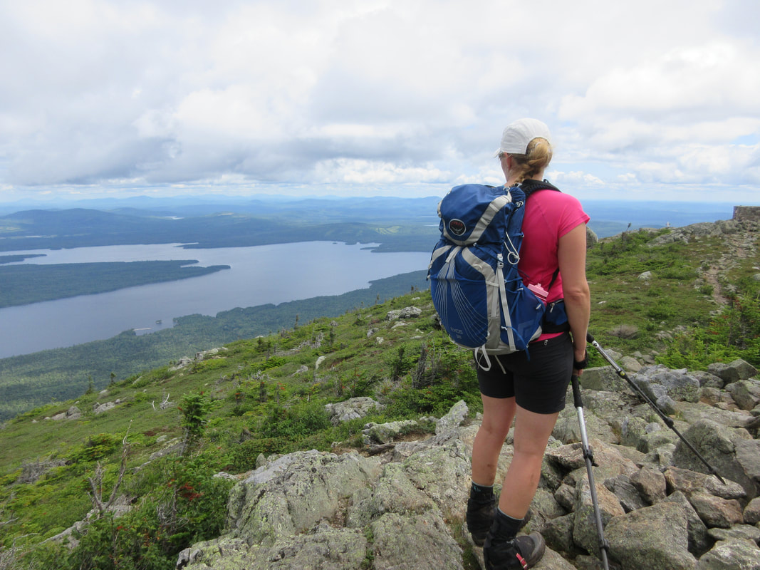
Looking for a short canoe trip in Algonquin south of Highway 60? Look no further than a spectacular trip from Smoke Lake to Rock Lake that our group of 6 did over 4 days in August 2018.
Day 1: Smoke Lake Access Point to Big Porcupine Lake
Upon arriving at the Smoke Lake Parking area, you actually need to cross over the highway to the Canoe Lake Permit Office to collect your camping and car permits before your trip. Park one car at the Rock Lake parking lot by running a shuttle with your second vehicle. The shuttle will take 50-60 minutes depending on traffic, construction, and wildlife-gawking tourists that stop in the middle of the road.
After the shuttle is set and you load your boats along the docks, head out on Smoke Lake to the southern terminus. We paddled Smoke lake on a day without wind, and it took the better part of 1.5 hours to complete. We portaged the short uphill 240 meters into Ragged Lake. I would suggest here that if you have a long drive (over 4 hrs) to get to the park stay here for the night. Ragged has a plethora of campsites and they all look to be descent ones.
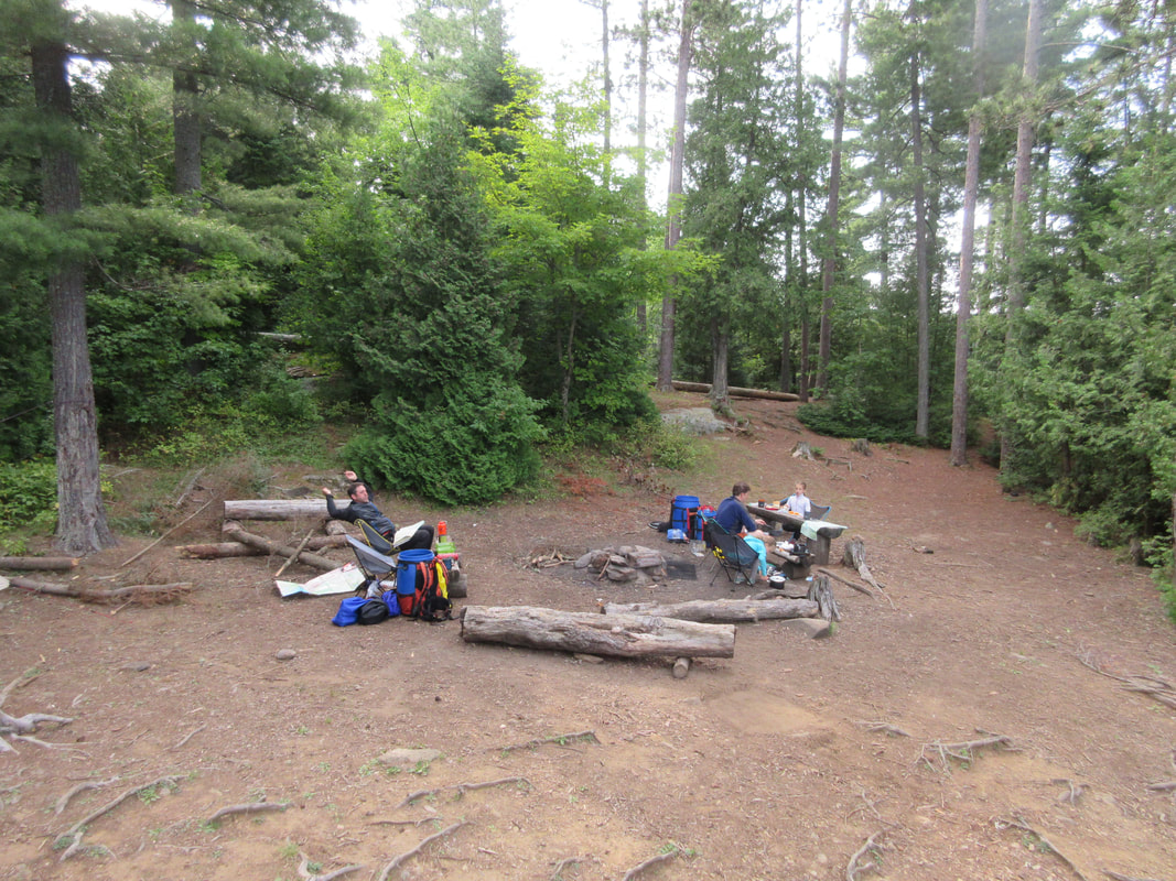
Continuing through Ragged we paddled into the swampy South Bay and to our next challenge: a heart-thumping uphill 590m portage into Big Porcupine Lake. Once this one has been completed head out of the bay into the breeze of the main part of the lake. Once we arrived we immediately looked for a campsite but this being August, the lake was almost completely full. Normally the extra paddle around looking for sites isn't such a big deal but with thunder and lightning approaching we were on a time crunch. We finally found our site at the last possible spot on the lake and quickly set up tents and tarps to prepare for the imminent rainstorm that of course didn't hit us!
Total travel time: 4 hours
Day 1: Smoke Lake Access Point to Big Porcupine Lake
Upon arriving at the Smoke Lake Parking area, you actually need to cross over the highway to the Canoe Lake Permit Office to collect your camping and car permits before your trip. Park one car at the Rock Lake parking lot by running a shuttle with your second vehicle. The shuttle will take 50-60 minutes depending on traffic, construction, and wildlife-gawking tourists that stop in the middle of the road.
After the shuttle is set and you load your boats along the docks, head out on Smoke Lake to the southern terminus. We paddled Smoke lake on a day without wind, and it took the better part of 1.5 hours to complete. We portaged the short uphill 240 meters into Ragged Lake. I would suggest here that if you have a long drive (over 4 hrs) to get to the park stay here for the night. Ragged has a plethora of campsites and they all look to be descent ones.
Continuing through Ragged we paddled into the swampy South Bay and to our next challenge: a heart-thumping uphill 590m portage into Big Porcupine Lake. Once this one has been completed head out of the bay into the breeze of the main part of the lake. Once we arrived we immediately looked for a campsite but this being August, the lake was almost completely full. Normally the extra paddle around looking for sites isn't such a big deal but with thunder and lightning approaching we were on a time crunch. We finally found our site at the last possible spot on the lake and quickly set up tents and tarps to prepare for the imminent rainstorm that of course didn't hit us!
Total travel time: 4 hours


Day 2: Big Porcupine Lake to Kirkwood Lake
Booking later than I normally do for this trip my only option for night 2 was Kirkwood Lake. This would make today's journey a short 2 hour jaunt. Adult-only groups that want to push the pace could easily combine our Day 2 and Day 3 itineraries. As we were travelling with children and wanted a more relaxed pace we decided to try our Kirkwood.
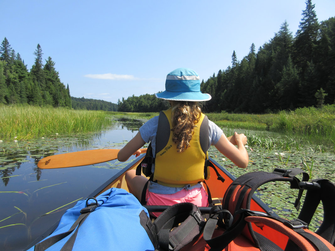
To get there we had to portage an easy 200m from Big Porcupine to Bonnechere Lake. Bonnechere is home to a few charming campsites that would be great spots to camp on at some point. Paddling to the north end of Bonnechere, we took the right fork and found the 175m portage to Phipps Lake. What we found on the Phipps side of the portage is a creek that was too low to paddle. A portage extension through the grasses and wetland doubled the length of this portage until we could load and continue on.
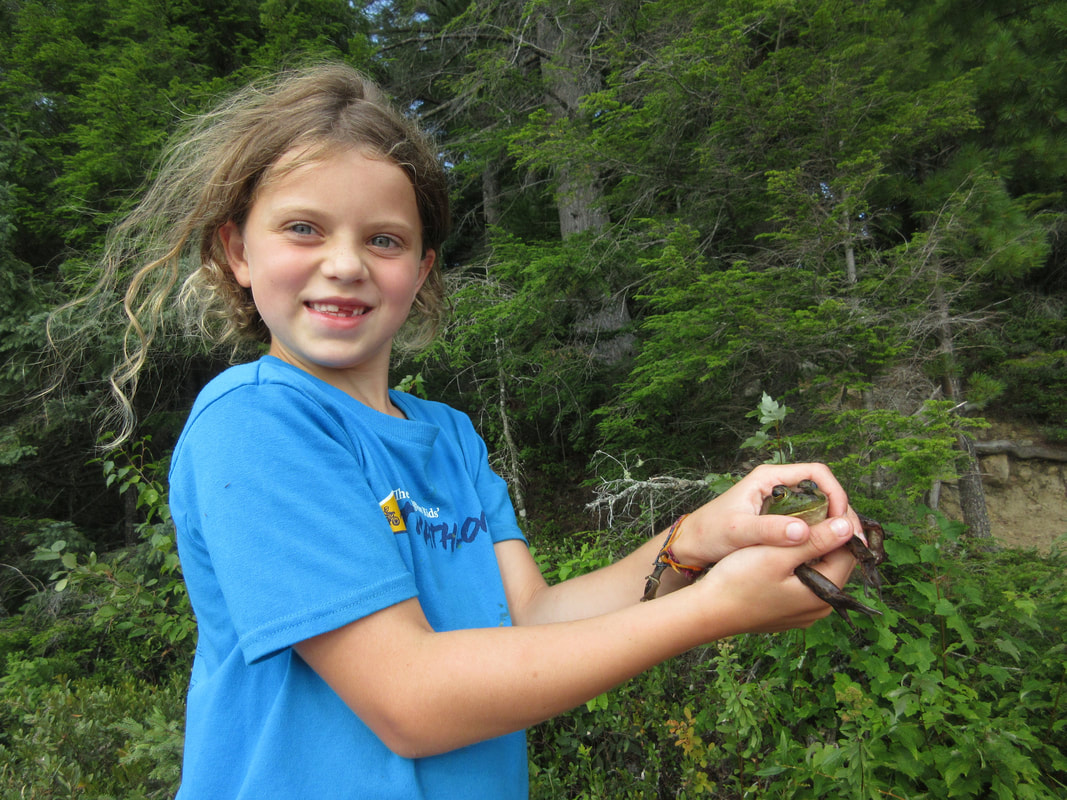
Phipps didn't look that inviting for camping and so we hopped over the 60 m portage to Kirkwood and found our campsite for the night on the island in the middle of the lake. What we didn't know is that this campsite had a name: Magic Island! We spent a beautiful afternoon there swimming a lap around the island, catching frogs and napping in hammocks. The magic ended however with a hard rainstorm over night that lasted a few hours. Luckily we all stayed dry but the rain sure tested out our gear.
Booking later than I normally do for this trip my only option for night 2 was Kirkwood Lake. This would make today's journey a short 2 hour jaunt. Adult-only groups that want to push the pace could easily combine our Day 2 and Day 3 itineraries. As we were travelling with children and wanted a more relaxed pace we decided to try our Kirkwood.
To get there we had to portage an easy 200m from Big Porcupine to Bonnechere Lake. Bonnechere is home to a few charming campsites that would be great spots to camp on at some point. Paddling to the north end of Bonnechere, we took the right fork and found the 175m portage to Phipps Lake. What we found on the Phipps side of the portage is a creek that was too low to paddle. A portage extension through the grasses and wetland doubled the length of this portage until we could load and continue on.
Phipps didn't look that inviting for camping and so we hopped over the 60 m portage to Kirkwood and found our campsite for the night on the island in the middle of the lake. What we didn't know is that this campsite had a name: Magic Island! We spent a beautiful afternoon there swimming a lap around the island, catching frogs and napping in hammocks. The magic ended however with a hard rainstorm over night that lasted a few hours. Luckily we all stayed dry but the rain sure tested out our gear.

Day 3: Kirkwood Lake to Lake Louisa
The rain ended around 9:30AM and we set off in the boats around 10AM. The plan for the day was to tackle 3 portages and end up into the gorgeous Lake Louisa and score a good site for the night. Unfortunately the plan didn't quite unwind as we first thought.
The first portage of the day begins at the end of Kirkwood and carries on for an easy 715m, ending in Lawrence Lake. I was the first one to carry through here with a canoe on my head limiting my vision. I saw the lake and put down my canoe. What we couldn't see on the two maps we brought is this portage trail fork at the end: one trail leading to Pardee Lake and one leading to Lawrence. I had taken the wrong trail.
After paddling Pardee and realizing that we were not where we should be, we backtracked and did a 10m (more like 25m) hop over portage back into Lawrence Lake. We lost about 30mins with this mistake. One of maps was large-scale and the other small-scale and neither noted that there is a split trail.
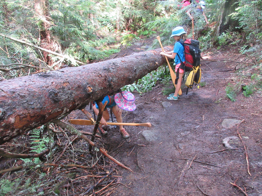
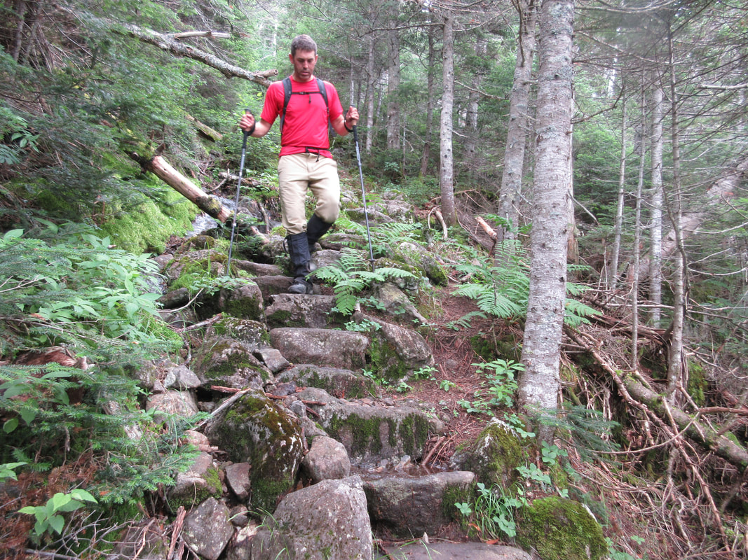
Back on track on the boomerang shaped lake of Lawrence we quickly arrived at the 415m portage into Rod and Gun Lake. This portage in August of 2018 had a large tree down near the Lawrence Lake side on a hill. At the time it was difficult to get over the tree (the only option) with a canoe on (take my word for it) so make sure you have another set of helping hands nearby before attempting. Continuing uphill again, you reach the small lake and scoot across it to complete the last portage, the 515m to Lake Louisa. This 515m portage had two tree obstacles to overcome as of August 2018.
Lake Louisa is one of Algonquin's gems. It is home to a number of excellent campspots and is a favourite lake of trout fishermen. This year we found an island site to call home for the night. With the breeze we dried out our wet gear and spent the afternoon swimming and playing bocce ball. Total travel time for the day was 3.5 hours.
The rain ended around 9:30AM and we set off in the boats around 10AM. The plan for the day was to tackle 3 portages and end up into the gorgeous Lake Louisa and score a good site for the night. Unfortunately the plan didn't quite unwind as we first thought.
The first portage of the day begins at the end of Kirkwood and carries on for an easy 715m, ending in Lawrence Lake. I was the first one to carry through here with a canoe on my head limiting my vision. I saw the lake and put down my canoe. What we couldn't see on the two maps we brought is this portage trail fork at the end: one trail leading to Pardee Lake and one leading to Lawrence. I had taken the wrong trail.
After paddling Pardee and realizing that we were not where we should be, we backtracked and did a 10m (more like 25m) hop over portage back into Lawrence Lake. We lost about 30mins with this mistake. One of maps was large-scale and the other small-scale and neither noted that there is a split trail.
Back on track on the boomerang shaped lake of Lawrence we quickly arrived at the 415m portage into Rod and Gun Lake. This portage in August of 2018 had a large tree down near the Lawrence Lake side on a hill. At the time it was difficult to get over the tree (the only option) with a canoe on (take my word for it) so make sure you have another set of helping hands nearby before attempting. Continuing uphill again, you reach the small lake and scoot across it to complete the last portage, the 515m to Lake Louisa. This 515m portage had two tree obstacles to overcome as of August 2018.
Lake Louisa is one of Algonquin's gems. It is home to a number of excellent campspots and is a favourite lake of trout fishermen. This year we found an island site to call home for the night. With the breeze we dried out our wet gear and spent the afternoon swimming and playing bocce ball. Total travel time for the day was 3.5 hours.

Day 4: Lake Louisa to Rock Lake Access Point
The morning of Day 4 arrived early as we had a deadline today back in civilization. We packed up and were on the water by 8:30AM. We paddled the length of Louisa in about an hour and then tacked the 2895m portage into Rock. This portage trends downhill in direction we are doing it in and has easy footing and many areas that one could take a break.
Depending on your number of packs and boats will determine the number of trips you make through the portage. We had to double back on this portage and it took a total of 1 hour and 30 mins. The final home stretch from the portage to the Rock Lake access took about an hour to paddle. Total time for the day 3.5 hours.

 RSS Feed


