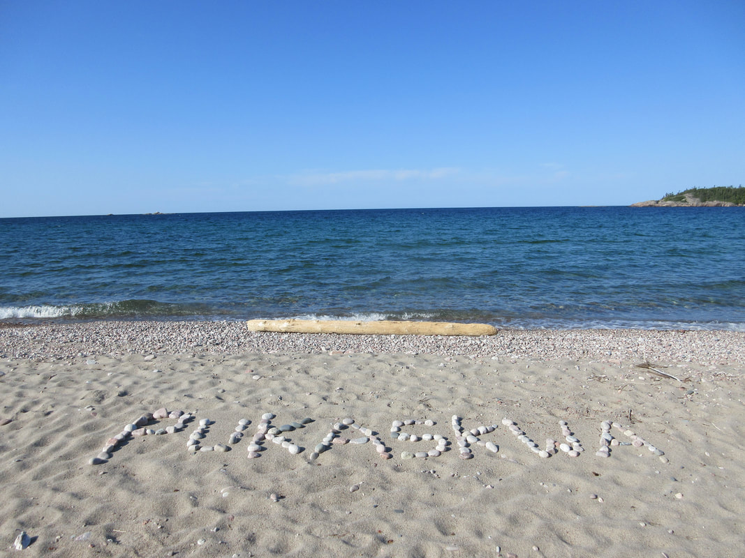
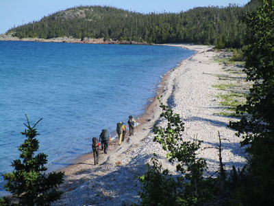
The trail encompasses sections of sandy driftwood covered beaches, moist moss covered mixed forests, and slippery lichen covered rock. The trail offers several scenic viewpoints and amazing camping in the small coves that are created by the landscape. Trail walking speeds vary from easy (on flat dirt trail) to difficult (wet boulder gardens and uneven terrain). Temperatures on our trip in early August ranged from lows of 5-10C and highs of 18-25C. This trail is characterized in other blogs as rugged and not to be underestimated. Although parts are rugged, I didn't find the terrain to be overly difficult. In comparison to the popular West Coast Trail located in Pacific Rim National Park, there are many similarities but I would affectionately call Pukaskwa the "little sister" of the West Coast Trail.
Our group of seven included Alpine Club of Ottawa friends that ranged in age from 38-71. All of us have previously completed multiple remote marked trail and trail-less backpacking trips in the past (check out my other backpacking trip reports). We all have extensive experience hiking the Adirondack 4000 footers, which are 46 technical hiking mountain summits in upper New York State. We did not find this trail particularly challenging based on our prior experience. There were sections that demanded your attention but there was also easier walking on well-defined trail.
To prepare for your hike:
1. Download the park trip planner here
2. Reserve campsites by calling ($9.80/pp/per night) starting March 15th: 1-877-737-RESERVE (1-877-737-3783)
3. Book boat shuttle if going to the end at North Swallow through Keith McCuaig [email protected]
4. To check out my packing list for the trip click here.
Getting to the park is your first step. Located a 4 hour drive away from Thunder Bay or Sault-Ste Marie airports, you will need to budget in a travel day before and after your trip. We arrived at the park at 1PM, and checked in at the park office. The park will provide a 20 minute backcountry orientation. This should be review for all backcountry travelers with a few tips thrown in specific to the park.
We had time to waste before our ferry arrived so we checked out the park's visitor centre and did a short hike up a lookout nearby. It was evident that this park is used mainly for backpacking but also for coastal sea kayaking/canoeing trips as well.
Our ferry picked us up right at the visitor's centre at Hattie Cove at 4PM. The boat is impressive - 2 x 250 HP motors, interior seating, stern deck, and a bow platform that can be lowered. Our Captain Keith was a great source of local information and was a likeable guy. He drove at 30 knots and it took us 1.5 hours to reach our destination at North Swallow. Alternatively, you can choose to get ferried out early in the morning and start your hike right away.
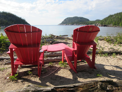
As the bow platform lowered and we prepared to disembark, I felt like we were troops landing in Normandy on D-Day. That thought quickly faded as we noticed the park had left us some obvious creature comforts: Parks Canada red chairs on the beach!
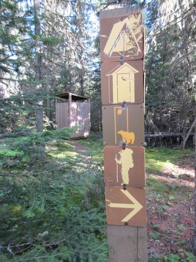
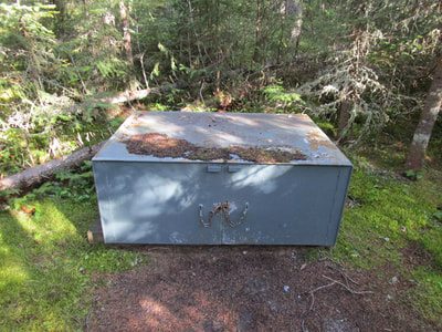
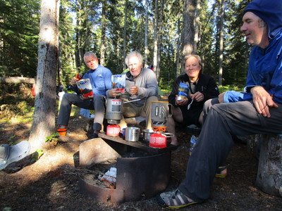
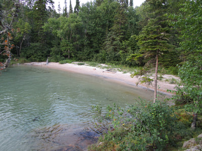
Campsites: All campsites are adjacent to beaches (or rivers) and are clustered in groups. They are marked with sign posts (however not numbered - which would be helpful). They all have a full size outhouse, a bear cache for food, and a firepit with grill. Other blogs have mentioned problems with rodents in the bear caches. Although I could see how they could get in, we didn't have any issues on our trip with rodents getting into our food.
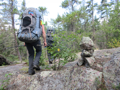
We left camp at 8:30 AM and started the trail crossing the North Swallow Brook. We were surprised to see the well-defined trail as we had heard that some navigational work/trailfinding may be necessary. The trail isn't marked with standard trail signs, but rock cairns are present when trailfinding may be tricky (ie on rock). We never once got off route the entire 65km.
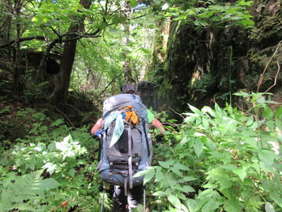
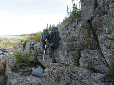
Footing on Day 1 was the most challenging, with the trail comprised mainly of uneven rocks, roots and moss at all angles. We gained and lost elevation a few times during the day, but nothing more than 100m at a time so it felt manageable. The forest provided a welcome reprieve from the sun as it beat down on us in the exposed rocky sections. We found out early that the exposed bedrock can be slippery with any moisture from water, moss, wet mud, etc. We fell in love with the trail immediately as it seemed that every 20 minutes offered a view of inland lakes, cliffs, and Lake Superior.
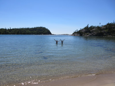
We ate lunch at Simons Harbour and arrived at camp at 3PM, enjoying a quick swim in the 11C water in the protected shallow cove. Our swims were quick, but we appreciated the dunk anyway. White Spruce Harbour (WSH1) is a well protected campsite with warmer water and is recommended.
We set off at 8:40AM and began our day on a easy section of flat trail to White Gravel Beach. There was little to no elevation gained between White Spruce and White Gravel. Leaving White Gravel you travel inland for 7km with the highest elevation gain on the entire trail. There is little to no water to filter during this section so it is recommended that you have full water bottles before embarking on this segment.
The inland forest section did rise in elevation, but I found it quite gradual and therefore not difficult. This section offered very few scenic views and at about 5km in, it begins to descend down to Fisherman's Cove. We stayed at FC2 and I believe that this was the BEST campsite on the entire trek. It's a cozy private site with perfect swimming spots. We arrived at the campsite at 1:30 PM, making for a short day on the trail.
Thunder boomed around us during the evening, but we never had a drop of rain. That was until the middle of the night when a storm finally hit us straight on and rained on us for about an hour.
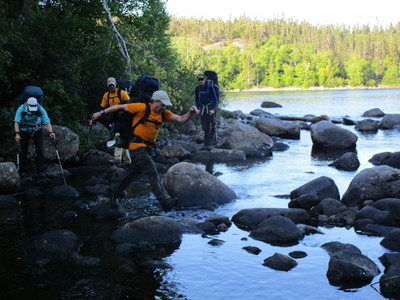
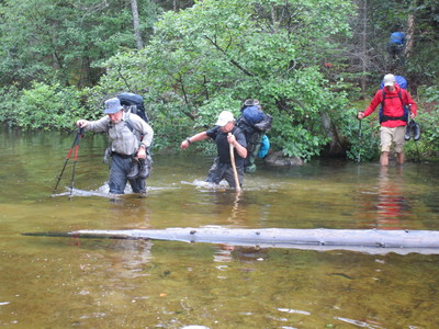
We woke up to wet raindrops on the tents, but no rain falling. We ate a quick breakfast and were on the trail again by 8:30 AM. Almost immediately on the trail, it started to rain and drizzle on and off. This continued all morning. Within a few hundred meters of starting today's leg, we had to take off our boots and wade through a thigh-high river. Luckily the basin was sand and we could walk quite easily through it. Nothing like starting the day off with wet feet and pants!
The first cove after Fisherman's was a shoreline walk on large round boulders. This particular morning the rain had made footing treacherous and we all were silent as we focused intensely on every step. It would have been very easy to slip here and I can see why rescues could happen quite frequently. I brought the SPOT satellite device to activate assistance if needed, which luckily we didn't.
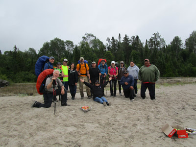
We continued to Nicols Cove, where we met our first humans. A couple with a dog were heading out to Fisherman's Cove. Coincidentally, they were also from Ottawa and knew some mutual people! Heading back through some forest, we came to Dampier Cove and then heard voices and a boat as we rounded the corner into Oiseau Bay. Keith, our ferry driver, was parked at the beach with local Pic River natives who were there to visit a trapper cabin (not on the map). They offered us muffins and watermelon which we graciously accepted and then had a great chat and a group photo!
It was still drizzling off and on, but blue skies in the distance gave us hope. We walked off the beach and started hiking inland onto a sand bar for 500m. The remainder of the day was on flat forested easy trail. We crossed what looked to be a brand new cedar bridge that appeared out of no where and then had to wade across a bay before reaching our destination for the night: Fish Harbour. We arrived at 4 PM.
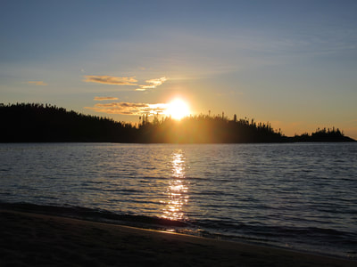
We stayed at FH1 (which was a nice site), but if I were to do it again I would stay at FH3. Fish Harbour is not protected and this night was the coldest of the trip as a result. We met a sea kayaker who was staying at a site beside us who was interesting to talk to. We also found a bunny rabbit in our outhouse! This campsite is the bomb for sunsets!
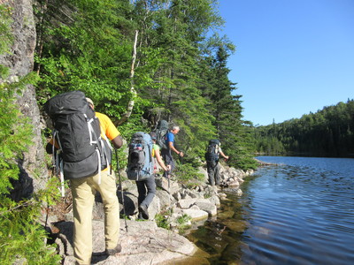
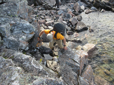
We left Fish Harbour at 8:30AM and began our day with some of the most awesome terrain on the trip. Rock scrambling! Starting through a cliff section, we scrambled down and across a rocky outcropping. I think this is the section people refer to having to 'pass your pack up' but as all of our group had rock climbing experience, we zoomed through this section without a thought of taking off our packs. It was super fun and I wish there were more sections like this! This scrambly section was followed by a picturesque section of shoreline rock, which we were happy was dry as we passed over it.
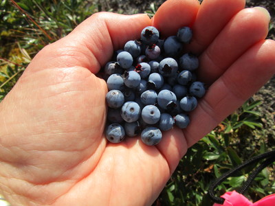
We followed some easy forested trail from cove to cove. We saw two girls packing up at a site at Morrison Harbour (wouldn't be my first choice for a campspot). We continued around Shot Watch Cove, scanning for Pukaskwa Pits (rocky circular ruins) that were created by natives some time ago. From this point north the trail is full of blueberries. We feasted on the first patch we saw, but later realized they are everywhere and can be easily consumed with barely a step off the trail. A welcome snack!
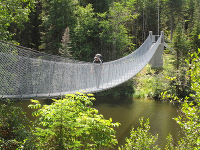
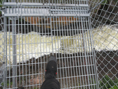
Just before the Willow River, the trail proposed two options: the direct forested route or the longer coastal route. We chose to do the longer coastal side trail en route to Willow River. This section was worth the extra effort: beautiful coastal views and more rock scrambling. Just before we got to the Willow River suspension bridge we met some rude hikers who were camped at our site WR1. They were booked into WR2 that evening, but seemed unwilling to move. After we crossed the suspension bridge, we popped out onto the beach and saw two Park Wardens. Apparently a hiker had broken a toe and needed evacuation. They were checking permits...but we didn't have ours as the park office had told us not to bother to bring it! They interrogated Deb for a bit wearing guns and backpacks! I guess they figured we were legit being in a large group and not ducking for cover. We had to tell them we were booked into WR1 and so the took it upon themselves to move the other group to WR2 as per original bookings. We waited 20 mins for them to move their stuff and arrived at camp at 2:30. WR1 was worth the wait - great site! We also saw a single woman staying at WR6 (not a recommended site) and another couple who were still moving onto Morrison that day. The north end of the hike is much more populated than the south end. Willow River seems to be the turning point as some hikers will start at the visitor's centre and return on an out-and-back trip.
WR1 and WR2 would be my recommendations for this area. We had warm water in the shallow sandy bay to swim in - especially when the air temperature is at 25C! That said, there was a feeling in the air that evening that the weather was changing again.
We woke up to rain falling on our tents and were reluctant to get out. It had been raining for hours and everything outside was soaked. For the first time I threw on my rain gear and for the first time we didn't leave until 9AM. It was only 15C when we left and only rose to 18C today.
Our route today was the first time we headed inland for the entire day. This section is on easy forested trail. It drizzled all morning on us so the rocks were again slippery and there was mud everywhere. We had to watch our footing. Everyone in our group of 7 had slipped and fallen on some of the rocks at some point during the past 5 days. Even with our modern boots and experience hiking tough terrain, the coastal trail can be hazardous.
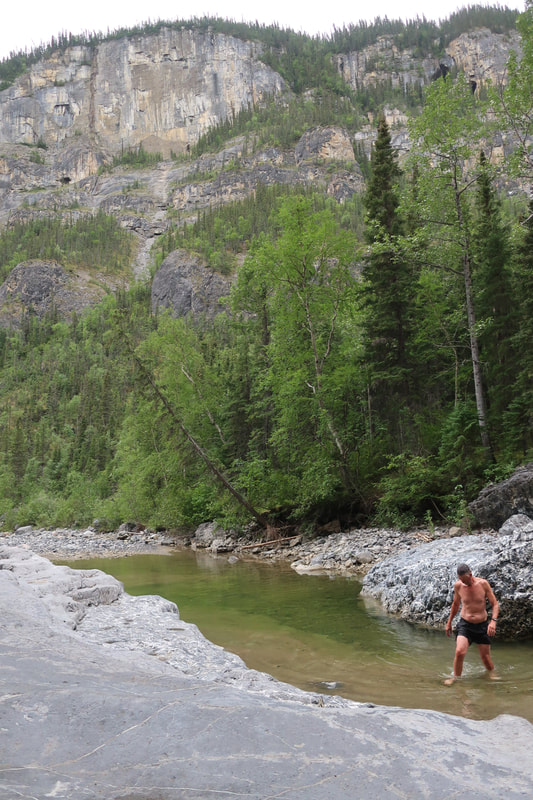
We made it to Hook Falls by noon and checked out the falls from viewpoint. We continued on down the White River, checking out more of the rapids and falls. Having to take the portage trail to our CHF1 campsite, we found it a good site for larger groups. CHF2 is very small. Both campsite are at the base of rapids and we met a father-son duo doing some camping and fishing there.
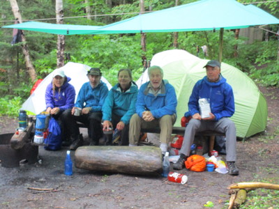
We arrived at 1:30PM and set up our soaking wet tents. We also set up a tarp as it was still raining. We retreated into our tents after we ate lunch, napping and reading all afternoon while listening to the sound of the rain on the tarp and our tent flies.
Early to bed we went today again due to the damp chill in the air. In hindsight this section went by so fast that we could have pushed on, but it's hard to know that when you are booking campsites months in advance.
Our original itinerary had us also doing the Mdaabi Miikna Trail today. We were supposed to add this trail as an extension to the coastal trail and stay at PH2 before heading out on the Saturday. However, when we woke up it was still cloudy and threatened of rain. We voted at the trail junction and the vote was 5 people wanted to hike out and 2 people wanted to continue. I think we were tired of being wet and didn't want to spend another afternoon in a wet tent reading. Why do that when you can walk out and get some real food?
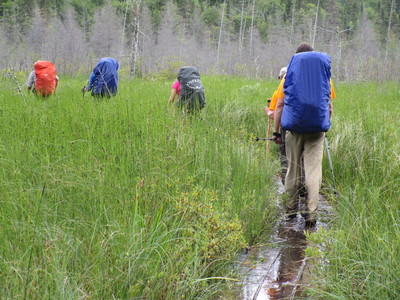
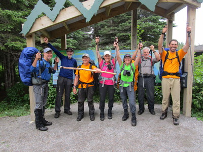
The 8km hike out to Hattie Cove is mostly flat and easy. A long boardwalk (underwater when we were there) helps you cross the marsh at the end of Hattie. We arrived back at the visitor's centre around 11AM and headed to the town of Marathon for lunch! It remained cloudy and rainy so we were happy with our decision! We had completed the coastal trail!
Totals: 65km with 1922m of total ascent
For a .gpx file of our track click here.

 RSS Feed

