
After completing my first round of the 46 Adirondack High Peaks in 2012, I then turned my attention to helping my husband and some friends finish their first round, repeating over half of the 46ers again. My husband finally finished on Allen Mountain in March of 2018. With that now complete, I've turned my attention to focus on completing the 46ers in the winter and become a Winter 46er (W46). Before starting today's hike I already have 15 winter official summits in the bag, and about a dozen unofficial (hiked in winter conditions but not really in the Dec 21-March 21st timeframe).
We planned to head down to Keene Valley on Mountainfest weekend in mid- January. Due to a mix of bizarre circumstances with other adventure partners (injuries, winter storms, other logistics) I found myself planning a solo winter hike. This was to be my first solo hike in the Adirondacks but I felt I had the experience, fitness and proper gear to tackle it. My objective for the day was to hike to Gothics (4736') via the Beaver Meadow Falls trail over Armstrong (4400') and Upper Wolfjaw (4185') and then return via the Wedge Brook trail.
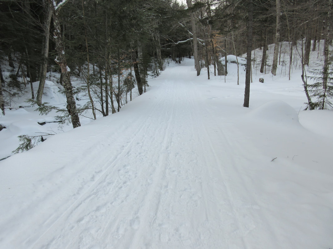
I signed in at the register at 7:30AM and started the march down the Lake Road. The road had been compressed with many snowmobile passes and that combined with the -17C temperatures, I was able to bareboot on the compact snow all the way to the junction with the Beaver Meadows Trail. The trail is immediately after the 2 mile sign on the Lake Road.
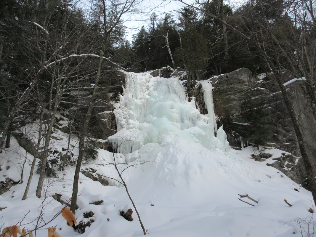
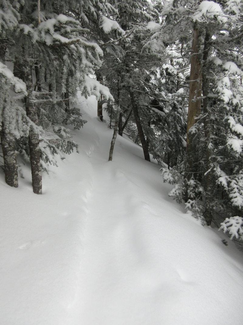
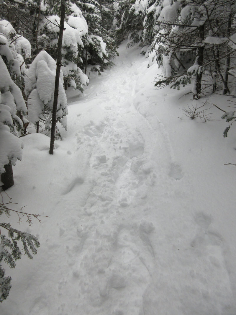
I have never ascended this trail before so it was a new approach for me. Upon arrival it was obvious that the trail had been used this winter but had been filled in with a couple inches of fresh powder that I would break to the col. I switched to snowshoes at this point and wore the snowshoes for the remainder of the day. It wasn't long on this fairly flat trail that you meet the beautiful Beaver Meadow Falls. Completely frozen, I would have preferred to ascend the blue line with crampons and ice axes (I am a climber) but this time I had to ascend the ladder to the left and snowshoe the vertical up the hiking trail. After a the quick heart pounding vertical, the trail grade eases and you fall into a nice hiking rhythm with views of the surrounding peaks in all directions.
We planned to head down to Keene Valley on Mountainfest weekend in mid- January. Due to a mix of bizarre circumstances with other adventure partners (injuries, winter storms, other logistics) I found myself planning a solo winter hike. This was to be my first solo hike in the Adirondacks but I felt I had the experience, fitness and proper gear to tackle it. My objective for the day was to hike to Gothics (4736') via the Beaver Meadow Falls trail over Armstrong (4400') and Upper Wolfjaw (4185') and then return via the Wedge Brook trail.
I signed in at the register at 7:30AM and started the march down the Lake Road. The road had been compressed with many snowmobile passes and that combined with the -17C temperatures, I was able to bareboot on the compact snow all the way to the junction with the Beaver Meadows Trail. The trail is immediately after the 2 mile sign on the Lake Road.
I have never ascended this trail before so it was a new approach for me. Upon arrival it was obvious that the trail had been used this winter but had been filled in with a couple inches of fresh powder that I would break to the col. I switched to snowshoes at this point and wore the snowshoes for the remainder of the day. It wasn't long on this fairly flat trail that you meet the beautiful Beaver Meadow Falls. Completely frozen, I would have preferred to ascend the blue line with crampons and ice axes (I am a climber) but this time I had to ascend the ladder to the left and snowshoe the vertical up the hiking trail. After a the quick heart pounding vertical, the trail grade eases and you fall into a nice hiking rhythm with views of the surrounding peaks in all directions.
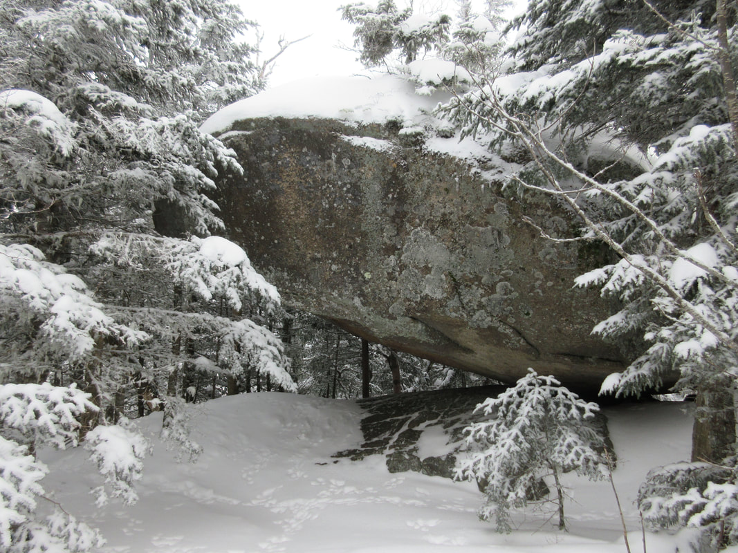
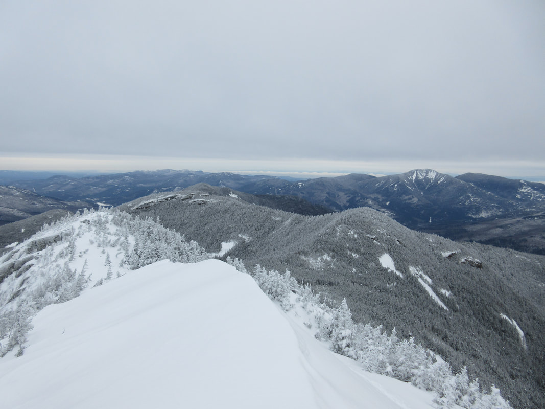
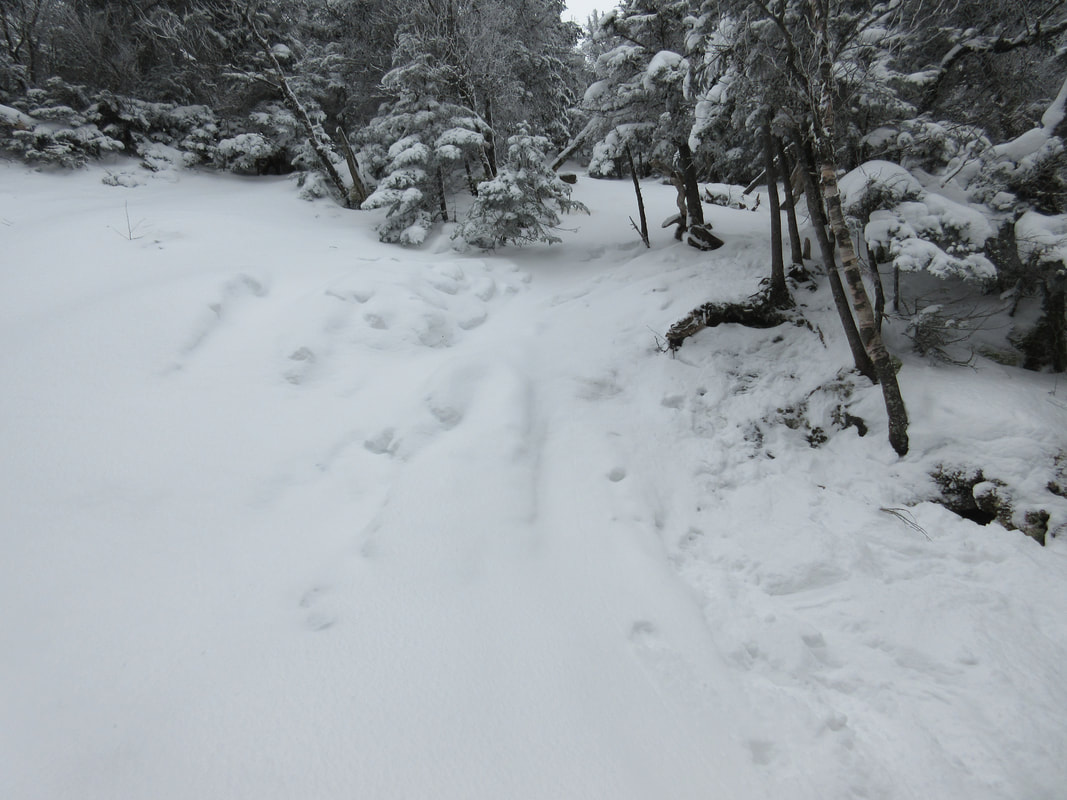
After at least a mile of gentle slope, the grade starts to steepen slightly (heel lifters up!) and climbs up over a ridge. On the far side of this ridge you get to see distant peaks like Sawteeth, Colvin, Nippletop and Dix. The trail here contained much more powder and I had a few tricky steps traversing a steep slope. Up here, there were many more open areas where the trail was difficult to follow as wind had filled in the path with snow. That said, there was an abundance of noticeable activity in all directions from snowshoe hares. At one point I found this extremely large boulder, which seemed to be the community centre of sorts for bunny activity with tracks galore.

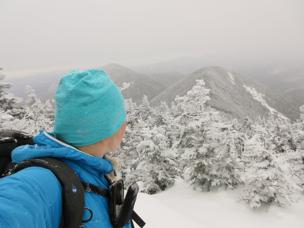
At 10:30AM I reached the the col between Gothics and Armstrong and the range trail. Gothics was in view and I knew that it was only another 0.5 mile to the top. Without stopping I started up towards Gothics noticing that the snow on the ridge was much deeper 6-12". Heading up to a treeless, exposed summit like Gothics I would normally stop to throw on a shell layer, goggles, and neck warmer. Today was a rare windless day (the calm before the storm) so I darted right up without stopping. I reached Gothics summit at 10:56AM and had completed the 3700 foot ascent from the Gate.
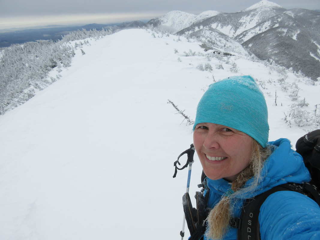

Without taking a break I returned down to the col and the junction. Just below the Gothics summit are these windswept small cornice type snow heaps. The windward side was awesome compact neve type snow that was easy to walk on whereas the leeward side had loads of loose snow on sketchy slopes. A hiker before I had arrived had taken the leeward side that I had unconsciously followed up to the summit struggling at times. On the return I took the smarter, faster option which was much more stable and less scary. Back at the junction I fueled up on hot chocolate, pepperettes and baked goods and continued up to Armstrong.
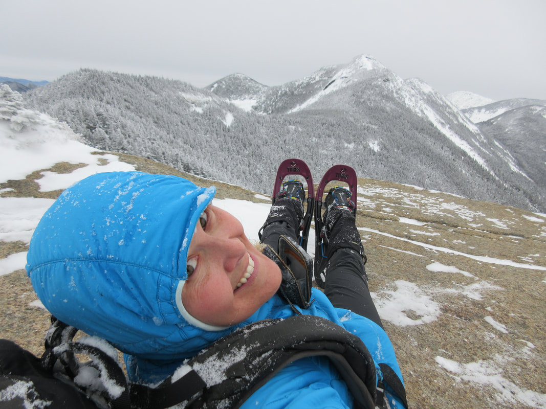
The trail up to Armstrong was fairly straight forward except for one waist-high rock outcropping that was hard to ascend with about a foot of fresh powder on it. The hiker before me was travelling in the opposite direction and had slid down the rock. I had to resort to using vegetation to help me up and over. I was at Armstrong's rocky summit less than a minute later. Had a quick swig of water (that was partially frozen even in my insulated cozy). It was 11:48AM! I had time to spare so I put my feet up!
The trail up to Armstrong was fairly straight forward except for one waist-high rock outcropping that was hard to ascend with about a foot of fresh powder on it. The hiker before me was travelling in the opposite direction and had slid down the rock. I had to resort to using vegetation to help me up and over. I was at Armstrong's rocky summit less than a minute later. Had a quick swig of water (that was partially frozen even in my insulated cozy). It was 11:48AM! I had time to spare so I put my feet up!
Heading down off Armstrong, the grade steepens and the focus narrows. There were a few sections where foot placements were specific and hanging onto trees ensured you didn't tumble down too quickly. Here is the point where I have in the past descended a ladder which I think was buried under snow (photo above, right). At one point I looked down and one of my Tubbs Flex VRT snowshoes were bent like a banana between a tree and the icy slope. I definitely see why they are called 'Flex' snowshoes - they were perfect all day long for me. After hitting the col between Armstrong and UWJ, I raised my heel lifters and headed up hopefully for the final time today.
About half way up, I finally met my first group of people today. Three guys dressed in mountaineering boots and no snowshoes post holing along the ridge trail - every step dropping 12 inches or more. I find this super frustrating as it not only wrecks the trail, but it is also a rule that you must bring skis or snowshoes with you at all times in the winter to avoid this. My only solace was that a winter storm was arriving that evening and dumping sufficient snow to fill in the post-holes. I arrived at UWJ summit at 12:35 and noticed that my summit shots were now different - clouded in and snow falling. The storm had started. I decided to put my water bottle in my jacket for the descent to help reverse the process of my water freezing.
About half way up, I finally met my first group of people today. Three guys dressed in mountaineering boots and no snowshoes post holing along the ridge trail - every step dropping 12 inches or more. I find this super frustrating as it not only wrecks the trail, but it is also a rule that you must bring skis or snowshoes with you at all times in the winter to avoid this. My only solace was that a winter storm was arriving that evening and dumping sufficient snow to fill in the post-holes. I arrived at UWJ summit at 12:35 and noticed that my summit shots were now different - clouded in and snow falling. The storm had started. I decided to put my water bottle in my jacket for the descent to help reverse the process of my water freezing.

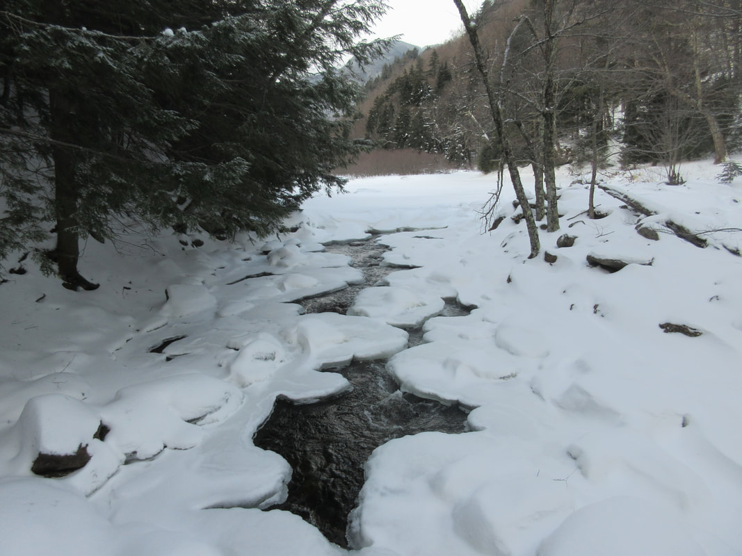
Leaving UWJ's summit I headed down to the Wolfjaw Col and pass a few parties on the way up to UWJ. There was so much powder on the descent that even without a small toboggan I could glissade down on my aggressive mountain snowshoes. I found the junction at the col, fueled up one more time and headed down the Wedge Brook Trail. I have descended this trail once before. It starts by ascending along some exposed rock and then steeply descends about 1900ft before the gradient eases. All alone again, the best way I could think of to march through this section was to sing. Unfortunately the song in my head all day today was Rick Springfield's "Jessie's Girl" whose lyrics I repeated over and over to pass the time. Meeting the river trail, the trail climbs along the banks of the East Branch Ausable River and then finally descends to a bridge and connects back to the Lake Road near the 1 mile mark. A quick flat march out and the day was complete. I finished the day at 3:00PM. Upon reflection I thoroughly enjoyed hiking solo and will definitely hike solo again in the future!
Stats:
Distance: 18 km / 11.2 miles
Time: 7.5 hours
Ascent: 4500ft
Temperature: -17C/1 F
.gpx file
What I wore:
Baselayer: Helly Hansen Lifa top and bottom
Pants: Outdoor Research Cirque Pants plus OR Crocodile Gaiters
Jacket: Outdoor Research Uberlayer
Hat: Buff
Mitts: Black Diamond Mercury Mitts
What I ate:
Homemade banana bread mini loaf
2 x Breakfast Cookies (I put craisins instead of raisins, other nuts & seeds, choc chips)
Pepperettes
Chocolate
Water and Hot Chocolate
 RSS Feed


