
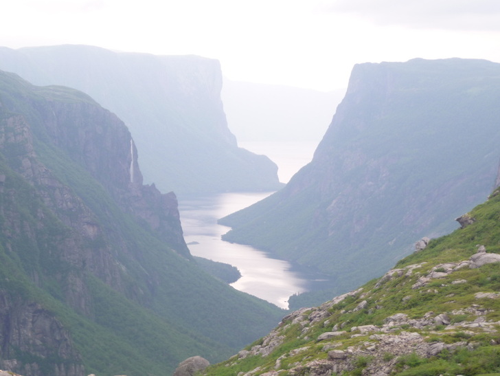
Western Brook Pond
Gros Morne National Park in Newfoundland is a recognized geographical area both nationally as a park and internationally as a UNESCO World Heritage Site. Gros Morne is jam-packed with unique geological features such as an inland fjord, the orange tablelands, sand beaches, coastal shoreline, and a large area of rugged wilderness. According to Parks Canada, it is visited annually by over 100,000 people.
In July of 2011 my husband and I attempted to complete the longest backpacking trip in the park-The North Rim and Long Range Traverse. The Long Range Traverse is a popular backpacking trip, starting at the end of the Western Brook Pond Fjord boat tour. The North Rim starts at the dock of the boat tour and adds about 27km to the 35km Long Range Traverse. The North Rim is not a hike that is popular due to its unappealing rugged nature. In fact, when we did it, only 2 groups had been in before us all year.
The trip actually starts at the Visitor Centre where you pick up your permit ($122.60CDN). Before you get your permit, you must pass a written test to prove your navigation skills. Did I forget to mention this trip is trail-less? Good map and compass/GPS skills are mandatory skills for this wilderness trip. In addition to your permit, Parks will give you a VHF transmitter to carry in your pack in case they have to find you! We parked our rental car at the Gros More Mountain trailhead and hired a taxi to take us up to the Western Brook Pond parking lot. The drive takes about a half hour. For more planning tips, click here.
Day 1- Start to Snug Harbour:We hiked into the Ferry boat landing and took a boat cruise to start the trip. We knew that we would miss out on this by not doing the Long Range Traverse, so we wanted to explore the fjord and scope out some of our route for the first two days. Getting to our first campsite ended up being much more than we bargained for. With 3 days straight of rain before we started, the water levels had risen greatly including the outflow from the Western Brook Pond. The Parks staff had warned us of this, citing that the level might be 'above the knee'. My husband took the first pack across and sank into waist deep fast flowing water. He yelled at me to say he'd come back to get my pack and good thing he did. When I went across I sank to armpit deep and my feet left the bottom and I ended up in a swimming position pulling myself over on the cable. Good thing I am a swimmer and a whitewater paddler and am comfortable in current. The rest of the journey to Snug Harbour displayed signs of moose activity everywhere, not surprising as there is an overpopulation of moose on the island.
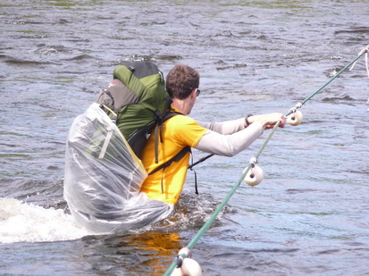
What ended up being waist deep on my 6'2" husband.
Day 2 - Snug Harbour to Long Pond: Our first night at Snug Harbour was uneventful and then next morning we got early to hike the 1500ft up to the top of the rim. As soon as we reached the rim and then the weather turned foul. High winds, rain, and plummeting temperatures challenged our abilities. In addition, we learned how frustrating tuckamore can be. Tuckamore is the Newfie word for low-lying dense, stunted fir trees that, when hiking through, is akin to walking through a cedar hedge. We got to the Long Pond campsite in gale force winds and driving rain. It took the two of us get the tent storm lashed down onto the platform and once finished we jumped into our sleeping bags with clothing we brought that was dry and it took 3 hours before we felt warm. Temperatures felt like they were at the freezing mark. We ate handfuls of snacks for dinner as the wind and rain howled for hours and hours.
Day 3 - Long Pond: We woke up to freezing cold temperatures, wet gear and complete fog. We couldn't even see 50m out of our tent. We pushed back our start time and kept postponing until our cut off time of noon. We got to noon and the weather hadn't broken, and spent the day reading and keeping warm in the tent. We were storm bound! We stayed inside most of the day until we heard the sounds of a helicopter. Yes, that's right, search and rescue was checking in on us! We didn't give them any S.O.S. type signals and so it left. We thought other groups may have bailed with the extreme weather.
Day 4 - Long Pond to Bear Box: We rose on day four and the temperature was significantly warmer. That said the thick fog still lingered but we figured it would burn off and headed out. Navigation was extremely difficult as we had to check our GPS position on the map every 100m to see if we were where we should be. Around 2 PM the clouds finally broke and we had our first sunbeams of the trip. The views opened up and we found the campsite no problem. We were able to find a boggy tent site and dry out our gear until the bugs came out. To escape the bugs, we jumped into the tent after dinner. We had just cleared our tent of bugs when my husband said "I need to go out and brush my teeth". I tried to persuade him to not go but he insisted. When he was outside brushing, he yelled at me to grab my trekking poles because he was looking at a bear. We watched the bear feeding for 45mins and in that time it kept getting closer and closer. Our food and stove was in the bear box (provided at each site) so we knew that wasn't attracting him. We returned to the tent to let him be and stayed quiet and wide-eyed for hours into the night. It started raining again and everything was soaked again. The next morning we got up and left as soon as we could. We called this site "Bear Box" as there was nothing at the campsite other than a bear box to distinguish it!
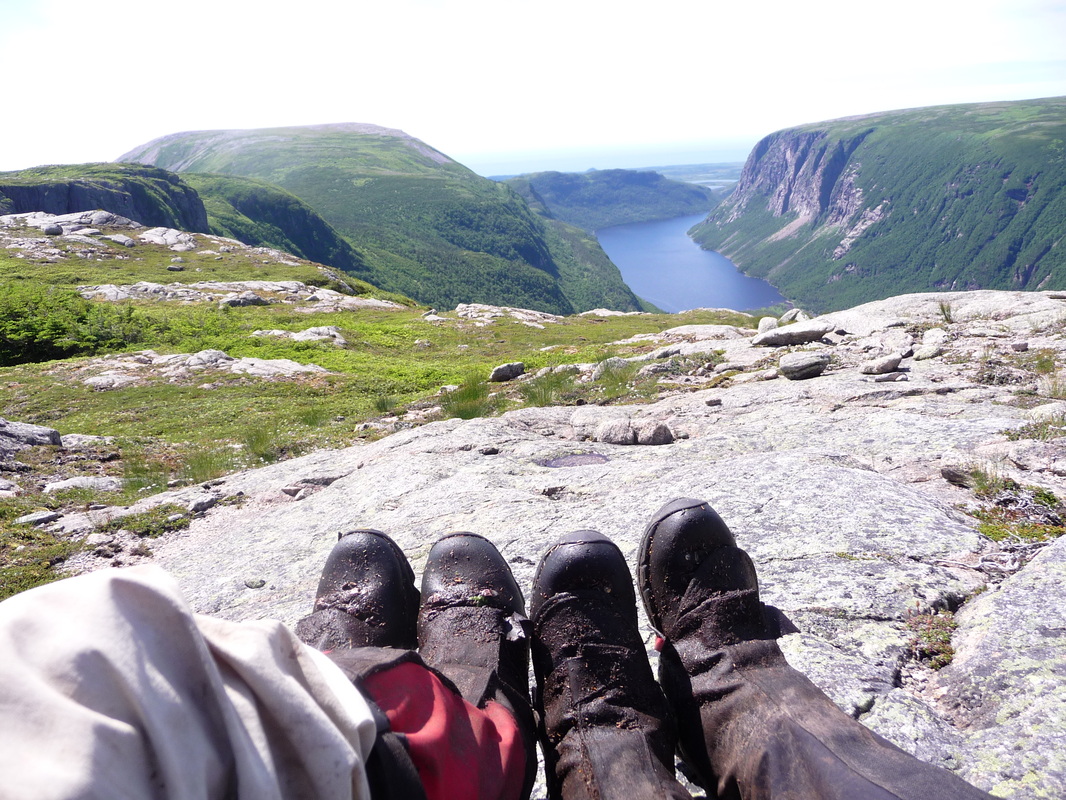
Day 5 - Bear Box to Hardings Pond (17km): Starting in the rain once again, we reached the end of the North Rim trail when we reached the viewpoint for the Western Brook Pond. Views weren't great and the famous photospot wasn't photogenic on that day (photo above). When we were hiking up the rocky slabs out of the valley, my hiking pole slipped on the rock and poked my husband just below the eye. A close call and lesson learned about following people up steep slippery slopes too closely. We continued on to Harding's pond for the night, where we found two other parties camped out on the tent platforms. People! We chatted with them for a bit before realizing that there was no third platform so Glenn and I had to pitch our tent on a small bit of sandy flat ground. As soon as we pitched our tent it started to rain, again.
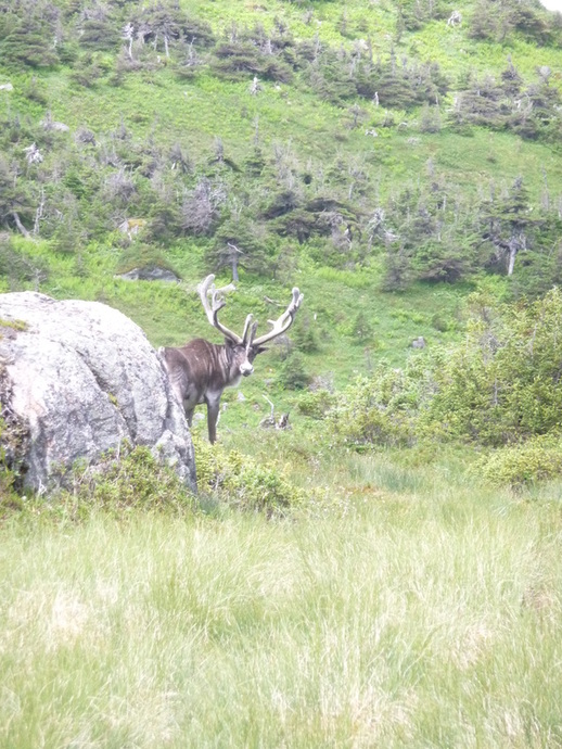
Day 6 - Harding's Pond to Finish (22km): We woke at Hardings Pond, packed up before the other parties and began the day with promising sunshine. Finally! The undulating terrain took us up and over many rock outcroppings and past many view points and we saw two massive caribou! We hiked around many mud puddles and bogs. The day ended up being the best day for views and weather, but our toughest day physically. We descended the steep and sketchy Ferry Gulch to the Gros Morne Campsite and made the decision to march out the last 5km to the parking lot, a total of 22km for the day.
Day 3 - Long Pond: We woke up to freezing cold temperatures, wet gear and complete fog. We couldn't even see 50m out of our tent. We pushed back our start time and kept postponing until our cut off time of noon. We got to noon and the weather hadn't broken, and spent the day reading and keeping warm in the tent. We were storm bound! We stayed inside most of the day until we heard the sounds of a helicopter. Yes, that's right, search and rescue was checking in on us! We didn't give them any S.O.S. type signals and so it left. We thought other groups may have bailed with the extreme weather.
Day 4 - Long Pond to Bear Box: We rose on day four and the temperature was significantly warmer. That said the thick fog still lingered but we figured it would burn off and headed out. Navigation was extremely difficult as we had to check our GPS position on the map every 100m to see if we were where we should be. Around 2 PM the clouds finally broke and we had our first sunbeams of the trip. The views opened up and we found the campsite no problem. We were able to find a boggy tent site and dry out our gear until the bugs came out. To escape the bugs, we jumped into the tent after dinner. We had just cleared our tent of bugs when my husband said "I need to go out and brush my teeth". I tried to persuade him to not go but he insisted. When he was outside brushing, he yelled at me to grab my trekking poles because he was looking at a bear. We watched the bear feeding for 45mins and in that time it kept getting closer and closer. Our food and stove was in the bear box (provided at each site) so we knew that wasn't attracting him. We returned to the tent to let him be and stayed quiet and wide-eyed for hours into the night. It started raining again and everything was soaked again. The next morning we got up and left as soon as we could. We called this site "Bear Box" as there was nothing at the campsite other than a bear box to distinguish it!
Day 5 - Bear Box to Hardings Pond (17km): Starting in the rain once again, we reached the end of the North Rim trail when we reached the viewpoint for the Western Brook Pond. Views weren't great and the famous photospot wasn't photogenic on that day (photo above). When we were hiking up the rocky slabs out of the valley, my hiking pole slipped on the rock and poked my husband just below the eye. A close call and lesson learned about following people up steep slippery slopes too closely. We continued on to Harding's pond for the night, where we found two other parties camped out on the tent platforms. People! We chatted with them for a bit before realizing that there was no third platform so Glenn and I had to pitch our tent on a small bit of sandy flat ground. As soon as we pitched our tent it started to rain, again.
Day 6 - Harding's Pond to Finish (22km): We woke at Hardings Pond, packed up before the other parties and began the day with promising sunshine. Finally! The undulating terrain took us up and over many rock outcroppings and past many view points and we saw two massive caribou! We hiked around many mud puddles and bogs. The day ended up being the best day for views and weather, but our toughest day physically. We descended the steep and sketchy Ferry Gulch to the Gros Morne Campsite and made the decision to march out the last 5km to the parking lot, a total of 22km for the day.
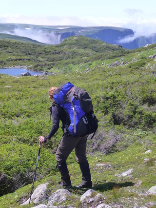
The conditions on this trip proved to be very challenging. The rain had created very muddy, slippery and boggy conditions and on many of our steps we sank over the ankle. My double gaiter (OR Salamander and OR Crocodiles on the right below) kept my feet absolutely dry until the end of Day 4. The saturated ground made us have to make many detours around puddles, deep mud, and bogs. At the last minute I had thrown in some plastic garbage bags to use if things got wet. The ended up saving the trip as we used them as extra protection ground covering on the floor of the tent, crossing swollen rivers, and keeping wet tents incased. The extra weight of our saturated gear ended up giving me a nasty case of plantar fasciitis after the trip was over. Hike totals: 70km and 10,000ft of ascent!
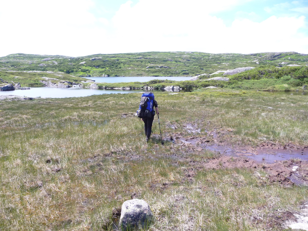
We coined a phrase on the trip that encapsulates this photo: Bog Sloggin'
This wasn't the first National Park I had backpacked in and I found the infrastructure in the backcountry sites lacking. Each site was to have 3 tent platforms (only one of the sites we stayed on did), a green pit toilet and no campfire rings. We found campfire rings that had been used at almost every site even though regulations said othewise. We advised the park office of our disappointment having to sleep on wet bog more that once. This may have changed since 2011. The parks staff also said they closed down the trail after we got on as it was too dangerious to cross rivers, etc. No kidding! The conditions apparently were the worst in 87 years with the volume of rain and the cold temperatures. Another great adventure in the books! :)
OR Salmander and OR Crocodile double gaiters kept my boots from getting wet unlike my husband's left.
 RSS Feed


