Our free continental breakfast at the hotel didn't open up on this day until 8AM so we waited around for it to open and finally got into the car around 8:15AM. We drove the short distance up Hwy 3 to the I-93 to the Basin parking lot and walked through a tunnel under the highway to start our hike.
The hike begins in a maze of trails at the bottom which could be quite confusing at first. Without a mistake we found the correct trail and started hiking up the Basin-Cascade trail which joins onto the Cascade Brook Trail. This section of trail was absolutely beautiful. Several waterfalls and moving water made me want to stop and take a photo of every one! It would be a perfect short hike for the aspiring photographer or even a great place to spend an afternoon on a hot summer day. Today was not the best trail conditions, as the trail was covered by snow, and iced over puddles were not supporting our weight leading to many soakers. Good thing we put on our gaiters as we luckily didn't get wet. We crossed the brook a few times but before we did we put on our microspikes as there was more grip on the ice and snow covered rocks with them on. We never took them off for the rest of the day! Up on the Cascade Brook and Kinsman Pond Trails I was the first to break since the snowfall two days before. We were delighted to see fresh tracks of pine martens, hare, squirrels and even a bear track on the way up!
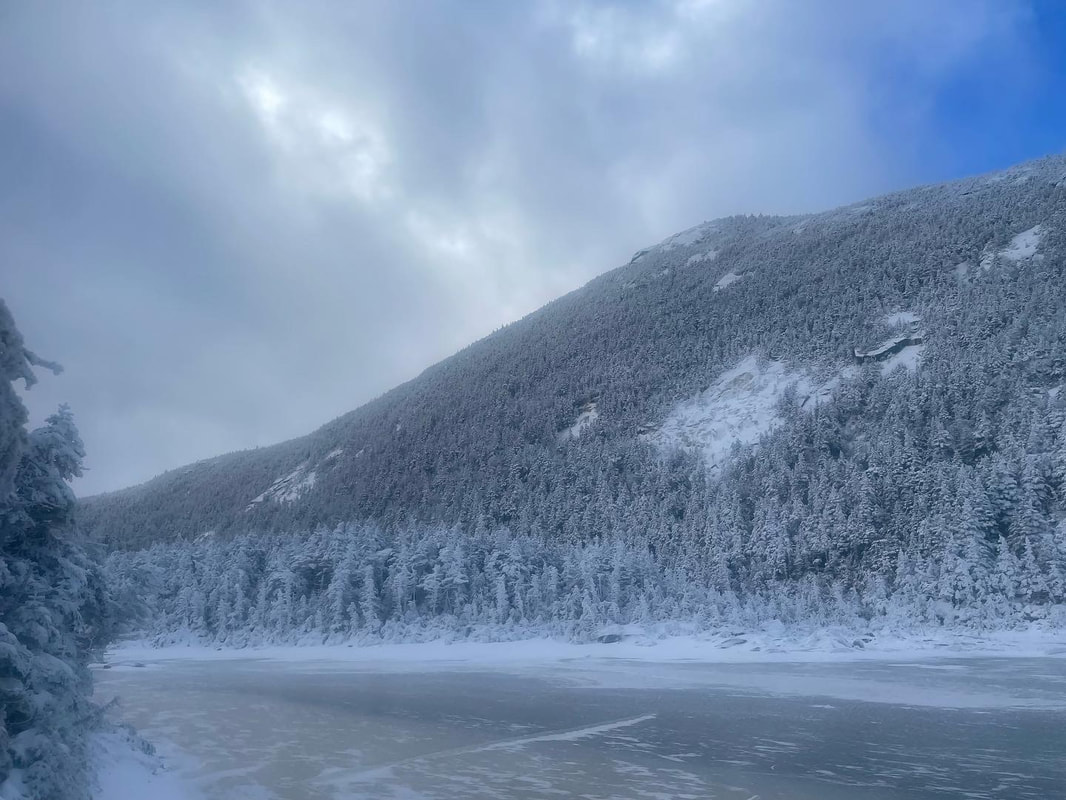
Continuing on to the Kinsman Pond trail, we were still breaking trail and hopping on boulders on what the trail was apparently created on....an old stream bed. The snow, water and ice created very moist conditions on this day and required full concentration for each step. We were moving slower than normal, and I realized that this trail would be much better suited for summer travel. We reached the Kinsman Pond and finally caught a glimpse of the summit of North Kinsman. The pond was iced over and the snow depths rose to over ankle depth. Temperatures dropped here so we took a moment to put on heavier mittens and pull up our hoods. We reached the Kinsman campsite and made a left turn to head up to the Kinsman ridge trail.
Here we finally caught up to footprints and noticed that two people were ahead of us on the trail. We turned a corner and found a fellow hiker who had come up from the opposite side than we did and startled him to the point he shouted out loud! He was standing on the North Kinsman summit. I am glad he was there, as I don't think I would have realized it was the summit. It was a snow covered chunk of rock. If you downclimb a couple of steps from here it leads to a nice lookout. We were getting some glimpses of views of the Franconia ridge in the distance but the summits today were mainly obscured. We decided to keep going on to the South Summmit.
Off we went to South, which includes downclimbing a couple hundred feet and then climbing back up to the summit. The South summit is somewhat confusing as there are two locations: The lookout point at the highest point and then a large open area with a rock cairn a few minutes further and slightly below it. Luckily my hiking partner remembered the cairn so we hit both spots in order to make it official. Here again the views were not ideal and we didn't waste too much time before turning around and heading back along the ridge to the North summit.
On the way back we met two fast-moving 30-something guys that were heading to the South summit. In what seemed like no time at all, they were back behind us so we asked which summit they went to and it was only the lookout they reached. My hiking partner Deb turned them around and sent them back to the cairn in order to make it official. We stopped for lunch on the North Kinsman summit lookout where it was snowing lightly and we were mainly in a cloud. After our break we descended back down but instead of taking the Kinsman Pond trail we took the Fishin' Jimmy Trail. This trail was much easier going as it wasn't a boulder ridden and did not involve creek crossings like the Kinsman Pond Trail does. It also has more infrastructure (boardwalks, etc) as it is part of the Appalachian Trail system. The two guys we saw up on the ridge caught up to us again and blew by us mentioning that they would be finishing their NH 48 on Carragain the next day.
We reached the Lonesome Lake Hut to see that it was open and functional and met a father and daughter duo outside working on some map and compass skills. We were chatting with the at the corner of our right turn and missed it initially as we were distracted with our conversation. We realized our mistake quickly and turned around and got back on path breaking trail on the connector back to the Cascade Brook Trail and Basin Cascade Trail.
Just before we finished we lost daylight and had to don our headlamps in order to cross the last brook and head down to the parking lot. We got to the tunnel, took off our microspikes and gave each other a high-five. It felt great to be back in the White Mountains after a 3 year hiatus!
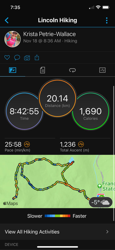
Stats:
Time: 8:42 hrs
Distance: 20km
Elevation: 4000ft


 RSS Feed


