At 7:45AM on Saturday August 27th, 2022, we left the parking lot at Underhill and headed up hill to the sign-in register past the group camping area. The 500ft ascent here has two options: trail or road. You can pick either to get to the upper trailhead. We signed in and headed up the Sunset Ridge trail. The trail was saturated with moisture from last night's storm and in some places was still flowing down hill on the trail. Luckily the temperature was cool and we could charge up the trail as fast as our feet could take us. Due to Covid, I hadn't been able to cross the border the past 2 summers and was a bit worried that my fitness wasn't up to par but there is only one way to find out if your lungs and legs were ready: go up!
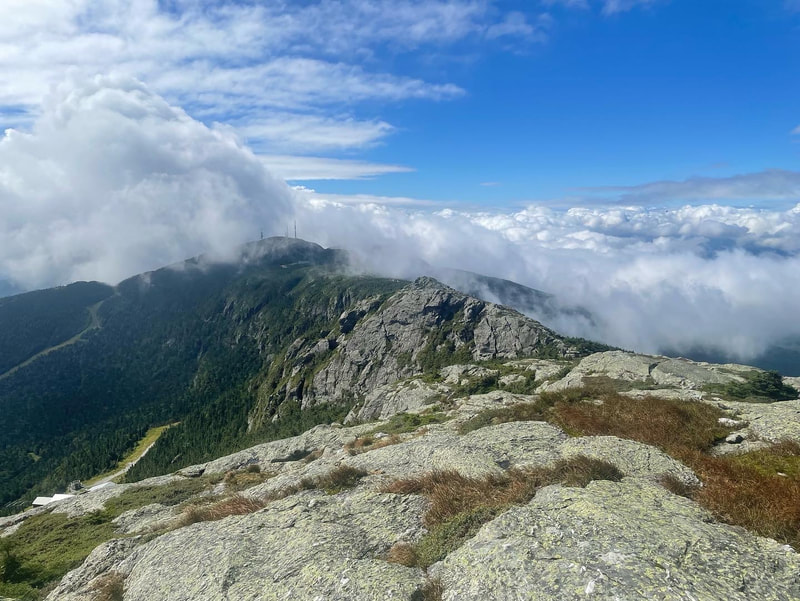
In less than an hour we had reached the turn off to a 0.1mile side trail to view the famous Cantilever rock. I had seen photos of this online previously but was floored by how large it was in person. It is definitely a unique feature and worth the side trip. Back on the ridge trail, we noticed it had been one hour in and we could all use a sip of water. Heading up hill from here, the theme of the trail is ROCK. There are many rock steps, rock ledges, and rock slabs to negotiate. Some views start popping out above the trees and a few welcome cool breezes started to be felt. The trees start to change from deciduous to coniferous and the height of the trees seems to start to shrink with every step. In the alpine zone, Vermont uses white string to guide hikers as to where to walk so that the impact to the alpine zone vegetation is minimized. At the 2 hour and 10 minute mark, we had ascended the 2543ft of elevation to the summit of Mount Mansfield, otherwise known as The Chin at 4393ft. The summit steward answered our questions about landmarks on either side of the summit and took some group photos for us. Crowds were definitely starting to build but we couldn't really figure out where all the traffic was coming from. Then we could see it: a gondola bringing hikers up the Stowe ski hill and a road that some people drive up bringing them about 90% of the way to the top!
We descended from the summit proper back down to the junction with the Sunset Ridge Trail and had a snack and water break before continuing our loop hike along the ridge. The sun had just started to break up the clouds and views were coming into play. The ridge walk is along the Long Trail in Vermont and is mainly rock boulders and slabs. There is a real mix of hikers here - everyone from multi-day thru hikers, to day hikers, to people in flip flops and white shirts who had drove up. Across the ridge, we came across a cell tower and hut and the Visitor Centre. We stopped in at the centre to read more information about the area and speak to some of the staff. We left and continued on the Long Trail to the Forehead and stopped for lunch.
Here I noticed one of my favourite pieces of gear was broken: my short gaiters from Outdoor Research (Salamanders). Vermont is affectionately known as 'Vermud' among thru-hikers and gaiters were helpful on our hike today, especially after the rains the night before. I have been holding on to these gaiters for years and think they are the best on the market but unfortunately the metal buckle broke and they are dunzo.
We found the Maple Ridge trail and found the mainly rock trail was a bit treacherous from the rains the night before. Many of the rocks were slimy and sloped and it was tricky in places to get a good pole plant or foot placement. In a few cases we had to resort to lowering down on our butts to safely descend. We all had instances where our feet slipped from underneath us so we slowed our pace down to ensure that no injuries took place. We found the chasm, and all had to jump over the crevasse-like crack to get to the other side. All in all the Maple Ridge trail is do-able, but isn't as fun to descend when wet. The first part of the decent is the steepest and then once it hooks up to the CCC road it is easy going again. The CCC road surprisingly climbs as it traverses at first and then descends back down to the trailhead on good trail. I enjoyed this hike with it's mix of interesting features and good challenging trail that keeps your focus.
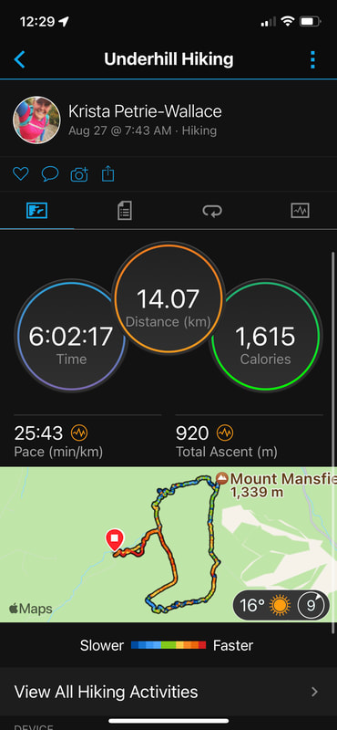
Arriving back at the trailhead we signed out of the register and chose to take the road walk back down to the campground. We looked at our watches and it took us 6 hours exactly to do the 14km (8.7 miles) with 3100ft of ascent. This is #68 for me on the Northeast 115 list.


 RSS Feed


