
Mount Katahdin, Maine
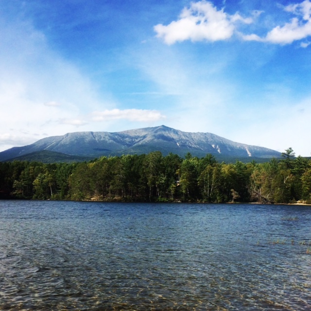
Mount Katahdin is located in Baxter State Park in the State of Maine. It stands at 5267ft and has 2 prominent peaks: Hamlin and Baxter. Both of these tall eastern peaks are on the NorthEast 111(115) peakbagging list and so our hike was to summit both peaks via a loop on September 20th, 2016. Our Plan A was to ascend the Helon Taylor Trail followed by a traverse of the famous Knife Edge Ridge then summit Baxter Peak at 5267ft and then continue on a saddle over to Hamlin Peak at 4756ft and then down the Hamlin Ridge Trail. This route is the classic way to summit Katahdin as a day hike and we are all have a background in rock climbing with exposure and are comfortable in that environment. There are other ways to get to Katahdin's summit and you should pick the route that is right for you.
Our group of three tent camped at Roaring Brook Campground the night before the hike. This campground is home to 9 Lean-To's, 10 tent sites, and 10 bunkhouse beds. Reservations are strongly recommended. The campsite has clean outhouses and a small brook as a water source (better to bring water in). After waiting for a sunny weather window for 3 days, we woke up at 5am to the unexpected weather change of rain. In fact, it had rained hard all night and we woke up with our spirits dampened. Poor weather such as rain, wind, and low-lying clouds were NOT optimal conditions for hiking the famous Knife Edge Ridge. We had to make a Plan B.
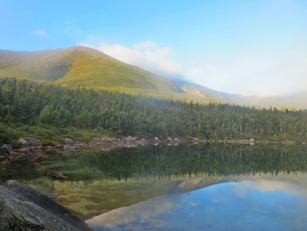
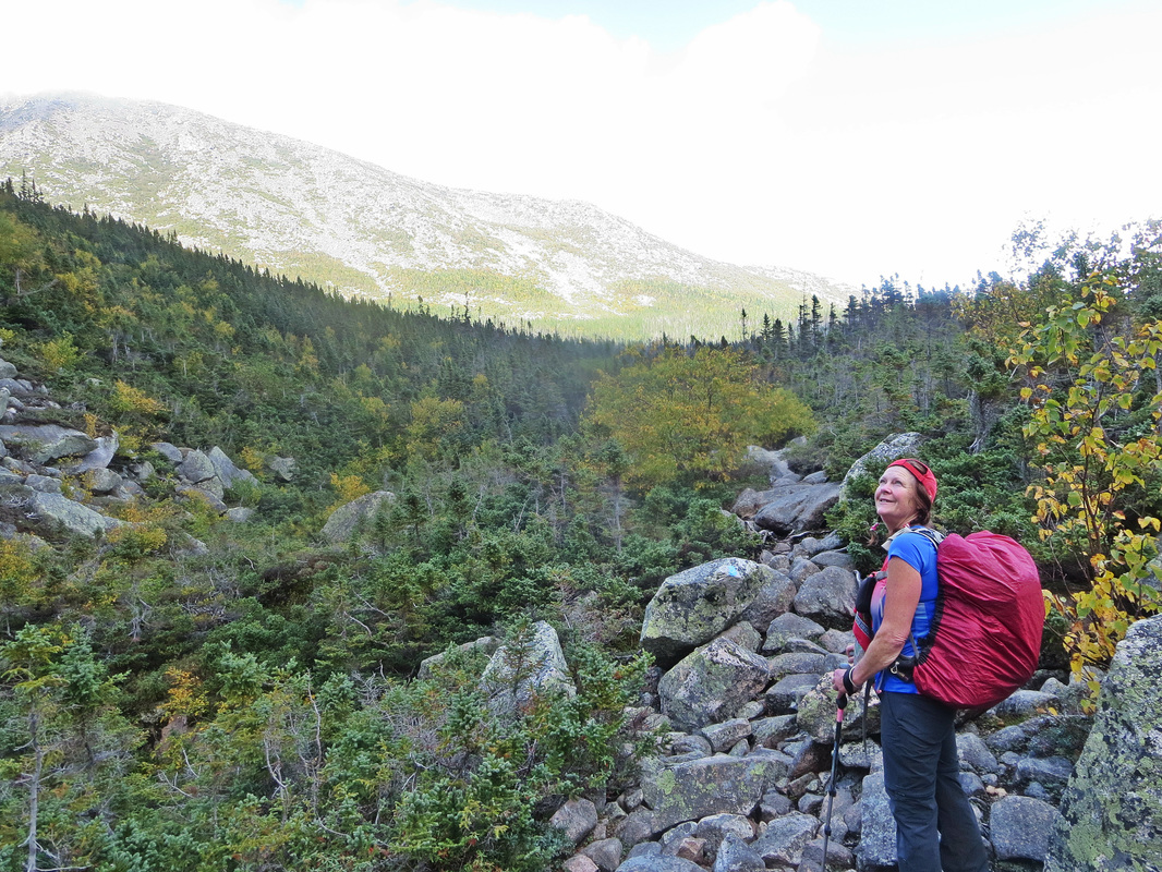
We decided to try to loop in the opposite direction as planned, hoping that the weather forecast would hold true and that by the time we got up on the ridges we would be able to do the Knife Edge. Starting just behind the Ranger Cabin, we took the Chimney Pond Trail up to Basin Ponds. The trail is rocky but has been engineered well for drainage of water. I decided to take off my gaiters an hour into this hike.
Heading onto the Hamlin Ridge trail, we started to gain elevation and quickly. Rocky boulders started appearing and the rock was wet from the overnight rains. As soon as we crossed the treeline, we entered into a cloud and began our scramble up some boulders. Reaching the Hamlin Peak summit marker 3 hours and 3600ft later, our bodies were dripping of sweat. The humidity levels were definitely high today.
Our group of three tent camped at Roaring Brook Campground the night before the hike. This campground is home to 9 Lean-To's, 10 tent sites, and 10 bunkhouse beds. Reservations are strongly recommended. The campsite has clean outhouses and a small brook as a water source (better to bring water in). After waiting for a sunny weather window for 3 days, we woke up at 5am to the unexpected weather change of rain. In fact, it had rained hard all night and we woke up with our spirits dampened. Poor weather such as rain, wind, and low-lying clouds were NOT optimal conditions for hiking the famous Knife Edge Ridge. We had to make a Plan B.
We decided to try to loop in the opposite direction as planned, hoping that the weather forecast would hold true and that by the time we got up on the ridges we would be able to do the Knife Edge. Starting just behind the Ranger Cabin, we took the Chimney Pond Trail up to Basin Ponds. The trail is rocky but has been engineered well for drainage of water. I decided to take off my gaiters an hour into this hike.
Heading onto the Hamlin Ridge trail, we started to gain elevation and quickly. Rocky boulders started appearing and the rock was wet from the overnight rains. As soon as we crossed the treeline, we entered into a cloud and began our scramble up some boulders. Reaching the Hamlin Peak summit marker 3 hours and 3600ft later, our bodies were dripping of sweat. The humidity levels were definitely high today.
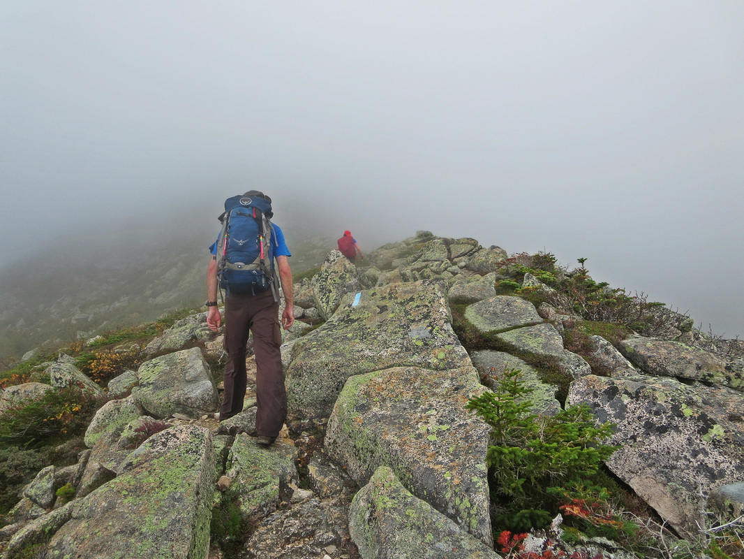
Donning our shell jackets, the cloud we were in was windy and drizzling water vapour on us. We descended down some slippery rock boulders onto some small ball bearing type rocks. These rocks if stepped on incorrectly will sit you down on your butt before you know it. Crossing the saddle, we lost approximately 400ft of elevation gain hiking through gravel paths and alpine scrub.
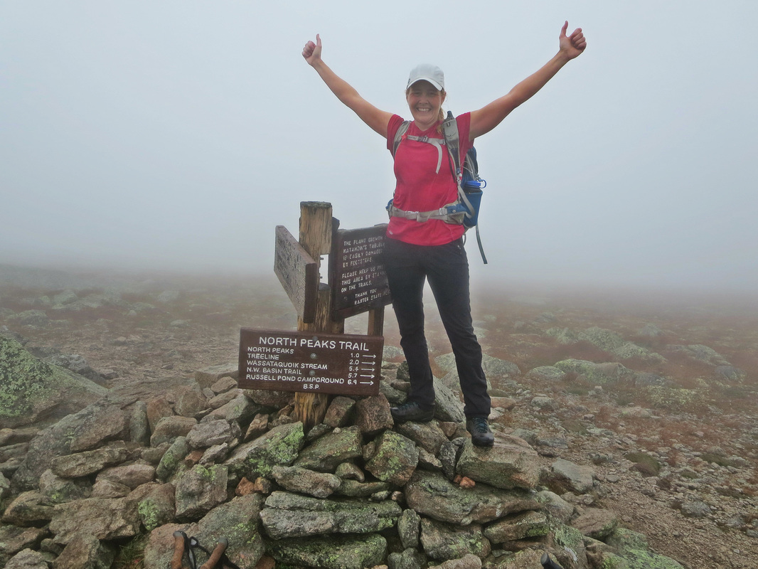
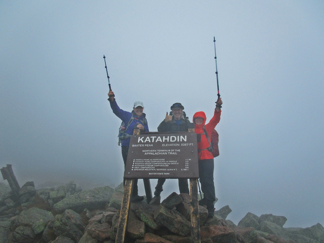
We continued on over to Baxter Peak, the highest point on Katahdin at 5267ft by ascending 900ft of rock steps to the summit. In some places red rock stones the size of a nalgene bottle create a path upwards and is easy to walk on. The grade of the ascent is manageable, especially after already ascending 3600ft. The summit sign on Baxter Peak of Mt Katahdin cannot be missed. It's a large sign and great for photos. Unfortunately today there were two compounding problems. One, we had no views being in a cloud, and two, there were about a dozen AT thru-hikers finishing their epic 3500km journeys with beer and wine to boot. AT hikers ascend the Hunt Trail from Katahdin Stream Campground. Luckily we were able to squeeze a quick summit pic in with our group amongst the crowds. At this point, we had hiked 10.5km and ascended over 4500ft. We sat down and had a lunch break beside a large rock cairn.
Looking over to where the Knife Edge is supposed to be, we saw nothing but cloud. One of our group members had done the ridge before and knew that under these less than ideal conditions, our goal of doing the Knife Edge Ridge was not meant to be on this day. Instead, we decided to descend the Cathedral Trail, a trail that descends right off Baxter Peak and connects with the Chimney Pond trail we started on to make a loop.
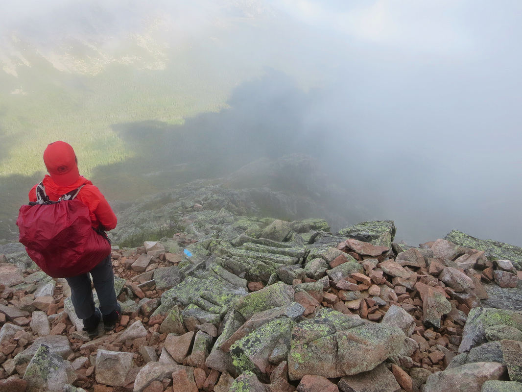
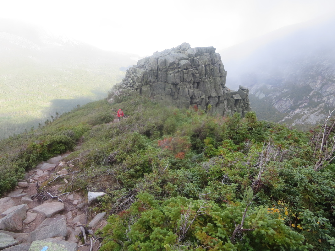
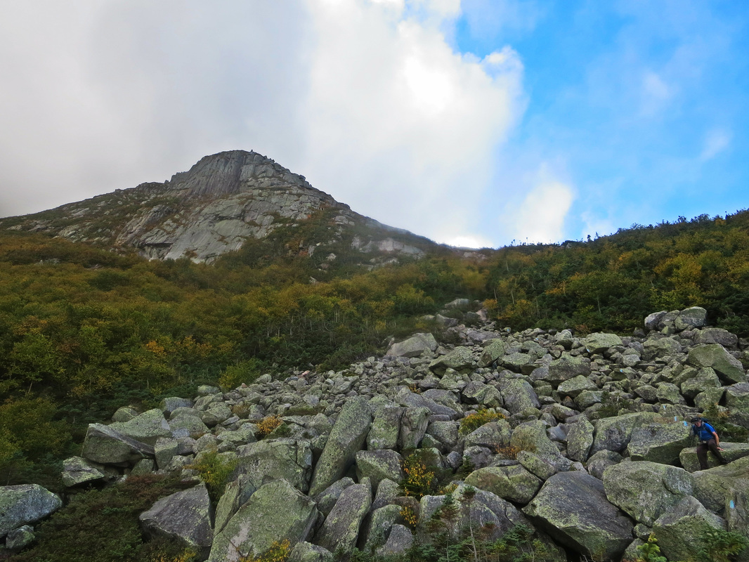
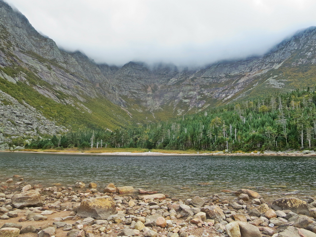
Not knowing much about the Cathedral trail we began our descent with man-made rock stairs. Still in a cloud, we couldn't really see where the trail was headed, but we followed the painted blue blazes on the rocks and continued downward. The rock stairs gave away quickly to steep rocky boulders. Full focus and full body concentration followed for 1500ft of descent. Using arms and legs, we scrambled down making sure of every foot placement. This trail was very mentally and physically engaging and demanded Class 3 scrambling skills. About half way down this trail we popped out of the cloud and into the sun. We could see! Stunning views of the valleys and lakes below began to emerge. We stopped many times for photos and ran into many groups heading up the trail to the summit.
It was a mental relief to exit the boulder scrambling and return to the rooty and rocky flat trail to Chimney Pond. We took a water and snack break at the lake and looked up at our descent route with amazement. We walked through the Chimney Pond Campground which looked like it had multiple facilities and then re-traced our steps on the Chimney Pond trail back to our car in the day use parking lot. Weather was sunny and warm on our return and as we left Baxter State Park it seems like a localized cloud had parked itself over the mountain, robbing us of a chance to do the Knife Edge. An excellent reason to return to this fantastic hiking area for sure in the future.
Data for this hike: 18km (11.1miles), 9hrs, 5000ft of ascent.
 RSS Feed


