
After completing the 46 Adirondack High Peaks in 2012 and becoming an Adirondack 46er, I spent most of the past three years repeating many of the High Peaks again with friends. This past weekend I decided to try some of the 'Lesser Peaks' or peaks below 4000 feet in elevation. I chose to do Haystack (not to be confused with the High Peak Haystack) and McKenzie Mountain as a day hike. As it turns out, these two peaks are part of another list, called the Saranac 6ers.
On Saturday December 5th 2015, my friend Deb and I set off for Haystack at 8:30am. Wearing bright colours because of rifle hunting season, temperatures were just above the freezing mark. Following a flat wet trail up to the turnoff, we passed a old ruin beside the trail. We began to encounter light snow cover around 2000ft at the same time crossing a stream with an old bridge foundation. Climbing gradually, the snow cover became more pronounced and when we hit the steepest part of the ascent we climbed a mix of wet rock and ice. The snow was very grippy underfoot, even over wet rock, so we didn't feel the need to wear microspikes. Throughout the day, the trees constantly dripped water and snow bombs as temperatures rose. We reached the clouded summit at 2864ft/873m elevation.
On Saturday December 5th 2015, my friend Deb and I set off for Haystack at 8:30am. Wearing bright colours because of rifle hunting season, temperatures were just above the freezing mark. Following a flat wet trail up to the turnoff, we passed a old ruin beside the trail. We began to encounter light snow cover around 2000ft at the same time crossing a stream with an old bridge foundation. Climbing gradually, the snow cover became more pronounced and when we hit the steepest part of the ascent we climbed a mix of wet rock and ice. The snow was very grippy underfoot, even over wet rock, so we didn't feel the need to wear microspikes. Throughout the day, the trees constantly dripped water and snow bombs as temperatures rose. We reached the clouded summit at 2864ft/873m elevation.


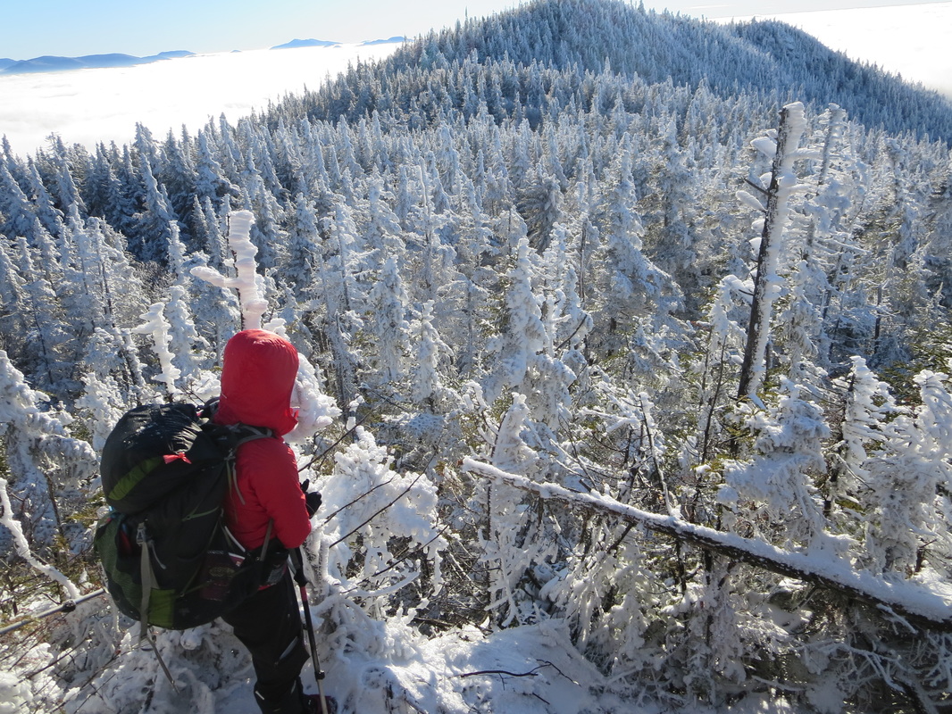
Descending down from Haystack, we lost approximately 1000 feet/300m. Back on the main trail we climbed gradually to the junction with the Jackrabbit cross country ski trail. After a brief break, we began the final mile and half or so to the summit of McKenzie. Beginning with a short rock hopping section on flooded trail, the topography changed drastically and we began a steep snow covered ascent. The final 1200 feet of elevation gain is the toughest part of this climb. For the past 2 months I have been suffering with a lower back injury that had me altering my technique in some places and in general, worried about falling. Instead of high stepping big boulders, I found myself kneeling on rock and using more roots and trees to pull me up the steeps. After hitting some icy sections we decided to put on our microspikes to gain more traction and not have to focus on precisely placing every footstep. This was a mental relief for me, as the added traction meant less chance for slipping and re-injury. We met a group of 4 women who turned around before the summit, unable to ascend a ice covered rocky section. We now doubted our chances of summiting, as we hadn't brought our crampons or ice axes with us.
Deb enroute to McKenzie Mtn.
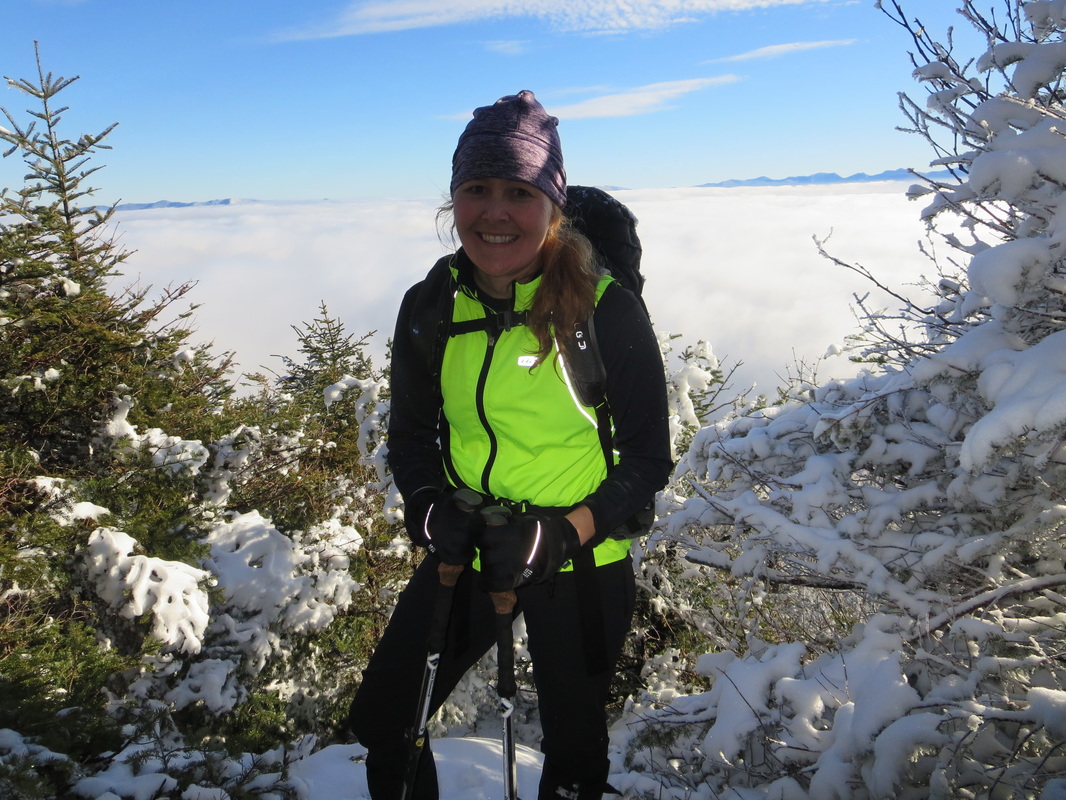
Deb and I decided to continue on, to see what we were up against. After a short flat section followed by a descent into a col, we began our final push to the summit. Blue sky peeked through and visibility was improving. We were hoping that we could summit and get a view. We hit the rocky outcropping that we thought the group of women before us had stopped at. Using our ice climbing/rock climbings skills, we were able to get past this tricky bit of ice. A few steep rocky outcroppings later, we arrived at some magical viewpoints. Our blue sky wasn't because the weather was improving, it was because we were above the clouds! Magical views in every direction! The High Peaks, from Algonquin to Giant were in view above the clouds. We were high off the heart-pounding ascent, the gift of warm sun on the summit, and the stunning views. It was our lucky day!
Above the clouds on the summit of McKenzie
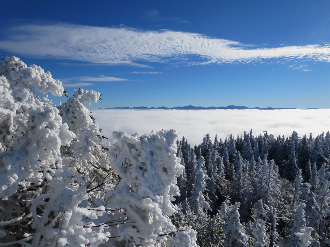
The Great Range & McIntyres in the distance.
The summit marker on McKenzie is like no other. It includes a thermometer! Reading in at -4 degrees celcius on the summit, we donned some warmer clothing and ate lunch. We contemplated descending a different route from the summit than which we came, but ultimately decided to go back the way we came.
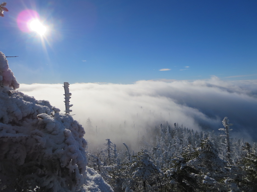
Descending into the clouds.
We made a quick descent off the steep sections and took off our microspikes when the terrain levelled out and conditions went from ice to water. Marching out the remaining miles went smoothly, as the majority was downhill. We returned to our vehicles just before dusk. Despite being lesser peaks, these two summits combined together or done separately, are 2 great summit hikes with very typical Adirondack steep trails and worthwhile summit views. Highly recommended!
Hike Totals: 4208 feet of ascent, 19 km/12 miles, 7hours 40mins.
Hike Totals: 4208 feet of ascent, 19 km/12 miles, 7hours 40mins.
 RSS Feed


