
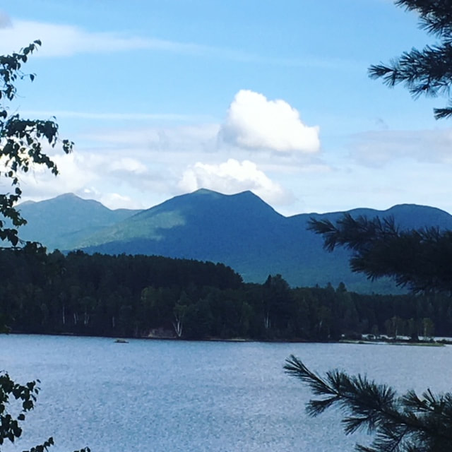
Bigelow Mountain, Maine. West Peak and Avery are on the far left
Avery and West Peak are the tallest peaks on the Bigelow Mountain Ridge just outside of Stratton, Maine. These peaks are part of 2 popular hiking missions: The Appalachian Trail and the NorthEast 115er list. My goal is eventually summit all of the NE 115ers, a goal that will take me decades to complete given the distance to travel to the areas to hike; especially the 14 peaks in Maine. As luck would have it my husband and I needed to travel through this part of the world to attend a wedding so we stopped to bag these two peaks en route.
This trip did not get off to a good start however. Upon arrival at Cathedral Pines Campground in Eustis, Maine, we realized that after packing the car full of camping gear, hiking gear and wedding attire we had independently forgotten BOTH our sleeping bags. Seeing as though it was already dark and a thunderstorm was approaching, we hunkered down in our tent with multiple layers on along with towels and Gore-tex jackets thrown over top. We survived the cool July night albeit with much tossing and turning and general discomfort. This area of Maine is pretty sparse in terms of finding camping supplies but we did end up finding a store that we bought warm but short blankets for the rest of the trip.
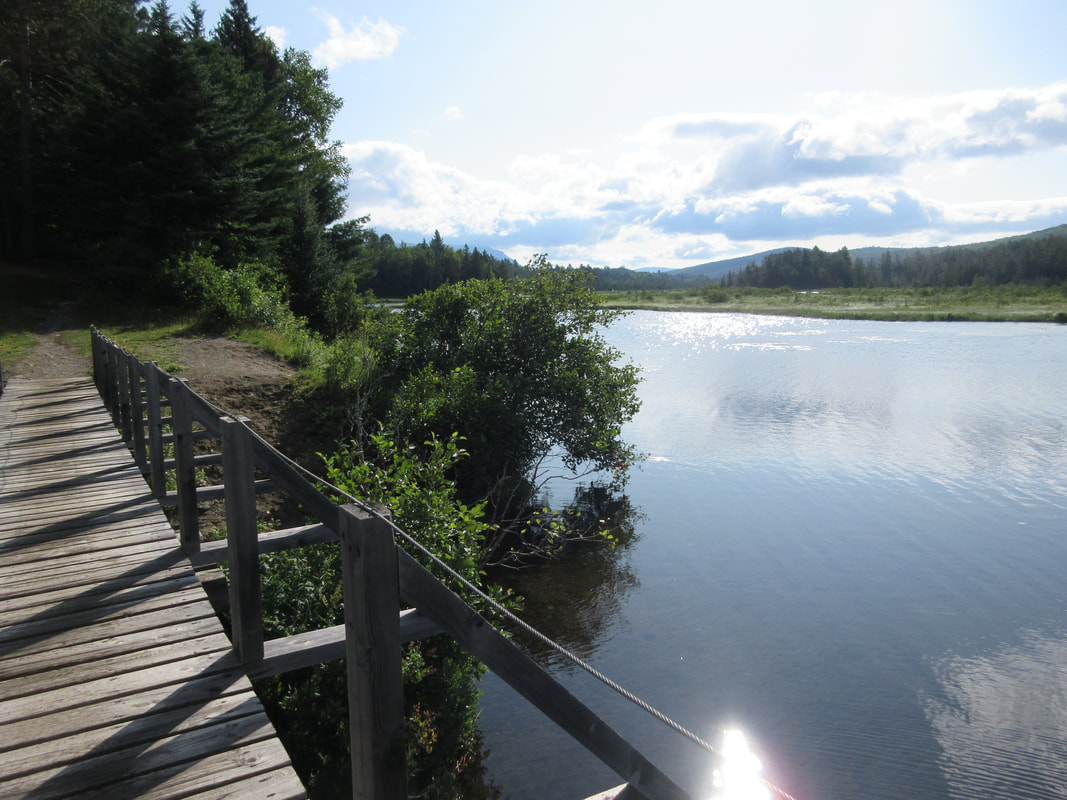
After our chilly evening, we filled our bellies with hot porridge and coffee and set out for the Fire Warden's trail at 8:30AM. We found the trailhead at Stratton Brook Pond on our first try (other reports say it's difficult) and parked at the busy trailhead and set off towards the pond. This area is obviously a popular free camping area in the summer - we found many people sleeping in or beside their cars.
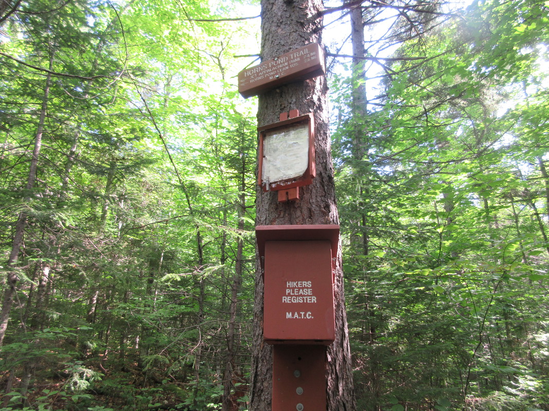
The Fire Warden's trail takes about 5miles/8km to ascend to the col on the ridge between the two peaks. It begins on a flat trail beside the ponds before turning into the forest for most of the remainder of the hike. The trail is marking with light blue blazes until the col where blazes turn white. The shade provided by the trees here is welcoming on a hot summer day. The trail ascends about 1000ft before leveling off again further up. 1.6 miles in you reach the junction with the Horns Pond Trail and a trail register to sign-in for the day.
This trip did not get off to a good start however. Upon arrival at Cathedral Pines Campground in Eustis, Maine, we realized that after packing the car full of camping gear, hiking gear and wedding attire we had independently forgotten BOTH our sleeping bags. Seeing as though it was already dark and a thunderstorm was approaching, we hunkered down in our tent with multiple layers on along with towels and Gore-tex jackets thrown over top. We survived the cool July night albeit with much tossing and turning and general discomfort. This area of Maine is pretty sparse in terms of finding camping supplies but we did end up finding a store that we bought warm but short blankets for the rest of the trip.
After our chilly evening, we filled our bellies with hot porridge and coffee and set out for the Fire Warden's trail at 8:30AM. We found the trailhead at Stratton Brook Pond on our first try (other reports say it's difficult) and parked at the busy trailhead and set off towards the pond. This area is obviously a popular free camping area in the summer - we found many people sleeping in or beside their cars.
The Fire Warden's trail takes about 5miles/8km to ascend to the col on the ridge between the two peaks. It begins on a flat trail beside the ponds before turning into the forest for most of the remainder of the hike. The trail is marking with light blue blazes until the col where blazes turn white. The shade provided by the trees here is welcoming on a hot summer day. The trail ascends about 1000ft before leveling off again further up. 1.6 miles in you reach the junction with the Horns Pond Trail and a trail register to sign-in for the day.

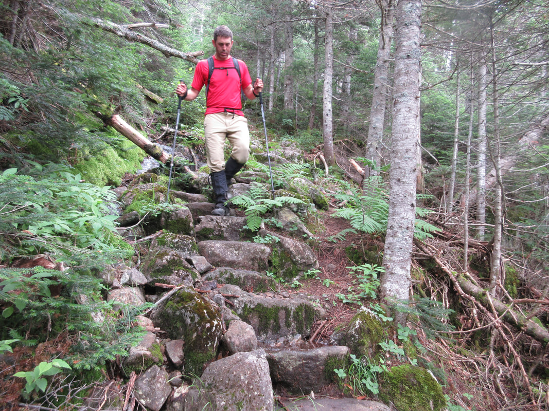
Continuing on a gradual up hill, you reach the Moose Falls campground complete with privy and a water spring. From this point on, the terrain significantly steepens. For about 600ft there is a section I will call 'The Staircase', where the trail follows steep rock stairs that is sure to get your heart pounding. Just when you're red in the face and covered in sweat you think "Are these stairs ever going to end?", the trail eases off a bit before hitting a Appalachian Trail camping area just before the junction on the ridge. Tent platforms and a caretaker's cabin can be found here. We thought we might see some AT hikers but instead the area was full of day hikers. It was only 11AM.
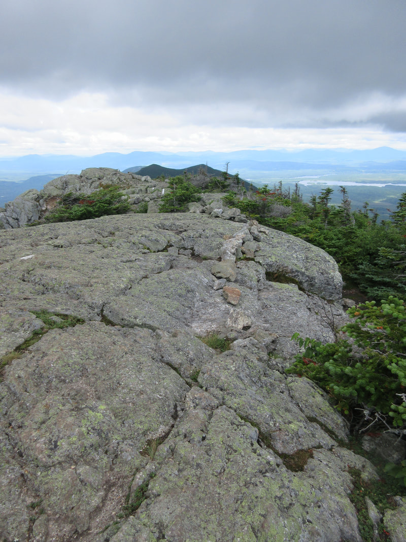
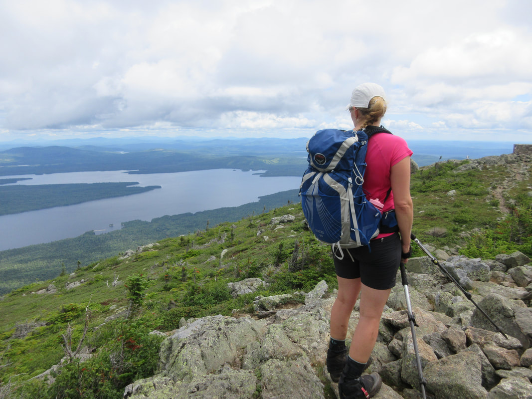
Once hitting the junction you can choose to take West Peak (0.3miles) or Avery (0.4miles) first. We chose to bear left to West Peak first. The mossy vegetation and well trod path lead up to a prominent rocky outcropping at the top of an obvious summit, complete with a summit cairn and sign. Beautiful views of Sugarloaf ski hill, the Crockers and Flagstaff Lake make this summit one to remember. It took us 3 hours from the Trailhead and 3000ft of climbing to get to this summit at 4145'.
Once hitting the junction you can choose to take West Peak (0.3miles) or Avery (0.4miles) first. We chose to bear left to West Peak first. The mossy vegetation and well trod path lead up to a prominent rocky outcropping at the top of an obvious summit, complete with a summit cairn and sign. Beautiful views of Sugarloaf ski hill, the Crockers and Flagstaff Lake make this summit one to remember. It took us 3 hours from the Trailhead and 3000ft of climbing to get to this summit at 4145'.
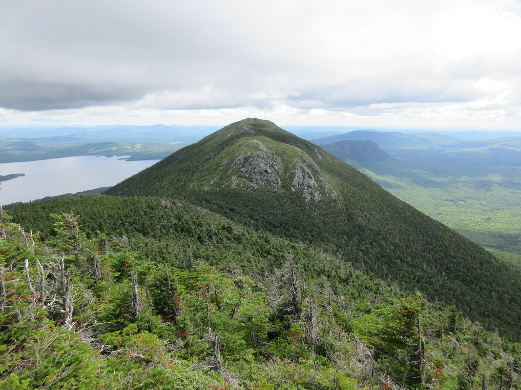
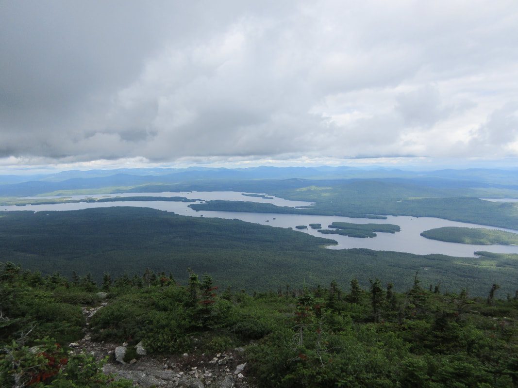
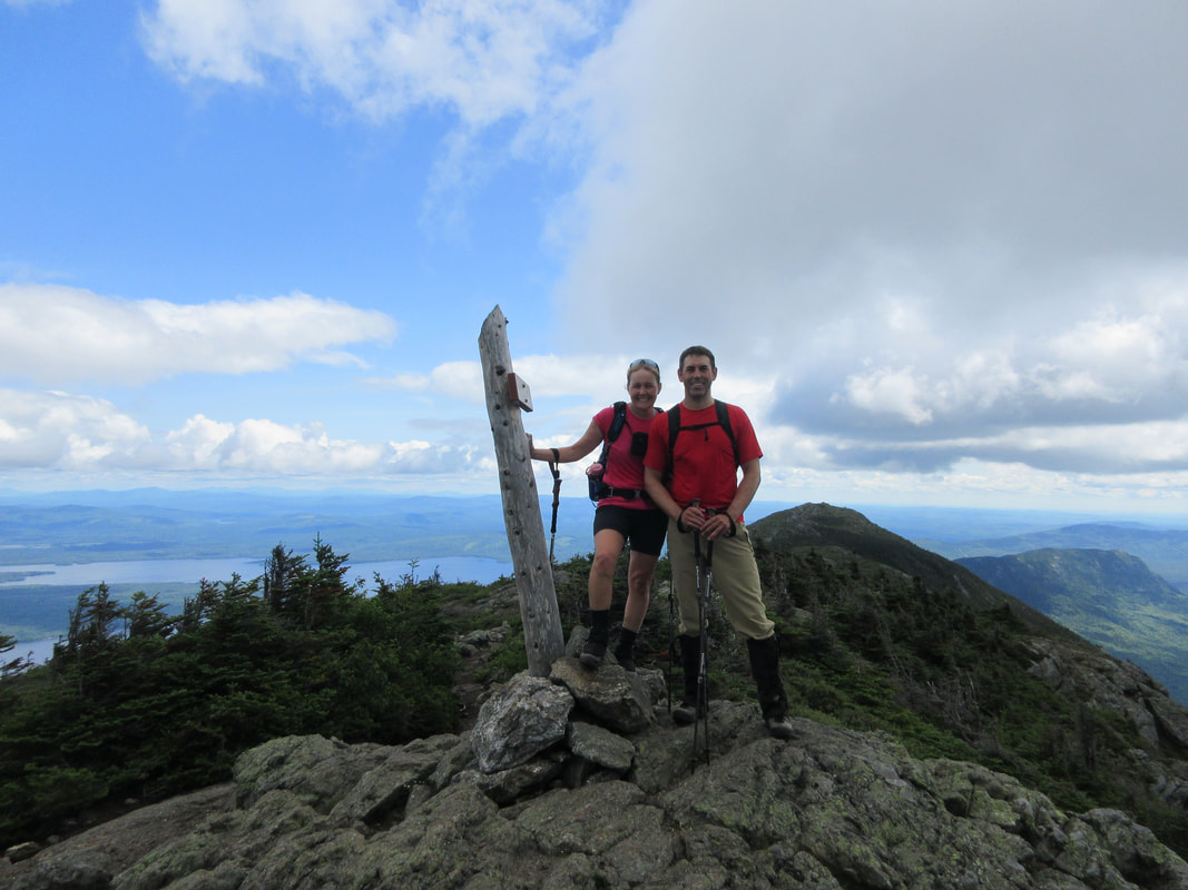
After a quick snack, we descended back down to the col and junction and continued on to Avery. After a few scramble moves to get around the backside of Avery's first rock bump we continued on good trail to the actual summit. Here another summit cairn with sign will signify your accomplishment along with many views of the ridge. An old man-made brick square structure (supposedly an old fire tower base) can also be seen from Avery's summit. A plaque commemorating Myron H. Avery's efforts to extend the AT into Maine is also worth a read here. We were lucky to hit this ridge on a sunny day - you can see for miles. Avery's summit is slightly less than West Peak's at 4088'. There is no advantage to do one over the other first in my opinion.
Descending down the staircase and forested trail was fairly straight forward and before we knew it we were back at the ponds and out to our car. The totals for the day were:
Date: July 29th, 2018
Distance: 9.72 miles/15.65km
Ascent: 3022ft
Time: 6.5 hours
Map: Rangeley Lakes Region Trail Map
.gpx track
 RSS Feed


